Shitlakhet

Last updated
Shitlakhet
Village
India Uttarakhand relief map.svg
Red pog.svg
Shitlakhet
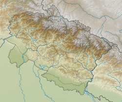
Location in Uttarakhand, India
India relief location map.jpg
Red pog.svg
Shitlakhet
Shitlakhet (India)
Coordinates: 29°23′31″N79°27′15″E / 29.39194°N 79.45417°E / 29.39194; 79.45417
CountryFlag of India.svg  India
Population
  Total119
  Estimate 
({{{pop_est_as_of}}})
300

Shitlakhet [1] is a Hill station and a small village in the Almora district of Uttarakhand, [2] India. It is located at an altitude of 1,900 meters above sea level, and is surrounded by the Kumaon Himalayas. The village is known for its scenic beauty, [3] including its panoramic views of the Chaukhamba peaks.

Shitlakhet is also a gateway to the Syahi Devi Temple. The temple is revered locally and was also one of the sites of meditation for Vivekananda. The site of the temple is the highest point of the hills between Shitlakhet and Almora.
Related Research Articles

<span class="mw-page-title-main">Kumaon division</span> Administrative division in India

Kumaon is a revenue and administrative division in the Indian State of Uttarakhand. It spans over the eastern half of the state and is bounded on the north by Tibet, on the east by Nepal, on the south by the state of Uttar Pradesh, and on the west by Garhwal. Kumaon comprises six districts of the state: Almora, Bageshwar, Champawat, Nainital, Pithoragarh and Udham Singh Nagar.

<span class="mw-page-title-main">Almora district</span> District of Uttarakhand in India

Almora is a district in the Kumaon Division of Uttarakhand state, India. The headquarters is at Almora. It is 1,638 meters above sea level. The neighbouring regions are Pithoragarh district to the east, Chamoli district to the west, Bageshwar district to the north and Nainital district to the south.

<span class="mw-page-title-main">Nanda Devi Raj Jat</span>

The three-week-long Nanda Devi Raj Jat is a pilgrimage and festival of Uttarakhand. India. The Raj-Jaat is celebrated in Chamoli Garhwal district, and traditionally only the deities of Garhwal Division took part in it. Sometimes, during the peaceful periods between the Kingdoms of Garhwal and Kumaun, the Goddess "Nanda of Almora" was invited and took part in the Raj-Jaat, while mostly there were separate Nanda-Sunanda fairs in Kumaun. Off late, after the formation of Uttarakhand, the state Government has been trying bring the people from Garhwal and Kumaun together for celebrations and fairs. Hence, in the Nanda Devi Raj Jaat held in the year 2000, the goddess "Almora ki Nanda" took part after 90 years and a number of other deities from Kumaun accompanied her. To facilitate this change, even the traditional route of the Yatra was tweaked and an additional stop with a detour was added, i.e. Nanadakesri. It is at this point, that the deities and devotees from Kumaon assimilate with the main Jaat. Now people from the entire Garhwal division-Kumaon division, as well as other parts of India and the world participate in Nanda Devi Raj Jat yatra

<span class="mw-page-title-main">Ranikhet</span> Town in Uttarakhand, India

Ranikhet is a hill station and cantonment town, near Almora Town in Almora district in the Indian state of Uttarakhand. It is the home of the Military Hospital, Kumaon Regiment (KRC) and Naga Regiment and is maintained by the Indian Army.

<span class="mw-page-title-main">Mukteshwar</span> Village in Uttarakhand, India

Mukteshwar is a village and tourist destination in the Nainital district of Uttarakhand, India. It sits high in the Kumaon Hills at an altitude of 2171 meters (7500 feet), 51 km from Nainital, 72 km from Haldwani, and 343 km from Delhi.

<span class="mw-page-title-main">Pauri Garhwal district</span> District in Uttarakhand, India

Pauri Garhwal is a district in the Indian state of Uttarakhand. Its headquarters is in the town of Pauri. It is sometimes referred to simply as Garhwal district, though it should not be confused with the larger Garhwal region of which it is only a part of.

<span class="mw-page-title-main">Bageshwar</span> Town in Uttarakhand, India

Bageshwar is a town and a municipal board in Bageshwar district in the state of Uttarakhand, India. It is located at a distance of 470 km from the National Capital New Delhi and 332 km from the State Capital Dehradun. Bageshwar is known for its scenic environment, glaciers, rivers and temples. It is also the administrative headquarters of Bageshwar district.

<span class="mw-page-title-main">Lansdowne, India</span> Town and hill station in Uttarakhand, India

Lansdowne is a cantonment town in Pauri Garhwal is a district in the Indian state of Uttarakhand.

<span class="mw-page-title-main">Bhowali</span> Town in Uttarakhand, India

Bhowali is a town and a municipal board in Nainital District in the state of Uttarakhand, India. It is situated at a distance of 11 km (6.8 mi) from the city of Nainital, the district headquarters; at an average elevation of 1,654 m (5,427 ft) from sea level. It is the seat of Bhowali tehsil, one of the eight subdivisions of Nainital district.

<span class="mw-page-title-main">Almora</span> Town in Uttarakhand, India

Almora is a municipal corporation and a cantonment town in the state of Uttarakhand, India. It is the administrative headquarters of Almora district. Almora is located on a ridge at the southern edge of the Kumaon Hills of the Himalaya range. The Koshi (Kaushiki) and Suyal (Salmale) rivers flow along the city and snow-capped Himalayas can be seen in the background.

<span class="mw-page-title-main">Berinag</span> Hill Station in Uttarakhand, India

Berinag is a hill station, located 124 km from Pithoragarh city in the Pithoragarh district, which is the easternmost Himalayan district in the state of Uttarakhand, India. It is one of the six Administrative Subdivisions (tehsil) of Pithoragarh district. National Highway 309A passes through Berinag. Closest prominent villages include Garawon, Dhanoli, Bana, Bhattigaon, Banoli, Quarali, Tripuradevi and Sangarh.

<span class="mw-page-title-main">Chaukori</span> Village in Uttarakhand, India

Chaukori is a hill station in the Pithoragarh district set among the lofty peaks of the western Himalayan Range in the Kumaon Division of Uttarakhand, India. To its north is Tibet and to its south is Terai. The Mahakali River, running along its eastern boundary, forms the Indo-Nepal international border. This place has become a prominent tourist place and from here a wide and picturesque view of Himalayan range can be viewed. The golden yellow colour of sun rays falling on the Himalayan range in the morning time is really worth seeing. There are cottages available here where one can stay and enjoy the serene surroundings. Tourists coming to this place generally also visit the nearby tourist places like Patal Bhuvaneshwar, Kausani, Bageshwar and Almora.

<span class="mw-page-title-main">Kausani</span> Hill Station in Uttarakhand, India

Kausani is a hill station and Village situated in Bageshwar district in the state of Uttarakhand, India. It is known for its scenery and its 300 km-wide panoramic view of Himalayan peaks like Trisul, Nanda Devi and Panchchuli. Mahatma Gandhi called this place the 'Switzerland of India', due to similarity in landscapes.

<span class="mw-page-title-main">Baijnath, Uttarakhand</span> Town in Uttarakhand, India

Baijnath is a small town on the banks of the Gomati river in the Bageshwar district in Kumaon division of Uttarakhand, India. The place is most noted for its ancient temples, which have been recognized as Monuments of National Importance by the Archaeological Survey of India in Uttarakhand. Baijnath has been selected as one of the four places to be connected by the 'Shiva Heritage Circuit' in Kumaon, under the Swadesh Darshan Scheme of the Government of India.

<span class="mw-page-title-main">Jaurasi</span> Jaurasi Range in Uttarakhand, India

Jaurasi is a mountain range situated between the middle of the Salt and Dwarahat assembly of the Almora district of Uttarakhand. It is situated between the Ramganga and Vinod rivers, which are about 6500 feet above sea level.

<span class="mw-page-title-main">Naukuchiatal</span> Fresh Water Lake in Uttarakhand, India

Naukuchiatal or "lake of nine corners" is a small hill station, near Nainital Town in Nainital district of Kumaon, Uttarakhand, India. The chairman is Devendra Singh chanotiya.

<span class="mw-page-title-main">Kasar Devi</span> Human settlement in India

Kasar Devi is a village near Almora, Uttarakhand. It is known for the Kasar Devi temple, a Devi temple, dedicated to Kasar Devi, after whom the place is also named. The temple structure dates to the 2nd century CE. Swami Vivekananda visited Kasar Devi in 1890s, and numerous western seeker, Sunyata Baba Alfred Sorensen and Lama Anagarika Govinda.

<span class="mw-page-title-main">Kalinka Temple</span> Hindu Temple in Uttarakhand

The hill temple of Kalinka is situated in Bironkhal block of Pauri Garhwal district, Uttarakhand in northern India. The temple complex lies close to the border with the Almora district and is dedicated to Goddess Kali. The temple has been in existence for centuries but the new structure has been renovated a couple of times in the last decade. It is often confused with Bunkhal kalinka, which is near Malund village of Raath region in Thalisain.

<span class="mw-page-title-main">Sarju</span> River in Uttarakhand, India

The Sarju, also known as Sarayu, is a major river draining Central Kumaon region in the Indian state of Uttarakhand. Originating from Sarmul, Sarju flows through the cities of Kapkot, Bageshwar and Seraghat before joining Mahakali at Pancheshwar. The Sarju is the largest tributary of the Sharda River. The river forms the South-eastern border between the districts of Pithoragarh and Almora. Temperate and sub-Tropical forests cover the entire Catchment area of the River.

<span class="mw-page-title-main">Vijaypur, Uttarakhand</span> Hill Station in Uttarakhand, India

Vijaypur, officially known as Bijaypur is a hill station and village situated in Bageshwar district in the state of Uttarakhand, India. It is located at a distance of 30 km from Bageshwar and 5 km from Kanda; amidst dense Pine Forests on the Bageshwar-Chaukori Highway.

References

  1. "Immerse In Kumaoni Culture At This Luxurious Stay In Uttarakhand's Shitlakhet With Lofty Peak Views". Curly Tales.
  2. "Shitlakhet village, must visit in Uttrakhand". Zee News Hindi. Retrieved 25 June 2023.
  3. "This small place in Uttarakhand beats the beautiful hill stations, there is a lot to visit nearby". Navbharat Times .