Shivadi

Last updated

Shivadi
village
CountryFlag of India.svg  India
State Maharashtra
District Nashik
Languages
  Official Marathi
Time zone UTC+5:30 (IST)
Vehicle registration MH-
Coastline0 kilometres (0 mi)

Shivadi is a village in the Niphad Subdistrict of the Nashik District of Maharashtra, India. [1]

Niphad Town in Nashik, India

Niphad is the name both of the town and the Taluka headquartered there. It is within the Nashik District of Maharashtra, India. The Marathi name signifies "a place without mountains", and indeed the taluka's topography is fairly level, with hardly any hills. It is served by Niphad railway station.Niphad's latitude and longitude coordinates are 20°5′0″N74°7′0″E. Located northeast of Nashik city, the Taluka borders Sinnar, Nashik, Dindori, Chandwad, and Yeola Talukas and Ahmednagar District, and has no direct access to the sea. The Niphad Sub-Division is composed of Niphad, Sinnar and Yeola Talukas.

Nashik Metropolis in Maharashtra, India

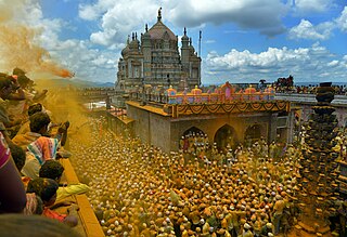
Nashik is an ancient holy city in the northern region of the Indian state of Maharashtra. Situated on the banks of river Godavari, Nasik is well known for being one of Hindu pilgrimage sites, that of Kumbh Mela which is held every 12 years. It is the Third largest city in Maharashtra after Mumbai, Pune.Mumbai-Nashik-Pune forms a golden triangle region in Maharashtra. Golden triangle region is the area of Mumbai Megaregion also known as Mumbai Megalopolis which includes Mumbai Metropolitan Region, Pune Metropolitan Region and Nashik and has a population of over 50 millions making Mumbai Megaregion the most populated area in the world.

Maharashtra State in western India

Maharashtra is a state in the western peninsular region of India occupying a substantial portion of the Deccan Plateau. It is the second-most populous state and third-largest state by area in India. Spread over 307,713 km2 (118,809 sq mi), it is bordered by the Arabian Sea to the west, the Indian states of Karnataka and Goa to the south, Telangana to the southeast and Chhattisgarh to the east, Gujarat and Madhya Pradesh to the north, and the Indian union territory of Dadra and Nagar Haveli to the north west. It is also the world's second-most populous subnational entity.

Related Research Articles

Mayani Bird Sanctuary is a bird sanctuary located in Mayani, in Maharashtra, India. Mayani is well connected from district places like Satara and Sangali, and around 20 km from Vita. It is a market place for near by villages and a developed place with colleges and medical facilities.

Bhima River river in India

The Bhima River is a major river in Western India and South India. It flows southeast for 861 kilometres (535 mi) through Maharashtra, Karnataka, and Telangana states, before entering the Krishna River. After the first sixty-five kilometers in a narrow valley through rugged terrain, the banks open up and form a fertile agricultural area which is densely populated.

Jejuri City in Maharashtra, India

Jejuri is a city and a municipal council in Pune district in the Indian state of Maharashtra. It is famous for the main temple of Lord Khandoba. It is a famous temple town being the family deity of many houses in Maharashtra and Karnataka. Its economy is centered on businesses catering to the numerous devotees coming to worship the Khandoba Temple there. Recently the increase in property rates and the planning of an international airport near the town has seen a spurt of development happening there.

Malhargad

Malhargad is a hill fort in western India near Saswad, 30 kilometres (19 mi) from Pune. It is also known as Sonori Fort due to the village of Sonori being situated at its base. The fort was named for the god Malhari and was the last fort built by the Marathas, about 1775.

Vinica, Veľký Krtíš District municipality of Slovakia

Vinica is a village and municipality in the Veľký Krtíš District of the Banská Bystrica Region of southern Slovakia.

Krčedin Village in Vojvodina, Serbia

Krčedin is a village in Serbia. It is situated in the Inđija municipality, in the Srem District, Vojvodina province. The village has a Serb ethnic majority and its population numbering 2,878 people. Great fishing and hunting place. It has the biggest natural island on all Danube river, Krčedinska Ada.

Sangvi village in Maharashtra, India

Sangvi is a village in Parola Taluka of Jalgaon district in northwestern part of the state of Maharashtra, India.

Nieborów Village in Łódź Voivodeship, Poland

Nieborów is a village in Łowicz County, Łódź Voivodeship, in central Poland. It is the seat of the gmina called Gmina Nieborów. It lies approximately 14 kilometres (9 mi) east of Łowicz and 60 km (37 mi) north-east of the regional capital Łódź.

İkinci Yüzbaşılı Place in Agdam, Azerbaijan

İkinci Yüzbaşılı is a village in the Agdam Rayon of Azerbaijan. The village forms part of the municipality of Xındırıstan.

Agasibeyli Place in Siazan, Azerbaijan

Agasibeyli is a village in the Siazan Rayon of Azerbaijan.

Dadaşlı is a village in the municipality of Xındırıstan in the Agdam Rayon of Azerbaijan.

Amdad is a small village in the state of Maharashtra, India. It is located in the Dhule taluka of Dhule District in Maharashtra.

Sagadi Village in Lääne-Viru County, Estonia

Sagadi is a village in Haljala Parish, Lääne-Viru County, in northern Estonia, on the territory of Lahemaa National Park.

Belgundi is a village in Belgaum district in the southern state of Karnataka, India. The local language is Marathi and the village is located at the state border of Karnataka and Maharashtra.

Chorla is a village in Belgaum district in the state of Karnataka. It is situated on border of Goa and Maharashtra.

Kudremani is a village in Belgaum district in Karnataka, India. surrounded by MaharashtraState by all side.

Kurund is a village in Parner taluka in Ahmednagar district of state of Maharashtra, India.

Gadhinglaj Taluka taluka in Maharashtra, India

Gadhinglaj Taluka is a taluka in Maharashtra. The city of Gadhinglaj is the taluka headquarters and Gadhinglaj subdivision headquarters as well. As of 2011, the taluka had a population of 874,015, of which 35% were urban. Languages spoken in this area are Marathi, Kannada, Hindi and English also. But the most-spoken language is Marathi, as Marathi is a state language.

Harali Town in Maharashtra, India

Harali is a Town in Gadhinglaj Taluka Kolhapur district situated in the southwest corner of state Maharashtra, India. Harali is situated on banks of Hiranyakeshi river originated from the Great Amboli Ghats is about 7 km from Gadhinglaj towards south and 12 km from the second largest city Kadgaon in Gadhinglaj Taluka and just 2 km from Mahagaon,Gadhinglaj. It is managed by Town Council.In 2011 it has a population of about 15,856. Harali is the eight largest city and town in Gadhinglaj Taluka. Shri Appasaheb Nalawade Gadhinglaj Taluka Sahakari Sakhar Karkhana is situated in the town.

Dhanora, commonly known as "Dhanora Motya" is a village located in Purna taluka of Parbhani district, in the state of Maharashtra, India.

References

  1. "Village Code Directory: Maharashtra" (PDF). Ministry of Home Affairs. Retrieved 24 November 2010.

Coordinates: 20°07′N74°08′E / 20.117°N 74.133°E / 20.117; 74.133

Geographic coordinate system Coordinate system

A geographic coordinate system is a coordinate system that enables every location on Earth to be specified by a set of numbers, letters or symbols. The coordinates are often chosen such that one of the numbers represents a vertical position and two or three of the numbers represent a horizontal position; alternatively, a geographic position may be expressed in a combined three-dimensional Cartesian vector. A common choice of coordinates is latitude, longitude and elevation. To specify a location on a plane requires a map projection.