The Neptune Range is a mountain range, 70 nautical miles long, lying west-southwest of Forrestal Range in the central part of the Pensacola Mountains, Antarctica. The range comprises Washington Escarpment with its associated ridges, valleys and peaks, the Iroquois Plateau, the Schmidt and the Williams Hills.
Hope Bay is a bay 3 nautical miles long and 2 nautical miles wide, indenting the tip of the Antarctic Peninsula and opening on Antarctic Sound.

James Ross Island is a large island off the southeast side and near the northeastern extremity of the Antarctic Peninsula, from which it is separated by Prince Gustav Channel. Rising to 1,630 metres (5,350 ft), it is irregularly shaped and extends 40 nautical miles in a north–south direction.
The Aviator Glacier is a major valley glacier in Antarctica that is over 60 nautical miles long and 5 nautical miles wide, descending generally southward from the plateau of Victoria Land along the west side of Mountaineer Range, and entering Lady Newnes Bay between Cape Sibbald and Hayes Head where it forms a floating tongue.
The Flood Range is a range of large snow-covered mountains extending in an east–west direction for about 60 nautical miles and forming a right angle with the southern end of the Ames Range in Marie Byrd Land, Antarctica.
The Bermel Peninsula is a rugged, mountainous peninsula, approximately 15 nautical miles long and 7 nautical miles ) wide, between Solberg Inlet and Mobiloil Inlet on the Bowman Coast, Graham Land, Antarctica. The feature rises to 1,670 metres (5,480 ft) in Bowditch Crests and includes Yule Peak, Mount Wilson, Campbell Crest, Vesconte Point, Wilson Pass, Rock Pile Peaks, Miyoda Cliff, and Rock Pile Point.

The Prince Charles Mountains are a major group of mountains in Mac. Robertson Land in Antarctica, including the Athos Range, the Porthos Range, and the Aramis Range. The highest peak is Mount Menzies, with a height of 3,228 m (10,591 ft). Other prominent peaks are Mount Izabelle and Mount Stinear. These mountains, together with other scattered peaks, form an arc about 420 km (260 mi) long, extending from the vicinity of Mount Starlight in the north to Goodspeed Nunataks in the south.
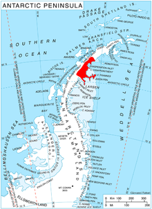
The Merz Peninsula is an irregular, ice-covered peninsula, about 15 nautical miles long in an east–west direction and averaging 25 nautical miles wide, between Hilton Inlet and Violante Inlet on the east coast of Palmer Land, Antarctica.

Ulu Peninsula is that portion of James Ross Island northwest of the narrow neck of land between Rohss Bay and Croft Bay, extending from Cape Obelisk to Cape Lachman, in Antarctica.
Ob' Bay is a bay lying between Lunik Point and Cape Williams in Antarctica. Lillie Glacier Tongue occupies the east part of the bay. The bay was charted by the Soviet Antarctic Expedition (1958) and named after the expedition ship Ob'.
The Mulock Glacier is a large, heavily crevassed glacier which flows into the Ross Ice Shelf 40 kilometers south of the Skelton Glacier in the Ross Dependency, Antarctica.
New Bedford Inlet is a large pouch-shaped, ice-filled embayment between Cape Kidson and Cape Brooks, along the east coast of Palmer Land, Antarctica.
The Land Glacier is a broad, heavily crevassed glacier, about 35 nautical miles long, descending into Land Bay in Marie Byrd Land, Antarctica. It was discovered by the United States Antarctic Service (1939–41) and named for Rear Admiral Emory S. Land, Chairman of the United States Maritime Commission.
Weddell Point is a low, tussock-covered point forming the east side of the entrance to Schlieper Bay, on the south coast and near the west end of South Georgia. The name Cape Weddell was given by David Ferguson, Scottish geologist, during his visit to South Georgia in 1911–12. Named after James Weddell, Master, Royal Navy, who visited South Georgia in 1823. Point is considered a more suitable descriptive term for this feature than cape.
The Duncan Mountains are a group of rugged coastal foothills, about 18 nautical miles long, extending from the mouth of Liv Glacier to the mouth of Strom Glacier at the head of the Ross Ice Shelf in Antarctica.
Fricker Glacier is a glacier, 10 nautical miles (19 km) long, which lies close north of Tindal Bluff and Monnier Point and flows in a northeasterly direction into the southwest side of Mill Inlet, on the east coast of Graham Land, Antarctica. It was charted by the Falkland Islands Dependencies Survey (FIDS) and photographed from the air by the Ronne Antarctic Research Expedition in 1947, and was named by the FIDS for Karl Fricker, a German Antarctic historian.

Hektoria Glacier is a glacier flowing south from the area around Mount Johnston between Mount Quandary and Zagreus Ridge into Vaughan Inlet next west of Brenitsa Glacier and east of Green Glacier, on the east coast of the Antarctic Peninsula.
Hilton Inlet is an ice-filled inlet, 12 nautical miles wide, which recedes about 22 nautical miles west from its entrance between Cape Darlington and Cape Knowles, along the east coast of Palmer Land, Antarctica.
Spring Point is a point forming the south side of the entrance to Brialmont Cove, on the west coast of Graham Land in Antarctica. Discovered in 1898 by the Belgian Antarctic Expedition under Gerlache. He named it for Professor Walthère-Victor Spring chemist of the Université de Liège, a member of the Académie Royale de Belgique and of the Commission de la Belgica.


