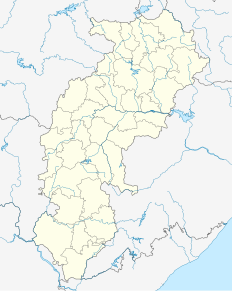
Shivrinarayan

Last updated

Sheorinarayan
town
India Chhattisgarh location map.svg
Red pog.svg
Sheorinarayan
Location in Chhattisgarh, India
India location map.svg
Red pog.svg
Sheorinarayan
Sheorinarayan (India)
Coordinates: 21°44′N82°35′E / 21.73°N 82.58°E / 21.73; 82.58 Coordinates: 21°44′N82°35′E / 21.73°N 82.58°E / 21.73; 82.58
CountryFlag of India.svg  India
State Chhattisgarh
District Janjgir-Champa
Elevation
235 m (771 ft)
Population
 (2001)
  Total8,107
Languages
  Official Hindi, Chhattisgarhi
Time zone UTC+5:30 (IST)
Vehicle registration CG

Shivrinarayan is a town and a nagar panchayat in Janjgir-Champa district in the Indian state of Chhattisgarh.

A Nagar Panchayat or Notified Area Council (NAC) or City Council in India is a settlement in transition from rural to urban.

India Country in South Asia

India is a country in South Asia. It is the seventh-largest country by area, the second-most populous country, and the most populous democracy in the world. Bounded by the Indian Ocean on the south, the Arabian Sea on the southwest, and the Bay of Bengal on the southeast, it shares land borders with Pakistan to the west; China, Nepal, and Bhutan to the north; and Bangladesh and Myanmar to the east. In the Indian Ocean, India is in the vicinity of Sri Lanka and the Maldives; its Andaman and Nicobar Islands share a maritime border with Thailand and Indonesia.

Chhattisgarh Central-east state in India

Chhattisgarh is one of the 29 states of India, located in the centre-east of the country. It is the ninth-largest state in India, with an area of 135,192 km2 (52,198 sq mi). With a 2011 population of 25.5 million, Chhattisgarh is the 16th-most populated state in the country. A resource-rich state, it is a source of electricity and steel for the country, accounting for 15% of the total steel produced. Chhattisgarh is one of the fastest-developing states in India.

Contents

Shivrinarayan has a significant role in the life of Lord Rama. Lord Rama along with his wife Sita and his younger brother Lakshaman had started his Vanvas (exile) in the Bastar district (more precisely Dandakaranya region) of Chhattisgarh. They lived more than 10 years of their 14 years of Vanvas in different places of Chhattisgarh. One of the remarkable place is Shivrinarayan which is nearby Bilaspur district of Chhattisgarh. Shivrinarayan was named after an old lady Shabari. When Ram visited Shabari she said "I do not have anything to offer other than my heart, but here are some berry fruits. May it please you, my Lord." Saying so, Shabari offered the fruits she had meticulously collected to Rama. When Rama was tasting them, Lakshmana raised the concern that Shabari had already tasted them and therefore unworthy of eating. To this Rama said that of the many types of food he had tasted, "nothing could equal these berry fruits, offered with such devotion. You taste them, then alone will you know. Whomsoever offers a fruit, leaf, flower or some water with love, I partake it with great joy."

Bastar district District of Chhattisgarh in India

Bastar District is a district of the state of Chhattisgarh in central India. Jagdalpur is the district headquarters. The district has an area of 10755.79 km². Bastar District is bounded on the northwest by Narayanpur district, on the north by Kondagaon District, on the east by Nabarangpur and Koraput districts of Odisha state, on the south and southwest by Dantewada District, and on the west by Gadchiroli District of Maharashtra state. It possesses a unique blend of tribal and Odia culture.

Dandakaranya

Dandakaranya is a spiritually significant region in India. It is roughly equivalent to the Bastar division in the Chhattisgarh state in the central-east part of India. It covers about 92,200 square kilometres (35,600 sq mi) of land, which includes the Abujhmar Hills in the west and the Eastern Ghats in the east, including regions of Telangana, Andhra Pradesh, Chhattisgarh and Odisha states. It spans about 300 kilometres (200 mi) from north to south and about 500 kilometres (300 mi) from east to west. Dandakaranya roughly translates from Sanskrit to "The Jungle (aranya) of Punishment (dandakas"). The Balaghat district of Madhya Pradesh and Bhandara, Gondia and Gadchiroli districts of Maharashtra are part of the ancient region Dandakaranya.

Bilaspur district, Chhattisgarh District of Chhattisgarh in India

Bilaspur district is a district of the Chhattisgarh state of India. Bilaspur city is the headquarters of the district. As of 2011 it is the second most populous district of Chhattisgarh, after Raipur.

Geography

Sheorinarayan is located at 21°44′N82°35′E / 21.73°N 82.58°E / 21.73; 82.58 . [1] It has an average elevation of 235 m (771 ft).

Demographics

As of 2001 India census, [2] Sheorinarayan had a population of 8107. Males constitute 52% of the population and females 48%. Sheorinarayan has an average literacy rate of 63%, higher than the national average of 59.5%: male literacy is 73%, and female literacy is 53%. In Sheorinarayan, 18% of the population is under 6 years of age.

Census Acquiring and recording information about the members of a given population

A census is the procedure of systematically acquiring and recording information about the members of a given population. This term is used mostly in connection with national population and housing censuses; other common censuses include agriculture, business, and traffic censuses. The United Nations defines the essential features of population and housing censuses as "individual enumeration, universality within a defined territory, simultaneity and defined periodicity", and recommends that population censuses be taken at least every 10 years. United Nations recommendations also cover census topics to be collected, official definitions, classifications and other useful information to co-ordinate international practice.

Shivrinarayan Math

Shivrinarayan Math is centuries old Hindu temple as well as institution located in the town of Shivrinarayan. It was established during the eighth century. It is a heritage centre and bears tremendous importance from Historical and Religious perspective.

Related Research Articles

Bhadrachalam Temple town in Telangana, India

Bhadrachalam is a census town in the Indian state of Telangana, Bhadradri Kothagudem district. It is an important Hindu pilgrimage town with an existence of the Bhadrachalam Temple of Lord Rama, situated on the banks of Godavari river. It is located 312 kilometres (194 mi) from east of state capital, Hyderabad,115 kilometres (71 mi) from Khammam, 177 kilometres (110 mi) from Suryapet, 180 kilometres (112 mi) from Warangal and 178 kilometres (111 mi) from the Andhra Pradesh State Capital Amaravathi.

Garhwa Hemant Princes City in Jharkhand, India

Garhwa is a town and a municipality in, and headquarters of, Garhwa district in the state of Jharkhand, India. Uttar Pradesh, Chhattisgarh and Bihar are nearby states. Garhwa Road (Rehla) is a major Railway Junction where thousands of passengers find this station most convenient to catch their train for Delhi and Kolkata. You can find bus services for Ranchi, Ambikapur, Gaya etc.

Shabari elderly woman ascetic in the later versions of the Hindu epic Ramayana

Shabari is an elderly Bhili woman ascetic in the later versions of the Hindu epic Ramayana. She is described as an ardently devoted woman who received Rama's darshan and blessing due to her Bhakti to him.

Baikunthpur, Koriya city in Chhattisgarh, India

Baikunthpur is a town and a notified area committee in Koriya District in the state of Chhattisgarh, India. It is the administrative headquarters of Koriya district.

Balod city in Chhattisgarh, India

Balod is a town in banks of river Tandula and a nagar palika in Balod district in the state of Chhattisgarh, India. Balod is 44 km from Dhamtari and 58 km from Durg. Balod has one college, one court, one CHC, and a jail. Medical facilities are good in Balod. There are two Dams nearby Tandula and Aadmabaad built on rivers sukha and tandula in 1912. On 1 January 2012 it was notified as Civil District though revenue district was declared from 10 January 2012. Balod became the 27th district of Chhattishgarh.There are several religious temples nearby town, particularly Ganga Maiyya temple and Siyadevi temple hold great religious value for the townsfolk.

Basna city in Chhattisgarh, India

Basna is a census town in Mahasamund district in the Chhattisgarh state of India.

Deori, Bilaspur district city in Chhattisgarh, India

See Deori (disambiguation) for disambiguation

Dhamdha city in Chhattisgarh, India

The city of Dhamdha is situated in the district of Durg in the state of Chhattisgarh, India.

Dipka city in Chhattisgarh, India

Dipka is a census town in Korba District in the state of Chhattisgarh, India.

Durllabhganj Census Town in West Bengal, India

Durllabhganj is a census town in Garhbeta III CD Block of Medinipur Sadar subdivision in Paschim Medinipur district in the state of West Bengal, India.

Gandai city in Chhattisgarh, India

Gandai is a town and a nagar panchayat in Rajnandgaon district in the state of Chhattisgarh, India.

Khamhria city in Chhattisgarh, India

Khamhria is a town and a nagar panchayat in Bemetara district in the Indian state of Chhattisgarh.

Lormi City in Chhattisgarh, India

Lormi is a city and a nagar panchayat and a Tehsil in Mungeli district in the Indian state of Chhattisgarh.

Phunderdihari city in Chhattisgarh, India

Phunderdihari is a census town in Surguja district in the Indian state of Chhattisgarh.

Singarayakonda Census town in Andhra Pradesh, India

Singarayakonda is a census town in Prakasam district of the Indian state of Andhra Pradesh. It is the mandal headquarters of Singarayakonda mandal. Singarayakonda is 26 m above sea level. It is spread across 10 Grama panchayats. It is under Kandukur Revenue division. Singarayakonda is located 30 kilometers from Ongole. This is situated on the NH-5 Highway and has a connectivity of the Railway line between Vijayawada and Chennai. This gives highest revenue than any other station in this line of South Central Railway in the Prakasam district. This also has been the center for transportation for all the nearby villages which are located around a distance of the 15 km from this place.

Telgaon city in Chhattisgarh, India

Telgaon is a census town in Surguja district in the Indian state of Chhattisgarh.

Bhatgaon, Raipur city in Chhattisgarh, India

Bhatgaon is a town and a nagar nigam in Raipur district in the state of Chhattisgarh, India.

Kota, Bilaspur city in Chhattisgarh, India

Kota is a town and a nagar panchayat in Bilaspur district in the Indian state of Chhattisgarh.

Kerura City in Karnataka, India

Kerur is a City in Bagalkot district in Karnataka, which located on NH 218. It has an average elevation of 617 meters (2024 feet). It's a birthplace of Jagadish Shettar, a former Chief Minister of Karnataka. Kerur is a Town Panchayat city in district of Bagalkot, Karnataka. The Kerur city is divided into 16 wards for which elections are held every five years. The Kerur Town Panchayat has population of 19,731 of which 9,929 are males while 9,802 are females as per report released by Census India 2011.

References

  1. Falling Rain Genomics, Inc - Sheorinarayan
  2. "Census of India 2001: Data from the 2001 Census, including cities, villages and towns (Provisional)". Census Commission of India. Archived from the original on 16 June 2004. Retrieved 1 November 2008.