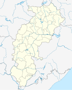
Janjgir–Champa is a district in the Indian state of Chhattisgarh. It is a small developing district. The district headquarters of the district Janjgir–Champa, Janjgir is the city of Maharaja Jajawalya Dev of the Kalachuri dynasty. Earlier a part of the Bilaspur district, Jangir was carved out in 1998 to a separate district of its own, and ran to a political controversy about the name of the freshly minted district, which it carries to date as the name "Janjgir–Champa". Inhabitants are generally migrants from nearby villages.

Kharsawan garh is a city and a notified area in Seraikela Kharsawan district in the Indian state of Jharkhand.

Akaltara is a nagar palika and tehsil in Janjgir-Champa district in the state of Chhattisgarh, India. It is the birthplace of a great freedom fighter Thakur Chhedi Lal (Barrister). Akaltara has a member in legislation assembly of Chhattisgarh state, which is now represented by Mr. Sourabh Singh of the Bhartiya Janta Party. It is under Janjgir Parliament seat, which is represented by Mrs. Kamla Devi Patle.

Bahadurganj is a Municipality town nestled in the Tarai of Himalaya and a notified area in Kishanganj district in the state of Bihar, India.

Baloda Bazar is a nagar palika parishad in Baloda Bazar district in the Indian state of Chhattisgarh. Its PIN code is 493332. On 15 August 2011, it was declared as a district. Baloda Bazar is also called Cement hub of Chhattisgarh because there are many reputed cement plants like Ambuja Cement Rawan, Lafarge Cement Sonadih, Emami Cement Risda, Shree Cement Khapradih, UltraTech Cement Hirmi, Grasim Cement Rawan, etc.

Bikihakola is a census town in Panchla CD Block of Howrah Sadar subdivision in Howrah district in the state of West Bengal, India.

See Deori (disambiguation) for disambiguation

Dharur is a city and a municipal council in Beed district in the state of Maharashtra, India.

Kachhwa is a town and a nagar panchayat in Mirzapur district in the Indian state of Uttar Pradesh.

Kharod is a town and a nagar panchayat in Janjgir-Champa district in the Indian state of Chhattisgarh. Kharod is historically very important place for Chhattisgarh.

Mahudha is a municipality in Kheda district in the Indian state of Gujarat.

Naya Baradwar is a town and a nagar panchayat in Janjgir-Champa district in the Indian state of Chhattisgarh.

Panchla is a census town in Panchla CD Block of Howrah Sadar subdivision in Howrah district in the Indian state of West Bengal.

Panchpara is a census town in Sankrail CD Block of Howrah Sadar subdivision in Howrah district in the Indian state of West Bengal. It is a part of Kolkata Urban Agglomeration.

Shivrinarayan is a town and a nagar panchayat in Janjgir-Champa district in the Indian state of Chhattisgarh.

Simga is a town and a nagar panchayat in Baloda bazar district in the Indian state of Chhattisgarh.

Takhatpur is a nagar palika in Bilaspur district in the Indian state of Chhattisgarh.

Kota is a town and a nagar panchayat in Bilaspur district in the Indian state of Chhattisgarh.

Kangan is a town in Ganderbal district, of Jammu and Kashmir, India. It is one of the tehsils in Ganderbal District. It is situated across the Nallah Sindh and spread over a 50-km-long gorge valley, with population of 1,20,934 and literacy rate of 52.8% and sex ratio 868 per thousand males. It is one of the beautiful places surrounded by various picnic spots like Sonamarg and Naranag. It is believed that the place embraces its name with the fact that it is surrounded by mountains in all sides, gives it a ring shape, which is called in Hindi kangan.

Goshainganj, also known as Gosainganj, is a city in Faizabad district in the Indian state of Uttar Pradesh. Goshainganj is one of the oldest market in Faizabad district of Uttar Pradesh.


