Shoal Harbour

Last updated

Shoal Harbour
Shoalharbour.JPG
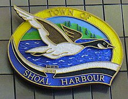
A wood carving of the town seal of Shoal Harbour on display at Memorial University of Newfoundland
Canada Newfoundland location map.svg
Red pog.svg
Shoal Harbour
Coordinates: 48°11′N53°59′W / 48.183°N 53.983°W / 48.183; -53.983
CountryFlag of Canada (Pantone).svg  Canada
Province Flag of Newfoundland and Labrador.svg  Newfoundland and Labrador
Census division Division No. 7
Elevation
0 - 74 m (0 - 243 ft)
Lowest elevation
0 m (0 ft)
Time zone UTC−4 (AST)
  Summer (DST) UTC−3 (Atlantic Daylight Saving Time)
Area code 709
Telephone Exchange 643, 283, 214, 649, 641 and 721

Shoal Harbour is a small community in Newfoundland and Labrador, Canada. [1] It is part of the Town of Clarenville and just north of Clarenville proper.

See also

Related Research Articles

Hillview-Adeytown is a former local service district and former designated place on the east coast of Newfoundland in Newfoundland and Labrador, Canada that existed from 1999 until 2008. It consisted of the village of Hillview on the Southwest Arm of Trinity Bay and the village of Adeytown on the Northwest Arm of Trinity Bay, just south of Clarenville.

The community of Lethbridge is located 20 km (12 mi) from Clarenville, Newfoundland and Labrador along Route 230, on the Cabot Highway, to Bonavista. Route 233 and Route 234 also pass through the community. It is an unincorporated community with a population of 635 (2016). It is part of the local service district of Lethbridge and Area.

Deep Bight is a local service district and designated place in the Canadian province of Newfoundland and Labrador. It is south of Clarenville. It became a post office on April 1, 1949, and was still active by 1966.

Alexander Bay Station was a Canadian settlement in the province of Newfoundland and Labrador.

Thoroughfare is a locality or small settlement located east of Clarenville, Newfoundland and Labrador. The post office closed in 1966 and mail was collected at British Harbour. The population was 62 in 1940.

George's Brook is a designated place in the Canadian province of Newfoundland and Labrador that is a neighbourhood in the Town of George's Brook-Milton. It is north of Clarenville.

<span class="mw-page-title-main">Southport, Newfoundland and Labrador</span>

Southport is a community in the Canadian province of Newfoundland and Labrador. It is located on the southern side of the entrance to Trinity Bay's Southwest Arm, about 41 km southeast of Clarenville. It is part of the local service district and designated place of Caplin Cove-Southport.

CKVO is an AM radio station in Clarenville, Newfoundland and Labrador, Canada, broadcasting on 710 kHz. Owned by Stingray Group, CKVO first went on the air in 1974. It is an affiliate of VOCM.

The Bonavista Peninsula is a large peninsula on the east coast of the island of Newfoundland in the Canadian province of Newfoundland and Labrador. It consists of 50 incorporated towns/unincorporated communities which have a population of 12,176 as of the 2016 Canadian Census. Bonavista is the largest population centre on the peninsula.

The Clarenville Dragway was a drag racing strip located just outside Clarenville, Newfoundland & Labrador. It was the only dragstrip in the province at the time, and the site doubled as Clarenville Airport. The Clarenville Dragway closed in 2014 being replaced by Eastbound Park in Avondale Newfoundland.

Petley is a local service district and designated place in the Canadian province of Newfoundland and Labrador. It is east of Clarenville.

Elliott's Cove is a settlement located southeast of Clarenville in Newfoundland and Labrador, Canada. It is located on the western coast of Random Island.

Lady Cove is a settlement located southeast of Clarenville, Newfoundland, and Labrador. The Post Office was established in 1898, and the first postmaster was Hayward Burt. It had a population of 120 in 1940 and 161 in 1956. Lady Cove is located on Random Island and is part of the local service district of Random Island West.

<span class="mw-page-title-main">Jamestown, Newfoundland and Labrador</span>

Jamestown is a village located northeast of Clarenville, Newfoundland and Labrador, Canada.

<span class="mw-page-title-main">Little Heart's Ease, Newfoundland and Labrador</span>

Little Heart's Ease is a community on the Southwest Arm on the east coast of Newfoundland, southeast of Clarenville. The Post Office was established in 1893. The first Postmaster was Eli Martin. It had a population of 443 in 1996. About 1612 it was referred as "Hearts Ease" by Governor John Guy of Cupids, as did Sir Richard Whitbourne, Governor of Renews. It was known for its fishing activity and as a very secure harbour for schooners. Today long-liners and draggers still enjoy its protection.

Little Rapids is a local service district and designated place in the Canadian province of Newfoundland and Labrador. It is east of Corner Brook.

Waterville, Newfoundland and Labrador is a small settlement located east of Clarenville.

Gin Cove is a village located on the north side of Smith Sound on the east coast of Newfoundland and Labrador. The community was first recorded in the 1901 census with a population of 33. Thomas and Louisa Frampton moved to Gin Cove in 1866 from Little Catalina, it is uncertain if they were the first settlers of Gin Cove or not. There were a variety of industries in Gin Cove including fishing, woodcutting and shipbuilding. The population peaked at 45 in 1941 but in the late 1940s people started to move away to find employment, mostly to nearby Clarenville. The community is now part of the local service district of Smith Sound.

Burgoyne's Cove is a local service district and designated place in the Canadian province of Newfoundland and Labrador.

<span class="mw-page-title-main">Division No. 1, Subdivision G, Newfoundland and Labrador</span> Unorganized territory in Newfoundland and Labrador, Canada

Division No. 1, Subdivision G is an unorganized subdivision on the Avalon Peninsula in Newfoundland and Labrador, Canada. It is in Division 1 and contains the unincorporated communities of Baccalieu Island, Besom Cove, Bradley's Cove, Burnt Point, Caplin Cove, Daniel's Cove, Grates Cove, Gull Island, Job's Cove, Kingston, Long Beach, Lower Island Cove, Low Point, Northern Bay, Ochre Pit Cove, Red Head Cove, Riverhead, Smooth Cove and Western Bay.

References

  1. "Search the Canadian Geographical Names Database (CGNDB)". Government of Canada. 2021-02-16. Retrieved 2024-12-01.

48°11′N53°59′W / 48.183°N 53.983°W / 48.183; -53.983