Shoreline Park, Santa Barbara

Last updated
Shoreline Park

Aerial-SantaBarbaraCA10-28-08.jpg

Aerial view of Shoreline Park in the foreground
Location Shoreline Drive in Santa Barbara, California; Extending from La Marina to west of San Rafael Ave.
Coordinates Coordinates: 34°23′48″N119°42′25″W / 34.3966°N 119.7070°W / 34.3966; -119.7070
Area 14.6 acres (6 ha) [1]
Created 1963 [1] -1967 [2]
Designer Richard B. Taylor
Operated by City of Santa Barbara Parks & Recreation Department
Website Shoreline Park

Shoreline Park, a long, narrow ocean-side strip of land on top of a mesa (i.e. coastal bluff), is located in Santa Barbara, California, United States. Facing the Pacific Ocean, Shoreline Park is one of Santa Barbara's most popular parks. [3]

Mesa Elevated area of land with a flat top and sides that are usually steep cliffs

Mesa is the American English term for tableland, an elevated area of land with a flat top and sides that are usually steep cliffs. It takes its name from its characteristic table-top shape. It may also be called a table hill, table-topped hill or table mountain. It is larger than a butte, which it otherwise resembles closely.

Santa Barbara, California City in California, United States

Santa Barbara is the county seat of Santa Barbara County in the U.S. state of California. Situated on a south-facing section of coastline, the longest such section on the West Coast of the United States, the city lies between the steeply rising Santa Ynez Mountains and the Pacific Ocean. Santa Barbara's climate is often described as Mediterranean, and the city has been promoted as the "American Riviera". As of 2014, the city had an estimated population of 91,196, up from 88,410 in 2010, making it the second most populous city in the county after Santa Maria. The contiguous urban area, which includes the cities of Goleta and Carpinteria, along with the unincorporated regions of Isla Vista, Montecito, Mission Canyon, Hope Ranch, Summerland, and others, has an approximate population of 220,000. The population of the entire county in 2010 was 423,895.

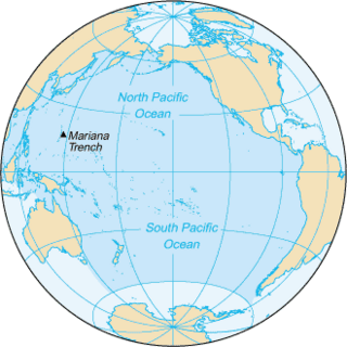
Pacific Ocean Ocean between Asia and Australia in the west, the Americas in the east and Antarctica or the Southern Ocean in the south.

The Pacific Ocean is the largest and deepest of Earth's oceanic divisions. It extends from the Arctic Ocean in the north to the Southern Ocean in the south and is bounded by Asia and Australia in the west and the Americas in the east.

Contents

Park Facilities

Torii gate leading to the beaches below the park, 2015 SB ShorelineParkTorii1 20150916.jpg
Torii gate leading to the beaches below the park, 2015

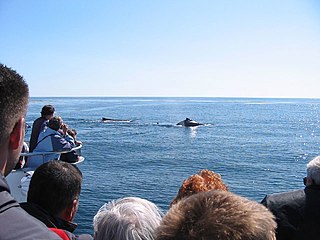
The park includes a playground, picnic area, a whale watching area with a telescope situated next to a statue of a large concrete whale tail, [4] as well as a sister city Japanese garden. The park also provides a clear view of the Channel Islands on a good day, and Gray Whale may be observed during their migration months, along with a number of marine mammals including dolphins and seals. [5]

Playground place with a specific design for children to be able to play there

A playground, playpark, or play area is a place specifically designed to enable children to play there. It is typically outdoors. While a playground is usually designed for children, some target other age groups. Berlin's Preußenpark for example is designed for people aged 70 or higher. A playground might exclude children below a certain age.

Whale watching

Whale watching is the practice of observing whales and dolphins (cetaceans) in their natural habitat. Whale watching is mostly a recreational activity, but it can also serve scientific and/or educational purposes. A study prepared for International Fund for Animal Welfare in 2009 estimated that 13 million people went whale watching globally in 2008. Whale watching generates $2.1 billion per annum in tourism revenue worldwide, employing around 13,000 workers. The size and rapid growth of the industry has led to complex and continuing debates with the whaling industry about the best use of whales as a natural resource.

Statue sculpture primarily concerned as a representational figure

A statue is a free-standing sculpture in which the realistic, full-length figures of persons or animals or non-representational forms are carved in a durable material like wood, metal, or stone. Typical statues are life-sized or close to life-size; a sculpture that represents persons or animals in full figure but that is small enough to lift and carry is a statuette or figurine, while one more than twice life-size is a colossal statue.

A Torii gateway atop the bluff leads to a wooden staircase descending to the tidal beach about 53 ft (16.15 m) feet below, [6] which is completely submerged during high tide and accessible only during low tide. [7] During the low tide periods, the adjacent Leadbetter Beach and Arroyo Burro Beach (aka Hendry's Beach) are accessible to the east and west, respectively.

<i>Torii</i> traditional Japanese gate

A torii is a traditional Japanese gate most commonly found at the entrance of or within a Shinto shrine, where it symbolically marks the transition from the mundane to the sacred.

Leadbetter Beach

Leadbetter Beach is a popular beach in Santa Barbara, California, situated below Leadbetter Hill.

Arroyo Burro Beach

Arroyo Burro Beach, also known as Hendry's Beach by local residents, is a public beach in Santa Barbara County, California. Located off of Cliff Drive, it is the terminus of Arroyo Burro Creek, and stands at the foot of the Santa Barbara coastal bluffs of the Wilcox Property, which is adjacent to the east. The community of Hope Ranch is about one mile to the west.

History

West end of Shoreline Park (looking east), 2015 SB ShorelineParkWest 20150916.jpg
West end of Shoreline Park (looking east), 2015

The area of "the Mesa" where Shoreline Park is located today was utilized as farmland by the Low and Babcock farms until the 1920s. This farmland extended from Cliff Drive (from the north) to the present day Shoreline Park bluffs. [8] When Shoreline Drive and the Marine Terrace subdivisions were constructed during the early 1950s, the present day park land was left undeveloped.

By the early 1960s, a number of attempts had been made to rezone the land to develop residential apartments. In 1963, a group of citizens had urged the City to purchase the land for use as a park, thereby preserving the viewshed and public access. By November of that year, the City Council passed a resolution condemning the land for park and recreational purposes. Subsequently, an ad hoc "Save Our Shoreline Committee" had successfully petitioned voters to approve a bond issue for park acquisition and development. On August 4, 1964, a $1,020,000 ballot proposal was carried out.

Signage at the east end of Shoreline Park, 2014 SBshorelineParkSign 20140908.jpg
Signage at the east end of Shoreline Park, 2014

In 1966, the City purchased the land from private owners for $852,844.96. By August 1967, the City had received an additional $325,000 from their application for Federal land and Water Conservation funds in order to assist with further acquisition expenses. [8]

Until 1967, the park had been commonly known to the public as “The Shoreline Park”. However, in June of that year, a contest (suggested by "La Mesa Improvement Association") was undertaken to select an official park name. The contest judges chose the new name to be “Shoreline Park”. On August 1, 1967, the City Council concurred with this decision. Over the years hence, a number of unsuccessful attempts have been made to change the name of the park.

Richard B. Taylor (1926-1993), a local landscape architect, was hired to design the park. [9] The park was formally dedicated on December 14, 1968. A plaque in memory of the late Congressman Charles M. Teague was installed at the east end of Shoreline Park on January 28, 1974.

Charles M. Teague American politician

Charles McKevett Teague was a congressman in the United States House of Representatives from Ventura County, California, from 1955 to 1974.

MacGillivray Point lookout, 2015 SB ShorelineParkMacGillivrayPoint 20150916.jpg
MacGillivray Point lookout, 2015

In 1995, MacGillivray Point, a sandstone lookout structure was constructed along the bluff toward the western end of the park (situated just west of the intersection of Santa Rosa Place and Shoreline Drive). The lookout point was dedicated after former City Councilor, Mayor, and State Legislator Don MacGillivray, who presided as Mayor during the period of the park's development from 1964-68. Since 2008, MacGillivray Point has been fenced off from public access due to safety risks concerning a potentially catastrophic landslide at the location.

By 2011, the City Parks and Recreation Department reported that cracks had occurred in the stone walls, which were likely to correspond with the location of a landslide. [10] Since March of that year, the city surveyor had been monitoring the site and observed minimal movement in 2 out of the 10 total survey points. The city also considered demolishing the structure's stone wall and flagstone pavement, but determined such a project to be too costly and potentially destructive to the bluff. [11]

Erosion Control Improvements

Studies have observed significant coastal erosion occurring along the edge of Shoreline Park since the 1970s, resulting from storm damage and geological activity. [12]

On January 15 through April 2008, [13] and again on June 19–24, 2008, [14] officials closed the stairway leading down to the beach over public safety concerns from a landslide occurring east of the stairway after repeated heavy rains. [15] [16] A portion of the sidewalk from the bluff above had resulted in a collapse, creating a hazard area for pedestrians. The landslide measured at an estimated 120 ft (36.58 m) wide x 60 ft (18.29 m) long, and toed the beach below at an elevation of about 7 ft (2.13 m). [6] The landslide area, as well as MacGillivray Point (located to the west of the landslide) were fenced off until mitigation and more permanent improvements were implemented through the City-approved Shoreline Park Safety Improvement Project (e.g. Shoreline Park Project), [17] all of which were completed by October 2012. [18] The $237,000 project stipulated; Replacing the sidewalk, fencing, and vegetation around the landslide area; Installing permanent safety fencing around MacGillivray Point to prevent public access; Relocating two park benches away from MacGillivray point; And replacing informational signage, corroding light fixtures and their metal halide bulbs with LEDs. [19]

An additional smaller landslide area was found in preliminary stages of development along the eastern side of the 2008 landslide. [6]

Related Research Articles

California State Route 1 highway in California

State Route 1 (SR 1) is a major north–south state highway that runs along most of the Pacific coastline of the U.S. state of California. At a total of just over 659 miles (1,061 km), it is the longest state route in California. SR 1 has several portions designated as either Pacific Coast Highway (PCH), Cabrillo Highway, Shoreline Highway, or Coast Highway. Its southern terminus is at Interstate 5 (I-5) near Dana Point in Orange County and its northern terminus is at U.S. Route 101 (US 101) near Leggett in Mendocino County. SR 1 also at times runs concurrently with US 101, most notably through a 54-mile (87 km) stretch in Ventura and Santa Barbara counties, and across the Golden Gate Bridge.
Malibu, California City in California, United States

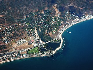
Malibu is a beach city in western Los Angeles County, California, situated about 30 miles (48 km) west of Downtown Los Angeles. It is known for its Mediterranean climate and its 21-mile (34 km) strip of the Malibu coast, incorporated in 1991 into the City of Malibu. The area is known for being the home of Hollywood movie stars, people in the entertainment industry, and other affluent residents. Most Malibu residents live within a few hundred yards of Pacific Coast Highway, which traverses the city, with some residents living up to a mile away from the beach up narrow canyons. As of the 2010 census, the city population was 12,645.

Goleta, California City in California in the United States

Goleta is a city in southern Santa Barbara County, California, USA. It was incorporated as a city in 2002, after a long period as the largest unincorporated populated area in the county. As of the 2000 census, the census-designated place had a total population of 55,204; however, a significant portion of the census territory of 2000 did not incorporate into the new city. The population was 29,888 at the 2010 census. It is known for being near the University of California, Santa Barbara campus, although the CDP of Isla Vista is closer to the campus.

Scarborough Bluffs

The Scarborough Bluffs, also known as The Bluffs, is an escarpment in the Scarborough district of Toronto, Ontario, Canada. There are nine parks along the bluffs, with Bluffers Park being the only one with a beach. Forming much of the eastern portion of Toronto's waterfront, the Scarborough Bluffs stands above the shoreline of Lake Ontario. At its highest point, the escarpment rises 90 metres (300 ft) above the coastline and spans a length of 15 kilometres (9.3 mi).
Goleta Beach

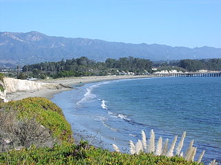
Goleta Beach is a region of coastline located near Goleta, California, just east of the University of California, Santa Barbara (UCSB) campus. A portion of the shore of Goleta Bay is managed by the County of Santa Barbara as Goleta Beach County ParkGBCP. The beach itself is partly man-made as sand was spread onto an existing sandspit in 1945. The beach is a seasonal habitat for migrating shorebirds including the snowy plover, an endangered species. The beach is occasionally closed due to nourishment efforts.

Point Mugu State Park

Point Mugu State Park is a state park located in the Santa Monica Mountains National Recreation Area in Southern California. Part of the Western Santa Monica Mountains, the main park entrance is at 9000 West Pacific Coast Highway, Malibu, California. There is a fee-based parking lot that is open from 8 AM to 10 PM. Park gates do not permit entry after 10 PM.

McLaughlin Eastshore State Park

McLaughlin Eastshore State Park is a state park and wildlife refuge along the San Francisco Bay shoreline of the East Bay between the cities of Richmond, Albany, Berkeley, Emeryville, and Oakland. It encompasses remnant natural wetlands, restored wetlands, as well as landfill west of the Eastshore Freeway. Its shoreline is 8.5 miles (13.7 km) long, and its total area is 1,854 acres (750 ha), which includes both tidelands and uplands. Originally named just Eastshore State Park, it was renamed in October 2012 to honor Save the Bay founder Sylvia McLaughlin. Prior to 2013, it was jointly managed by the California State Parks and East Bay Regional Park District (EBRPD). The state agency and EBRPD executed a 30-year agreement for EBRPD to manage the park.

Douglas Family Preserve

The Douglas Family Preserve is a public park in Santa Barbara, California. The Preserve is located on the mesa above Arroyo Burro Beach. The property spans 70 acres (280,000 m2) of undeveloped ocean-front land, and represents the largest area of coastal open space within the city limits of Santa Barbara.

Point Dume

Point Dume is a promontory on the coast of Malibu, California that juts out into the Pacific Ocean. The point, a long bluff, forms the northern end of the Santa Monica Bay. Point Dume Natural Area affords a vista of the Palos Verdes Peninsula and Santa Catalina Island. Zuma Beach lies to its immediate northwest.

Mori Point

Mori Point is a 110-acre (0.4 km2) park located in Pacifica, California that is part of the Golden Gate National Recreation Area (GGNRA). Mori Point itself is a bluff next to the Pacific Ocean that provides scenic views of the peninsula coastline. In addition to the bluff and ridge, Mori Point contains a few small ponds and wetlands. Trails, many newly built, connect the ridgeline to the entrances to the park and to Sharp Park beach. A portion of the California Coastal Trail will run through Mori Point.

California Coastal Trail a partially completed hiking trail along the coast of California, USA, from the Mexican border to the Oregon border

The California Coastal Trail, or CCT, is an environmental project by the California Coastal Conservancy, an organization developed to enhance coastal resources and promote access to the shore, in 2001.
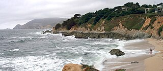
Montara State Marine Reserve & Pillar Point State Marine Conservation Area

Montara State Marine Reserve (SMR) and Pillar Point State Marine Conservation Area (SMCA) are two adjoining marine protected areas that extend offshore from Montara to Pillar Point in San Mateo County on California’s north central coast. The combined area of these marine protected areas is 18.42 square miles (47.7 km2), with 11.76 square miles (30.5 km2) in the SMR and 6.66 in the SMCA. Montara SMR prohibits the take of all living marine resources. Pillar Point SMCA prohibits the take of all living marine resources, except the recreational and commercial take of pelagic finfish by trolling or seine, the commercial or recreational take of Dungeness crab by trap and the commercial or recreational take or market squid by hand-held dip net or round haul net.

Point Sal State Beach beach in Santa Barbara County, California, USA

Point Sal State Beach is a beach on the Pacific coast of California, located near the city of Guadalupe, in the northwestern part of Santa Barbara County. There are approximately 80 acres (320,000 m2) of property with 1.5 miles (2.4 km) of ocean frontage. The rocks around the headland constitute part of the Coast Range Ophiolite, one of the largest ophiolite terranes in the world. This beach is at risk of landslides as there are rocky shorelines and extremely steep slopes.
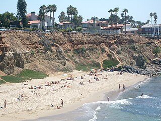
Sunset Cliffs, San Diego neighborhood of San Diego

Sunset Cliffs is a neighborhood in the Point Loma community of San Diego, California. It is bordered by the Pacific Ocean on the west, Ocean Beach on the north, Catalina Blvd. and Santa Barbara St. on the east, and Sunset Cliffs Natural Park on the south.

The Rincon Parkway is a portion of California State Route 1 along the north coast of Ventura County, California. This narrow coastal area north of the city of Ventura and south of the Santa Barbara County line is commonly referred to as The Rincon. The automobile route along this portion of coastline opened up in 1913 as the Rincon Causeway or the Rincon Sea Level Road as the first driveable coastal route for motorists traveling between San Francisco and Los Angeles, California. Stagecoaches were delayed by high tides, storms, mud or rock slides before an alternate route was established in 1878 over the inland Casitas Pass that was accessed by traveling through the narrow Ventura River Valley towards Ojai. The access road alongside the railroad bed, that cut through the area in 1886, provided the basis for building the Rincon Sea Level Road.

Mesa Oil Field

The Mesa Oil Field is an abandoned oil field entirely within the city limits of Santa Barbara, California, in the United States. Discovered in 1929, it was quickly developed and quickly declined, as it proved to be but a relatively small accumulation of oil in a single geologic formation. While the field was active in the 1930s, residential development in most of the Mesa neighborhood of Santa Barbara came to a halt. The field included two major productive areas with a total surface extent of only 210 acres (0.85 km2), and produced 3,700,000 barrels (590,000 m3) of oil during its brief lifetime.

Dana Point State Marine Conservation Area

Dana Point State Marine Conservation Area (SMCA) is one of four adjoining marine protected areas off the coast of Orange County, CA, on California’s South Coast. By itself, the SMCA measures 3.45 square miles. The SMCA protects marine life by limiting the removal of marine wildlife from within its borders, including tide pools. Dana Point SMCA prohibits take of living marine resources except: only the following species may be taken recreationally below the mean lower low tide line only: finfish by hook-and-line or by spearfishing, and lobster and sea urchin. The commercial take of coastal pelagic species by round haul net, and spiny lobster and sea urchin only is allowed.
References

  1. 1 2 City of Santa Barbara, California: Parks Division - Shoreline Park (accessed Aug 2015)
  2. Orozco, Alonzo (December 8, 2011). "SB Planning Commission Focuses on Park Proposal". Santa Ynez Valley Journal.
  3. City of Santa Barbara, Department of Parks & Recreation Interactive Park Map - Shoreline Park (accessed Aug 2015)
  4. John Dickson's Santa Barbara Activity Guide: Parks - Shoreline Park (accessed 2015)
  5. Leadbetter Beach & Shoreline Park: Santa Barbara, California, California's Best Beaches website (accessed Aug 2015)
  6. 1 2 3 Engineering Geologic Report of the 2008 Active Landslide Shoreline Park, Santa Barbara, California., Kenton, Frank J., February 26, 2009
  7. Ford, Ray (December 1, 2007). "Shoreline Park Beach Walking: The closest place to go for a secluded beach walk". Santa Barbara Independent.
  8. 1 2 Histories of Individual Parks: City of Santa Barbara California, Days, Mary L., Santa Barbara Community Development Department, City Planning Division, June 1977, p. 71-72
  9. Online Archive of California (OAC) reference to the Richard B. Taylor papers, Architecture and Design Collection. Art, Design & Architecture Museum; University of California, Santa Barbara
  10. City of Santa Barbara Planning Commission - Staff Report, November 22, 2011
  11. Smithwick, Ben (November 30, 2011). "Relatives of late mayor Don MacGillivray oppose Shoreline Park changes" (PDF). Santa Barbara News-Press.
  12. "Park Officials Review Plan for Shoreline: Active Landslide Necessitates New Path". Santa Barbara Independent. March 8, 2008.
  13. Zachary, Jill (April 26, 2008). "Shoreline Park Steps to Open to Public". edhat: Santa Barbara.
  14. Zachary, Jill (June 24, 2008). "Shoreline Park Beach Access Steps Reopened". Noozhawk. Malamute Ventures LLC. ISSN   1947-6086.
  15. Weldon, Eric (June 21, 2008). "Shoreline Park Beach Steps Closed: Ground Stability Continues to Lose Battle With Nature". Santa Barbara Independent.
  16. Preston, Ben (January 26, 2008). "Severe Weather To Come, Precautions Taken". Santa Barbara Independent.
  17. The City of Santa Barbara City Council Agenda Report, December 6, 2011. santabarbaraca.gov
  18. Crosbie, Jack (October 11, 2012). "Shoreline Park Safety Improvements Finished". Santa Barbara Independent.
  19. The City of Santa Barbara City Council Agenda Report, February 14, 2012. santabarbaraca.gov