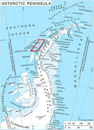
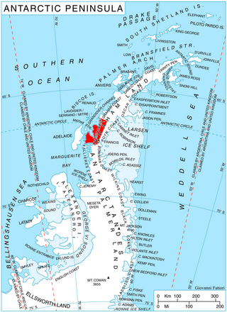
Pavie Ridge or Cap Pavie or Île Pavie is a rocky ridge located at 68°34′S66°59′W in Antarctica which rises over 500 m. It extends south and west from Martin Glacier to Moraine Cove, and forms the southeastern limit of the Bertrand Ice Piedmont, on the west coast of Graham Land.

The French Antarctic Expedition is any of several French expeditions in Antarctica.

Telefon Rocks is a group of rocks 1.5 miles (2.4 km) south-southwest of Demay Point, and just east of Telefon Point, at the west side of the entrance to Admiralty Bay, King George Island, in the South Shetland Islands. Named after the Telefon, a vessel which went aground and was abandoned there in 1908.
The Porthos Range is the second range south in the Prince Charles Mountains of Antarctica, extending for about 30 miles in an east-to-west direction between Scylla Glacier and Charybdis Glacier. First visited in December 1956 by the Australian National Antarctic Research Expeditions (ANARE) southern party under W.G. Bewsher (1956-57) and named after Porthos, a character in Alexandre Dumas, père's novel The Three Musketeers, the most popular book read on the southern journey.
Wirth Peninsula is a broad ice-covered peninsula, 37 kilometres (20 nmi) long, between Eltanin Bay and Fladerer Bay in Ellsworth Land, Antarctica. Mapped by United States Geological Survey (USGS) from surveys and U.S. Navy air photos, 1961–66. Named by Advisory Committee on Antarctic Names (US-ACAN) for Captain Laurence Wirth, commander of USNS Eltanin on Antarctic cruises, September 1966-November 1967.

The Barcroft Islands are a group of small islands and rocks about 5 miles (8 km) in extent, lying close south of Watkins Island, Biscoe Islands. The group comprises St. Brigid, Irving, St. Isidore, Chakarov, Hervé, Montojo, Alcheh, Leppe and Bedford Islands. The islands were mapped from air photos by the Falkland Islands and Dependencies Aerial Survey Expedition (1956–57), and named by the UK Antarctic Place-Names Committee for Sir Joseph Barcroft, a pioneer investigator of the physiological effects of high altitudes and cold.

Bulbur Glacier is a glacier in south-central Thurston Island; it flows south along the west side of Boker Rocks into O'Dowd Cove. It was named by the Advisory Committee on Antarctic Names after E.R. Bulbur, Photographer's Mate in the Eastern Group of U.S. Navy Operation Highjump, which obtained aerial photographs of Thurston Island and adjacent coastal areas, 1946–47.
Crystal Sound is a sound in Antarctica between the southern part of the Biscoe Islands and the coast of Graham Land, with northern limit Cape Evensen to Cape Leblond and southern limit Holdfast Point, Roux Island, Liard Island and the Sillard Islands. It was so named by the UK Antarctic Place-Names Committee in 1960 because many features in the sound are named for men who have undertaken research on the structure of ice crystals. To the north of Crystal Sound, many geographical features are named after physiologists.
Cumbers Reef is a group of rocks aligned in an arc forming the north and west parts of the Amiot Islands, off the southwest part of Adelaide Island. It was named by the UK Antarctic Place-Names Committee for Roger N. Cumbers, 3rd officer of RRS John Biscoe, 1961–62, the ship which assisted the Royal Navy Hydrographic Survey Unit in the charting of this area in 1963.
Davidson Island is a small, dome-shaped ice-covered island between Wollan Island and Shull Rocks in Crystal Sound. It was mapped from air photos obtained by the Ronne Antarctic Research Expedition (1947–48) and the Falkland Islands and Dependencies Aerial Survey Expedition (1958–59) and from surveys by the Falkland Islands Dependencies Survey (1958–59). It was named by the UK Antarctic Place-Names Committee for William L. Davidson, an American physicist who used neutron diffraction to determine the position of the hydrogen atoms in ice.
Dennison Reef is a reef between the Shull Rocks and the Pauling Islands, lying east of the south end of the Biscoe Islands in Crystal Sound. It was mapped from air photos obtained by the Ronne Antarctic Research Expedition (1947–48) and from surveys by the Falkland Islands Dependencies Survey (1958–59). It was named by the UK Antarctic Place-Names Committee for David M. Dennison, a physicist who took x-ray diffraction pictures which were used to interpret the crystal structure of ice.
Petite Rocks are two small isolated rocks in the west part of Sallee Snowfield, about 5 nautical miles (9 km) east of central Dufek Massif, Pensacola Mountains. Mapped by United States Geological Survey (USGS) from surveys and U.S. Navy air photos, 1956–66. The name applied by Advisory Committee on Antarctic Names (US-ACAN) is descriptive of their small size.

Drummond Glacier is a glacier 10 nautical miles (18 km) long and 2 nautical miles (4 km) wide, on the west coast of Graham Land, situated south of Hopkins Glacier and flowing west-northwest between Voit Peak and Sherba Ridge into Darbel Bay east of Sokol Point.

The Eden Rocks are two rocks lying 1.5 km off the east coast of Dundee Island, at the northern end of the Antarctic Peninsula. A small island was reported there on 30 December 1842 by Captain James Clark Ross of the Royal Navy, who named it "Eden Island" for Captain Charles Eden. Following a survey by the Falkland Islands Dependencies Survey in 1953, it was reported that the feature consists of two rocky islets rising to about 90 m in height and lying close together.
Erskine Glacier is a glacier 16 nautical miles (30 km) long on the west coast of Graham Land, flowing west into Darbel Bay to the north of Hopkins Glacier. It was first surveyed by the Falkland Islands Dependencies Survey (FIDS) in 1946–47, and named "West Gould Glacier". With East Gould Glacier it was reported to fill a transverse depression across Graham Land, but further survey in 1957 showed no close topographical alignment between the two. The name Gould has been limited to the east glacier and an entirely new name, for Angus B. Erskine, leader of the first FIDS party to travel down the glacier and to survey it in detail, has been approved for the west glacier.
Hill Glacier is a broad glacier that drains the west-central part of Spaatz Island, Antarctica, at the south side of Ronne Entrance. It was mapped by the United States Geological Survey (USGS) from surveys and U.S. Navy aerial photographs, 1961–66, and was named by the Advisory Committee on Antarctic Names for Lennie J. Hill, a USGS topographic engineer who was a member of the Marie Byrd Land Survey Party, 1967–68.
The Matsuyama Rocks are a small group of rocks close off the west side of Stefan Ice Piedmont, Graham Land, Antarctica. They are located towards the western end of Crystal Sound. They were mapped from air photos taken by the Falkland Islands and Dependencies Aerial Survey Expedition (1956–57), and were named by the UK Antarctic Place-Names Committee after Motonori Matsuyama, Professor of Geology and Geophysics at Kyoto University, Japan, who made laboratory studies of the crystal forms of ice.
Spanley Rocks is a group of about six rocks standing 10 nautical miles (18 km) southwest of Cordiner Peaks, marking the northern extremity of Neptune Range, Pensacola Mountains. Mapped by United States Geological Survey (USGS) from surveys and U.S. Navy air photos, 1956–66. Named by Advisory Committee on Antarctic Names (US-ACAN) for John A. Spanley, Jr., cook at South Pole Station, winter 1965.
Rigsby Islands is a small group of ice-capped islands lying off the northeast coast of Adelaide Island, about 2 nautical miles (3.7 km) south of Sillard Islands. Mapped from air photos taken by Ronne Antarctic Research Expedition (RARE) (1947–48) and Falkland Islands and Dependencies Aerial Survey Expedition (FIDASE) (1956–57). Named by United Kingdom Antarctic Place-Names Committee (UK-APC) for George P. Rigsby, American geologist who has specialized in the investigation of ice crystal structure and the plasticity of ice.
![]() This article incorporates public domain material from "Shull Rocks". Geographic Names Information System . United States Geological Survey.
This article incorporates public domain material from "Shull Rocks". Geographic Names Information System . United States Geological Survey. 


