Sian Lowland or Oversian basin (Ukrainian: Надсіанська котловина) is a lowland located at the border between Poland and Ukraine along the San River. Most of the region is located in Poland except for a small portion in southeastern end which is in Ukraine.
Ukrainian is an East Slavic language. It is the official state language of Ukraine and first of two principal languages of Ukrainians; it is one of the three official languages in the unrecognized state of Transnistria, the other two being Romanian and Russian. Written Ukrainian uses a variant of the Cyrillic script.
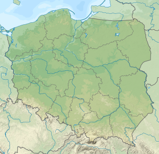
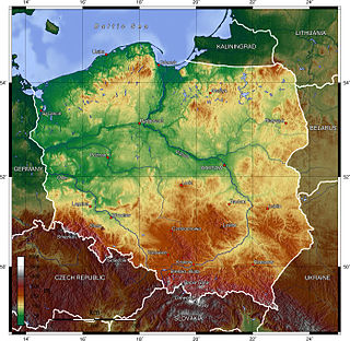
Poland, officially the Republic of Poland, is a country located in Central Europe. It is divided into 16 administrative subdivisions, covering an area of 312,696 square kilometres (120,733 sq mi), and has a largely temperate seasonal climate. With a population of approximately 38.5 million people, Poland is the sixth most populous member state of the European Union. Poland's capital and largest metropolis is Warsaw. Other major cities include Kraków, Łódź, Wrocław, Poznań, Gdańsk, and Szczecin.
Ukraine, sometimes called the Ukraine, is a country in Eastern Europe. Excluding Crimea, Ukraine has a population of about 42.5 million, making it the 32nd most populous country in the world. Its capital and largest city is Kiev. Ukrainian is the official language and its alphabet is Cyrillic. The dominant religions in the country are Eastern Orthodoxy and Greek Catholicism. Ukraine is currently in a territorial dispute with Russia over the Crimean Peninsula, which Russia annexed in 2014. Including Crimea, Ukraine has an area of 603,628 km2 (233,062 sq mi), making it the largest country entirely within Europe and the 46th largest country in the world.
The Carpathian Mountains or Carpathians are a mountain range system forming an arc roughly 1,500 km (932 mi) long across Central and Eastern Europe, making them the third-longest mountain range in Europe after the Ural Mountains with 2,500 km (1,553 mi) and Scandinavian Mountains with 1,700 km (1,056 mi).
The Miocene is the first geological epoch of the Neogene Period and extends from about 23.03 to 5.333 million years ago (Ma). The Miocene was named by Charles Lyell; its name comes from the Greek words μείων and καινός and means "less recent" because it has 18% fewer modern sea invertebrates than the Pliocene. The Miocene is preceded by the Oligocene and is followed by the Pliocene.
Loess is a clastic, predominantly silt-sized sediment that is formed by the accumulation of wind-blown dust. 10% of the Earth's land area is covered by loess or similar deposits.
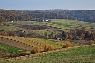
A large proportion of the lowland's forests have been cleared out, although pine forests mixed with firs and birches occur in the region's sandy areas, and fir forests mixed with hornbeams and maples grow in its heavier soils.
Firs (Abies) are a genus of 48–56 species of evergreen coniferous trees in the family Pinaceae. They are found through much of North and Central America, Europe, Asia, and North Africa, occurring in mountains over most of the range. Firs are most closely related to the genus Cedrus (cedar). Douglas firs are not true firs, being of the genus Pseudotsuga.
Hornbeams are hardwood trees in the flowering plant genus Carpinus in the birch family Betulaceae. The 30–40 species occur across much of the temperate regions of the Northern Hemisphere.
The lowland has a population density of 80 persons/km2; the population is predominantly (75%) rural.
This page is based on this Wikipedia article Text is available under the CC BY-SA 4.0 license; additional terms may apply. Images, videos and audio are available under their respective licenses.
Related Research Articles
Ghana is a country in Africa, along the Gulf of Guinea, just a few degrees north of the equator.
Wikimedia Atlas of Ghana
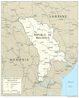
Located in Eastern Europe, Moldova is bordered on the west and southwest by Romania and on the north, south, and east by Ukraine. Most of its territory lies between the area's two main rivers, the Nistru and the Prut. The Nistru forms a small part of Moldova's border with Ukraine in the northeast and southeast, but it mainly flows through the eastern part of the country, separating Bessarabia and Transnistria. The Prut River forms Moldova's entire western boundary with Romania. The Danube touches the Moldovan border at its southernmost tip, and forms the border for 200 m (656 ft).
The geography of Ukraine varies greatly from one region of the country to another, with the majority of the country lying within the East European Plain. Ukraine is the second-largest country by area in Europe. Its various regions have diverse geographic features ranging from highlands to lowlands, as well as climatic range and a wide variety in hydrography.
Podolia or Podilia is a historic region in Eastern Europe, located in the west-central and south-western parts of Ukraine and in northeastern Moldova. The name derives from Old Slavic po, meaning "by/next to/along" and dol, "valley".
UNESCO Biosphere Reserves are environment-protected scientific-research institutions of international status that are created with the intent for conservation in a natural state the most typical natural complexes of biosphere, conducting background ecological monitoring, studying of the surrounding natural environment, its changes under the activity of anthropogenic factors.
Ivano-Frankivsk Oblast is an oblast (region) in western Ukraine. Its administrative center is the city of Ivano-Frankivsk. As is the case with most other oblasts of Ukraine this region has the same name as its administrative center – which was renamed by the Soviet Ukrainian authorities after the Ukrainian writer Ivan Franko on November 9, 1962. Population: 1,382,352 (2016 est.).
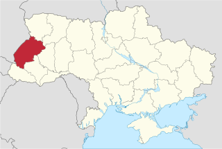
Lviv Oblast is an oblast (province) in western Ukraine. The administrative center of the oblast is the city of Lviv. Population: 2,534,174 (2016 est.).
Subcarpathia denotes the depression area at the outer base of the Carpathian arc. It stretches from Austria to the Czech Republic, Poland, Ukraine and Romania. The opposite lowland plain inside the Carpathians is called the Pannonian Basin.
The East European Plain is a vast interior plain extending east of the North/Central European Plain, and comprising several plateaus stretching roughly from 25 degrees longitude eastward. It includes the westernmost Volhynian-Podolian Upland, the Central Russian Upland, and on the eastern border, encompasses the Volga Upland. The plain includes also a series of major river basins such as the Dnepr Basin, the Oka-Don Lowland, and the Volga Basin. Along the southernmost point of the East European Plain are the Caucasus and Crimean mountain ranges. Together with the North European Plain, and covering the Baltics, Moldova, south-eastern Romania, and its most southern expansion - the Danubian Plain in Northern Bulgaria, it constitutes the European Plain, the greatest mountain-free part of the European landscape.
The European Plain or Great European Plain is a plain in Europe and is a major feature of one of four major topographical units of Europe - the Central and Interior Lowlands. It is the largest mountain-free landform in Europe, although a number of highlands are identified within it.
Małopolska Upland is an upland located in southern part of Poland, in the historic region of Lesser Poland. It extends from the valley of the upper Vistula, between Kraków and Sandomierz, to Opoczno and Radomsko in the northwest. Average height is between 200 and 400 meters above sea level, with the highest peak being the Łysica in the Holy Cross Mountains. Major cities of the region are Kielce, Ostrowiec Świętokrzyski and, Skarżysko-Kamienna.
Sandomierz Basin is a lowland, located in southeastern Poland, between the Lesser Poland Upland, Lublin Upland and the Western Carpathians. Its name comes from the historical city of Sandomierz, and the basin has a triangular shape with the size of around 15,000 km2 (5,800 sq mi). It is drained by the Vistula River, as well as its eastern tributary, the San. Among major cities located in the Sandomierz Basin are Dębica, Jarosław, Mielec, Przemyśl, Przeworsk, Rzeszów, Stalowa Wola, Sandomierz, Tarnobrzeg, and Tarnów.
The Podolian Upland or Podillia Upland is a big in terms of area upland in southwestern Ukraine on the left bank of Dniester, with its small northwestern part stretching into eastern Poland.
The Moldavian Plateau or Pokutian-Bessarabian Upland is a geographic area spanning northeast Romania, most of Moldova, and most of the Chernivtsi Oblast of Ukraine.
Poland is a country in East-Central Europe with an area of 312,679 square kilometres, and mostly temperate climate. Generally speaking, Poland is an almost unbroken plain reaching from the Baltic Sea in the north, to the Carpathian Mountains in the south. Within that plain, terrain variations run in bands east to west.
The Baltic coast has two natural harbors, the larger one in the Gdańsk-Gdynia region, and a smaller one near Szczecin in the far northwest. The northeastern region, also known as the Masurian Lake District with more than 2,000 lakes, is densely wooded and sparsely populated. To the south of the lake district, and across central Poland a vast region of plains extends all the way to the Sudetes on the Czech and Slovak borders southwest, and to the Carpathians on the Czech, Slovak and Ukrainian borders southeast. The central lowlands had been formed by glacial erosion in the Pleistocene ice age. The neighboring countries are Germany to the west, the Czech Republic and Slovakia to the south, Ukraine and Belarus to the east, and Lithuania and the Russian exclave of Kaliningrad to the northeast.
Opillia is a geographic region of the Podolian Upland in Lviv Oblast, Ivano-Frankivsk Oblast and Ternopil Oblast in western Ukraine.
Carpathian Foothills or Subcarpathia or Ciscarpathia is a plain and transitional region in the Western Ukraine and northern Romania between Carpathian Mountains to the southwest and number of plain regions to the east and north. Its average elevation is around 300–500 m (980–1,640 ft) above sea level. The region stretches across Lviv, Ivano-Frankivsk and Chernivtsi Oblasts and Suceava County.
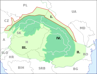
The Central European mixed forest ecoregion is a temperate hardwood forest covering much of northeastern Europe, from Germany to Russia. The area is only about one-third forested, with pressure from human agriculture leaving the rest in a patchwork of traditional pasture, meadows, wetlands. The ecoregion is in the Temperate broadleaf and mixed forest biome, and the Palearctic ecozone, with a Humid Continental climate. It covers 731,154 km2 (282,300 sq mi).
Derman-Ostroh National Nature Park sits in a river valley that separates the southern edge of the Polesian Lowland, and the northern edge of the Podolian Upland in northwestern Ukraine. The terrain is a mixture of pine-oak forest and marshy river lowlands. The park is in the administrative districts of Zdolbuniv Raion and Ostroh Raion, in the southernmost region of Rivne Oblast.