Mindanao is the second-largest island in the Philippines, after Luzon, and seventh-most populous island in the world. Located in the southern region of the archipelago, the island is part of an island group of the same name that also includes its adjacent islands, notably the Sulu Archipelago. According to the 2020 census, Mindanao had a population of 26,252,442, while the entire island group had an estimated population of 27,021,036.

The Philippines is an archipelago that comprises 7,641 islands, and with a total land area of 300,000 square kilometers (115,831 sq mi), it is the world's fifth largest island country. The eleven largest islands contain 95% of the total land area. The largest of these islands is Luzon at about 105,000 square kilometers (40,541 sq mi). The next largest island is Mindanao at about 95,000 square kilometers (36,680 sq mi). The archipelago is around 800 kilometers (500 mi) from the Asian mainland and is located between Taiwan and Borneo.

Leyte Gulf, also known simply as the Leyte, is a gulf in the Eastern Visayan region in the Philippines. The bay is part of the Philippine Sea of the Pacific Ocean, and is bounded by two islands; Samar in the north and Leyte in the west. On the south of the bay is Mindanao Island, separated from Leyte by the Surigao Strait. Dinagat Island partly encloses the gulf to the southeast, and the small Homonhon Island and Suluan Island, sit astride the eastern entrance to the Gulf. It is approximately 130 km (81 mi) north-south, and 60 km (37 mi) east-west.
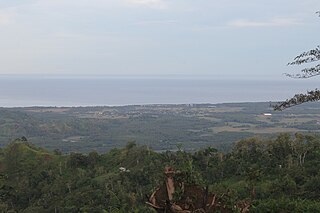
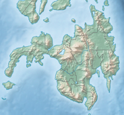
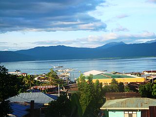
The Moro Gulf is the largest gulf in the Philippines. It is located off the coast of Mindanao Island, and is part of the Celebes Sea. The gulf is one of the country's tuna fishing grounds.

Zamboanga Sibugay, officially the Province of Zamboanga Sibugay, is a province in the Philippines located in the Zamboanga Peninsula region in Mindanao. Its capital and largest town is Ipil and it borders Zamboanga del Norte to the north, Zamboanga del Sur to the east and Zamboanga City to the southwest. To the south lies Sibuguey Bay in the Moro Gulf.

The Spencer Gulf is the westernmost and larger of two large inlets on the southern coast of Australia, in the state of South Australia, facing the Great Australian Bight. It spans from the Cape Catastrophe and Eyre Peninsula in the west to Cape Spencer and Yorke Peninsula in the east.
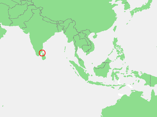
The Gulf of Mannar is a large shallow bay forming part of the Laccadive Sea in the Indian Ocean with an average depth of 5.8 m (19 ft). It lies between the southeastern tip of India and the west coast of Sri Lanka, in the Coromandel Coast region. The chain of low islands and reefs known as Adam’s Bridge or Rama Setu, which includes Mannar Island, separates the Gulf of Mannar from Palk Bay, which lies to the north between India and Sri Lanka. The estuaries of Thamirabarani River and Vaippar River of South India and the Malvathu Oya of Sri Lanka drain into the Gulf. The dugong is found here.

Lobo, officially the Municipality of Lobo, is a 3rd class municipality in the province of Batangas, Philippines. According to the 2020 census, it has a population of 40,736 people.

Milagros, officially the Municipality of Milagros, is a 1st class municipality in the province of Masbate, Philippines. According to the 2020 census, it has a population of 57,538 people.

Dinagat, officially the Municipality of Dinagat, is a 5th class municipality in the province of Dinagat Islands, Philippines. According to the 2020 census, it has a population of 10,621.

Palompon, officially the Municipality of Palompon, is a 2nd class municipality in the province of Leyte, Philippines. According to the 2020 census, it has a population of 58,313 people.
Olutanga is a Philippine island in the Moro Gulf, part of Zamboanga Sibugay Province. It is separated from the Zamboanga Peninsula by a narrow channel and Tantanang Bay.
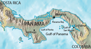
The Gulf of Panama is a gulf of the Pacific Ocean off the southern coast of Panama, where most of eastern Panama's southern shores adjoin it. The Gulf has a maximum width of 250 kilometres, a maximum depth of 220 metres (722 ft) and the size of 2,400 square kilometres (930 sq mi). The Panama Canal connects the Gulf of Panama with the Caribbean Sea, thus linking the Pacific and Atlantic oceans. The Panamanian capital Panama City is the main urban centre on the gulf shore.
The Florida mangroves ecoregion, of the mangrove forest biome, comprise an ecosystem along the coasts of the Florida peninsula, and the Florida Keys. Four major species of mangrove populate the region: red mangrove, black mangrove, white mangrove, and the buttonwood. The mangroves live in the coastal zones in the more tropical southern parts of Florida; mangroves are particularly vulnerable to frosts. Mangroves are important habitat as both fish nursery and brackish water habitats for birds and other coastal species.

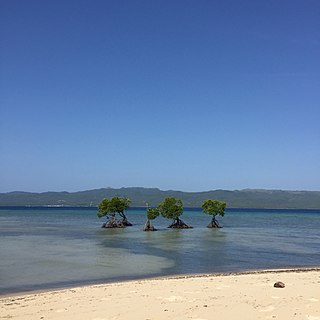
Illana Bay, also known as Iranun Bay, is a large bay of the Moro Gulf, off the southwestern coast of Mindanao island in the Philippines.

The 1918 Celebes Sea earthquake occurred on August 15 at 12:18 UTC near the Moro Gulf coast of Mindanao. It had a magnitude of 8.3 on the moment magnitude scale and a maximum perceived intensity of X (Extreme) on the Mercalli intensity scale. It triggered a tsunami of up to 7 m in height and the combined effects of the earthquake and tsunami led to the deaths of 52 people.
Dumanquilas Bay is an arm of the Moro Gulf on the southern side of the Zamboanga Peninsula in western Mindanao island in the Philippines. It is shared between the provinces of Zamboanga del Sur on the eastern and northern shore, and Zamboanga Sibugay on the western shore. An irregularly shaped peninsula extending to Flecha Point separates it from Pagadian Bay to the east, while to the west, the bay connects with Sibuguey Bay through Canalizo Strait which separates Olutanga island from the mainland of Zamboanga. Politically, it is divided between the Zamboanga del Sur municipalities of Margosatubig, Vincenzo Sagun, Lapuyan and Kumalarang, and the Zamboangay Sibugay municipalities of Buug, Malangas and Alicia.
Alibijaban is a small island located off the southeastern coast of Bondoc Peninsula in the island of Luzon. It belongs administratively to the municipality of San Andres, Quezon province, and is coterminous with the barangay of the same name. With a population of 1,738 inhabitants in 2020, it is the smallest of seven barangays in San Andres.

The Esmeraldas-Pacific Colombia mangroves (NT1409) is an ecoregion of mangrove forests along the Pacific coast of Colombia and Ecuador. It is threatened by human population growth, leading to over-exploitation for wood and clearance for farming and aquaculture.