Michoacán, formally Michoacán de Ocampo, officially the Estado Libre y Soberano de Michoacán de Ocampo, is one of the 31 states which, together with Mexico City, comprise the Federal Entities of Mexico. The state is divided into 113 municipalities and its capital city is Morelia. The city was named after José María Morelos, a native of the city and one of the main heroes of the Mexican War of Independence.

Guanajuato, officially the Free and Sovereign State of Guanajuato, is one of the 32 states that make up the Federal Entities of Mexico. It is divided into 46 municipalities and its capital city is Guanajuato.

León/Bajio International Airport ; officially Aeropuerto Internacional de Guanajuato, is an international airport situated in Silao, Guanajuato, Mexico. It is the main international airport serving the Greater León Metropolitan Area and the State of Guanajuato, which is home to a population of 6 million residents, including the cities of Celaya, Guanajuato, Irapuato, Salamanca, and San Miguel de Allende. In addition to offering domestic flights within Mexico, it serves as a gateway for international travel, connecting Central Mexico to various destinations in the United States. It serves as a focus city for Volaris and supports flight training, cargo, logistics and general aviation activities.

Silao, officially Silao de la Victoria, is a city in the west-central part of the state of Guanajuato in Mexico. It is the seat of the municipality with the same name. As of the 2005 census, the city had a population of 66,485, making it the seventh-largest city in the state. Silao is a center of agricultural and industrial activity.

El Jorullo is a cinder cone volcano in Michoacán, central Mexico, on the southwest slope of the central plateau, 33 miles southeast of Uruapan in an area known as the Michoacán-Guanajuato volcanic field. It is about 6 miles (9.7 km) east-northeast of La Huacana. Its current elevation is 4,360 ft (1,329 m). El Jorullo has four smaller cinder cones which have grown from its flanks. The vents of El Jorullo are aligned in a northeast to southwest direction. Lava from these vents cover nine square km around the volcano. Later eruptions produced lavas that had higher silica contents making them thicker than the earlier basalts and basaltic andesite lavas. El Jorullo's crater is about 1,300 by 1,640 feet wide and 490 feet (150 m) deep.

Yuriria, Guanajuato, Mexico,(Spanish:[ɟʝuˈɾiɾja] ), is one of 46 municipalities in the Mexican state of Guanajuato.

The Lerma River is Mexico's second longest river.

The Bajío is a cultural and geographical region within the central Mexican plateau which roughly spans from northwest of Mexico City to the main silver mines in the northern-central part of the country. This includes the states of Querétaro, Guanajuato, parts of Jalisco, Aguascalientes and parts of Zacatecas, San Luis Potosí and Michoacán.

Valle de Santiago is a municipio (municipality) in the Mexican state of Guanajuato, and also the name of its largest township and cabecera municipal. The municipality is located in the southern portion of the state in the Bajío region of central Mexico, and has an area of some 819.6 square kilometres (316.4 sq mi). The city of Valle de Santiago lies at an elevation of 1,744 metres (5,722 ft) in the east-central part of the municipality, approximately 90 kilometres (56 mi) south of the state capital, Guanajuato.

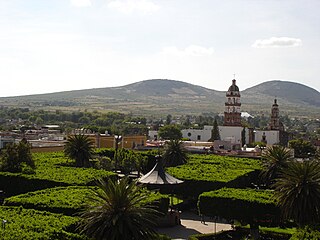
Salvatierra is a Mexican city located in the valley of Huatzindeo in the lowlands of the state of Guanajuato. It is rich in civil and religious architecture; haciendas, bridges, convents and large houses surrounded in tradition and history. With an area of 507.70 square kilometres, Salvatierra accounts for 1.66% the total area of the state. It is bordered to the north by Tarimoro and Cortazar, to the south by Acámbaro and the state of Michoacán, to the west by Yuriria and Santiago Maravatío, and to the northeast by Jaral del Progreso. The municipality had a total of 94,558 inhabitants of which 34,066 lived in the city of Salvatierra, according to the 2005 census. As of 2020 the municipality had a total of 94,126 inhabitants, compared to 2010, the population in Salvatierra decreased by -3.02%
Mexico's natural monuments are protected natural areas.

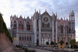
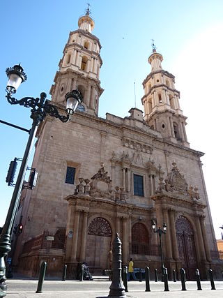
The Roman Catholic Archdiocese of León is an ecclesiastical territory or Metropolitan diocese of the Roman Catholic Church based in the Mexican city of León, Guanajuato. It currently covers an area of 41,940 km², and has a population of 6,500,000, including the states of Guanajuato and Querétaro. It was created as the Diocese of León on January 26, 1863 by Pope Pius IX, and elevated to the rank of a metropolitan archdiocese by Pope Benedict XVI on November 25, 2006, with the suffragan sees of Celaya, Irapuato, and Querétaro.

The Central Mexican Plateau, also known as the Mexican Altiplano, is a large arid-to-semiarid plateau that occupies much of northern and central Mexico. Averaging 1,825 m (5,988 ft) above sea level, it extends from the United States border in the north to the Trans-Mexican Volcanic Belt in the south, and is bounded by the Sierra Madre Occidental and Sierra Madre Oriental to the west and east, respectively.

The Trans-Mexican Volcanic Belt pine–oak forests is a subtropical coniferous forest ecoregion of the Trans-Mexican Volcanic Belt of central Mexico.

Santiago Papasquiaro is a municipality in the Mexican state of Durango. The municipal seat lies at Santiago Papasquiaro. The municipality covers an area of 7,238.4 km². Santiago Papasquiaro municipality is at an average height of 1,730 m (5,675 ft) over the sea level. The municipality lies east of Sierra Madre Occidental Mountain Range. It neighbors with other municipalities: Canelas and Tepehuanes municipalities at the north; San Dimas and Otáez, south; Nuevo Ideal to the east, Tamazula to the west and El Oro located northeast.

The Bajío dry forests is a tropical dry broadleaf forest ecoregion in western−central Mexico.

Michoacán–Guanajuato volcanic field is located in the Michoacán and Guanajuato states of central Mexico. It is a volcanic field that takes the form of a large cinder cone field, with numerous shield volcanoes and maars. Pico de Tancítaro is the highest peak.

Angamacutiro is a municipality in the Mexican state of Michoacán. It is located in the far north portion of the state and its municipal seat is the city of Angamacutiro de la Unión. The name "Angamacutiro" originates from the Uapeani, Pauacume, and Tariácuri native indigenous languages, where it denotes "place on the edge of the canyon" or "lugar al borde de la barranca." This name highlights the region's proximity to a canyon's cliff edge, which is a reflection of its geographic features.

Guanajuato handcrafts and folk art are mostly of European origin, although some indigenous work still survives in some communities. The most notable craft is the making of glazed mayolica pottery, followed by handmade traditional toys of various materials, especially a hard paper mache called cartonería. While handcrafts are not a large an industry here as in some other states, it does have several major handcraft markets which sell to tourists and foreign residents. Other handcraft traditions include wrought iron work, tin and glass, wood carving and leather working.

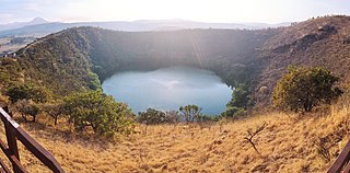
The Alberca de Los Espinos or Alberca de Santa Teresa is a volcanic crater lake that is located in a state protected area that includes 142 hectares within the Mexican state of Michoacán.


