Silas Canyon

Last updated
Silas Canyon
Image of Upper Silias Lake.jpg
Upper Silas Lake near the mouth of Silas Canyon.
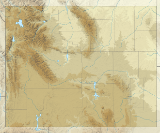
USA Wyoming location map.svg
Red pog.svg
Location in Wyoming
Location Lander, Fremont County, Wyoming, United States
Coordinates 42°47′59.5″N108°57′13.1″W / 42.799861°N 108.953639°W / 42.799861; -108.953639 Coordinates: 42°47′59.5″N108°57′13.1″W / 42.799861°N 108.953639°W / 42.799861; -108.953639 [1]
Elevation10,102 ft (3,079 m) [1]

Silas Canyon is a canyon in the Wind River mountain range near Lander, Wyoming in the United States. [2]

The canyon is a long glacial-carved trough with numerous lakes, which makes it a popular destination for backpackers and fishermen. [3] [4] The 33-acre (13 ha)Thumb Lake sits at its head. [2]

Plant life

Silas Canyon and the surrounding area is home the various plant species common in the Southern Wind River Mountains. Whitebark pine and Lodgepole pine are the predominant tree species. [5]
Related Research Articles

Rocky Mountains Major mountain range in western North America

The Rocky Mountains, also known as the Rockies, are a major mountain range and the largest mountain system in North America. The Rocky Mountains stretch 3,000 mi (4,800 km) in straight-line distance from the northernmost part of western Canada, to New Mexico in the southwestern United States. Depending on differing definitions between Canada and the United States, its northern terminus is located either in northern British Columbia's Terminal Range south of the Liard River and east of the Trench, or in the northeastern foothills of the Brooks Range/British Mountains that face the Beaufort Sea coasts between the Canning River and the Firth River across the Alaska-Yukon border. Its southernmost point is near the Albuquerque area adjacent to the Rio Grande rift and north of the Sandia–Manzano Mountain Range. Being the easternmost portion of the North American Cordillera, the Rockies are distinct from the tectonically younger Cascade Range and Sierra Nevada, which both lie farther to its west.

Grand Teton National Park United States National Park in northwestern Wyoming

Grand Teton National Park is an American national park in northwestern Wyoming. At approximately 310,000 acres (1,300 km2), the park includes the major peaks of the 40-mile-long (64 km) Teton Range as well as most of the northern sections of the valley known as Jackson Hole. Grand Teton National Park is only 10 miles (16 km) south of Yellowstone National Park, to which it is connected by the National Park Service–managed John D. Rockefeller Jr. Memorial Parkway. Along with surrounding national forests, these three protected areas constitute the almost 18-million-acre (73,000-square-kilometer) Greater Yellowstone Ecosystem, one of the world's largest intact mid-latitude temperate ecosystems.

Rocky Mountain National Park National park in Colorado, United States

Rocky Mountain National Park is an American national park located approximately 55 mi (89 km) northwest of Denver in north-central Colorado, within the Front Range of the Rocky Mountains. The park is situated between the towns of Estes Park to the east and Grand Lake to the west. The eastern and western slopes of the Continental Divide run directly through the center of the park with the headwaters of the Colorado River located in the park's northwestern region. The main features of the park include mountains, alpine lakes and a wide variety of wildlife within various climates and environments, from wooded forests to mountain tundra.

Wasatch Range Mountain range in Utah, United States

The Wasatch Range or Wasatch Mountains is a mountain range in the western United States that runs about 160 miles (260 km) from the Utah-Idaho border south to central Utah. It is the western edge of the greater Rocky Mountains, and the eastern edge of the Great Basin region. The northern extension of the Wasatch Range, the Bear River Mountains, extends just into Idaho, constituting all of the Wasatch Range in that state.

Bighorn Mountains Mountain range in Wyoming and Montana, United States

The Bighorn Mountains are a mountain range in northern Wyoming and southern Montana in the United States, forming a northwest-trending spur from the Rocky Mountains extending approximately 200 mi (320 km) northward on the Great Plains. They are separated from the Absaroka Range, which lie on the main branch of the Rockies to the west, by the Bighorn Basin. Much of the land is contained within the Bighorn National Forest.

Wind River Range Mountain subrange of the Rocky Mountains in Wyoming, United States

The Wind River Range is a mountain range of the Rocky Mountains in western Wyoming in the United States. The range runs roughly NW–SE for approximately 100 mi (160 km). The Continental Divide follows the crest of the range and includes Gannett Peak, which at 13,802 ft (4,207 m), is the highest peak in Wyoming; and also Fremont Peak at 13,750 ft (4,191 m), the third highest peak in Wyoming. There are more than 40 other named peaks in excess of 12,999 ft (3,962 m). With the exception of the Grand Teton in the Teton Range, the next 19 highest peaks in Wyoming after Gannett are also in the Winds.

Fremont Peak (Wyoming)

Fremont Peak is the third highest peak in the state of Wyoming, surpassed only by Gannett Peak and Grand Teton, and straddles the boundary between Fremont and Sublette counties in the Wind River Range. It is named for American explorer John C. Fremont who climbed the peak with Charles Preuss and Johnny Janisse from August 13 to August 15, 1842. Kit Carson had been with the climbing party on its first attempt at the peak, but had gone back for supplies the day Fremont and his men reached the summit. Carson is thought by some to have been the first to climb neighboring Jackson Peak. At that time, Fremont Peak was mistakenly thought to be the highest mountain in the Rocky Mountains, although there are actually over 100 higher peaks in the Rocky Mountain range.

Bridger–Teton National Forest Protected area in western Wyoming, US

Bridger–Teton National Forest is located in western Wyoming, United States. The forest consists of 3.4 million acres, making it the third largest National Forest outside Alaska. The forest stretches from Yellowstone National Park, along the eastern boundary of Grand Teton National Park and from there rides along the western slope of the Continental Divide to the southern end of the Wind River Range. The forest also extends southward encompassing the Salt River Range and Wyoming Range mountains near the Idaho border.

Shoshone National Forest National Forest in Wyoming, US

Shoshone National Forest is the first federally protected National Forest in the United States and covers nearly 2,500,000 acres (1,000,000 ha) in the state of Wyoming. Originally a part of the Yellowstone Timberland Reserve, the forest is managed by the United States Forest Service and was created by an act of Congress and signed into law by U.S. President Benjamin Harrison in 1891. Shoshone National Forest is one of the first nationally protected land areas anywhere. Native Americans have lived in the region for at least 10,000 years, and when the region was first explored by European adventurers, forestlands were occupied by several different tribes. Never heavily settled or exploited, the forest has retained most of its wildness. Shoshone National Forest is a part of the Greater Yellowstone Ecosystem, a nearly unbroken expanse of federally protected lands encompassing an estimated 20,000,000 acres (8,100,000 ha).

Bridger Wilderness

The Bridger Wilderness is located in Bridger-Teton National Forest in Wyoming, United States. Originally established in 1931 as a primitive area, 428,169-acre (1,732.74 km2) region was redesignated as a wilderness in 1964 and expanded to the current size in 1984. The wilderness lies on the west side of the Continental Divide in the Wind River Range and contains Gannett Peak; at 13,809 feet (4,209 m) it is the tallest mountain in Wyoming. The wilderness is a part of the Greater Yellowstone Ecosystem.

Black Hills National Forest

Black Hills National Forest is located in southwestern South Dakota and northeastern Wyoming, United States. The forest has an area of over 1.25 million acres (5,066 km²) and is managed by the Forest Service. Forest headquarters are located in Custer, South Dakota. There are local ranger district offices in Custer, Rapid City, and Spearfish in South Dakota, and in Sundance, Wyoming.

California Coast Ranges Mountain range

The Coast Ranges of California span 400 miles (644 km) from Del Norte or Humboldt County, California, south to Santa Barbara County. The other three coastal California mountain ranges are the Transverse Ranges, Peninsular Ranges and the Klamath Mountains.

Sinks Canyon State Park

Sinks Canyon State Park is a public recreation and nature preservation area located in the Wind River Mountains, six miles (9.7 km) southwest of Lander, Wyoming, on Wyoming Highway 131. The state park is named for a portion of the Middle Fork of the Popo Agie River where it flows into an underground limestone cavern, named "the Sinks," and emerges a quarter-mile down the canyon in a pool named "the Rise." The park is managed by the Wyoming Division of State Parks and Historic Sites.

Mount Sacagawea Mountain in Wyoming, United States

Mount Sacagawea is the eighth-highest peak in the U.S. state of Wyoming and the seventh-highest in the Wind River Range. It was named after Sacagawea, the young Lemhi Shoshone woman who accompanied the Lewis and Clark Expedition as an interpreter and guide. The Upper Fremont Glacier is located southeast and the Sacagawea Glacier is northeast of the mountain. Straddling the Continental Divide, Mount Sacagawea is one mile (1.6 km) northwest of Fremont Peak.

The South Warner Wilderness is a federally designated wilderness area 12 miles (19 km) east of Alturas, California, United States. It encompasses more than 70,000 acres (283 km2) of the Warner Mountains. It is within the Modoc National Forest and managed by the US Forest Service. Elevations range from 5,000 feet (1,500 m) to 9,895 feet at Eagle Peak.

Ecology of the Rocky Mountains Ecology of the Rocky Mountain range in North America

The ecology of the Rocky Mountains is diverse due to the effects of a variety of environmental factors. The Rocky Mountains are the major mountain range in western North America, running from the far north of British Columbia in Canada to New Mexico in the southwestern United States, climbing from the Great Plains at or below 1,800 feet (550 m) to peaks of over 14,000 feet (4,300 m). Temperature and rainfall varies greatly also and thus the Rockies are home to a mixture of habitats including the alpine, subalpine and boreal habitats of the Northern Rocky Mountains in British Columbia and Alberta, the coniferous forests of Montana and Idaho, the wetlands and prairie where the Rockies meet the plains, a different mix of conifers on the Yellowstone Plateau in Wyoming and in the high Rockies of Colorado and New Mexico, and finally the alpine tundra of the highest elevations.

Whiskey Mountain Mountain in Wyoming, United States

Whiskey Mountain is located in the northern Wind River Range in the U.S. state of Wyoming. Located 5 mi (8.0 km) south of Dubois, Wyoming, Whiskey Mountain is within the Whiskey Mountain Wilderness Study Area, which has the largest wintering concentration of Rocky Mountain Bighorn sheep in the coterminous United States.

Raid Peak

Raid Peak is located in the Wind River Range in the U.S. state of Wyoming. The mountain is in the Bridger Wilderness of Bridger-Teton National Forest, 1.25 mi (2.01 km) west of the Continental Divide and .85 mi (1.37 km) south of Mount Bonneville. The east face of Raid Peak has one of the most spectacular cliff faces in the Wind River Range, rising almost 2,000 ft (610 m) above an unnamed lake with 1,700 ft (520 m) of that being a nearly sheer wall which is rated at class 5.8 and Grade IV-V. Most ascents up this face take at least a day if not two days.

The flora of the Colorado Plateau and Canyonlands region of the Western United States.

Schiestler Peak

Schiestler Peak is an 11,624-foot-elevation (3,543 meter) mountain summit located in Sublette County of Wyoming, United States.

References

  1. 1 2 "Silas Canyon". Geographic Names Information System . United States Geological Survey.
  2. 1 2 Osthoff, Rich (1999). Fly-Fishing the Rocky Mountain Backcountry. Stackpole Books. ISBN   9780811727662.
  3. Adkison, Ben (2018-06-22). Hiking Wyoming's Wind River Range: A Guide to the Area's Greatest Hiking Adventures. Rowman & Littlefield. ISBN   9781493034642.
  4. Adkison, Ron (1996). Hiking Wyoming's Wind River Range. Globe Pequot Press. ISBN   9781560444022.
  5. Ecological Types of the Eastern Slope of the Wind River Range, Shoshone National Forest, Wyoming (Report). USDA. 2015.