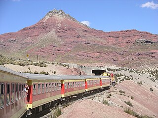
The Yauli Province is one of the nine provinces in Peru that form the Junín Region. It is bordered to the north by the Pasco Region and the Junín Province, to the east by the Tarma Province, to the south by the Jauja Province and to the west by the Lima Region. The population of the province was estimated at 66,093 inhabitants in 2002. The capital of the Yauli Province is La Oroya.
Marcapomacocha District is one of ten districts of the Yauli Province in the Junín Region in Peru.

Chumpe, is a mountain in the north of the Pariacaca mountain range in the Andes of Peru, about 5,200 metres (17,060 ft) high. It is situated in the Junín Region, Yauli Province, in the districts of Huay-Huay and Yauli District. Chumpe lies east of Lake Pumacocha. The mining town of San Cristóbal is situated at its feet.

Huacracocha is a lake in Peru located in the Junín Region, Yauli Province, Morococha District. It lies southeast of the mountain Anticona and south of the mountain Yanashinga, near the Ticlio (Anticona) mountain pass.

Carhuachuco is a mountain in the Pariacaca mountain range in the Andes of Peru, about 5,507 metres (18,068 ft) high. It is situated in the Junín Region, Yauli Province, in the districts Suitucancha and Yauli. Carhuachuco lies south of the mountain Putka and south-west of the lake Putkaqucha.
Putka is a mountain in the Paryaqaqa mountain range in the Andes of Peru, about 5,300 metres (17,388 ft) high. It is located in the Junín Region, Yauli Province, in the districts of Suitucancha and Yauli, north of Qarwachuku.
Anta Q'asa is a mountain in the Andes of Peru, about 5,000 metres (16,404 ft) high. It is situated in the Junín Region, Yauli Province, Marcapomacocha District, and in the Lima Region, Huarochirí Province, Chicla District. Anta Q'asa lies southwest of the mountain Pukaqucha, west of the mountains Yuraqqucha and Sillaqaqa, northeast of Llawa P'ukru and east of the mountain Quriqucha.
Yuraqqucha is a mountain in the Andes of Peru, about 5,100 metres (16,732 ft) high. It is located in the Junín Region, Yauli Province, Morococha District, and in the Lima Region, Huarochirí Province, Chicla District. Yuraqqucha lies northwest of a lake named Waqraqucha, the Antikuna mountain pass and the peak of Antikuna. Anta Q'asa, Sillaqaqa, Inka Kancha and Pukaqucha are situated west, southwest and northwest of Yuraqqucha.
Uqhu or Ukhu is a mountain in the Paryaqaqa mountain range in the Andes of Peru, about 5,200 metres (17,060 ft) high. It is situated in the Junín Region, Yauli Province, Yauli District. Uqhu lies east of a lake named Wallaqucha (Huallacocha).
Quri is a mountain in the Cordillera Central in the Andes of Peru, about 5,200 metres (17,060 ft) high. It is situated in the Lima Region, Huarochiri Province, San Mateo District, and in the Junín Region, Yauli Province, Yauli District. Quri lies west of the main branch of the Paryaqaqa or Waruchiri mountain range, southwest of a lake named Wallaqucha (Huallacocha).
Wayllakancha is a mountain in the Paryaqaqa mountain range in the Andes of Peru, about 5,400 metres (17,717 ft) high. It is situated in the Junín Region, Yauli Province, in the districts Suitucancha and Yauli. The peaks of Qarwachuku, Wallakancha and Ukhu Qhata lie north-west, north and north-east of Wayllakancha.
Pukaqucha is a mountain in the Andes of Peru, about 5,100 metres (16,732 ft) high, at a small lake of the same name. The mountain is located in the Junín Region, Yauli Province, in the districts of Marcapomacocha and Morococha, and in the Lima Region, Huarochirí Province, Chicla District. It lies near the Antikuna pass, northwest of Yuraqqucha and northeast of Inka Kancha and Sillaqaqa.
Quriqucha is a mountain in the Andes of Peru, about 5,000 metres (16,404 ft) high. It is located in the Junín Region, Yauli Province, Marcapomacocha District. It lies west of Anta Q'asa and Sillaqaqa and north of Qunchupata.
Kashpi is a mountain in the Andes of Peru, about 5,200 metres (17,060 ft) high. The mountain is located in the Junín Region, Yauli Province, Marcapomacocha District, and in the Lima Region, Huarochirí Province, Huanza District. It lies southeast of Chunta and northwest of a lake named Pukaqucha.
Yanque is a 5,205-metre-high (17,077 ft) mountain in the Andes of Peru. It is located in the Junín Region, Yauli Province, Carhuacayan District, and in the Lima Region, Huaral Province, Atavillos Alto District. It lies southwest of Tuctococha and northeast of the peak of Alcay.
Alcay or Alcoy is a 5,359-metre-high (17,582 ft) mountain in the Andes of Peru. It is located in the Junín Region, Yauli Province, Carhuacayan District and in the Lima Region, Huaral Province, Atavillos Alto District. It lies southwest of Yanque.
Yantayuq, also known as Shallanqa, is a mountain in the Paryaqaqa mountain range in the Andes of Peru which reaches an altitude of approximately 5,300 metres (17,388 ft). It is located in the Junín Region, Yauli Province, in the districts of Suitucancha and Yauli. Yantayuq lies southwest of Putka and north of Qarwachuku.


