
Trout Lake Township is located in north central Minnesota in Itasca County, United States. It is bordered by the City of Coleraine to the west and north, City of Bovey on the north, an unorganized township on the east, and Blackberry Township to the south. Town government was adopted on March 6, 1894. The population was 1,056 at the 2020 census.

Sabine Lake is a bay on the Gulf coasts of Texas and Louisiana, located approximately 90 miles (140 km) east of Houston and 160 miles (260 km) west of Baton Rouge, adjoining the city of Port Arthur. The lake is formed by the confluence of the Neches and Sabine Rivers and connects to the Gulf of Mexico through Sabine Pass. It forms part of the Texas–Louisiana border, falling within Jefferson and Orange Counties in Texas and Cameron Parish, Louisiana.

Lahontan State Recreation Area is a public recreation area surrounding Lake Lahontan, a 17-mile-long (27 km) impoundment of the Carson River, located approximately 18 miles (29 km) west of Fallon, Nevada. The reservoir features 69 miles (111 km) of shoreline and 11,200 acres (4,500 ha) of water when full. Much of the park lies below 4,000 feet (1,200 m) in elevation and is dominated by high desert sagebrush. Wooded areas of native cottonwoods and willow trees can be found along the shore of the lake. Primary access points to the park are along U.S. Route 50 near the Lahontan Dam and off U.S. Route 95 in the town of Silver Springs. A corridor known as Carson River Ranches connects Lahontan with Fort Churchill State Historic Park.

The Crow River is a tributary of the Mississippi River in south-central Minnesota in the United States. It drains a watershed of 2,756 square miles (7,140 km2).
Rice Lake State Park is a state park of Minnesota, United States, just east of Owatonna. Park lands entirely surround Rice Lake, an important stopping point for migrating waterfowl. The lake covers 750 acres (300 ha) with an average depth of three feet (1 m).

Judge C. R. Magney State Park is a state park in the U.S. state of Minnesota, on the North Shore of Lake Superior. It was named for Clarence R. Magney, a former mayor of Duluth and justice of the Minnesota Supreme Court, who was instrumental in getting 11 state parks and scenic waysides established along the North Shore. The park is best known for the Devil's Kettle, an unusual waterfall and rock formation in which half of the Brule River disappears into a pothole.

The Lake Vermilion-Soudan Underground Mine State Park is a Minnesota state park at the site of the Soudan Underground Mine, on the south shore of Lake Vermilion, in the Vermilion Range (Minnesota). The mine is known as Minnesota's oldest, deepest, and richest iron mine, and now hosts the Soudan Underground Laboratory. As the Soudan Iron Mine, it has been designated a U.S. National Historic Landmark.
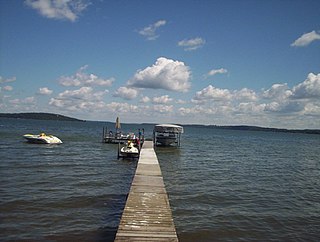
Green Lake — also known as Big Green Lake — is a lake in Green Lake County, Wisconsin, United States. Green Lake has a maximum depth of 237 ft (72 m), making it the deepest natural inland lake in Wisconsin and the second largest by volume. The lake covers 29.72 km2 and has an average depth of 30.48 m (100.0 ft). Green Lake has 43.94 km (27.30 mi) of diverse shoreline, ranging from sandstone bluffs to marshes.

The Straight River is a tributary of the Cannon River, 55.6 miles (89.5 km) long, in southeastern Minnesota, United States. Via the Cannon River, it is part of the watershed of the Mississippi River, draining an area of approximately 450 square miles (1,200 km2) in an agricultural region.
Whitewater Lake is located in Walworth County, Wisconsin, United States in the Kettle Moraine State Forest.

The Poplar River is a river in northeastern Minnesota that drains into Lake Superior.

The Graham Lakes are a pair of lakes located in the northeastern corner of Nobles County, Minnesota. The lakes are known as West Graham Lake and East Graham Lake. West Graham Lake is an oval shaped body of water that extends east-to-west slightly more than one mile (1.6 km). The north-to-south width of the lake is approximately 3/4 of a mile. The area of West Graham Lake is 519.28 acres (2.1015 km2), the average depth is 5 feet (1.5 m), and the maximum depth is 8 feet (2.4 m). The elevation of West Graham Lake is 1,438.7 feet (438.5 m), or 438.52 meters. East Graham Lake is a longer, narrower lake that extends from northeast-to-southwest for 11⁄2 miles. Its width is less than 1/2 mile. The area of East Graham Lake is 511.32 acres (2.0692 km2), the average depth is 5 feet (1.5 m), and the maximum depth is 8 feet (2.4 m). The elevation of East Graham Lake is 1,435.08 feet (437.41 m), or 437.41 meters. A small creek runs from West Graham Lake and empties into East Graham Lake. Another creek runs from East Graham Lake, and eventually flows into the Des Moines River.

Lake Rescue is located in Windsor County of south central Vermont, in the northeastern United States. Occupying 180 acres (73 ha) and reaching depths of 95 feet (29 m), it is the tenth-deepest and 23rd-largest lake in the state. Lake Rescue is located along VT Route 100 about three miles north of Ludlow and Okemo Mountain, and it is surrounded by the town of Ludlow. The lake is fed by the Black River and is the third of four lakes extending from Plymouth, Vermont through Ludlow, with Lake Amherst and Echo Lake to the north and Lake Pauline to the south. The northern section of the lake, connected to the main body via a shallow channel, is referred to as Round Pond.
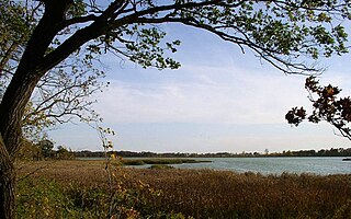
Crescent Lake is a lake located in Tofte Township and Lutsen Township, Cook County, Minnesota.

Gooseberry River is a 23-mile stream in Lake County, Minnesota, USA, draining into Lake Superior. It is known for its waterfalls, near its mouth in Gooseberry Falls State Park. The Gooseberry, like many of its neighboring streams, has an irregular discharge highly dependent on runoff from rain and snow melt. The region around the river was heavily forested and much logging took place during the early 20th century. The forest has since regrown and the falls and mouth of the river are now a thriving tourist destination.
Iowa Lake is a 30-acre lake in Cook County, Minnesota which is a tributary to the Poplar River. It has a maximum depth of 13 feet and is clear down to 7 feet. Water access is provided by a portage trail leading to its northeast shore. The lake is fed primarily by a stream on its northwest shore, with secondary intake coming from a pond of less than 100 feet to the north and an intermittent stream located to the south of the portage trail. Its outlet, on the south, empties into Corny Lake through a wetland area. A 1972 survey by Minnesota's DNR indicated the presence of a beaver lodge on the south outlet, and multiple beaver dams along the course of the creek have converted patches of the marsh into open water. A 1971 survey by the fisheries department indicated the lake was home to populations of northern pike, white sucker, and yellow perch.
Manymoon Lake is a 24-acre lake in Cook County, Minnesota belonging to the Poplar River watershed. At its deepest point it measures only 6.5 feet deep and has abundant aquatic plant life to a depth of 2.5 feet. Water clarity as of 2008 measured 1.41 meters. The substrate consists of muck and stones of no uniform size. Manymoon lake has neither inlet nor permanent outlet, although an intermittent stream feeds a wetland on the end of the southeastern bay. Nonetheless, Manymoon is located in the sub-watershed dominated by Rice Lake to the north, and water from Manymoon enters into lower portions of the Poplar River through Rice Lake's outflow. Manymoon is accessible through a portage off Rice Lake Road.
Bulge Lake is a 12-acre lake in Cook County, Minnesota which is a tributary to the Poplar River. Bulge Lake reaches a maximum depth of 19 feet in a sudden depression just west of the mouth of the stream leading to Dogtrot Lake. Bulge lake is accessible through portages to Silver Lake and Dogtrot Lake. A fisheries survey turned up populations of walleye, northern pike, yellow perch, and white suckers.
Bouder Lake is a 129 acres (52 ha) lake in Cook County, Minnesota and a tributary of the Poplar River. Bouder Lake reaches a maximum depth of 17 feet (5.2 m). Bouder is accessible through a navigable channel leading into Crescent Lake. A fisheries survey turned up populations of walleye, muskellunge, smallmouth bass, yellow perch, and white suckers. An aquatic plants survey found the lake to be home to several species of water marigolds, pondweed, bladderwort, water lily, burreed, sedges, and cattails.

