Related Research Articles

Savanna Portage State Park is a state park of Minnesota, USA, established in 1961 to preserve the historic Savanna Portage, a difficult 6-mile (9.7 km) trail connecting the watersheds of the Mississippi River and Lake Superior. The portage trail crosses a drainage divide separating the West Savanna River, which drains to the Mississippi River and the Gulf of Mexico, from the East Savanna River, which flows in an opposite direction to the Saint Louis River, Lake Superior and the Great Lakes, and the Saint Lawrence River to the Atlantic Ocean.

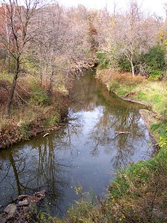
The Straight River is a tributary of the Cannon River, 55.6 miles (89.5 km) long, in southeastern Minnesota, United States. Via the Cannon River, it is part of the watershed of the Mississippi River, draining an area of approximately 450 square miles (1,200 km2) in an agricultural region.
Rice Creek is a tributary of the Mississippi River in the northern suburbs of the Minneapolis–St. Paul metropolitan area of Minnesota in the United States. It is approximately 28 miles (45 km) long and drains a watershed of 201 square miles (520 km2).

The Poplar River is a river in northeastern Minnesota that drains into Lake Superior.

The Temperance River is a 39.2-mile-long (63.1 km) river in northern Minnesota, the United States. It drains into Lake Superior along its north shore just south of Tofte. It flows out of Brule Lake in Cook County generally south towards its mouth within Temperance River State Park. Its name is supposedly a pun on its lack of a sand bar.
Abita Lake is a lake in West Cook, Minnesota, which, at an elevation of 2,040.19 feet (621.85 m) above sea level, is Minnesota's ninth highest named lake. Prior to modern surveys, the lake was once believed to be Minnesota's highest elevation lake.
Crescent Lake is a lake located in Tofte Township and Lutsen Township, Cook County, Minnesota.
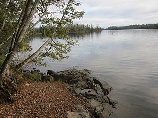
Brule Lake is a lake in Cook County, Minnesota. It is situated between two long sills in the Superior Upland, causing the lake to be eight times longer east and west than it is north and south. Out of the opposite ends flow the Temperance River and the South Brule, a tributary of the Brule River. Brule Lake was logged heavily in the early 1900s, and the region around it was consumed in 1929 by a logging-related forest fire which bears Brule Lake's name. Now the lake is part of the protected Boundary Waters Canoe Area, a federal wilderness area for which Brule Lake serves as an entrance point.
Rice Lake is a lake in Cook County, Minnesota.

Gooseberry River is a 23-mile stream in Lake County, Minnesota, USA, draining into Lake Superior. It is known for its waterfalls, near its mouth in Gooseberry Falls State Park. The Gooseberry, like many of its neighboring streams, has an irregular discharge highly dependent on runoff from rain and snow melt. The region around the river was heavily forested and much logging took place during the early 20th century. The forest has since regrown and the falls and mouth of the river are now a thriving tourist destination.
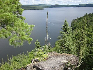
Rose Lake is a lake on the border between Cook County, Minnesota and Ontario.
Iowa Lake is a 30-acre lake in Cook County, Minnesota which is tributary to the Poplar River. It has a maximum depth of 13 feet and is clear down to 7 feet. Water access is provided by a portage trail leading to its northeast shore. The lake is fed primarily by a stream on its northwest shore, with secondary intake coming from a pond of less than 100 feet to the north and an intermittent stream located to the south of the portage trail. Its outlet, on the south, empties into Corny Lake through a wetland area. A 1972 survey by Minnesota's DNR indicated the presence of a beaver lodge on the south outlet, and multiple beaver dams along the course of the creek have converted patches of the marsh into open water. A 1971 survey by the fisheries department indicated the lake was home to populations of northern pike, white sucker, and yellow perch.
Anderson Lake is a 28-acre lake in Cook County, Minnesota which is tributary to the Poplar River. It consists of a western lobe of 15 acres and an eastern lobe of 13 acres. Anderson Lake should not be confused with the Anderson Lake which is tributary to the Temperance River and lies slightly more than one mile northwest.
Silver Lake is a 22-acre lake in Cook County, Minnesota which is tributary to the Poplar River. Silver Lake is six feet deep and has clarity down to 4.5 feet. It has one inflow from Bulge Lake, and drains into Rice Lake South of the inflow on the northwest shore, most of the west shore is a brush bog. Silver Lake has a shoreline of 1.1 miles.
Bulge Lake is a 12-acre lake in Cook County, Minnesota which is tributary to the Poplar River. Bulge Lake reaches a maximum depth of 19 feet in a sudden depression just west of the mouth of the stream leading to Dogtrot Lake. Bulge lake is accessible through portages to Silver Lake and Dogtrot Lake. A fisheries survey turned up populations of walleye, northern pike, yellow perch, and white suckers.
Dogtrot Lake is a 15-acre lake in Cook County, Minnesota which is tributary to the Poplar River. Dogtrot Lake reaches a maximum depth of 24 feet in a depression just south of the mouth of the stream leading to Slip Lake. Dogtrot lake is accessible through portages to Bulge Lake and Slip Lake. A fisheries survey turned up populations of walleye, northern pike, yellow perch, and white suckers.
Slip Lake is a 22-acre lake in Cook County, Minnesota which is tributary to the Poplar River. Slip Lake reaches a maximum depth of 18 feet in a depression just south of the mouth of the stream leading to Fleck Lake. Slip Lake is accessible through portages to Dogtrot Lake and Fleck Lake. A fisheries survey turned up populations of walleye, northern pike, yellow perch, and white suckers.
Bouder Lake is a 136-acre lake in Cook County, Minnesota which is tributary to the Poplar River. Bouder Lake reaches a maximum depth of 17 feet. Bouder is accessible through a navigable channel leading into Crescent Lake. A fisheries survey turned up populations of walleye, muskellunge, smallmouth bass, yellow perch, and white suckers. An aquatic plants survey found the lake to be home to several species of water marigolds, pondweed, bladderwort, water lily, burreed, sedges, and cattails.
Lichen Lake is a 276-acre lake in Cook County, Minnesota which is tributary to the Poplar River. It sits 1781 feet above sea level. Lichen Lake previously also went by the name Beaver Lake, but was formally affirmed in the present name in 1959 by the United States Board on Geographic Names.

Lake Agnes is a lake in Douglas County, in the U.S. state of Minnesota in the watershed of Long Prairie River. It is 135 acres (0.55 km2) in size, and has a maximum depth of 35 feet (11 m).
References
- 1 2 3 4 5 Minnesota Department of Natural Resources. Manymoon Lake Information Report. 2013. Accessed August 28, 2013.
- 1 2 Cook County Information Services, Poplar River Watershed. May 2, 2006. Accessed August 28, 2013.
- ↑ University of Minnesota Lakebrowser. Manymoon Lake. Accessed August 28, 2013.
- ↑ Minnesota Department of Natural Resources. Manymoon Lake Depth Map. 1979. Accessed August 28, 2013.
| This article about a location in Cook County, Minnesota is a stub. You can help Wikipedia by expanding it. |