Simri Simari | |
---|---|
village | |
Simri | |
Coordinates: 25°38′26″N84°07′10″E / 25.64049°N 84.11951°E [1] | |
Country | India |
State | Bihar |
District | Buxar |
Area | |
• Total | 8.518 km2 (3.289 sq mi) |
Elevation | 66 m (217 ft) |
Population (2011) [2] | |
• Total | 17,670 |
• Density | 2,100/km2 (5,400/sq mi) |
Languages | |
• Official | Hindi |
• Local | Bhojpuri |
Time zone | UTC+5:30 (IST) |
PIN | 802135 [2] |
Simri is a village and corresponding community development block in Buxar district of Bihar, India.
As of 2011, the population of Simri was 17,670, in 2,621 households, while the total population of Simri block was 207,225, in 30,388 households. [2]
Year | Pop. | ±% |
---|---|---|
2001 | 181,003 | — |
2011 | 207,225 | +14.5% |
Source: 2011 Census of India [2] |
Simri is a rural block, with no urban centres. Between 2001 and 2011, it experienced the lowest rate of population growth among blocks in Buxar district. As of 2011, the block sex ratio was 909, lower than the district ratio of 922. The sex ratio among the 0-6 age group was higher, at 921, although still somewhat lower than the district ratio of 934. Members of scheduled castes made up 10.86% of block residents, and members of scheduled tribes made up 2.83 (the latter being the highest among blocks in Buxar district). The block's literacy rate was 68.3% (79.53% of men and 55.89% of women), which was slightly lower than the district value of 70.14%. [2]
A majority of Simri block's workforce was engaged in agriculture in 2011, with 22.63% being cultivators who owned or leased their own land and another 48.84% being agricultural labourers who worked someone else's land for wages. 6.93% were household industry workers, and the remaining 21.61%. [2]
There are 156 villages in Simri block, 94 of which are inhabited and 62 of which are uninhabited. They are as follows: [2]
Village name | Total land area (hectares) | Population (in 2011) |
---|---|---|
Rajpur Kalan (Parnahi Khurd) | 38 | 0 |
Rajpur Kalan (Parnahi) | 469 | 2,389 |
Rajpur Kalan (Kamkarhi) | 21 | 0 |
Manikpur | 93.9 | 2,922 |
Keshopur | 320.5 | 5,303 |
Simri (block headquarters) | 815.8 | 17,670 |
Khaira | 72 | 2,835 |
Nagpura | 329.4 | 5,824 |
Balihar | 270.3 | 4,494 |
Bhan Bahrauli | 58 | 672 |
Dubauli | 19 | 0 |
Khandhara | 179.3 | 1,349 |
Panrepur | 30.8 | 1,693 |
Daunpura | 33 | 635 |
Bankat | 90.2 | 52 |
Dubauli | 63.9 | 165 |
Parari | 83.8 | 2,749 |
Saranga | 65.2 | 0 |
Gop Bharauli | 24.7 | 805 |
Rampur | 37.2 | 0 |
Rajpur Kalan (Sonikpur) | 30.8 | 0 |
Rajpur Kalan (Mathauli Kalan) | 110.5 | 0 |
Semri English | 27.7 | 0 |
Semri English | 25.1 | 0 |
Rajpur Kalan (Bhatkara) | 24.7 | 0 |
Rajpur Kalan (Rajipah) | 46 | 768 |
Rajpur Kalan (Patsar) | 13.8 | 1,836 |
Rajpur Kalan (Garaya) | 33.6 | 0 |
Rajpur Kalan (Bishunpur) | 23.5 | 1,287 |
Rajpur Kalan (Balipur) | 50.6 | 0 |
Rajpur Kalan (Dilia) | 114.1 | 1,572 |
Rajpur Kalan (Dalpatpur) | 102 | 0 |
Rajpur Kalan (Sultanhi) | 229 | 0 |
Belarpur | 439 | 0 |
Rajpur Kalan (Parsanpah) | 90 | 1,431 |
Rajpur Kalan (Jagdishpur) | 269 | 0 |
Rajpur Kalan (Dullahpah) | 133 | 1,797 |
Rajpur Kalan (Dullahpah) | 67 | 1,137 |
Rajpur Kalan (Dalipur) | 65.2 | 836 |
Rajpur Kalan | 361.8 | 8,643 |
Neyazipur | 134 | 3,954 |
Dullahpur | 104 | 3,081 |
Rajpur Kalan (Mathauli Khurd) | 44.1 | 0 |
Rajpur Kalan (Kalwari) | 70.4 | 0 |
Rajpur Kalan (Bhimpah) | 70.2 | 0 |
Rajpur Kalan (Dhusari Bhan) | 29.7 | 0 |
Rajpur Kalan (Dhusari Dhari) | 46.9 | 0 |
Rajpur Kalan (Dhusari Geyan) | 26.3 | 0 |
Sahiyar Bhagar | 226 | 0 |
Lachhmipur | 12 | 0 |
Bhinikpura | 50 | 117 |
Bhakura | 49.9 | 1,209 |
Rajauli | 31 | 157 |
Sundarpur | 93 | 0 |
Narayanpur | 48 | 1,166 |
Sahiyar | 82 | 4,978 |
Jalalpur | 112.3 | 1,908 |
Sorbatara | 34 | 0 |
Kanspatti | 23 | 88 |
Arjunpur | 92.3 | 2,257 |
Neyazipur | 172 | 1,704 |
Neyazipur | 521 | 7,418 |
Partappur | 254 | 0 |
Rajapur Taufir | 364.6 | 125 |
Dubha Taufir | 186.6 | 306 |
Dubha | 150.1 | 1,115 |
Rajapur | 491.3 | 5,196 |
Bhaudatahi | 33.2 | 1,143 |
Ekauna | 249 | 3,890 |
Imirta | 28.3 | 0 |
Chhitanpura | 10.5 | 0 |
Nag Amirta | 134.8 | 0 |
Gangauli | 207 | 6,433 |
Mohanpur | 18.2 | 0 |
Kharhatanr | 426 | 5,303 |
Dabauli | 164 | 0 |
Mahrauli | 45.1 | 2,009 |
Nemauwa | 36.9 | 687 |
Nagarpura | 68 | 1,666 |
Bisu Sirkhiri | 29.1 | 0 |
Sirkhiri | 42.7 | 353 |
Ganauli | 53 | 1,418 |
Hirpur | 60.7 | 316 |
Rani Singhanpura | 123.8 | 1,294 |
Ranipatti | 70.4 | 749 |
Narayanpur Bisen | 50 | 502 |
Dubauli Mahesh | 45 | 1,028 |
Arazi Kashi Shingan Pura | 29 | 0 |
Paigambarpur | 60.7 | 4,001 |
Nag Singhanpura | 98.4 | 471 |
Arazi Kashi Singhanpura | 28 | 0 |
Dhanaipur | 65.6 | 380 |
Dumri | 511.2 | 8,794 |
Dia Parmeswar | 306 | 2,302 |
Kharagpur | 51 | 67 |
Purandarpur | 77.9 | 263 |
Bharathpa | 49.3 | 635 |
Kathar | 348.8 | 6,243 |
Diaman | 272.4 | 3,505 |
Domanjhakhra | 120.2 | 0 |
Durasan | 136 | 2,511 |
Berahimpur | 18.6 | 0 |
Kazipur | 80 | 4,678 |
Nikhura | 15 | 0 |
Khaira | 23 | 1,131 |
Chakani | 86 | 2,340 |
Kusahara | 49.9 | 0 |
Semrauna | 38 | 0 |
Chunidanr | 57 | 1,155 |
Gayaghat | 129.9 | 2,468 |
Shikarpur | 27.8 | 0 |
Pakari | 47.8 | 306 |
Lakri | 23.9 | 0 |
Paila Dih | 66.8 | 1,055 |
Sonbarsa | 49 | 127 |
Nagwan Kalika | 40.9 | 170 |
Nagwan Jagdish | 87.2 | 1,596 |
Sisuhar | 60 | 0 |
Dullahpur | 101.2 | 4,345 |
Gopalpur | 123 | 752 |
Dhanaha | 87 | 1,554 |
Majhwari | 230 | 3,880 |
Majhwari | 70.1 | 0 |
Marwatiya | 32 | 0 |
Dhanrajepur | 55.4 | 1,015 |
Chandpali | 106.4 | 1,640 |
Koliya | 364.4 | 0 |
Ramdhanpur | 28.5 | 0 |
Pitambarpur | 25.2 | 110 |
Jagdeopur | 31 | 0 |
Salempur | 81 | 90 |
Rampur Mathiya | 144.1 | 1,878 |
Misrauliya | 40 | 46 |
Parmanpur | 32.4 | 1,022 |
Makundpur | 86.6 | 2,110 |
Basgitiya | 263.4 | 138 |
Majhwari Gautam | 143.3 | 598 |
Usmanpur | 61.1 | 0 |
Lakhrawan | 62 | 176 |
Dhakaich | 547 | 10,144 |
Chaukiya | 103 | 1,574 |
Barbatara | 94 | 485 |
Bhirgu Ashram | 146.5 | 0 |
Tiwari Gangauli | 12 | 0 |
Bitaspur (Unsurveyed) | 0 | 0 |
Sabdalpur (Unsurveyed) | 0 | 0 |
Bijalpur | 0 | 0 |
Dhanapah (Unsurveyed) | 0 | 0 |
Rampah (Unsurveyed) | 0 | 0 |
Taranpur (Unsurveyed) | 0 | 0 |
Shahpur Gangabarar (Unsurveyed) | 0 | 0 |
Haranpura (Unsurveyed) | 0 | 0 |
Kot (Unsurveyed) | 0 | 0 |
ParanpurDegreeSudaPrivyCouncil | 0 | 0 |
Pratappur Naubarar (Unsurveyed) | 0 | 0 |
KeshopurRajpurDegree Suda (Unsurveyed) | 0 | 0 |
Chausa is a village and corresponding community development block in Buxar district, Bihar, India. It is located 11 km west of the district headquarters, Buxar, on the bank of the river Ganga. As of 2011, the population of the village of Chausa was 9,011, in 1,362 households, while the total block population was 103,670, in 15,817 households.
Nokha is a nagar panchayat town and corresponding community development block in Rohtas district in the Indian state of Bihar. As of 2011, the population of the town of Nokha was 27,302 in 4,381 households. The rural population of Nokha block was 146,025, thus bringing the total block population 173,327. The economic situation of this region is mainly dependent on parboiled rice processed by number of rice mills in this area.
Nawanagar is a village and corresponding community development block situated in the Buxar district of Bihar, India, and one of the developing settlements of the district. It is one of several minor villages governed and administered by the Nawanagar panchayat. The village has the only chauki among other nearby villages. Nawangar is one of the seven blocks making up the Dumraon sub-division.
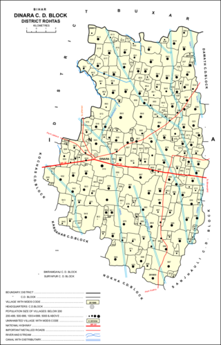
Dinara is a regional market in Rohtas district, Bihar, India, near the National Highway 30. The birthplace of the famous poet Dariya Saheb is just 5 km from Dinara.
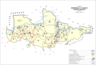
Barhara, also spelled Badahar, Barahara, or Barahra, is a village and corresponding community development block in Bhojpur District of Bihar, India. It is situated on the bank of the river Ganges. By the time of July–August most of the villages under this block are affected by deluge. As of 2011, its population was 6,889, in 927 households, while the total block population was 240,636, in 35,185 households.
Rajpur is a village and corresponding community development block in Rohtas district of Bihar, India. As of 2011, the village of Rajpur had a population of 11,780, in 1,778 households, while Rajpur block had a population of 75,213.
Kargahar is a village and corresponding community development block in Rohtas district of Bihar, India. As of 2011, the population of Kargahar was 10,170, in 1,464 households, while the population of Kargahar block was 225,082, in 31,528 households. The nearest city is Sasaram, the district headquarters.
Kesath is a village and corresponding community development block in Buxar district of Bihar, India. It is the least populous of Buxar's 11 blocks, with a population of 33,820, in 5,304 households. The population of Kesath itself is 14,843, in 2,351 households.
Rajpur is a village and corresponding community development block in Buxar district of Bihar, India.
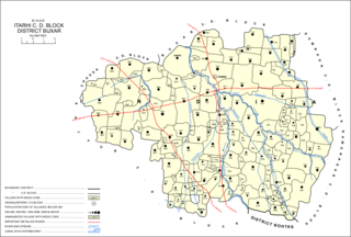
Itarhi is a Nagar Panchayat and corresponding community development block in Buxar district of Bihar, India. According to the 2011 Census of India, its population is 10,275, in 1,711 households, while the total block population is 170,629, in 25,557 households.
Chaugain is a village and corresponding community development block in Buxar district of Bihar, India.
Chakki, also Charkhi, is a village and corresponding community development block in Buxar district of Bihar, India.
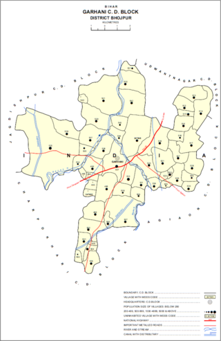
Garhani is a village and corresponding community development block in Bhojpur district of Bihar, India. As of 2011, its population was 5,597, in 959 households. The total block population was 103,262, in 16,427 households.
Udwantnagar is a village and corresponding community development block in Bhojpur district of Bihar, India. As of 2011, its population was 9,000, in 1,496 households. The total block population was 157,809, in 24,336 households.
Charpokhari is a village and corresponding community development block in Bhojpur district of Bihar, India. As of 2011, its population was 1,874, in 314 households. The total block population was 101,363, in 15,961 households.
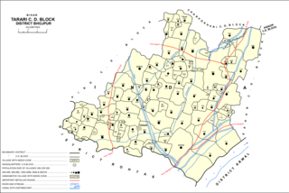
Tarari is a village and corresponding community development block in Bhojpur district of Bihar, India. As of 2011, its population was 3,586, in 393 households. The total block population was 182,631, in 28,316 households.
Agiaon is a village and corresponding community development block in Bhojpur district of Bihar, India. As of 2011, its population was 4,801, in 835 households. The total block population was 148,373, in 23,117 households.
Sandesh is a village and corresponding community development block in Bhojpur district of Bihar, India. As of 2011, its population was 6,874, in 1,037 households. The total block population was 109,712, in 17,011 households.
Nuaon, also spelled Noawan or Noan, is a village and corresponding community development block in Kaimur district of Bihar, India. As of 2011, its population was 5,292, in 798 households, while the overall block population was 106,530, in 15,263 households.
Bhagwanpur is a village and corresponding community development block in Kaimur district of Bihar, India. As of 2011, its population was 6,213, in 1,081 households, while the total block population was 91,113, in 15,145 households.