
The Nzérékoré Region is a region in the southern part of Guinea. Its capital and largest city is Nzérékoré. It is one of the eight regions of Guinea. It is bordered by the countries of Sierra Leone, Liberia, and Ivory Coast, and the Guinean regions of Kankan and Faranah.

The Faranah Region is located in east-central Guinea. It is bordered by the countries of Sierra Leone and Mali and the Guinean regions of Kankan, Mamou, Nzérékoré, and Labé.

Mamou is a prefecture located in the Mamou Region of Guinea. The capital is Mamou. The prefecture covers an area of 8,000 km.² and has an estimated population of 222,000.

Dalaba is a prefecture located in the Mamou Region of Guinea. The capital is Dalaba. The prefecture covers an area of 4,400 km² and has an estimated population of 155,000.
Mali is a prefecture, also known as the Préfecture De Mali, located in the Labé Region of Guinea. The capital is Mali. The prefecture covers an area of 9,790 km.² and has an estimated population of 246,000.

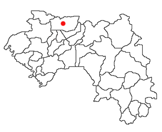
Labé is a prefecture in the Labé Region of Guinea. The capital is Labé. The prefecture covers an area of 3,014 km.² and has an estimated population of 204,000.

The Kindia Region is located in western Guinea. It is bordered by the country of Sierra Leone and the Guinean regions of Conakry, Labé, Mamou, and Boké.

The Labé Region is located in north-central Guinea. It is bordered by the countries of Senegal and Mali and the Guinean regions of Faranah, Kindia, Mamou, and Boké.

Nionsomoridou is a town and sub-prefecture in the Beyla Prefecture in the Nzérékoré Region of south-eastern Guinea.
Lisso is a town and sub-prefecture in the Boffa Prefecture in the Boké Region of western Guinea. As of 2014 it had a population of 11,861 people.
Yalenzou is a town and sub-prefecture in the Nzérékoré Prefecture in the Nzérékoré Region of Guinea.It is located southeast of Nzérékoré along the N2 road. The town of Nzao lies between Yalenzou and Nzérékoré.
Diatiféré is a town and sub-prefecture in the Dinguiraye Prefecture in the Faranah Region of western Guinea. As of 2014 it had a population of 33,729 people.
Songoyah is a town and sub-prefecture in the Faranah Prefecture in the Faranah Region of Guinea. As of 2014 it had a population of 13,422 people.
Tormelin is a town and sub-prefecture in the Fria Prefecture in the Boké Region of western Guinea. As of 2014 it had a population of 12,313 people.
Fafaya is a town and sub-prefecture in the Koubia Prefecture in the Labé Region of northern Guinea.
Balaya is a town and sub-prefecture in the Lélouma Prefecture in the Labé Region of northern-central Guinea.
Maléa is a town and sub-prefecture in the Siguiri Prefecture in the Kankan Region of northern Guinea.
Gougoudjé is a town and sub-prefecture in the Télimélé Prefecture in the Kindia Region of western-central Guinea.
Sarékaly is a town and sub-prefecture in the Télimélé Prefecture in the Kindia Region of western-central Guinea.
Tarihoye is a town and sub-prefecture in the Télimélé Prefecture in the Kindia Region of western-central Guinea.


