
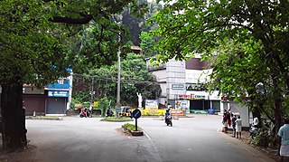
Taliparamba is a Municipality in Taliparamba taluk of Kannur district, Kerala, India. The municipal town spreads over an area of 18.96 square kilometres (7.32 sq mi) and is inhabited by 44,247 number of people.

Kannur University is a multi-campus public university established in 1996 to provide development of higher education in Kasaragod, Kannur, Wayanad districts of Kerala, India. It serves the region of North Malabar. It was established after the passing of Act No. 22 of 1996 of the Kerala Legislative Assembly. A university by the name of "Malabar University" had come into existence even earlier by the passing of an ordinance by the Governor of Kerala, on 9 November 1995.

The Government College of Engineering, Kannur (GCEK) is a public engineering institute affiliated to APJ Abdul Kalam Technological University in Kerala, India. The institute was established in October 1986 by Directorate of Technical Education under the Government of Kerala. In 2012, Careers360, a magazine promoted by Outlook Group, ranked it among the best engineering institutes in Kerala with AA+ rating.
Irikkur is a town and grama panchayat in Kannur District of Kerala state, India.
Brennen College is an educational institution in Kerala, affiliated to the Kannur University. It is located in Dharmadam, Thalassery of Kerala state, India. The college evolved from a school established by the English philanthropist Edward Brennen, master attendant of the Thalassery Port, who had made Thalassery his home. The college was granted special heritage status by the University Grants Commission in 2016 with an aim of conserving college which is more than 125 years old. The college secured 97th position in NIRF all India ranking.

Sreekandapuram is a municipality in Kannur district, in the Indian state of Kerala.
National College, Taliparamba is a private college located in Taliparamba, Kannur district, in the state of Kerala, India. It was founded over 46 years ago.

Pattuvam is a village in Kannur district in the Indian state of Kerala. It is bordered by the Kuppam river on the north, west and south. It shares a border with Taliparamba municipality on the east. A bridge over the river connects Pattuvam to Kottakkeel of Ezhome village in the northwest.

Ezhome is a census town in Kannur district in the Indian state of Kerala.
The District Agricultural Farm in Taliparamba is one of the oldest farms in India. It is located at Karimbam village on State Highway 36 in Kannur district of Kerala State in India. Kerala government has proposed to develop Karimbam farm to be a tourist spot in the state.

Karimbam is a suburb of Taliparamba town in Kannur district in the Indian state of Kerala. It stretches from Government Hospital Karimbam to Panakkad and Varadool villages.
Krishna Menon Memorial Government Women's College is an educational institution in Kannur, India.
Payyannur College is a government aided college located at Edat village in Payyannur, Kerala, India, which is affiliated to Kannur University under Payyanur Educational Society.
Pazhassi Raja N. S. S. College, Mattanur, also locally known as Mattanur College, is a Post Graduate college run by the Nair Service Society. It was established in 1964 as a junior college. It was upgraded as a Degree College in 1967 and as a Post Graduate institution in 1999.

Dharmashala is a small town and headquarters of the Anthoor Municipality in Kannur district of the North Malabar region in the Indian state of Kerala. It is located near National Highway 66 between Kannur and Taliparamba. It is located about 16 kilometres (9.9 mi) north of Kannur. Dharmashala is an important educational and industrial hub in the Kannur district and also an important tourism destination of Malabar region. Dharmashala is a major government officials settlement area in Kannur. A large number of migrant labourers from various other states are working in the industrial development area in Dharmashala. Students from various parts of country study at institutes such as NIFT. Nearby important institutions and attractions are the Kerala Armed Police (KAP) 4th Battalion Mangattuparamba, Government College of Engineering Kannur, Kannur University, KELTRON, Vismaya water theme park, Parassinikkadavu Shree Muthappan temple, Doordarshan kendra, Parassinikkadavu Snake Park, Industrial Development Plot, Central School, EK Nayanar memorial women and child hospital, Si-met college of nursing, M.V.R memorial Ayurveda Medical College, Institute of Co-operative Management (ICM), National Institute of Fashion Technology, Vellikkeel eco tourism park, Hi-Five sports indoor stadium, Kerala Clays and Ceramics Ltd. etc.
Government College Kasaragod(GCK) is the campus located in Vidyanagar, Kasaragod with 19 departments including degree courses, PG courses and research centers under Kannur University was established in 1957. The college is re-accredited with 'A' grade by NAAC. The college is now running with more than 1500 students, 100 teaching staffs and 40 Non-Teaching Staffs. The college has functioning facilities like Library, Computer Lab, Career Guidance and Placement Cell etc. and several active groups such as NSS, NCC, Bhoomithra Sena (BMS), Women Empowerment Cell (WEC) etc.
Anchampeedika is a town in the Kannur district of the North Malabar region in the Indian state of Kerala. Anchampeedika is located roughly 13.5 km from the Kannur Corporation, and it is adjacent to the Taliparamba municipality.
