
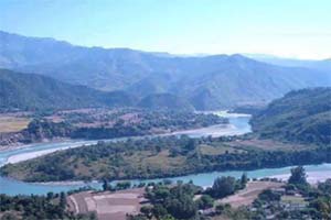
Phungling Municipality is a municipality located in Taplejung District in the Province No. 1 of Nepal. The municipality was formed merging the then two Village Development Committees of Phungling and Dokhu in May 2014. At the time of the 2011 Nepal census it had a population of 19,085 people and 4,480 individual households.
Mangalsen Nepali: मंगलसेन is a municipality and the capital of Achham District in Sudurpashchim Province, Nepal. It was established on 18 May 2014 by merger of the former Village development committees of Janalibandali, Kuntibandali, Oligaun, Jupu, Kalagaun into its current form. At the time of the 2011 Nepal census it had a population of 32,507 people living in 6,604 individual households.
Krishnanagar is a municipality in Kapilvastu district of Lumbini Zone in the western terai part of Nepal. The municipality was established on 18 May 2014 by merging the existing Krishnanagar, Sirsihawa, Shivanagar village development committees (VDCs). on Nepal's southern border with India across from Barhani Bazar. Movement of Indian and Nepalese nationals across the border is unrestricted, however there is a customs checkpoint for goods. Goods bound for Dang and Arcghakhanchi cross here. Krishnanagar is connected by F-12 Chandrauta-Krishnanagar to the east-west Mahendra Highway and Postal Highway.
Kimadanda is a market center in Sandhikharka Municipality of Arghakhanchi District in the Lumbini Zone of Western Nepal. The former village development committee (VDC) was converted into municipality on 18 May 2014 by merging the existing Sandhikharka, Bangla, Narapani, Khanchikot, Kimadada, Argha and Dibharna VDCs. At the time of the 1991 Nepal census, the town had a population of 5,430 living in 1,085 houses. At the time of the 2001 Nepal census, the population was 3,514, of which 53% was literate.

Nilkantha is a Municipality in Dhading District in the Bagmati Zone of central Nepal. The municipality was established on 18 May 2014, merging with the existing Nilkantha, Sunaula Bazar, Murali Bhanjyang, and Sangkosh village development committees. At the time of the 1991 Nepal census it had a population of 1,975 and had 9,667 houses in it.

Chandannath is a municipality in Jumla District in the Karnali Province of Nepal. The municipality was established on 18 May 2014 by merging the existing Mahat Gaun, Talium, Kartik Swami (Jumla), and Chandannath village development committees (VDCs). At the time of the 1991 Nepal census it had a population of 5,842 persons living in 1,000 individual households.
Dakha Kwadi is a town and market center in Pyuthan Municipality in Pyuthan, a Middle Hills district of Rapti Zone, western Nepal. The former Village Development Committee along with Pyuthan Khalanga, Bijubar, Dakha Kwadi, Bijaya Nagar, Dharmawati, Maranthana and Khaira were merged to form the new municipality since 18 May 2014.
Dullu is an urban Municipality in Dailekh District of Karnali Province in Nepal.
Chapakot is a municipality in the southeastern part of Syangja District in Gandaki Province of central Nepal. The new municipality was formed by merging three existing villages—Ratnapur, Kuwakot and Chapakot—on 18 May 2014. In 12 March 2017 The government implemented the new local administrative structure consisting of 744 local units. With the implementation of this new local administrative structure, the old structure will no longer be in existence. According to the new structure, VDCs will be replaced with village councils. Newly merged VDCs are Sankhar, Sekham, Ward no. 8 of Pakbadi & Ward no. of Malyangkot. The office of the municipality is that of the former Chapakot Municipality.
Dharampani is a market center in Bandipur Municipality in Tanahu District in the Gandaki Zone of central Nepal. The formerly Village Development Committee was merged to form new municipality since 18 May 2014. At the time of the 1991 Nepal census it had a population of 3444 people living in 616 individual households.
Dandagaun, Rapti is market center in Sharada Municipality in Salyan District in the Rapti Zone of western-central Nepal. The place formerly existing as Village Development Committee was annexed to form a new municipality since 18 May 2014. At the time of the 1991 Nepal census it had a population of 4198 people living in 740 individual households.
Chainpur is a municipality in Sankhuwasabha District in the Kosi Zone of north-eastern Nepal. It was formed by merging five villages i.e. Chainpur, Siddhakali, Siddhapokhari, Baneshwar and Kharang. The municipality was implemented on 18 May 2014. At the time of the 1991 Nepal census it had a population of 4933 people in 948 households.
Shambhunath Municipality is a Town in Saptari District in the Sagarmatha Zone of south-eastern Nepal. Merging the existing Khoksar Parbaha, Shambhunath, Mohanpur, Bhangha, Basbalpur and Rampur Jamuwa village development committee this new municipality was formed on 18 May 2014. Kathauna Bazar is now finally head office of this new municipality. At the time of the 1991 Nepal census it had a population of 5168 people living in 933 individual households.
Khaliban is a town in Rampur Municipality in Palpa District in the Lumbini Zone of southern Nepal. The municipality was established on 18 May 2014 by merging the existing Gadakot, Gegha, Khaliban, Darchha village development committee. At the time of the 1991 Nepal census it had a population of 2272 people living in 399 individual households.
Shivanagar is a town in Krishnanagar Municipality in Kapilvastu District in the Lumbini Zone of southern Nepal. The former VDC was merged to form the municipality established on 18 May 2014 Krishnanagar, Sirsihawa, Shivanagar VDCs. At the time of the 2011 Nepal census it had a population of 4,774 people living in 735 individual households.
Pathari Shanishchare (पथरी-शनिश्चरे) is a Municipality in Morang District in the Koshi Zone of south-eastern Nepal. It was formed by merging three existing village development committees i.e. Hasandaha, Pathari and Sanischare in May 2014.

Sainamaina Municipality, also known as Dudharakchhe, is one of the new 72 municipalities formed in Nepal. It is located in Rupandehi District in Lumbini Province of southern Nepal. The Municipality was established on 18 May 2014 merging two existing VDCs i.e. Dudharakchhe and Parroha. At the time of the 2011 Nepal census it had a population of 48,178 people. Official website of Sainamaina Municipality is https://sainamainamun.gov.np/.
Khairahani is a municipality in Chitwan District in Bagmati Province of southern Nepal. The municipality was established on 8 May 2014 by merging the existing Khairahani, Kumroj and Chainpur VDCs. At the time of the 1991 Nepal census it had a population of 13,629 people living in 2262 households.

A municipality in Nepal is an administrative division in the Provinces of Nepal. The urban population of Nepal refers to the inhabitants residing in the designated municipal area. Population size has been taken as the principal criteria in the declaration of urban areas in Nepal since 1961. Municipalities can therefore also include rural areas. It functions as a sub-unit of a district. Nepal currently has 293 municipalities, which given the 2011 population estimate of 16,656,057.
Sundar Haraicha is a municipality in Morang District of Province No. 1 in Nepal. It is centered around Biratchowk town which is the gateway to Biratnagar. It borders Itahari Sub- Metropolitan city to the West, Dharan Sub- Metropolitan city to the Northwest and Belbari municipality to the East and is connected by the Mahendra Highway. It is one of the fastest growing cities in the Eastern Nepal and the second largest city of Morang district after Biratnagar with 121,305 inhabitants living in 26,677 households. It consists the town centres of Biratchowk and Gothgaun which are parts of the Greater Birat Development Area which incorporates the cities of Biratnagar-Itahari-Gothgau-Biratchowk-Dharan primarily located on the Koshi Highway in Eastern Nepal, with an estimated total urban agglomerated population of 804,300 people living in 159,332 households.
