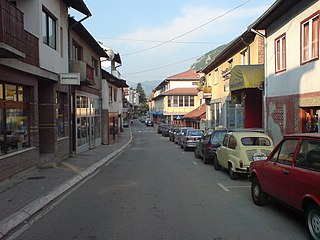
Gizaburuaga is a town and municipality located in the province of Biscay, in the autonomous community of Basque Country, northern Spain.

Jaszyce is a village in the administrative district of Gmina Trzebnica, within Trzebnica County, Lower Silesian Voivodeship, in south-western Poland. Prior to 1945 it was in Germany.

Karmirgyugh is a major village in the Gegharkunik Province of Armenia. The village was founded in 1831 by emigrants from Beyazid. It has two old churches of S. Astvatsatsin and S. Grigor, in ruins with khachkars, and was the discovery site of a boundary stone of King Artashes, inscribed in Aramaic. Urartian ruins are also nearby.
Pierekał is a village in the administrative district of Gmina Szudziałowo, within Sokółka County, Podlaskie Voivodeship, in north-eastern Poland, close to the border with Belarus.

Verin Sasunik ; formerly known as Gharajilar, is a village in the Aragatsotn Province of Armenia. It was depopulated in 1960 and resettled in 1989.

Yuxarı Maralyan is a village in the Jabrayil Rayon of Azerbaijan.

Bozlu is a village in the Lachin Rayon of Azerbaijan.

Kamieniec is a village in the administrative district of Gmina Szczawin Kościelny, within Gostynin County, Masovian Voivodeship, in east-central Poland. It lies approximately 9 kilometres (6 mi) south of Szczawin Kościelny, 17 km (11 mi) south-east of Gostynin, and 96 km (60 mi) west of Warsaw.

Kopaniny is a village in the administrative district of Gmina Zwoleń, within Zwoleń County, Masovian Voivodeship, in east-central Poland. It lies approximately 5 kilometres (3 mi) south-west of Zwoleń and 106 km (66 mi) south of Warsaw.
Çilov-Neft Daşları is a municipality in the Khazar raion of Baku, Azerbaijan. It has a population of 1,797. The municipality consists of an island with the three villages of Çilov and Neft Daşları, and Jiloy.
Żurawieniec is a village in the administrative district of Gmina Babiak, within Koło County, Greater Poland Voivodeship, in west-central Poland.

Pustki is a village in the administrative district of Gmina Puck, within Puck County, Pomeranian Voivodeship, in northern Poland. It lies approximately 10 kilometres (6 mi) north-west of Puck and 50 km (31 mi) north-west of the regional capital Gdańsk.

Rogowo is a village in the administrative district of Gmina Trzebiatów, within Gryfice County, West Pomeranian Voivodeship, in north-western Poland. It lies approximately 11 kilometres (7 mi) north of Trzebiatów, 28 km (17 mi) north of Gryfice, and 96 km (60 mi) north-east of the regional capital Szczecin.
Phượng Sơn is a commune (xã) and village in Lục Ngạn District, Bắc Giang Province, in northeastern Vietnam.

La Jolla Ranch is an unincorporated community in Fresno County, California. It lies at an elevation of 338 feet.

Buštranje is a village in the municipality of Preševo, Serbia. According to the 2002 census, the village had a population of 872 people. Of these, 682 were ethnic Albanians, 186 (21,33 %) were Serbs and 2 others.

Boljanovići is a village in the municipality of Kalinovik, Republika Srpska, Bosnia and Herzegovina.

The Pinacoteca Nazionale is a national museum in Siena, Tuscany, Italy. Inaugurated in 1932, it houses especially late medieval and Renaissance paintings from Italian artists. It is housed in the Brigidi and Buonsignori palaces in the city's center: the former, built in the 14th century, it is traditionally identified as the Pannocchieschi family's residence. The Palazzo Bichi-Buonsignori, although built in the 15th century, has a 19th-century neo-medieval façade based on the city's Palazzo Pubblico.

Gray is a census-designated place (CDP) within the town of Gray, in Cumberland County, Maine, United States. The population was 884 at the 2010 census., comprising 11.4% of the town's population of 7,761.
Prisovjani is a village in Municipality of Struga, Macedonia.


