Slab Cabin Run

Last updated

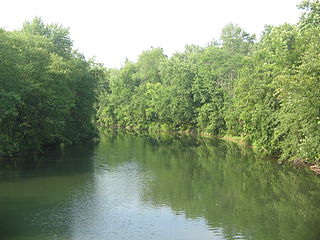
Slab Cabin Run is an 11.2-mile-long (18.0 km) [1] tributary of Spring Creek in Centre County, Pennsylvania in the United States. [2]

Tributary stream or river that flows into a main stem river or lake

A tributary or affluent is a stream or river that flows into a larger stream or main stem river or a lake. A tributary does not flow directly into a sea or ocean. Tributaries and the main stem river drain the surrounding drainage basin of its surface water and groundwater, leading the water out into an ocean.

Centre County, Pennsylvania county in Pennsylvania, United States

Centre County is a county in the U.S. state of Pennsylvania. As of the 2010 census, the population was 153,990. Its county seat is Bellefonte. Centre County comprises the State College, PA Metropolitan Statistical Area.

Pennsylvania State of the United States of America

Pennsylvania, officially the Commonwealth of Pennsylvania, is a state located in the northeastern and Mid-Atlantic regions of the United States. The Appalachian Mountains run through its middle. The Commonwealth is bordered by Delaware to the southeast, Maryland to the south, West Virginia to the southwest, Ohio to the west, Lake Erie and the Canadian province of Ontario to the northwest, New York to the north, and New Jersey to the east.

Slab Cabin Run joins Spring Creek at Houserville. [2]

Houserville, Pennsylvania Census-designated place in Pennsylvania, United States

Houserville is an unincorporated community and census-designated place (CDP) in Centre County, Pennsylvania, United States. It is part of the State College, Pennsylvania Metropolitan Statistical Area. The population was 1,814 at the 2010 census.

Water from Slab Cabin Run flows via Spring Creek to Bald Eagle Creek, the West Branch Susquehanna River, the Susquehanna River, and ultimately Chesapeake Bay.

West Branch Susquehanna River river in Pennsylvania, United States

The West Branch Susquehanna River is one of the two principal branches, along with the North Branch, of the Susquehanna River in the northeastern United States. The North Branch, which rises in upstate New York, is generally regarded as the extension of the main branch, with the shorter West Branch being its principal tributary. The West Branch, which is 243 miles (391 km) long, is entirely within the state of Pennsylvania, draining a large mountainous area within the Allegheny Plateau in the western part of the state. Along most of its course it meanders along mountain ridges and through water gaps, forming a large zigzag arc through central Pennsylvania around the north end of the Allegheny Ridge. In colonial times the river provided an important water route to the Ohio River valley. In the 18th century, its lower valley became a significant industrial heartland of Pennsylvania. In the 20th century, the upper reaches of the West Branch turned a yellow/orange color due to sulfurous drainage from nearby and abandoned deep bituminous coal mines.

Susquehanna River river in the northeastern United States

The Susquehanna River is a major river located in the northeastern and mid-Atlantic United States. At 464 miles (747 km) long, it is the longest river on the East Coast of the United States that drains into the Atlantic Ocean. With its watershed, it is the 16th-largest river in the United States, and the longest river in the early 21st-century continental United States without commercial boat traffic.

Chesapeake Bay An estuary in the U.S. states of Maryland and Virginia

The Chesapeake Bay is an estuary in the U.S. states of Maryland and Virginia. The Bay is located in the Mid-Atlantic region and is primarily separated from the Atlantic Ocean by the Delmarva Peninsula with its mouth located between Cape Henry and Cape Charles. With its northern portion in Maryland and the southern part in Virginia, the Chesapeake Bay is a very important feature for the ecology and economy of those two states, as well as others. More than 150 major rivers and streams flow into the Bay's 64,299-square-mile (166,534 km2) drainage basin, which covers parts of six states and all of Washington, D.C.

See also

Related Research Articles

Swatara Creek is a 72-mile-long (116 km) tributary of the Susquehanna River in east central Pennsylvania in the United States. It rises in the Appalachian Mountains in central Schuylkill County and passes through northwest Lebanon Valley before draining into the Susquehanna at Middletown.

Pine Creek is an 18.4-mile-long (29.6 km) tributary of Penns Creek in central Pennsylvania in the United States. Via Penns Creek, it is part of the Susquehanna River watershed.

Stony Creek is a 23.0-mile-long (37.0 km) tributary of the Susquehanna River in Dauphin County, Pennsylvania, in the United States.

Young Womans Creek is an 11.3-mile-long (18.2 km) tributary of the West Branch Susquehanna River in Pennsylvania in the United States.

Penns Creek tributary of the Susquehanna River in Pennsylvania

Penns Creek is a 67.1-mile-long (108.0 km) tributary of the Susquehanna River in central Pennsylvania in the United States.

Yellow Breeches Creek river in the United States of America

Yellow Breeches Creek, also known as Callapatscink Creek, Callapatschink Creek or Shawnee Creek is a 56.1-mile-long (90.3 km) tributary of the Susquehanna River in central Pennsylvania, USA. There is no agreed upon explanation for the name Yellow Breeches Creek, which it is found in land warrants as early as 1736.

Big Spring Creek is a 5.0-mile-long (8.0 km) tributary of Conodoguinet Creek in Cumberland County, Pennsylvania in the United States.

Sherman Creek (Pennsylvania) river in the United States of America

Sherman Creek is a 53.4-mile-long (85.9 km) tributary of the Susquehanna River in Perry County, Pennsylvania in the United States.

Spring Creek is a 25.2-mile-long (40.6 km) tributary of Bald Eagle Creek in Centre County, Pennsylvania in the United States.

Raystown Branch Juniata River river in the United States of America

The Raystown Branch Juniata River is the largest and longest tributary of the Juniata River in south-central Pennsylvania in the United States.

Elk Creek is a 19.2-mile-long (30.9 km) tributary of Pine Creek in Centre County, Pennsylvania in the United States. Via Penns Creek, it is part of the Susquehanna River watershed.

Little Aughwick Creek is a 10.8-mile-long (17.4 km) tributary of Aughwick Creek in Fulton and Huntingdon counties, Pennsylvania in the United States.

Mahantango Creek is a 36.2-mile-long (58.3 km) tributary of the Susquehanna River in Dauphin, Northumberland, Schuylkill, and Snyder County counties, Pennsylvania in the United States.

The LeTort Spring Run is a 9.4-mile-long (15.1 km) tributary of Conodoguinet Creek in Cumberland County, Pennsylvania in the United States.

Bald Eagle Creek (West Branch Susquehanna River tributary) tributary of the West Branch Susquehanna River in Pennsylvania, United States

Bald Eagle Creek is a 55.2-mile-long (88.8 km) tributary of the West Branch Susquehanna River mostly in Centre County, Pennsylvania, in the United States.

Rauchtown Run tributary of the West Branch Susquehanna River

Rauchtown Run, named Rauchtown Creek on United States Geological Survey maps, is a tributary of the West Branch Susquehanna River in Clinton and Lycoming Counties, Pennsylvania, in the United States.

Cocolamus Creek is a 22.1-mile-long (35.6 km) tributary of the Juniata River in Juniata and Perry counties, Pennsylvania in the United States.

Sugar Run Creek is a tributary of the Susquehanna River in Bradford County, Pennsylvania, in the United States. It is approximately 7.9 miles (12.7 km) and flows through North Branch Township, Windham Township, and Wilmot Township.

Fowler Hollow Run

Fowler Hollow Run is a stream in Perry County, Pennsylvania, in the United States. It is part of the Susquehanna River watershed as it is a tributary of Shultz Creek, which is a tributary of Sherman Creek, which flows into the Susquehanna. The drainage basin for Fowler Hollow Run is 5.59 square miles (14.48 km²) and enters Shultz Creek 3.90 miles (6.28 km) from its mouth on Sherman Creek. It is 48.14 miles (77.47 km) along Sherman Creek to the lower Susquehanna River.

Spring Creek is a 6.0-mile-long (9.7 km) tributary of the Susquehanna River in Dauphin County, Pennsylvania, in the United States.

References

  1. U.S. Geological Survey. National Hydrography Dataset high-resolution flowline data. The National Map, accessed August 8, 2011
  2. 1 2 Gertler, Edward. Keystone Canoeing, Seneca Press, 2004. ISBN   0-9749692-0-6

Coordinates: 40°45′28″N77°51′02″W / 40.757751°N 77.850531°W / 40.757751; -77.850531

Geographic coordinate system Coordinate system

A geographic coordinate system is a coordinate system that enables every location on Earth to be specified by a set of numbers, letters or symbols. The coordinates are often chosen such that one of the numbers represents a vertical position and two or three of the numbers represent a horizontal position; alternatively, a geographic position may be expressed in a combined three-dimensional Cartesian vector. A common choice of coordinates is latitude, longitude and elevation. To specify a location on a plane requires a map projection.