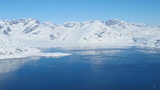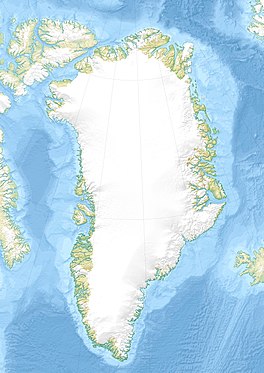
Kaiser Franz Joseph Fjord is a major fjord system in the NE Greenland National Park area, East Greenland.

Ilulissat Icefjord is a fjord in western Greenland. Located 250 km north of the Arctic Circle, the Ilulissat Icefjord runs west 40 km (25 mi) from the Greenland ice sheet to Disko Bay just south of the town of Ilulissat. Ilulissat Icefjord was declared a UNESCO World Heritage Site in 2004 because of its natural beauty and the importance of the fast-moving Jakobshavn Glacier in developing the current scientific understanding of anthropogenic climate change.
Ensomheden, meaning 'Loneliness' in the Danish language, is an uninhabited island in southeastern Greenland. Administratively it is part of the Sermersooq municipality. The weather of the island is characterized by tundra climate.

Bernstorff Fjord is a fjord in King Frederick VI Coast, eastern Greenland.

Umivik Bay, also known as Umiivik and Umerik, is a bay in King Frederick VI Coast, southeastern Greenland. It is part of the Sermersooq municipality.

King Frederick VI Coast is a major geographic division of Greenland. It comprises the coastal area of Southeastern Greenland in Sermersooq and Kujalleq municipalities fronting the Irminger Sea of the North Atlantic Ocean. It is bordered by King Christian IX Land on the north and the Greenland Ice Sheet to the west.
Thorland is a peninsula in the King Frederick VI Coast, southeastern Greenland. It is a part of the Sermersooq municipality.
Akuliarutsip Sermerssua, also known as Nordenskiöld Glacier,, is a large glacier located on the east coast of Greenland.

Odinland, also Odinsland in the Defense Mapping Agency Greenland Navigation charts, is a peninsula in the King Frederick VI Coast, southeastern Greenland. It is a part of the Sermersooq municipality.

Fimbul Glacier, is a glacier in eastern Greenland.

Inglefield Gulf or Inglefield Fjord is a fjord in northwestern Greenland. To the west, the fjord opens into the Baffin Bay. Administratively it belongs to the Avannaata municipality.
Cape Møsting is a headland in the North Atlantic Ocean, southeast Greenland, Kujalleq municipality.

Torgilsbu was a Norwegian hunting, meteorological and radio station located on the King Frederick VI Coast, Southeastern Greenland.

Finnsbu was a Norwegian hunting, meteorological and radio station located on the King Frederick VI Coast, Southeastern Greenland.

Storfjord was a Norwegian hunting, meteorological and radio station ("Storfjord/LMR") located in King Christian IX Land, Eastern Greenland.

Ensom Majestaet is the highest mountain in Odinland, SE Greenland.

Alfheimbjerg is a mountain in the King Frederick VI Coast, Sermersooq, southeastern Greenland.

Bernstorff Glacier, is a glacier in the King Frederick VI Coast, Sermersooq, southeastern Greenland.


