Interpretation
Because the flow rate into or out of the well is not constant, as is the case in a typical aquifer test, the standard Theis solution does not work.
Mathematically, the Theis equation is the solution of the groundwater flow equation for a step increase in discharge rate at the pumping well; a slug test is instead an instantaneous pulse at the pumping well. This means that a superposition (or more precisely a convolution) of an infinite number of sequential slug tests through time would effectively be a "standard" Theis aquifer test.
There are several known solutions to the slug test problem; a common engineering approximation is the Hvorslev method, which approximates the more rigorous solution to transient aquifer flow with a simple decaying exponential function.
The aquifer parameters obtained from a slug test are typically less representative of the aquifer surrounding the well than an aquifer test which involves pumping in one well and monitoring in another. Complications arise from near-well effects (i.e., well skin and wellbore storage), which may make it difficult to get accurate results from slug test interpretation.

An aquifer is an underground layer of water-bearing, permeable rock, rock fractures, or unconsolidated materials. Groundwater from aquifers can be extracted using a water well. Aquifers vary greatly in their characteristics. The study of water flow in aquifers and the characterization of aquifers is called hydrogeology. Related terms include aquitard, which is a bed of low permeability along an aquifer, and aquiclude, which is a solid, impermeable area underlying or overlying an aquifer, the pressure of which could create a confined aquifer. The classification of aquifers is as follows: Saturated versus unsaturated; aquifers versus aquitards; confined versus unconfined; isotropic versus anisotropic; porous, karst, or fractured; transboundary aquifer.

Hydrogeology is the area of geology that deals with the distribution and movement of groundwater in the soil and rocks of the Earth's crust. The terms groundwater hydrology, geohydrology, and hydrogeology are often used interchangeably.
Darcy's law is an equation that describes the flow of a fluid through a porous medium. The law was formulated by Henry Darcy based on results of experiments on the flow of water through beds of sand, forming the basis of hydrogeology, a branch of earth sciences. It is analogous to Ohm's law in electrostatics, linearly relating the volume flow rate of the fluid to the hydraulic head difference via the hydraulic conductivity.
In hydrology, a well test is conducted to evaluate the amount of water that can be pumped from a particular water well. More specifically, a well test will allow prediction of the maximum rate at which water can be pumped from a well, and the distance that the water level in the well will fall for a given pumping rate and duration of pumping.
In hydrogeology, an aquifer test is conducted to evaluate an aquifer by "stimulating" the aquifer through constant pumping, and observing the aquifer's "response" (drawdown) in observation wells. Aquifer testing is a common tool that hydrogeologists use to characterize a system of aquifers, aquitards and flow system boundaries.
A flow net is a graphical representation of two-dimensional steady-state groundwater flow through aquifers.
In science and engineering, hydraulic conductivity, is a property of porous materials, soils and rocks, that describes the ease with which a fluid can move through the pore space, or fractures network. It depends on the intrinsic permeability of the material, the degree of saturation, and on the density and viscosity of the fluid. Saturated hydraulic conductivity, Ksat, describes water movement through saturated media. By definition, hydraulic conductivity is the ratio of volume flux to hydraulic gradient yielding a quantitative measure of a saturated soil's ability to transmit water when subjected to a hydraulic gradient.

Hydraulic head or piezometric head is a specific measurement of liquid pressure above a vertical datum.
In hydrology, there are two similar but distinct definitions in use for the word drawdown:
In the field of hydrogeology, storage properties are physical properties that characterize the capacity of an aquifer to release groundwater. These properties are storativity (S), specific storage (Ss) and specific yield (Sy). According to Groundwater, by Freeze and Cherry (1979), specific storage, [m−1], of a saturated aquifer is defined as the volume of water that a unit volume of the aquifer releases from storage under a unit decline in hydraulic head.
Used in hydrogeology, the groundwater flow equation is the mathematical relationship which is used to describe the flow of groundwater through an aquifer. The transient flow of groundwater is described by a form of the diffusion equation, similar to that used in heat transfer to describe the flow of heat in a solid. The steady-state flow of groundwater is described by a form of the Laplace equation, which is a form of potential flow and has analogs in numerous fields.
A cone of depression occurs in an aquifer when groundwater is pumped from a well. In an unconfined aquifer, this is an actual depression of the water levels. In confined aquifers (artesian), the cone of depression is a reduction in the pressure head surrounding the pumped well.
Groundwater discharge is the volumetric flow rate of groundwater through an aquifer.
Groundwater models are computer models of groundwater flow systems, and are used by hydrologists and hydrogeologists. Groundwater models are used to simulate and predict aquifer conditions.
Well drainage means drainage of agricultural lands by wells. Agricultural land is drained by pumped wells to improve the soils by controlling water table levels and soil salinity.

A well is an excavation or structure created in the ground by digging, driving, or drilling to access liquid resources, usually water. The oldest and most common kind of well is a water well, to access groundwater in underground aquifers. The well water is drawn up by a pump, or using containers, such as buckets or large water bags that are raised mechanically or by hand. Water can also be injected back into the aquifer through the well. Wells were first constructed at least eight thousand years ago and historically vary in construction from a simple scoop in the sediment of a dry watercourse to the qanats of Iran, and the stepwells and sakiehs of India. Placing a lining in the well shaft helps create stability, and linings of wood or wickerwork date back at least as far as the Iron Age.

Dewatering is the removal of water from a location. This may be done by wet classification, centrifugation, filtration, or similar solid-liquid separation processes, such as removal of residual liquid from a filter cake by a filter press as part of various industrial processes.

A drainage equation is an equation describing the relation between depth and spacing of parallel subsurface drains, depth of the watertable, depth and hydraulic conductivity of the soils. It is used in drainage design.

In hydrology, a lens, also called freshwater lens or Ghyben-Herzberg lens, is a convex-shaped layer of fresh groundwater that floats above the denser saltwater and is usually found on small coral or limestone islands and atolls. This aquifer of fresh water is recharged through precipitation that infiltrates the top layer of soil and percolates downward until it reaches the saturated zone. The recharge rate of the lens can be summarized by the following equation:
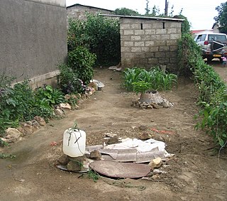
Groundwater pollution occurs when pollutants are released to the ground and make their way into groundwater. This type of water pollution can also occur naturally due to the presence of a minor and unwanted constituent, contaminant, or impurity in the groundwater, in which case it is more likely referred to as contamination rather than pollution. Groundwater pollution can occur from on-site sanitation systems, landfill leachate, effluent from wastewater treatment plants, leaking sewers, petrol filling stations, hydraulic fracturing (fracking) or from over application of fertilizers in agriculture. Pollution can also occur from naturally occurring contaminants, such as arsenic or fluoride. Using polluted groundwater causes hazards to public health through poisoning or the spread of disease.