E-ZPass is an electronic toll collection system used on toll roads, toll bridges, and toll tunnels in the Eastern United States, Midwestern United States, and Southern United States. The E-ZPass Interagency Group (IAG) consists of member agencies in several states, which use the same technology and allow travelers to use the same transponder on toll roads throughout the network.

The Central Florida Expressway Authority (CFX) is a highway authority responsible for construction, maintenance and operation of toll roads in six counties of Greater Orlando. It was created in 2014 to replace the Orlando–Orange County Expressway Authority (OOCEA), which only had authority in Orange County, and as of 2016 no roads outside that county have been added to the system. Other toll roads in the area are operated by Florida's Turnpike Enterprise and the Osceola County Expressway Authority; with the latter of which possibly merging into CFX some time after 2018.
The Maryland Transportation Authority (MDTA) is an independent state agency responsible for financing, constructing, operating, and maintaining eight transportation facilities, currently consisting of two toll roads, two tunnels, and four bridges in Maryland. It also provides the Maryland Department of Transportation with financing for other revenue producing transportation projects.
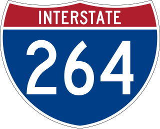
Interstate 264 (I-264) is an Interstate Highway in the US state of Virginia. It serves as the primary east–west highway through the South Hampton Roads region in southeastern Virginia. The route connects the central business districts of Chesapeake, Portsmouth, Norfolk, and Virginia Beach and serves as the most direct link between those cities and the resort beaches along Virginia's Atlantic coast.

State Route 195 is a primary state highway in the U.S. state of Virginia. Known as the Downtown Expressway, the state highway runs 3.39 miles (5.46 km) from Interstate 195 (I-195) east to I-95 within the independent city of Richmond. SR 195 is a toll freeway that connects the West End of Richmond with Downtown Richmond. In conjunction with another toll road, SR 76, the state highway also connects the Southside suburbs of the metropolitan area with downtown. SR 195 has a mainline barrier toll plaza and ramp toll plazas at its interchanges with U.S. Route 1 and US 301 and with US 60, all of which accept E-ZPass. The state highway was constructed in the mid- to late 1970s and is maintained by the Richmond Metropolitan Authority.
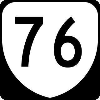
State Route 76 is a state highway in the U.S. state of Virginia. Known as Powhite Parkway, the state highway runs 13.04 miles (20.99 km) from SR 652 near Midlothian north to Interstate 195 (I-195) in Richmond. SR 76 is a toll freeway that connects SR 288, U.S. Route 60, and SR 150 in Chesterfield County with I-195 and SR 195 west of Downtown Richmond. The highway includes a pair of mainline barrier toll plazas and ramp toll plazas at most interchanges, all of which accept E-ZPass. SR 76 is maintained by the Virginia Department of Transportation (VDOT) in Chesterfield County and the Richmond Metropolitan Authority in the city of Richmond. The Richmond section of the freeway was constructed in the early 1970s; the highway was extended to its current terminus in Chesterfield County in the late 1980s.
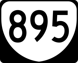
State Route 895, also known as the Pocahontas Parkway and Pocahontas 895, is a primary state highway in the U.S. state of Virginia. It connects the junction of Interstate 95 and State Route 150 in Chesterfield County with Interstate 295 near Richmond International Airport in Henrico County, forming part of a southeastern bypass of Richmond. Due to a quirk in the evolution of the road, the long-planned designation of Interstate 895 could not be used.
E-ZPass Minnesota, formerly MnPass is the brand name associated with a series of high occupancy toll lanes in the Minneapolis-St. Paul Metropolitan Area of Minnesota and is also associated with the electronic toll collection (ETC) system used for those HO/T lanes. The lanes and the ETC system are owned by the Minnesota Department of Transportation (MnDOT) and fully compatible with the multi-state E-ZPass network.
The Richmond Metropolitan Transportation Authority is an independent authority and political subdivision which serves the Richmond, Virginia metropolitan area. Created by an act of the Virginia General Assembly in 1966, then called the Richmond Metropolitan Authority, the RMTA was originally tasked with building and maintaining a toll expressway system for the Richmond area. Since then, the role of the RMTA has been expanded, and it currently owns and operates other facilities, including a number of parking decks. The RMTA built and previously owned The Diamond, home stadium of the Richmond Braves minor league baseball team until 2008, and the current home of the Richmond Flying Squirrels. The Authority also operates historic Main Street Station on behalf of the City of Richmond.

Open road tolling (ORT), also called all-electronic tolling, cashless tolling, or free-flow tolling, is the collection of tolls on toll roads without the use of toll booths. An electronic toll collection system is usually used instead. The major advantage to ORT is that users are able to drive through the toll plaza at highway speeds without having to slow down to pay the toll. In some installations, ORT may also reduce congestion at the plazas by allowing more vehicles per hour/per lane.

State Route 161 is a primary state highway in and near Richmond, Virginia, United States. It extends from an interchange with Interstate 95 (I-95) in the independent city of Richmond north to an intersection with U.S. Route 1 in the Lakeside area of central Henrico County.

The Southside of Richmond is an area of the Metropolitan Statistical Area surrounding Richmond, Virginia. It generally includes all portions of the City of Richmond that lie south of the James River, and includes all of the former city of Manchester. Depending on context, the term "Southside of Richmond" can include some northern areas of adjacent Chesterfield County, Virginia in the Richmond-Petersburg region. With minor exceptions near Bon Air, VA, the Chippenham Parkway forms the border between Chesterfield County and the City of Richmond portions of Southside, with some news agencies using the term "South Richmond" to refer to the locations in Southside located in the city proper.

State Route 147 is a primary state highway in the U.S. state of Virginia. The state highway runs 13.13 miles (21.13 km) from U.S. Route 60 in Midlothian east to US 60 in Richmond. In various places, it is known as Huguenot Road, River Road, Cary Street Road and Main Street. SR 147 connects Midlothian with the West End of Richmond via the Huguenot Memorial Bridge across the James River. Within Richmond, the state highway follows Cary Street, a major thoroughfare that connects the city's two major universities, the University of Richmond and Virginia Commonwealth University, with Downtown Richmond.

Transportation in the Commonwealth of Virginia is by land, sea and air. Virginia's extensive network of highways and railroads were developed and built over a period almost 400 years, beginning almost immediately after the founding of Jamestown in 1607, and often incorporating old established trails of the Native Americans.

Transportation in Richmond, Virginia and its immediate surroundings include land, sea and air modes. This article includes the independent city and portions of the contiguous counties of Henrico and Chesterfield. While almost all of Henrico County would be considered part of the Richmond area, southern and eastern portions of Chesterfield adjoin the three smaller independent cities of Petersburg, Hopewell, and Colonial Heights, collectively commonly called the Tri-Cities area. A largely rural section of southwestern Chesterfield may be considered not a portion of either suburban area.

State Route 168 is a primary state highway in the South Hampton Roads region of the U.S. state of Virginia. It runs from the border with North Carolina through the independent cities of Chesapeake and Norfolk where it ends in the Ocean View area near the Hampton Roads Bridge-Tunnel.

TxTag, operated by the Texas Department of Transportation (TxDOT), is one of three interoperable electronic toll collection systems in Texas. The system is also interoperable with the K-TAG system used in Kansas and the Pikepass system used in Oklahoma.
The North Carolina Turnpike Authority was created in 2002 to speed the implementation of needed transportation improvements by funding some projects with tolls. Governed by a nine-member authority board, it is located within the Department of Transportation and under the direct supervision of the Secretary of Transportation. The authority has the power to study, plan, develop and undertake preliminary design work on up to eleven turnpike projects. At the conclusion of these actives, the authority is authorized to design, establish, purchase, construct, operate and maintain toll highways and bridges. The authority is also authorized to designate one or more lanes of any highway, or portion thereof, into a high-occupancy toll lanes or other type of managed lanes; provided that such designation does not reduce the number of existing non-toll general purpose lanes.