
Accomack County is a United States county located in the eastern edge of the Commonwealth of Virginia. Together, Accomack and Northampton counties make up the Eastern Shore of Virginia, which in turn is part of the Delmarva Peninsula, bordered by the Chesapeake Bay and the Atlantic Ocean. The Accomack county seat is the town of Accomac.
Northampton County is a county located in the U.S. state of North Carolina. As of the 2010 census, the population was 22,099. Its county seat is Jackson.

Cape Charles is a town / municipal corporation in Northampton County, Virginia, United States. The population was 1,009 as of the 2010 U.S.Decennial Census.

Eastville is a town in Northampton County, Virginia, United States. The population was 203 at the 2000 census. It is the county seat of Northampton County. The Northampton County Courthouse Historic District is part of the Eastville Historic District at the county seat.
The Eastern Shore of Virginia consists of two counties on the Atlantic coast detached from the mainland of the Commonwealth of Virginia in the United States. The 70-mile-long (110 km) region is part of the Delmarva Peninsula and is separated from the rest of Virginia by the Chesapeake Bay. Its population was 45,553 as of 2010.

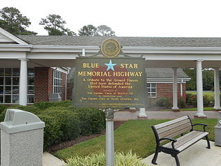
Founded in 1889, the Association for the Preservation of Virginia Antiquities was the United States' first statewide historic preservation group. In 2003 the organization adopted the new name APVA Preservation Virginia to reflect a broader focus on statewide Preservation and in 2009 it shortened its name to Preservation Virginia. Preservation Virginia owns historic sites across Virginia including Historic Jamestowne, located at Jamestown, Virginia, site of the first permanent English settlement in North America, and the Cape Henry Light, one of the first public works projects of the United States of America.

State Route 183 is a primary state highway in the U.S. state of Virginia. Known as Occohannock Neck Road, the state highway runs 7.45 miles (11.99 km) from SR 613 and SR 709 in Jamesville east to U.S. Route 13 Business in Exmore in northern Northampton County.

State Route 184 is a primary state highway in the U.S. state of Virginia. The state highway runs 3.20 miles (5.15 km) from Washington Avenue and Bay Street in Cape Charles east to U.S. Route 13 and US 13 Business near Bayview. SR 184 connects US 13 with Cape Charles in southern Northampton County. The state highway is the old alignment of US 13 from when the U.S. highway used the Little Creek-Cape Charles Ferry to cross the Chesapeake Bay to Norfolk. SR 184 was designated after US 13 was extended south to the new terminal of the Little Creek Ferry at Kiptopeke and later the Chesapeake Bay Bridge-Tunnel.

Lake Gaston is a hydroelectric reservoir in the eastern United States. Part of the lake is in the North Carolina counties of Halifax, Northampton, and Warren. The part extending into Virginia lies in Brunswick and Mecklenburg counties. Lake Gaston is roughly 35 miles (56 km) long and covers over 20,000 acres (81 km2), with 350 miles (560 km) of shoreline.

Cape Charles Coastal Habitat Natural Area Preserve is a 29-acre (12 ha) Natural Area Preserve located in Northampton County, Virginia on the Chesapeake Bay side of Virginia's Eastern Shore. The small preserve protects coastal beach, dune, and maritime forest habitat, preserving a home for the northeastern beach tiger beetle, listed as threatened in the United States. Coast bedstraw grows on the dunes. The preserve serves as a staging area for southward-bound migratory birds in the fall.
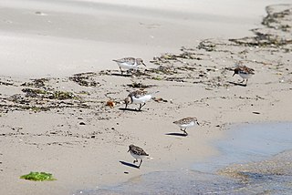
Savage Neck Dunes Natural Area Preserve is a 298-acre (121 ha) Natural Area Preserve located in Northampton County, Virginia on the Chesapeake Bay. Fifty-foot-tall (15 m) dunes within the preserve are among the highest points on Virginia's Eastern Shore. The preserve contains beach, dune, and maritime forest natural communities of various sorts, as well as habitat for migratory songbirds and northeastern beach tiger beetles. Regionally rare plants at the preserve include Engelmann's umbrella-sedge, dwarf burhead, and southern bladderwort.
William B. Trower Bayshore Natural Area Preserve is a Natural Area Preserve located in Northampton County, Virginia. A small preserve with no public facilities, it is located on the Chesapeake Bay, and contains beach strand and dune communities. It supports a population of the northeastern beach tiger beetle, as well as some scrubland and woodland areas.
Wreck Island Natural Area Preserve is a 1,380-acre (5.6 km2) Natural Area Preserve located in Northampton County, Virginia. One of the Virginia Barrier Islands, it protects various marsh, beach, grassland, dune, and shrubland habitats. It was designated as part of the National Audubon Society's "Barrier Island/Lagoon System Important Bird Area" for its importance as a nursery for nesting bird colonies. The island, which is slowly migrating towards the mainland, formerly featured dune-like mounds of shells which were destroyed by Hurricane Isabel.

Franktown is an unincorporated community in Northampton County, Virginia, United States.
Silver Beach is an unincorporated community in Northampton County, Virginia, United States.
District 1 of the Virginia Senate is a senatorial district that encompasses all of the City of Williamsburg, most of the City of Newport News and parts of James City County, York County, the City of Suffolk and the City of Hampton. The current Senator from District 1 is Monty Mason.
District 6 of the Virginia Senate is a senatorial district that encompasses portions of Accomack County, Mathews County, Northampton County, Norfolk and Virginia Beach in the U.S. state of Virginia. This district is currently represented by Lynwood Lewis.
Smith Vocational and Agricultural High School is a four-year Career/Technical High School located in Northampton, Massachusetts. Smith Vocational and Agricultural High School is a public high school for residents of Northampton and tuition students from all of Hampshire County. Students spend alternating weeks in shop and academic programs as they prepare for both a high school diploma and a Certificate of Occupational Proficiency. The school is accredited by the New England Association of Schools and Colleges, and all shop programs meet state standards for vocational education programs.
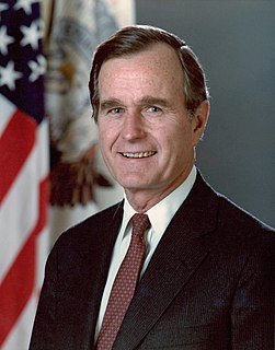
The 1988 United States presidential election in Virginia took place on November 8, 1988. All fifty states and the District of Columbia, were part of the 1988 United States presidential election. Virginia voters chose twelve electors to the Electoral College, which selected the president and vice president.


