Westerhouse Woods, Virginia

Last updated

Westerhouse Woods is an unincorporated community in Northampton County, Virginia, United States.

Northampton County, Virginia County in the United States

Northampton County is a county located in the Commonwealth of Virginia. As of the 2010 census, the population was 12,389. Its county seat is Eastville.

Virginia State of the United States of America

Virginia, officially the Commonwealth of Virginia, is a state in the Southeastern and Mid-Atlantic regions of the United States located between the Atlantic Coast and the Appalachian Mountains. Virginia is nicknamed the "Old Dominion" due to its status as the first English colonial possession established in mainland North America and "Mother of Presidents" because eight U.S. presidents were born there, more than any other state. The geography and climate of the Commonwealth are shaped by the Blue Ridge Mountains and the Chesapeake Bay, which provide habitat for much of its flora and fauna. The capital of the Commonwealth is Richmond; Virginia Beach is the most populous city, and Fairfax County is the most populous political subdivision. The Commonwealth's estimated population as of 2018 is over 8.5 million.

United States Federal republic in North America

The United States of America (USA), commonly known as the United States or America, is a country comprising 50 states, a federal district, five major self-governing territories, and various possessions. At 3.8 million square miles, the United States is the world's third or fourth largest country by total area and is slightly smaller than the entire continent of Europe's 3.9 million square miles. With a population of over 327 million people, the U.S. is the third most populous country. The capital is Washington, D.C., and the largest city by population is New York City. Forty-eight states and the capital's federal district are contiguous in North America between Canada and Mexico. The State of Alaska is in the northwest corner of North America, bordered by Canada to the east and across the Bering Strait from Russia to the west. The State of Hawaii is an archipelago in the mid-Pacific Ocean. The U.S. territories are scattered about the Pacific Ocean and the Caribbean Sea, stretching across nine official time zones. The extremely diverse geography, climate, and wildlife of the United States make it one of the world's 17 megadiverse countries.
Related Research Articles

Friberg Township, Otter Tail County, Minnesota township in Otter Tail County, Minnesota, United States

Friberg Township' is a township in Otter Tail County, Minnesota, United States. The population was 774 at the 2000 census.

Sicamous District municipality in British Columbia, Canada

Sicamous is a district municipality in British Columbia located adjacent to the Trans-Canada Highway at the Highway 97A junction, where Mara Lake empties into Shuswap Lake via a short narrows. Sicamous is a resort town about halfway between Calgary and Vancouver and is the eastern gateway to the Apple Country. With 341 km (212 mi) of shoreline, it styles itself as the houseboat capital of Canada. It has a population of 3,166.

Mystic River (Connecticut) river in Connecticut, United States

The Mystic River is a 3.4-mile-long (5.5 km) estuary in the southeast corner of the U.S. state of Connecticut. Its main tributary is Whitford Brook. It empties into Fishers Island Sound, dividing the village of Mystic, Connecticut between the towns of Groton and Stonington. Much of the river is tidal. The Mystic River was the location of three large shipbuilding firms during the 19th-century, and it is now the home of the Mystic Seaport maritime museum. The name Mystic is derived from the Pequot term "missi-tuk", describing a large river whose waters are driven into waves by tides or wind, according to the Mystic River Historical Society.

Los Olivos District District in Lima, Peru

Los Olivos is a district of the Lima Province in Peru. It is considered the unofficial capital of the Cono Norte area in the city of Lima.

CHLX-FM

CHLX-FM is a Canadian radio station, which broadcasts at 97.1 FM in Gatineau, Quebec. A francophone station owned by RNC Media, CHLX airs a mixed format of adult contemporary and jazz, branded as Wow 97.1. CHLX's studios are located on Jean-Prioux Avenue in Gatineau, while its transmitter is located in Camp Fortune.

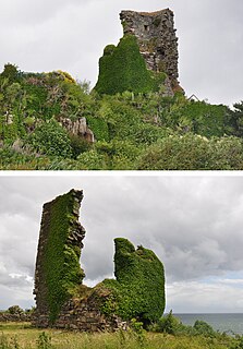
Kildonan Castle

Kildonan Castle stands in the small village of Kildonan on the southern coast of the Isle of Arran in Scotland. The castle's name is derived from the name of a former resident, Saint Donan, who is said to be buried on the island.

Winnipeg Beach is located on the west shore of Lake Winnipeg, Manitoba, and is a popular swimming and cottage destination that began mainly in the early 1900s with train access to the area from Winnipeg. The small town of Winnipeg Beach once had a dance hall, roller coaster, luxurious hotel, and was the main destination for many when Winnipeg was one of the largest cities in Canada. Today the area is still popular, and was the main filming location for the TV series named Falcon Beach.

Freeburg Township, St. Clair County, Illinois Township in Illinois, United States

Freeburg Township is located in St. Clair County, Illinois. As of the 2010 census, its population was 5,109 and it contained 2,118 housing units.

Herrera International Airport was located in Santo Domingo, Dominican Republic. Herrera used to be the hub of most Dominican airlines before being closed in 2006 and replaced by La Isabela International Airport, also in Santo Domingo. The airport had domestic flights and connections to Puerto Rico, Cuba, and other Caribbean islands.

Perry Crossing, Indiana Unincorporated community in Indiana, United States

Perry Crossing is an unincorporated community in Union Township, Clark County, Indiana, United States.

Bartlettsville, Indiana Unincorporated community in Indiana, United States

Bartlettsville is an unincorporated community in Pleasant Run Township, Lawrence County, Indiana, United States.

Dalbys, Virginia human settlement in United States of America

Dalbys is an unincorporated community in Northampton County, Virginia, United States.

Ostrów, Garwolin County Village in Masovian, Poland

Ostrów is a village in the administrative district of Gmina Maciejowice, within Garwolin County, Masovian Voivodeship, in east-central Poland. It lies approximately 11 kilometres (7 mi) north-west of Maciejowice, 21 km (13 mi) south-west of Garwolin, and 60 km (37 mi) south-east of Warsaw.

Riacho dos Cavalos is a municipality in the state of Paraíba in the Northeast Region of Brazil.

Aïn Khadra Commune and town in MSila Province, Algeria

Aïn Khadra is a town and commune in M'Sila Province, Algeria.

Covell is an unincorporated community in Dale Township, McLean County, Illinois, United States.

Del Muerto, Arizona Census-designated place in Arizona, United States

Del Muerto is a census-designated place (CDP) in Apache County, Arizona, United States. The population was 329 at the 2010 census.

New Philadelphia, Indiana Unincorporated community in Indiana, United States

New Philadelphia is an unincorporated community in Franklin Township, Washington County, in the U.S. state of Indiana.

Handsome Eddy is a hamlet in Sullivan County, New York, in the United States.

Vallehermoso (Madrid) Ward of Madrid in Spain

Vallehermoso is a ward (barrio) of Madrid belonging to the district of Chamberí.

References

Coordinates: 37°26′34″N75°58′13″W / 37.44278°N 75.97028°W / 37.44278; -75.97028

Geographic coordinate system Coordinate system

A geographic coordinate system is a coordinate system that enables every location on Earth to be specified by a set of numbers, letters or symbols. The coordinates are often chosen such that one of the numbers represents a vertical position and two or three of the numbers represent a horizontal position; alternatively, a geographic position may be expressed in a combined three-dimensional Cartesian vector. A common choice of coordinates is latitude, longitude and elevation. To specify a location on a plane requires a map projection.