Snoddington

Last updated

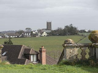
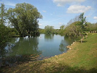
Farmland at Snoddington Down Farmland, Snoddington Down - geograph.org.uk - 440674.jpg
Farmland at Snoddington Down

Snoddington is a small hamlet in Hampshire and close to the border of Wiltshire near to Thruxton Aerodrome and first mentioned in the eleventh century in the Domesday Book. [1] The name derives from Old English; the town of Snodd's people. [2]

The hamlet is surrounded by agricultural downlands and has become part of the South of England urban sprawl being largely inhabited by commuters. Local facilities are limited with no local shop. Likewise the absence of public transport links requires that local inhabitants own at least one vehicle for the purposes of shopping in local supermarkets. The hamlet is part of the parish of Shipton Bellinger where St Peters Parish Church provides Sunday services. [3] [4]

Snoddington Manor House is first mentioned in Domesday Book and has a long history of occupancy passing through a number of different families.

In a "History of Hampshire" a limited history is offered:

The manor of SNODDINGTON belonged before the Conquest to Tovi and at the time of the Domesday Survey to Hugh de Port, tenant-in-chief. (fn. 38) It was held in the 13th century of Robert de Pont de L'Arche, lord of Newton Valence, and by him of Robert St. John, a descendant of Hugh de Port. (fn. 39) The overlordship of the St. John family subsequently lapsed, and the manor was held henceforward as of the manor of Newton Valence (q.v.) by suit of court and the service due from the fourth part of a knight's fee. (fn. 40) [5]

At the beginning of the 13th century Thomas de Port and Margery de Cundy held jointly of Robert de St. John the fourth part of a knight's fee in Snoddington, (fn. 41) and a century later, in 1305, Gilbert Cundy held the same land, valued at 60s., of Aymer de Valence. (fn. 42) However, before 1316, Snoddington had come into the possession of Ingram Berenger, (fn. 43) lord of Shipton Bellinger, who two years later obtained from Thomas Harengod and Eleanor his wife (fn. 44) a quitclaim of all their rights in two messuages and 2 carucates of land in Snoddington for a rent of £5 during the life of Eleanor. (fn. 45) From this date the manor followed almost exactly the descent of Shipton Bellinger (fn. 46) (q.v.) until 1466, when Robert Bodenham died seised only of the reversion of the manor. This right passed to his infant grandson and heir Richard, son of his son Robert, (fn. 47) who as soon as he came into possession evidently sold the manor, probably to pay his grandfather's debts, to Tristram Fauntleroy, (fn. 48) a younger son of the Dorset family of that name. Tristram died in 1538, leaving a son and heir Brian, (fn. 49) whose son Henry held the manor until his death in 1578. (fn. 50) His heir was his son William, (fn. 51) who evidently died in a few years without issue, since his brother Henry was returned as the heir of his father Henry in 1589. (fn. 52) From this date the descent of the manor is unknown until the beginning of the 18th century, when it was in the possession of Richard Bird. Elizabeth, daughter and heir of Richard, brought Snoddington in marriage to Ralph Etwall of Andover, and the manor continued in the Etwall family until 1885. when Mr. William Etwall sold it to Mr. William H. Alexander. (fn. 53) The latter dying in 1905 devised the manor by will to Mr. H. C. Formby, B.A., J.P., the present owner. (fn. 54)

Related Research Articles

<span class="mw-page-title-main">Fordingbridge</span> Town in Hampshire, England

Fordingbridge is a town and broader civil parish with a population of 6,000 on the River Avon in the New Forest District of Hampshire, England, near the Dorset and Wiltshire borders and on the edge of the New Forest, famed for its late medieval seven-arch bridge.

<span class="mw-page-title-main">Whitminster</span> Human settlement in England

Whitminster is a village and civil parish in Gloucestershire, England, and on the A38 trunk road approximately 6 miles (10 km) south of Gloucester and 6 miles (10 km) north-west of Stroud. The parish population at the 2011 census was 881. The hamlet of Wheatenhurst is signposted from the A38 at Whitminster. Whitminster is close to the M5 motorway, with Bristol, South Wales and the south Midlands all within an hour's drive.

<span class="mw-page-title-main">Bigby, Lincolnshire</span> Village and civil parish in the West Lindsey district of Lincolnshire, England

Bigby is a village and civil parish in the West Lindsey district of Lincolnshire, England.

<span class="mw-page-title-main">Addingrove</span> Human settlement in England

Addingrove is a former hamlet in Buckinghamshire, about 4 miles (6.4 km) northwest of the market town of Thame in neighbouring Oxfordshire. The settlement is on the B4011 road between Oakley and Long Crendon.

<span class="mw-page-title-main">Colbury</span> Village in Hampshire, England

Colbury is a small village in the New Forest National Park, in Hampshire, England. The village lies along Deerleap Lane, near the modern village of Ashurst.

<span class="mw-page-title-main">South Charford</span> Human settlement in England

South Charford is a hamlet in the New Forest district, in Hampshire, England. It is in the civil parish of Breamore on the west bank of the River Avon.

<span class="mw-page-title-main">North Charford</span> Human settlement in England

North Charford is a hamlet in the New Forest district, in Hampshire, England, near the Wiltshire border. Historically the name refers to a manor which is now in the civil parish of Breamore on the west bank of the River Avon.

<span class="mw-page-title-main">St Giles in the Wood</span> Village and civil parish in Devon, England

St Giles in the Wood is a village and civil parish in the Torridge district of Devon, England. The village lies about 2.5 miles east of the town of Great Torrington, and the parish, which had a population of 566 in 2001 compared with 623 in 1901, is surrounded clockwise from the north by the parishes of Huntshaw, Yarnscombe, High Bickington, Roborough, Beaford, Little Torrington and Great Torrington. Most of the Victorian terraced cottages in the village, on the east side of the church, were built by the Rolle Estate.

<span class="mw-page-title-main">Tandridge</span> Human settlement in England

Tandridge is a village and civil parish in the Tandridge District, in the county of Surrey, England. Its nucleus is on a rise of the Greensand Ridge between Oxted and Godstone. It includes, towards its middle one named sub-locality (hamlet), Crowhurst Lane End. In 2011 the parish had a population of 663 and the district had a population of 82,998.

<span class="mw-page-title-main">Umberleigh</span> Human settlement in England

Umberleigh is a former large manor within the historic hundred of (North) Tawton, but today a small village in North Devon in England. It used to be an ecclesiastical parish, but following the building of the church at Atherington it became a part of that parish. It forms however a part of the civil parish of Chittlehampton, which is mostly located on the east side of the River Taw.

<span class="mw-page-title-main">West Dean, West Sussex</span> Human settlement in England

West Dean is a village, Anglican parish and civil parish in the District of Chichester in West Sussex, England 5 miles (8 km) north of Chichester on the A286 road just west of Singleton. The parishes include the hamlets of Binderton and Chilgrove.

<span class="mw-page-title-main">Shalden</span> Human settlement in England

Shalden is a village and civil parish in the East Hampshire district of Hampshire, England. It is 2.3 miles (3.7 km) northwest of Alton and 1.9 miles (3.1 km) northeast of Bentworth, just off the A339 road. The parish covers an area of 1,536 acres (622 ha) and has an average elevation of 600 feet (180 m) above sea level. The nearest railway station is Alton, 2.5 miles (4.0 km) southeast of the village. According to the 2011 census, it had a population of 435.

<span class="mw-page-title-main">Bradley, Hampshire</span> Human settlement in England

Bradley is a small village and civil parish in the Basingstoke and Deane district of Hampshire, England. Its nearest town is Alton, which lies 5.4 miles (8.7 km) southeast from the village, although Basingstoke lies 6.6 miles (10.6 km) to the north. According to the 2011 census, the village had a population of 202 people. The parish covers an area of 975 acres (395 ha), of which 149 acres (60 ha) is woodland and its highest point is 170 metres (560 ft) above sea level. It contains no hamlets.

<span class="mw-page-title-main">Burgate, Hampshire</span> Human settlement in England

Burgate is a hamlet situated on the western edge of the New Forest National Park in Hampshire, England. The hamlet is situated on the A338 road. The nearest town is Fordingbridge, which lies approximately 0.5 miles (1 km) to the southwest.

<span class="mw-page-title-main">Newton Stacey</span> Hamlet in England

Newton Stacey is a hamlet in the Barton Stacey civil parish in the Test Valley district of Hampshire, England. Its nearest town is Stockbridge, which lies approximately 4.5 miles (7.3 km) south-west from the hamlet.

<span class="mw-page-title-main">Knighton Gorges Manor</span> Building in Isle of Wight, England

Knighton Gorges Manor was one of the grandest manor houses on the Isle of Wight, located in the hamlet of Knighton, near Newchurch.

<span class="mw-page-title-main">Hale Manor</span>

Hale Manor is a manor house on the Isle of Wight, situated in the parish of Arreton. It forms the south-eastern portion of the parish adjoining Newchurch, and comprises the high ground to the south of the River Yar above Horringford.

<span class="mw-page-title-main">Popham, Hampshire</span> Human settlement in England

Popham is a hamlet and civil parish south of Basingstoke, Hampshire, England. According to the Post Office the population of the 2011 Census was included in the civil parish of Dummer. The area was occupied from pre-historic times and was established as a permanent habitation during the Roman occupation of Britain. The manor of Popham was established by the monastery of Winchester as an outlying agricultural grain station. A small church and school were later established, but have long since disappeared. The parish and hamlet were later dissected by the M3 Motorway and A303 trunk road. Although named for Popham, Popham Airfield and the Popham Little Chef restaurant are situated in the neighbouring parish of Steventon.

Barnsley Manor is a manor house in the parish of Brading on the Isle of Wight.

<span class="mw-page-title-main">Feudal barony of Plympton</span>

The feudal barony of Plympton was a large feudal barony in the county of Devon, England, whose caput was Plympton Castle and manor, Plympton. It was one of eight feudal baronies in Devonshire which existed during the medieval era. It included the so-called Honour of Christchurch in Hampshire, which was not however technically a barony. The de Redvers family, first holders of the barony, were also Lords of the Isle of Wight, which lordship was not inherited by the Courtenays, as was the barony of Plympton, as it had been sold to the king by the last in the line Isabel de Redvers, 8th Countess of Devon (1237–1293).

References

  1. "Snoddington | Domesday Book". opendomesday.org. Retrieved 4 February 2024.
  2. Ekwall, Eilert (1960). The concise Oxford dictionary of English place-names (4 ed.). Oxford: Oxford University Press. p. 429. ISBN   0-19-869103-3.
  3. "Election Maps". ordnancesurvey.co.uk. Retrieved 4 February 2024. On the left of the screen is the "Boundary" tab; click this and activate either civil parishes or Westminster Constituencies (or both), however, only two functions can be active at any one time.
  4. "Genuki: Shipton Bellinger, Hampshire". genuki.org.uk. Retrieved 4 February 2024.
  5. "Parishes: Shipton Bellinger | British History Online". british-history.ac.uk. Retrieved 4 February 2024.

51°12′0″N1°39′30″W / 51.20000°N 1.65833°W / 51.20000; -1.65833