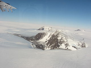
The Ohio Range is a range in the Transantarctic Mountains of Antarctica. It is about 30 nautical miles long and 10 nautical miles wide, extending west-southwest – east-northeast from Eldridge Peak to Mirsky Ledge. The range forms the northeast end of the Horlick Mountains and consists primarily of a large snow-topped plateau with steep northern cliffs and several flat-topped ridges and mountains. The highest point, 2,990 metres (9,810 ft), is the summit of Mount Schopf.
The Thiel Mountains are isolated, mainly snow-capped mountains of the Transantarctic Mountains System, located in the Ellsworth Land region of Antarctica. The mountain range is 45 nautical miles long, is located roughly between the Horlick Mountains and the Pensacola Mountains, and extends from Moulton Escarpment on the west to Nolan Pillar on the east. Major components include Ford Massif, Bermel Escarpment and a group of eastern peaks near Nolan Pillar.

The Pensacola Mountains are a large group of mountain ranges and peaks that extend 280 nautical miles in a northeast–southwest direction in the Transantarctic Mountains System, Queen Elizabeth Land region of Antarctica. They comprise the Argentina Range, Forrestal Range, Dufek Massif, Cordiner Peaks, Neptune Range, Patuxent Range, Rambo Nunataks and Pecora Escarpment. These mountain units lie astride the extensive Foundation Ice Stream and Support Force Glacier which drain northward to the Ronne Ice Shelf.

Shackleton Glacier is a major Antarctic glacier, over 60 nautical miles long and from 5 to 10 nautical miles wide, descending from the Antarctic Plateau from the vicinity of Roberts Massif and flowing north through the Queen Maud Mountains to enter the Ross Ice Shelf between Mount Speed and Waldron Spurs. Discovered by the United States Antarctic Service (USAS) (1939–41) and named by the Advisory Committee on Antarctic Names (US-ACAN) for Sir Ernest Shackleton, British Antarctic explorer.

Bowers Mountains is a group of north–south trending mountains in Antarctica, about 90 nautical miles long and 35 nautical miles wide, bounded by the coast on the north and by the Rennick Glacier, Canham Glacier, Black Glacier and Lillie Glacier in other quadrants. They are west of the Usarp Mountains, north of the Freyberg Mountains, northeast of the Concord Mountains, east of the Anare Mountains.
The Jones Mountains are an isolated group of mountains, trending generally east–west for 27 nautical miles, situated on the Eights Coast, Ellsworth Land, Antarctica, about 50 nautical miles south of Dustin Island.

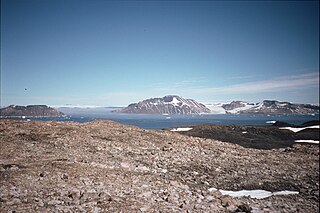
James Ross Island is a large island off the southeast side and near the northeastern extremity of the Antarctic Peninsula, from which it is separated by Prince Gustav Channel. Rising to 1,630 metres (5,350 ft), it is irregularly shaped and extends 40 nautical miles in a north–south direction.

Bear Peninsula is a peninsula about 50 nautical miles long and 25 nautical miles wide which is ice-covered except for several isolated rock bluffs and outcrops along its margins, lying 3 nautical miles east of Martin Peninsula on Walgreen Coast, Marie Byrd Land, Antarctica.

Wilhelmina Bay is a bay 15 nmi wide between the Reclus Peninsula and Cape Anna along the west coast of Graham Land on the Antarctic Peninsula.

The Prince Charles Mountains are a major group of mountains in Mac. Robertson Land in Antarctica, including the Athos Range, the Porthos Range, and the Aramis Range. The highest peak is Mount Menzies, with a height of 3,228 m (10,591 ft). Other prominent peaks are Mount Izabelle and Mount Stinear. These mountains, together with other scattered peaks, form an arc about 420 km (260 mi) long, extending from the vicinity of Mount Starlight in the north to Goodspeed Nunataks in the south.
The Allan Hills are a group of hills, mainly ice free and about 12 nautical miles long, lying just north-west of the Coombs Hills near the heads of Mawson Glacier and Mackay Glacier in the Oates Land and Victoria Land regions of Antarctica.
Eagle Island is an island 5 nautical miles long and 4 nautical miles wide, rising to 560 metres (1,840 ft) on the NE side. It is the largest island in the archipelago which lies between Trinity Peninsula and Vega Island. Eagle Island is separated from the Antarctic mainland by the 1.77 km wide Aripleri Passage. It is volcanic in origin, having been K-Ar dated 1.7 ± 0.2 and 2.0 ± 0.2 million years old. It forms part of the James Ross Island Volcanic Group.
The Worcester Range is a high coastal range, about 30 nautical miles long, in Antarctica. It stands between Skelton Glacier and Mulock Glacier on the western side of the Ross Ice Shelf. It is southwest of the Royal Society Range and north of the Conway Range of the Cook Mountains.
On the continent of Antarctica, the Aramis Range is the third range south in the Prince Charles Mountains, situated 11 miles southeast of the Porthos Range and extending for about 30 miles in a southwest–northeast direction. It was first visited in January 1957 by Australian National Antarctic Research Expeditions (ANARE) southern party led by W.G. Bewsher, who named it for a character in Alexandre Dumas' novel The Three Musketeers, the most popular book read on the southern journey.
Williams Hills is a compact group of hills, 10 nautical miles long, located south of Childs Glacier and west of Roderick Valley in the Neptune Range, Pensacola Mountains, Antarctica.
The Anderson Hills are an irregular group of hills, ridges and peaks between Mackin Table and the Thomas Hills in the Patuxent Range, Pensacola Mountains, Antarctica.
Carroll Inlet is an inlet, 40 nautical miles long and 6 nautical miles wide, trending southeast along the coast of Ellsworth Land, Antarctica, between the Rydberg Peninsula and Smyley Island. The head of the inlet is divided into two arms by the presence of Case Island and is bounded to the east by Stange Ice Shelf.
Orwell Glacier is a small glacier, less than 0.5 nautical miles (0.9 km) long, which descends steeply from the south slopes of Snow Hills and terminates in 20 m ice cliffs along the south margin of Elephant Flats in the east part of Signy Island, in the South Orkney Islands. Surveyed by DI personnel in 1927 and named by them for the Norwegian transport throughout the seasons 1925–26 to 1929–30. Resurveyed by the Falkland Islands Dependencies Survey (FIDS) in 1947.
Sunshine Glacier is a glacier, 3 nautical miles (6 km) long and 2 nautical miles (3.7 km) wide, flowing south into Iceberg Bay on the south coast of Coronation Island, in the South Orkney Islands. It is the largest glacier on the south side of Coronation Island and terminates in ice cliffs up to 60 m high. Surveyed in 1948-49 by the Falkland Islands Dependencies Survey (FIDS) and so named by them because, when all else was in shadow, small gaps in the clouds above frequently allowed patches of sunshine to appear on the surface of this glacier. At the west side of Sunshine Glacier stands the conspicuous black ridge of Beaufoy Ridge, rising to 650 metres (2,130 ft) at its northwest end.

The Sobral Peninsula is a high and mainly ice-covered peninsula in northern Graham Land, Antarctica. The feature is 11 nautical miles long and 5 nautical miles wide and projects southward into the northern part of the Larsen Ice Shelf west of Larsen Inlet.