Chodang University is the only university in Muan County, a largely rural district of South Korea's South Jeolla province. The current president is Boung-Sik, Kim.
The South River is a 10.6 mile long river in eastern New Hampshire and western Maine in the United States. It is a tributary of the Ossipee River, which flows east to the Saco River and ultimately the Atlantic Ocean.

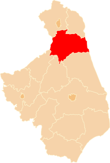
Tvarožná is a village and municipality in Kežmarok District in the Prešov Region of north Slovakia.

Kiyawa is a town and Local Government Area in Jigawa State, Nigeria.

Wieruszów is a village in the administrative district of Gmina Świdnica, within Świdnica County, Lower Silesian Voivodeship, in south-western Poland. Prior to 1945 it was in Germany.

Malolwane is a village in Kgatleng District of Botswana. The village is located 70 km east of Gaborone, and the population was 2,369 in 2001 census.
The Mazowe River is a river in Zimbabwe and Mozambique.
Murczynek is a village in the administrative district of Gmina Żnin, within Żnin County, Kuyavian-Pomeranian Voivodeship, in north-central Poland.
Głupice-Parcela is a village in the administrative district of Gmina Drużbice, within Bełchatów County, Łódź Voivodeship, in central Poland.
Żółków is a village in the administrative district of Gmina Jasło, within Jasło County, Subcarpathian Voivodeship, in south-eastern Poland. It lies approximately 5 kilometres (3 mi) south of Jasło and 53 km (33 mi) south-west of the regional capital Rzeszów.
Stary Niedróż is a village in the administrative district of Gmina Raciąż, within Płońsk County, Masovian Voivodeship, in east-central Poland. It lies approximately 8 kilometres (5 mi) west of Raciąż, 31 km (19 mi) north-west of Płońsk, and 93 km (58 mi) north-west of Warsaw.
Józefowo is a village in the administrative district of Gmina Chojnice, within Chojnice County, Pomeranian Voivodeship, in northern Poland. It lies approximately 10 kilometres (6 mi) north of Chojnice and 94 km (58 mi) south-west of the regional capital Gdańsk.
Sosnówko is a village in the administrative district of Gmina Resko, within Łobez County, West Pomeranian Voivodeship, in north-western Poland. It lies approximately 8 kilometres (5 mi) east of Resko, 19 km (12 mi) north of Łobez, and 74 km (46 mi) north-east of the regional capital Szczecin.
Dalęcinko is a settlement in the administrative district of Gmina Szczecinek, within Szczecinek County, West Pomeranian Voivodeship, in north-western Poland. It lies approximately 8 kilometres (5 mi) north of Szczecinek and 144 km (89 mi) east of the regional capital Szczecin.
Chiên Sơn is a commune (xã) and village in Sơn Động District, Bắc Giang Province, in northeastern Vietnam.
Shunqing District is a district of Nanchong city, Sichuan Province, China.
Mustametsa is a village in Kuusalu Parish, Harju County in northern Estonia.

The Pontifical Institute of Arabic and Islamic Studies is a Roman Catholic academic organization in Rome, Italy.

Jarovići is a village in the Republika Srpska, Bosnia and Herzegovina. According to the 1991 census, the village is located in the municipality of Rogatica.

Kanda Station is a railway station on the Nippō Main Line operated by Kyushu Railway Company in Kanda, Fukuoka, Japan.