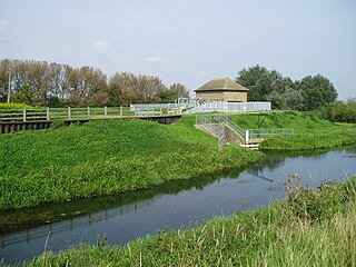
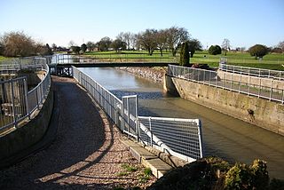
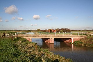
Last updated Soak Dike, Skeffling; the left bank protects the flat farmland between the Humber and Skeffling village
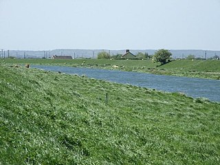
The term Soak dike is used in The Fens of eastern England to mean a ditch or drain running parallel with an embankment, for the purpose of taking any water that soaks through from the river or drain beyond the bank. In Lincolnshire, sock dyke was formerly a frequently found form of the expression.[1]
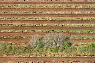
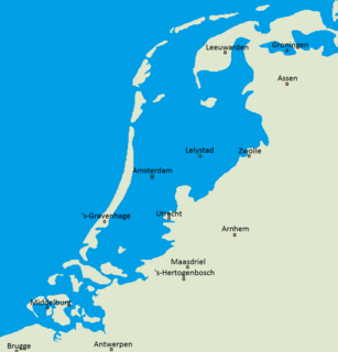
The Fens, also known as the Fenlands, are a coastal plain in eastern England. This natural marshy region supported a rich ecology and numerous species, as well as absorbing storms. But most of the fens were drained several centuries ago, resulting in a flat, dry, low-lying agricultural region supported by a system of drainage channels and man-made rivers and automated pumping stations. There have been unintended consequences to this reclamation, as the land level has continued to sink and the dykes must be built higher to protect it from flooding.
England is a country that is part of the United Kingdom. It shares land borders with Wales to the west and Scotland to the north-northwest. The Irish Sea lies west of England and the Celtic Sea lies to the southwest. England is separated from continental Europe by the North Sea to the east and the English Channel to the south. The country covers five-eighths of the island of Great Britain, which lies in the North Atlantic, and includes over 100 smaller islands, such as the Isles of Scilly and the Isle of Wight.
A river is a natural flowing watercourse, usually freshwater, flowing towards an ocean, sea, lake or another river. In some cases a river flows into the ground and becomes dry at the end of its course without reaching another body of water. Small rivers can be referred to using names such as stream, creek, brook, rivulet, and rill. There are no official definitions for the generic term river as applied to geographic features, although in some countries or communities a stream is defined by its size. Many names for small rivers are specific to geographic location; examples are "run" in some parts of the United States, "burn" in Scotland and northeast England, and "beck" in northern England. Sometimes a river is defined as being larger than a creek, but not always: the language is vague.
In some parts of the world, the embankment would be called a levee.
A levee, dike, dyke, embankment, floodbank or stopbank is an elongated naturally occurring ridge or artificially constructed fill or wall, which regulates water levels. It is usually earthen and often parallel to the course of a river in its floodplain or along low-lying coastlines.
Peat, also known as turf, is an accumulation of partially decayed vegetation or organic matter. It is unique to natural areas called peatlands, bogs, mires, moors, or muskegs. The peatland ecosystem is the most efficient carbon sink on the planet, because peatland plants capture CO2 naturally released from the peat, maintaining an equilibrium. In natural peatlands, the "annual rate of biomass production is greater than the rate of decomposition", but it takes "thousands of years for peatlands to develop the deposits of 1.5 to 2.3 m [4.9 to 7.5 ft], which is the average depth of the boreal [northern] peatlands". Sphagnum moss, also called peat moss, is one of the most common components in peat, although many other plants can contribute. Soils consisting primarily of peat are known as histosols. Peat forms in wetland conditions, where flooding obstructs the flow of oxygen from the atmosphere, slowing the rate of decomposition.
Silt is granular material of a size between sand and clay, whose mineral origin is quartz and feldspar. Silt may occur as a soil or as sediment mixed in suspension with water and soil in a body of water such as a river. It may also exist as soil deposited at the bottom of a water body, like mudflows from landslides. Silt has a moderate specific area with a typically non-sticky, plastic feel. Silt usually has a floury feel when dry, and a slippery feel when wet. Silt can be visually observed with a hand lens, exhibiting a sparkly appearance. It also can be felt by the tongue as granular when placed on the front teeth.
The water table is the upper surface of the zone of saturation. The zone of saturation is where the pores and fractures of the ground are saturated with water.
In The Fens, water from the surrounding higher land is carried across the land which lies below high tide level, in embanked rivers. In this way, the need for pumping is reduced. However, the banks are never completely waterproof so that even in an otherwise thoroughly drained fen, the water table near the river bank would be high, reducing the value of the land and weakening the bank.
A pump is a device that moves fluids, or sometimes slurries, by mechanical action. Pumps can be classified into three major groups according to the method they use to move the fluid: direct lift, displacement, and gravity pumps.
A fen is one of the main types of wetland, the others being grassy marshes, forested swamps, and peaty bogs. Along with bogs, fens are a kind of mire. Fens are minerotrophic peatlands, usually fed by mineral-rich surface water or groundwater. They are characterised by their distinct water chemistry, which is pH neutral or alkaline, with relatively high dissolved mineral levels but few other plant nutrients. They are usually dominated by grasses and sedges, and typically have brown mosses in general including Scorpidium or Drepanocladus. Fens frequently have a high diversity of other plant species including carnivorous plants such as Pinguicula. They may also occur along large lakes and rivers where seasonal changes in water level maintain wet soils with few woody plants. The distribution of individual species of fen plants is often closely connected to water regimes and nutrient concentrations.
The leaky condition of the river embankments usually arose from a difficulty in finding good materials for their construction and from the piecemeal way in which the structures accumulated as the ground shrank or repairs were needed.
The difficulty is overcome by cutting a fairly small ditch, perhaps twenty or thirty metres from the bank, so that it collects the ground water and feeds it to a pump.
Counter drain
Counter drain is another term for much the same thing though in this case, it may have been designed also to deal with water overflowing the river bank. The counter drain would therefore need to be bigger than the soak dike. Counter drain has tended to supersede the other term, particularly in its use as a proper name.
The Counter Drain in Deeping Fen is a good example, where the land between it and the bank of the River Glen was designed as a wash. In other words, the land between the river and the outer bank of the counter drain was originally intended to act as a reservoir in the event of an overflow from the river.[3]
Notes and references
↑ Wheeler, W.H. A History of the Fens of South Lincolnshire (1896). facsimile edn. Paul Watkins, Stamford. (1990) ISBN1-871615-19-4. Appendix IV.
↑ See Oxford English Dictionary. ISBN0-19-861212-5. See soak, substantive, 2.
This page is based on this Wikipedia article Text is available under the CC BY-SA 4.0 license; additional terms may apply. Images, videos and audio are available under their respective licenses.
Related Research Articles
A polder is a low-lying tract of land enclosed by dikes that form an artificial hydrological entity, meaning it has no connection with outside water other than through manually operated devices. There are three types of polder:
Land reclaimed from a body of water, such as a lake or the sea bed
Flood plains separated from the sea or river by a dike
Marshes separated from the surrounding water by a dike and subsequently drained; these are also known as koogs especially in Germany
The River Welland is a lowland river in the east of England, some 65 miles (105 km) long. It drains part of the Midlands eastwards to The Wash. The river rises in the Hothorpe Hills, at Sibbertoft in Northamptonshire, then flows generally northeast to Market Harborough, Stamford and Spalding, to reach The Wash near Fosdyke. It is a major waterway across the part of the Fens called South Holland, and is one of the Fenland rivers which were laid out with washlands. There are two channels between widely spaced embankments with the intention that flood waters would have space in which to spread while the tide in the estuary prevented free egress. However, after the floods of 1947, new works such as the Coronation Channel were constructed to control flooding in Spalding and the washes are no longer used solely as pasture, but may be used for arable farming.
The River Glen is a river in Lincolnshire, England with a short stretch passing through Rutland near Essendine.
A ditch is a small to moderate depression created to channel water. A ditch can be used for drainage, to drain water from low-lying areas, alongside roadways or fields, or to channel water from a more distant source for plant irrigation. Ditches are commonly seen around farmland, especially in areas that have required drainage, such as The Fens in eastern England and much of the Netherlands.
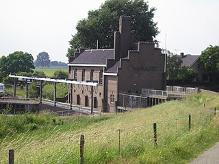
Pumping stations are facilities including pumps and equipment for pumping fluids from one place to another. They are used for a variety of infrastructure systems, such as the supply of water to canals, the drainage of low-lying land, and the removal of sewage to processing sites.
The South Forty-Foot Drain, also known as the Black Sluice Navigation, is the main channel for the land-drainage of the Black Sluice Level in the Lincolnshire Fens. It lies in eastern England between Guthram Gowt and the Black Sluice pumping station on The Haven, at Boston. The Drain has its origins in the 1630s, when the first scheme to make the Fen land available for agriculture was carried out by the Earl of Lindsey, and has been steadily improved since then. Water drained from the land entered The Haven by gravity at certain states of the tide until 1946, when the Black Sluice pumping station was commissioned.
Bourne Eau is a short river which rises in the town of Bourne in Lincolnshire, England, and flows in an easterly direction to join the River Glen at Tongue End. It is an embanked river, as its normal level is higher than that of the surrounding Fens. It was navigable in the 18th and 19th century, but now forms an important part of the drainage system that enables the surrounding fen land to be used for agriculture.
Flood control is an important issue for the Netherlands, as about two thirds of its area is vulnerable to flooding, while the country is densely populated. Natural sand dunes and constructed dikes, dams, and floodgates provide defense against storm surges from the sea. River dikes prevent flooding from water flowing into the country by the major rivers Rhine and Meuse, while a complicated system of drainage ditches, canals, and pumping stations keep the low-lying parts dry for habitation and agriculture. Water control boards are the independent local government bodies responsible for maintaining this system.
A scoop wheel may be a pump or an excavator.
The Witham Navigable Drains are located in Lincolnshire, England, and are part of a much larger drainage system managed by the Witham Fourth District Internal Drainage Board. The Witham Fourth District comprises the East Fen and West Fen, to the north of Boston, which together cover an area of 97 square miles (250 km2). In total there are over 438 miles (705 km) of drainage ditches, of which under 60 miles (97 km) are navigable. Navigation is normally only possible in the summer months, as the drains are maintained at a lower level in winter, and are subject to sudden changes in level as a result of their primary drainage function, which can leave boats stranded. Access to the drains is from the River Witham at Anton's Gowt Lock.
Pode Hole is a small village 2 miles (3.2 km) to the west of the centre of Spalding in Lincolnshire, England, at the confluence of several drainage channels. Two pumping stations discharge water into Vernatt's Drain from land in Deeping Fen to the South and West. Water from Pinchbeck South Fen to the North is also lifted into Vernatt's Drain. The village arose to service the pumping stations.
Gilbert Heathcote's tunnel was an engineering project dating from the 1630s as one of the earliest modern attempts to drain The Fens in Lincolnshire. Rendered obsolete by the mechanical drainage improvements after World War II, it was finally removed in 1991.
Guthram Gowt is a small settlement in the South Holland district of Lincolnshire, England. It is situated 5 miles (8 km) both east from Bourne and west from Spalding, and at a bend in the River Glen.
Deeping Fen is a low-lying area in the South Holland district of Lincolnshire, England, which covers approximately 47 square miles (120 km2). It is bounded by the River Welland and the River Glen, and is extensively drained, but the efficient drainage of the land exercised the minds of several of the great civil engineers of the 17th and 18th centuries.
Witham First District IDB is an English internal drainage board which was set up under the terms of the Land Drainage Act 1930. The Board inherited the responsibilities of the Witham General Drainage Commissioners, who were first constituted by an Act of Parliament of 1762. They manage the land drainage of an area to the west of the River Witham, between Lincoln and Dogdyke, which includes the valley of the River Slea to above Sleaford.
South Holland IDB is an English internal drainage board set up under the terms of the Land Drainage Act 1930. It has responsibility for the land drainage of 148.43 square miles (384.4 km2) of low-lying land in South Lincolnshire. It is unusual as its catchment area is the same as the area of the drainage district, and so it does not have to deal with water flowing into the area from surrounding higher ground. No major rivers flow through the area, although the district is bounded by the River Welland to the west and the River Nene to the east.
The Beverley and Barmston Drain is the main feature of a land drainage scheme authorised in 1798 to the west of the River Hull in the East Riding of Yorkshire, England. The area consisted of salt marshes to the south and carrs to the north, fed with water from the higher wolds which lay to the north, and from inundation by tidal water passing up the river from the Humber. Some attempts to reduce the flooding by building embankments had been made by the fourteenth century, and windpumps appeared in the seventeenth century. The Holderness Drainage scheme, which protected the area to the east of the river, was completed in 1772, and attention was then given to resolving flooding of the carrs.
The River Till is a river is the county of Lincolnshire in England and is ultimately a tributary of the River Witham. Its upper reaches drain the land east of Gainsborough. The middle section is embanked, as the water level is higher than that of the surrounding land, and pumping stations pump water from low level drainage ditches into the river. Its lower reaches from the hamlet of Odder near Saxilby into the city of Lincoln were canalised, possibly as early as Roman times, as part of the Foss Dyke.