Society for Conservation GIS

Last updated
Society for Conservation GIS
Formation1997
Type Non-profit
Membership
1000
President
Jason Winner
Website www.scgis.org

The Society for Conservation Geographic Information Systems (SCGIS) is an international non-profit society with around 1000 members in 80 countries.

The idea for an international GIS user group for Conservation was first suggested by Charles Convis in 1991 [1] Supported by grants from the Esri Conservation Program and hosted by the University of California James Reserve, this group met annually under evolving names, including the "Conservation GIS Alliance". [2] It incorporated as the Society for Conservation GIS in 1997 [3] and received initial endowments from Robert Arenz (Money-Arenz Foundation) and Jack Dangermond (Esri). Over the next 5 years, SCGIS grew to around 300 US members drawn from many of America's premier conservation organizations, united around a common concept of how technology can best be used to help non-profit conservationists worldwide. SCGIS adopts a broad view of conservation, the members and programs include native and First Nations peoples, environmental justice programs and sustainable development. The Gordon and Betty Moore Foundation awarded a "Science Special Projects" grant via The Nature Conservancy in 2004 which funded 6 new international SCGIS chapters and new national workshops and training programs in conservation technology. [4] By 2007, SCGIS Kenya had grown to 100 members, SCGIS Madagascar had over 300 members and new chapters had started in Philippines, Slovenia, Brazil, South Africa, Siberia, DR Congo, Mexico & Russia. [5] The book Conservation Geography ( ISBN   1-58948-024-4) describes many SCGIS international member and chapter projects.

The SCGIS Mission is to assist conservationists worldwide in using GIS and spatial technologies through nonprofit conferences, programs, scholarships, and training. This helps to provide a level playing field so that conservation and local self-determination voices can be heard in development and resources decisions often conducted behind walls of expensive technologies and inaccessible data. Providing high-tech support, training and tools in an "appropriate technology" manner so that these tools are usable and beneficial for local activists, local programs and local communities is a core value of SCGIS. In 2018, Scgis was given the John Muir Association Nonprofit Conservation Award for "leadership in the advancement of environmental protection or conservation". [6]

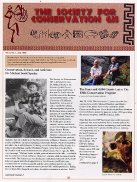
Cover of 1999 issue of SCGIS newsletter SCGIS Newsletter 1999.jpg
Cover of 1999 issue of SCGIS newsletter

The multidisciplinary nature of cultural and natural resource conservation efforts benefits greatly from computer-based tools that manage information. In addition to data management, computer-based tools greatly enhance the communication of conservation ideas to policymakers and the public. One of the most effective computer-based tools is a Geographic Information System (GIS). GIS consists of software, hardware, geographic data, and scientific methods that can efficiently store and analyse various types of spatial data and display these data as maps, charts, videos, images, or other graphic types.

Supported by an all volunteer staff, a volunteer Board of Directors and Advisory Council, SCGIS hosts an annual conference that features discussion panels on the integration of GIS and conservation science, user group meetings, hands-on training sessions, and workshops. This Annual Conference, led by an all-volunteer Conference Committee Archived 2021-06-21 at the Wayback Machine , is recognized as a one-of-a-kind event that attracts GIS conservationists from all over the world. Technical seminar programs that are offered before and after the conference are especially popular; members who participate in the training and conference often report that their involvement has changed their lives. Published & filmed proceedings and Interviews have been created for member access since 2016 by the Scgis Camera Team Archived 2020-08-12 at the Wayback Machine . The Scgis Communications & Website committees Archived 2021-08-13 at the Wayback Machine support the official website with member-exclusive content including hundreds of technical workshops, conference proceedings & webinars. The SCGIS Global Committee Archived 2021-06-21 at the Wayback Machine oversees dozens of international chapters (as of 2019), an annual competitive Scholarship Program [ permanent dead link ], and a growing global network of certified Conservation GIS Trainers [ permanent dead link ]. [6]

Related Research Articles

<span class="mw-page-title-main">Geographic information system</span> System to capture, manage and present geographic data

A geographic information system (GIS) consists of integrated computer hardware and software that store, manage, analyze, edit, output, and visualize geographic data. Much of this often happens within a spatial database, however, this is not essential to meet the definition of a GIS. In a broader sense, one may consider such a system also to include human users and support staff, procedures and workflows, the body of knowledge of relevant concepts and methods, and institutional organizations.

<span class="mw-page-title-main">Esri</span> Geospatial software & SaaS company

Environmental Systems Research Institute, Inc., doing business as Esri, is an American multinational geographic information system (GIS) software company headquartered in Redlands, California. It is best known for its ArcGIS products. With a 40% market share, Esri is the world's leading supplier of GIS software, web GIS and geodatabase management applications.

<span class="mw-page-title-main">Society of Petroleum Engineers</span> Not-for-profit professional organization

The Society of Petroleum Engineers (SPE) is a 501(c)(3) not-for-profit professional organization.

ArcSDE is a server-software sub-system that aims to enable the usage of Relational Database Management Systems for spatial data. The spatial data may then be used as part of a geodatabase.

<span class="mw-page-title-main">ArcGIS</span> Geographic information system maintained by Esri

ArcGIS is a family of client, server and online geographic information system (GIS) software developed and maintained by Esri.

ArcInfo is a full-featured geographic information system produced by Esri, and is the highest level of licensing in the ArcGIS Desktop product line. It was originally a command-line based system. The command-line processing abilities are now available through the GUI of the ArcGIS Desktop product.

Pennsylvania Spatial Data Access (PASDA) is Pennsylvania's official public access geospatial information clearinghouse. PASDA serves as Pennsylvania's node on the National Spatial Data Infrastructure (NSDI). PASDA is a cooperative effort of the Pennsylvania Geospatial Technologies Office of the Office of Information Technology and the Pennsylvania State University Institute of Energy and the Environment.

The Open Source Geospatial Foundation (OSGeo), is a non-profit non-governmental organization whose mission is to support and promote the collaborative development of open geospatial technologies and data. The foundation was formed in February 2006 to provide financial, organizational and legal support to the broader Free and open-source geospatial community. It also serves as an independent legal entity to which community members can contribute code, funding and other resources.

GIS Day is an annual event celebrating geographic information systems (GIS) based technologies. The event first took place in 1999. It was initiated by spatial analytics software provider Esri. Esri president and co-founder Jack Dangermond credits Ralph Nader with being the person who inspired the creation of GIS Day. He considered the event a good initiative for people to learn about geography and the many uses of GIS. He wanted GIS Day to be a grassroots effort and open to everyone to participate.

TOXMAP was a geographic information system (GIS) from the United States National Library of Medicine (NLM) that was deprecated on December 16, 2019. The application used maps of the United States to help users explore data from the United States Environmental Protection Agency's (EPA) Toxics Release Inventory (TRI) and Superfund programs with visual projections and maps.

Distributed GIS refers to GI Systems that do not have all of the system components in the same physical location. This could be the processing, the database, the rendering or the user interface. It represents a special case of distributed computing, with examples of distributed systems including Internet GIS, Web GIS, and Mobile GIS. Distribution of resources provides corporate and enterprise-based models for GIS. Distributed GIS permits a shared services model, including data fusion based on Open Geospatial Consortium (OGC) web services. Distributed GIS technology enables modern online mapping systems, Location-based services (LBS), web-based GIS and numerous map-enabled applications. Other applications include transportation, logistics, utilities, farm / agricultural information systems, real-time environmental information systems and the analysis of the movement of people. In terms of data, the concept has been extended to include volunteered geographical information. Distributed processing allows improvements to the performance of spatial analysis through the use of techniques such as parallel processing.

Defying Ocean's End (DOE) is a global agenda for action in marine conservation compiled in a 2004 Island Press book. It is also the title of a 2003 Los Cabos (Mexico) conference, where the agenda was formulated.

The Esri International User Conference is an event dedicated to geographic information system (GIS) technology. It is held annually in the United States, usually for one week in July at the San Diego Convention Center in San Diego, California. The Esri UC dates back to 1981. In 2008, conference attendance grew to more than 14,000 attendees.

Launched in 2000, Esri's Education User Conference (EdUC), is organized and hosted by Esri's Educational Programs Team the weekend before the annual Esri International User Conference. Held in San Diego, California, during the month of July, the mission of the EdUC is to support and promote the use of geographic information systems (GIS) in educational research, instruction, administration, and policy. Over the years, it has grown into a sizable and popular event for those involved in using and teaching GIS in the greater educational community. This includes school teachers, youth program leaders, college and university instructors, community leaders, librarians, museum professionals, and administrators of educational institutions. The conference includes user presentation sessions, hands-on training workshops, exhibits, special interest group meetings, and a plenary session including a keynote presentation.

Esri Canada is the Canadian provider of enterprise geographic information system (GIS) solutions from Esri. GIS allows multiple layers of information to be displayed on a single map. Esri Canada’s solutions are based on ArcGIS technology. The company also distributes vertical-focused solutions. from technology partners such as Schneider Electric. A third of its offerings are professional services.

<span class="mw-page-title-main">Open Geospatial Consortium</span> Standards organization

The Open Geospatial Consortium (OGC), an international voluntary consensus standards organization for geospatial content and location-based services, sensor web and Internet of Things, GIS data processing and data sharing. It originated in 1994 and involves more than 500 commercial, governmental, nonprofit and research organizations in a consensus process encouraging development and implementation of open standards.

The Urban and Regional Information Systems Association (URISA) is a non-profit association of professionals using geographic information systems (GIS) and other information technologies to solve challenges at all levels of government. URISA promotes the effective and ethical use of spatial information and technology for the understanding and management of urban and regional systems.

The Harvard Laboratory for Computer Graphics and Spatial Analysis pioneered early cartographic and architectural computer applications that led to integrated geographic information systems (GIS). Some of the Laboratory's influential programs included SYMAP, SYMVU, GRID, CALFORM, and POLYVRT. The Laboratory's Odyssey project created a geographic information system that served as a milestone in the development of integrated mapping systems. The Laboratory influenced numerous computer graphic, mapping and architectural systems such as Intergraph, Computervision, and Esri.

<span class="mw-page-title-main">Joseph Kerski</span> American geographer

Joseph Kerski is a geographer with a focus on the use of Geographic Information Systems (GIS) in education.

DIVA-GIS is a free geographic information system software program used for the analysis of geographic data, in particular point data on biodiversity. The software was first designed for application to the study of wild potatoes in South America.

References

  1. Convis, Charles L, (1991). ESRI Conservation Program Statement, Esri Inc. https://www.esri.com/library/whitepapers/pdfs/consprgm.pdf
  2. "History of SCGIS". www.scgis.org. Retrieved 2020-05-05.
  3. Bowser, Pickert, Coveny, Bechtold, Convis, Hamlton et al. "Annual Report and Financial Statement for The Society for Conservation GIS, founded July 1997", SCGIS (http://www.conservationgis.org/scgis/1997/Scgis1997AnnReptJan98.pdf)
  4. Society for Conservation GIS International Committee, Convis, C., Yumakaev, A., & Hedao, P. (2005) "Year 1 Narrative Status Report to the Gordon and Betty Moore Foundation" http://www.conservationgis.org/scgis/Moore/ScgisMooreIntlGrantReport2005.doc
  5. Society for Conservation GIS International Committee, Convis, C., Yumakaev, A., & Hedao, P. (2008). "Gordon and Betty Moore Foundation International Conservation GIS Capacity Building Partnership Year Three Report"http://www.conservationgis.org/scgis/Moore/ScgisMooreIntlGrantReport05-07Final.doc
  6. 1 2 Scgis Annual Report 2018-2019 https://scgis.org/documents/2018-19.pdf