Troms is a former county in northern Norway. On 1 January 2020 it was merged with the neighboring Finnmark county to create the new Troms og Finnmark county. This merger is expected to be reversed by the government resulting from the 2021 Norwegian parliamentary election.

Dovre is a municipality in Innlandet county, Norway. It is located in the traditional district of Gudbrandsdal. The administrative centre of the municipality is the village of Dovre. Other villages in Dovre include Dombås and Hjerkinn. The municipality is bordered on the north by Oppdal municipality, on the east by Folldal, on the south by Sel and Vågå, and on the northwest by Lesja. The highest peak in the municipality is Snøhetta at a height of 2,286 metres (7,500 ft).
Vågå is a municipality in Innlandet county, Norway. It is located in the traditional district of Gudbrandsdal. The administrative centre of the municipality is the village of Vågåmo. Other village areas in Vågå include Lalm and Bessheim.
Nord-Fron is a municipality in Innlandet county, Norway. It is located in the traditional district of Gudbrandsdal. The administrative centre of the municipality is the town of Vinstra. Other population centers in Nord-Fron include the villages of Kvam and Skåbu.

Sirdal is a municipality in Agder county, Norway. It is located in the northwestern part of the traditional district of Lister. The administrative centre of the municipality is the village of Tonstad. Other villages in Sirdal include Bjørnestad, Haughom, Kvæven, Lunde, and Tjørhom.
Flå is a municipality in Viken county, Norway. The administrative centre of the municipality is the village of Flå. The municipality of Flå was established when it was separated from the municipality of Nes on 1 January 1905. The municipality lies at the most southeasterly point in the valley and traditional region of Hallingdal.

Skien is a city and municipality in Vestfold og Telemark county in Norway. In modern times it is regarded as part of the traditional region of Grenland, although historically it belonged to Grenmar/Skiensfjorden, while Grenland referred the Norsjø area and Bø. The administrative centre of the municipality is the city of Skien. Skien is also the capital of Vestfold og Telemark county.

Rauma is a municipality in Møre og Romsdal county, Norway. It is part of the traditional district of Romsdal. The administrative centre is the town of Åndalsnes. Other settlements in Rauma include the villages of Måndalen, Innfjorden, Veblungsnes, Verma, Isfjorden, Eidsbygda, Rødven, Åfarnes, and Mittet. Most settlement in the municipality is located along the fjords and in the Romsdalen valley.

Valle is a municipality in Agder county, Norway. It is located in the traditional district of Setesdal. The administrative centre of the municipality is the village of Valle. Other villages in Valle include Besteland, Brokke, Homme, Hovet, Rygnestad, Rysstad, and Uppstad.

Bykle is a municipality in Agder county, Norway. It is located in the traditional district of Setesdal. The administrative centre of the municipality is the village of Bykle. Other villages in Bykle municipality include Berdalen, Bjåen, Breive, Hoslemo, Hovden, and Nordbygdi. Bykle was established as a municipality on 1 January 1902 when it was separated from the municipality of Valle.

Lærdal is a municipality in Vestland county, Norway. It is located on the south side of the Sognefjorden in the traditional district of Sogn. The administrative center of the municipality is the village of Lærdalsøyri. The old Filefjell Kongevegen road passes through Lærdal on its way to Valdres and later to Oslo.

Førde is a former municipality in the county of Sogn og Fjordane, Norway. It was located in the traditional district of Sunnfjord. The administrative center was the town of Førde which in 2016 had 10,255 inhabitants. Other villages in Førde municipality included Bruland, Holsen, Moskog, and Haukedalen. The Øyrane area in the town of Førde was a large industrial/commercial area for the region. The European Route E39 highway passed through the municipality, and it passed by the lake Holsavatnet.

Saltdal is a municipality in Nordland county, Norway. It is part of the traditional district of Salten. The administrative centre of the municipality is the village of Rognan. Other villages in Saltdal include Røkland and Lønsdal.

Rondane National Park is the oldest national park in Norway, having been established on 21 December 1962. The park is located in Innlandet county, in the municipalities of Dovre, Folldal, Sel, Nord-Fron, Sør-Fron, Stor-Elvdal, and Ringebu. The park contains ten peaks above 2,000 metres (6,560 ft), with the highest being Rondeslottet at an altitude of 2,178 m (7,146 ft). The park is an important habitat for herds of wild reindeer.

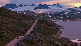
Gudbrandsdalen is a valley and traditional district in the Norwegian county of Innlandet. The valley is oriented in a north-westerly direction from Lillehammer and the lake of Mjøsa, extending 230 kilometers (140 mi) toward the Romsdalen valley. The river Gudbrandsdalslågen (Lågen) flows through the valley, starting from the lake Lesjaskogsvatnet and ending at the lake Mjøsa. The Otta river which flows through Otta valley is a major tributary to the main river Lågen. The valleys of the tributary rivers such as Otta and Gausa (Gausdal) are usually regarded as part of Gudbrandsdalen. The total area of the valley is calculated from the areas of the related municipalities. Gudbrandsdalen is the main valley in a web of smaller valleys. On the western side there are long adjacent valleys: Ottadalen stretches 100 kilometers (62 mi) from Otta village, Gausdal some 50 kilometers (31 mi) from Lillehammer and Heidal some 40 kilometers (25 mi) from Sjoa. Gudbrandsdalen runs between the major mountain ranges of Norway including Jotunheimen and Dovrefjell–Rondane.

Helgeland is the most southerly district in Northern Norway. Generally speaking, Helgeland refers to the part of Nordland county that is located south of the Arctic Circle. It is bordered in the north by the Saltfjellet mountains and Svartisen glacier, which form a natural border with the Salten district. In the south, Helgeland borders Trøndelag county.

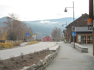
Vinstra is a town in Nord-Fron Municipality in Innlandet county, Norway. The town is the administrative centre of the municipality. The town is located in the Gudbrandsdalen valley, at the confluence of the Gudbrandsdalslågen river and the Vinstra river. The 3.07-square-kilometre (760-acre) town has a population (2021) of 2,678 and a population density of 872 inhabitants per square kilometre (2,260/sq mi).

Ottadalen is a valley in the municipalities of Skjåk, Lom, Vågå, and Sel in Innlandet county, Norway.

Bøverdal or Bøverdalen is a valley in Lom Municipality in Innlandet county, Norway. The 50-kilometre (31 mi) long valley lies on the south side of the main Ottadalen valley. The valley begins at the Bøverbrean glacier, just west of the Smørstabbtindene mountains and it then follows the river Bøvra to the northeast to the village of Fossbergom where the valley ends and the river joins the river Otta. The Leirdalen and Visdalen valleys are side valleys that lead to the Bøverdalen valley. The valley is the dividing line between the Breheimen mountains to the northwest and the Jotunheimen mountains to the southeast.
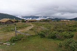
Høvringen is a village in Sel Municipality in Innlandet county, Norway. The village is located in the northern part of the municipality, high up in the mountains along the Gudbrandsdalen valley. The village area sits at an elevation of about 1,000 metres (3,300 ft) above sea level. The village area now serves as the main entrance into the mountainous Rondane National Park, the first national park that was established in Norway.