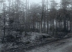
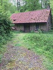
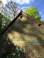
| Soignes Forest Railway | |||||||||||||||||||||||||||||||||||||||||||||||||||||||||||||||||||||||||
|---|---|---|---|---|---|---|---|---|---|---|---|---|---|---|---|---|---|---|---|---|---|---|---|---|---|---|---|---|---|---|---|---|---|---|---|---|---|---|---|---|---|---|---|---|---|---|---|---|---|---|---|---|---|---|---|---|---|---|---|---|---|---|---|---|---|---|---|---|---|---|---|---|---|
| Overview | |||||||||||||||||||||||||||||||||||||||||||||||||||||||||||||||||||||||||
| Native name | Chemin de fer de la forêt de Soignes | ||||||||||||||||||||||||||||||||||||||||||||||||||||||||||||||||||||||||
| Status | Closed and disappeared | ||||||||||||||||||||||||||||||||||||||||||||||||||||||||||||||||||||||||
| Service | |||||||||||||||||||||||||||||||||||||||||||||||||||||||||||||||||||||||||
| Type | Decauville | ||||||||||||||||||||||||||||||||||||||||||||||||||||||||||||||||||||||||
| History | |||||||||||||||||||||||||||||||||||||||||||||||||||||||||||||||||||||||||
| Opened | 1902 | ||||||||||||||||||||||||||||||||||||||||||||||||||||||||||||||||||||||||
| Closed | 1918 | ||||||||||||||||||||||||||||||||||||||||||||||||||||||||||||||||||||||||
| Technical | |||||||||||||||||||||||||||||||||||||||||||||||||||||||||||||||||||||||||
| Line length | 2.5 km (1.6 mi) | ||||||||||||||||||||||||||||||||||||||||||||||||||||||||||||||||||||||||
| Number of tracks | 1 | ||||||||||||||||||||||||||||||||||||||||||||||||||||||||||||||||||||||||
| Track gauge | 600 mm (1 ft 11+5⁄8 in) | ||||||||||||||||||||||||||||||||||||||||||||||||||||||||||||||||||||||||
| Electrification | No | ||||||||||||||||||||||||||||||||||||||||||||||||||||||||||||||||||||||||
| |||||||||||||||||||||||||||||||||||||||||||||||||||||||||||||||||||||||||
The Soignes Forest Railway was a Belgian type Decauville railway, which has disappeared since its closing in 1918.