Related Research Articles
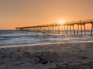
Southern California is a geographic and cultural region that generally comprises the southern portion of the U.S. state of California. It includes the Los Angeles metropolitan area as well as the Inland Empire. The region generally contains ten of California's 58 counties: Imperial, Kern, Los Angeles, Orange, Riverside, San Bernardino, San Diego, Santa Barbara, San Luis Obispo, and Ventura counties.

Huntington Beach is a seaside city in Orange County in Southern California, United States. The city is named after American businessman Henry E. Huntington. The population was 198,711 as of the 2020 census, making it the fourth most populous city in Orange County, the most populous beach city in Orange County, and the seventh most populous city in the Los Angeles-Long Beach-Anaheim, CA Metropolitan Statistical Area. Located 35 miles (56 km) southeast of Downtown Los Angeles, it is bordered by Bolsa Chica Basin State Marine Conservation Area on the west, the Pacific Ocean on the southwest, by Seal Beach on the northwest, by Westminster on the north, by Fountain Valley on the northeast, by Costa Mesa on the east, and by Newport Beach on the southeast.

State Route 1 (SR 1) is a major north–south state highway that runs along most of the Pacific coastline of the U.S. state of California. At 656 miles (1,056 km), it is the longest state route in California, and the second-longest in the US after Montana Highway 200. SR 1 has several portions designated as either Pacific Coast Highway (PCH), Cabrillo Highway, Shoreline Highway, or Coast Highway. Its southern terminus is at Interstate 5 (I-5) near Dana Point in Orange County and its northern terminus is at U.S. Route 101 (US 101) near Leggett in Mendocino County. SR 1 also at times runs concurrently with US 101, most notably through a 54-mile (87 km) stretch in Ventura and Santa Barbara counties, and across the Golden Gate Bridge.

Ventura County is a county located in the southern part of the U.S. state of California. As of the 2020 census, the population was 843,843. The largest city is Oxnard, and the county seat is the city of Ventura.
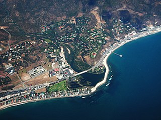
Malibu is a beach city in the Santa Monica Mountains region of Los Angeles County, California, about 30 miles (48 km) west of Downtown Los Angeles. It is known for its Mediterranean climate, its strip of beaches stretching 21 miles along the Pacific Ocean coast, and for its longtime status as the home of numerous affluent Hollywood celebrities and executives. Although a high proportion of its residents are entertainment industry figures with million-dollar mansions, Malibu also features several middle- and upper-middle-class neighborhoods. The Pacific Coast Highway traverses the city and has led most residents to settle anywhere from half a mile to within a few hundred yards of it, with some residents living up to one mile away from the beach in areas featuring narrow canyons. As of the 2020 census, the city's population was 10,654.

Ventura, officially named San Buenaventura, is a city in and the county seat of Ventura County, California, United States. It is a coastal city located northwest of Los Angeles. The population was 110,763 at the 2020 census. Ventura is a popular tourist destination, owing to its historic landmarks, beaches, and resorts.

Bolsa Chica State Beach is a public ocean beach in Orange County, California, United States. It is surrounded entirely by the city of Huntington Beach to the north and east, and to the northwest by the Huntington Beach community of Sunset Beach and the Pacific Ocean to the west. The beach extends 3 miles (5 km) from Warner Avenue in Sunset Beach south to Seapoint Avenue, where the Huntington City Beach begins. The Bolsa Chica Ecological Reserve is located across the busy Pacific Coast Highway (PCH) from the beach and is a popular spot for birdwatching. The Bolsa Chica Bicycle Path runs along the length of the park through Huntington City Beach.

Emma Wood State Beach is a California State Beach in Ventura, California. It is located on the Santa Barbara Channel on the west side of the Ventura River estuary and south of the railroad tracks of the Coast Line and the US Highway 101 freeway.

Huntington State Beach is a protected beach in Southern California, located in the City of Huntington Beach in Orange County. It extends 2 miles (3.2 km) from Newport Beach north to Beach Boulevard, where the Huntington City Beach begins. The 121-acre (49 ha) park was established in 1942.
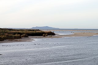
McGrath State Beach is a protected beach park located on the south bank of the mouth of Santa Clara River in the city of Oxnard, California. McGrath State Beach is one of the best bird-watching areas in California, with the lush riverbanks of the Santa Clara River and sand dunes along the shore. A nature trail leads to the Santa Clara Estuary Natural Preserve. Camping sites are available. Two miles of beach provide surfing and fishing opportunities. Just south of the station is the undeveloped Mandalay Beach Park which is about a mile downcoast beach walk from the park or a bike ride along Harbor Blvd. Located south of Ventura on Harbor Boulevard, the beach is on the Pacific Coast Bicycle Route and the California Coastal Trail.
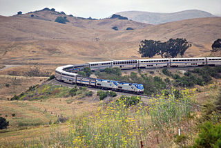
The Coast Line is a railroad line between Burbank, California and the San Francisco Bay Area, roughly along the Pacific Coast. It is the shortest rail route between Los Angeles and the Bay Area. Though not as busy as the Surf Line, the continuation of the Coast Line southbound to San Diego, it still sees freight movements and lots of passenger trains. The Pacific Surfliner, which runs from the San Diego Santa Fe Depot to San Luis Obispo via Union Station in Los Angeles, is the third busiest Amtrak route, and the busiest outside of the Northeast Corridor between Washington D.C. and Boston.

The Oxnard Plain is a large coastal plain in southwest Ventura County, California, United States surrounded by the mountains of the Transverse ranges. The cities of Oxnard, Camarillo, Port Hueneme and much of Ventura as well as the unincorporated communities of Hollywood Beach, El Rio, Saticoy, Silver Strand Beach, and Somis lie within the over 200-square-mile alluvial plain (520 km2). The population within the plain comprises a majority of the western half of the Oxnard-Thousand Oaks-Ventura Metro Area and includes the largest city along the Central Coast of California. The 16.5-mile-long coastline (26.6 km) is among the longest stretches of continuous, linear beaches in the state.
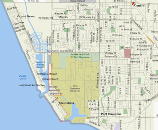
Silver Strand Beach is an unincorporated beach neighborhood in Ventura County, California, United States. Lying between the mouth of Channel Islands Harbor on the north and the ocean entrance to the Port of Hueneme on the south, the eastern side of the beach community lies along the boundary of the Naval Construction Battalion Center Port Hueneme. The harbors and the Naval base almost completely surround Silver Strand, keeping the area relatively separate from the city of Oxnard and making it accessible by only one main road, Victoria Avenue.

Ventura station is a passenger rail station in downtown Ventura, California. The station is served by Amtrak's Pacific Surfliner from San Luis Obispo to San Diego. Ten Pacific Surfliner trains serve the station daily. Of the 73 California stations served by Amtrak, Ventura was the 33rd-busiest in FY2010, boarding or detraining an average of approximately 125 passengers daily. The single platform is located on the south side of the tracks with a view of the Santa Barbara Channel and the Channel Islands. The Ventura Freeway is parallel with and on the north side of tracks.

The Salinian Block or Salinian terrane is a geologic terrane which lies west of the main trace of the San Andreas Fault system in California. It is bounded on the south by the Big Pine Fault in Ventura County and on the west by the Nacimiento Fault. It was named for the Salinas Valley in Monterey County, California.

The San Miguelito Oil Field is a large and currently productive oil field in the hills northwest of the city of Ventura in southern California in the United States. The field is close to the coastline, with U.S. Highway 101 running past at the base of the hills and is sandwiched between the larger Ventura Oil Field to the east and the Rincon Oil Field, which is partially offshore, to the north and northwest. Discovered in 1931, and with about 125 million barrels of cumulative production out of its original 290 million, it ranks 44th in the state by size. It is currently operated by CalNRG Operating LLC which acquired ownership of the field in 2021 after the bankruptcy of California Resources Corporation, a former subsidiary of Occidental Petroleum.
Seaside Park is an event venue in Ventura, California, United States. The 62-acre site (25 ha) is the home of the Ventura County Fair. Trade shows, concerts, and other events are held throughout the year at the fairgrounds. The beachfront site, near the mouth of the Ventura River, also includes Surfers' Point, known for its point break that produces distinctive waves.
County Line Beach is a beach located in Solromar, California, an unincorporated community of Ventura County. This stretch of sandy beach is easily accessible from the adjacent Pacific Coast Highway. This surf spot popularized by the Beach Boys in their 1963 hit song "Surfin' U.S.A." is administered by the California State Parks' Malibu Sector Coastal Lifeguard Program in addition to Leo Carrillo State Park. The beach lies within the south coast portion of Ventura County amidst a mostly rugged coastline that is some of the most striking and diverse coastal terrain in the County and a backdrop for many televised car scenes. The beach lies at the mouth of a canyon in the Santa Monica Mountains that hugs the shore along the Ventura County's south coast.
References
- ↑ Ventura County Parks Department. "Ventura County Parks - Dog Beach Guide" (PDF). ventura.org. Archived (PDF) from the original on 24 June 2023. Retrieved 23 June 2023.
- ↑ Boero, Kristina (September 11, 2014). "Initial Study for the Sandefer Tentative Parcel Map and Coastal Planned Development Permit" (PDF). County of Ventura. Archived from the original (PDF) on March 4, 2016.
- ↑ "Mary Osborne Of 'Surf Girls'...Where Is She Now?". mtv.com. Archived from the original on December 1, 2022. Retrieved 20 June 2023.