Polańczyk is a village in Lesko County, Subcarpathian Voivodeship, in south-eastern Poland. It lies in, and serves as the seat of, the administrative district of Gmina Solina. Polańczyk lies approximately 4 kilometres (2 mi) south-west of Solina, 14 km (9 mi) south-east of Lesko, and 80 km (50 mi) south of the regional capital Rzeszów. In 2002 the village had a population of 830.
Gmina Baligród is a rural gmina in Lesko County, Subcarpathian Voivodeship, in south-eastern Poland. Its seat is the village of Baligród, which lies approximately 15 kilometres (9 mi) south of Lesko and 79 km (49 mi) south of the regional capital Rzeszów.
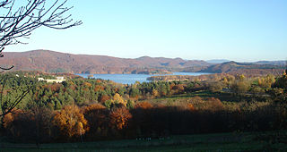
Gmina Solina is a rural gmina in Lesko County, Subcarpathian Voivodeship, in south-eastern Poland. It takes its name from its former seat, the village of Solina, which lies approximately 15 kilometres (9 mi) south-east of Lesko and 80 km (50 mi) south-east of the regional capital Rzeszów. The present seat is Polańczyk.
Cisna-Wetlina Landscape Park is a protected area in south-eastern Poland, established in 1992, covering an area of 510.14 square kilometres (196.97 sq mi).

Buk is a village in the administrative district of Gmina Cisna, within Lesko County, Subcarpathian Voivodeship, in south-eastern Poland, close to the border with Slovakia. It lies approximately 6 kilometres (4 mi) north-east of Cisna, 26 km (16 mi) south of Lesko, and 92 km (57 mi) south of the regional capital Rzeszów.
Dołżyca is a village in the administrative district of Gmina Cisna, within Lesko County, Subcarpathian Voivodeship, in south-eastern Poland, close to the border with Slovakia. It lies approximately 2 kilometres (1 mi) north-east of Cisna, 29 km (18 mi) south of Lesko, and 94 km (58 mi) south of the regional capital Rzeszów.
Habkowce is a village in the administrative district of Gmina Cisna, within Lesko County, Subcarpathian Voivodeship, in south-eastern Poland, close to the border with Slovakia. It lies approximately 4 kilometres (2 mi) north-west of Cisna, 27 km (17 mi) south of Lesko, and 92 km (57 mi) south of the regional capital Rzeszów.
Kalnica is a village in the administrative district of Gmina Cisna, within Lesko County, Subcarpathian Voivodeship, in south-eastern Poland, close to the border with Slovakia. It lies approximately 8 kilometres (5 mi) east of Cisna, 33 km (21 mi) south of Lesko, and 99 km (62 mi) south of the regional capital Rzeszów.
Krzywe is a village in the administrative district of Gmina Cisna, within Lesko County, Subcarpathian Voivodeship, in south-eastern Poland, close to the border with Slovakia. It lies approximately 4 kilometres (2 mi) south-east of Cisna, 32 km (20 mi) south of Lesko, and 97 km (60 mi) south of the regional capital Rzeszów.
Liszna is a village in the administrative district of Gmina Cisna, within Lesko County, Subcarpathian Voivodeship, in south-eastern Poland, close to the border with Slovakia. It lies approximately 3 kilometres (2 mi) south-west of Cisna, 31 km (19 mi) south of Lesko, and 96 km (60 mi) south of the regional capital Rzeszów.
Łuh is a village in the administrative district of Gmina Cisna, within Lesko County, Subcarpathian Voivodeship, in south-eastern Poland, close to the border with Slovakia.

Majdan is a hamlet, a part of Cisna village, in the administrative district of Gmina Cisna, within Lesko County, Subcarpathian Voivodeship, in south-eastern Poland, close to the border with Slovakia. It lies approximately 3 kilometres (2 mi) west of Cisna, 30 km (19 mi) south of Lesko, and 95 km (59 mi) south of the regional capital Rzeszów.
Moczarne is a settlement in the administrative district of Gmina Cisna, within Lesko County, Subcarpathian Voivodeship, in south-eastern Poland, close to the border with Slovakia. It lies approximately 18 kilometres (11 mi) south-east of Cisna, 43 km (27 mi) south of Lesko, and 109 km (68 mi) south of the regional capital Rzeszów.

Przysłup is a village in the administrative district of Gmina Cisna, within Lesko County, Subcarpathian Voivodeship, in south-eastern Poland, close to the border with Slovakia. It lies approximately 5 kilometres (3 mi) south-east of Cisna, 33 km (21 mi) south of Lesko, and 98 km (61 mi) south of the regional capital Rzeszów.
Roztoki Górne is a village in the administrative district of Gmina Cisna, within Lesko County, Subcarpathian Voivodeship, in south-eastern Poland, close to the border with Slovakia. It lies approximately 7 kilometres (4 mi) south of Cisna, 36 km (22 mi) south of Lesko, and 101 km (63 mi) south of the regional capital Rzeszów.
Smerek is a village in the administrative district of Gmina Cisna, within Lesko County, Subcarpathian Voivodeship, in south-eastern Poland, close to the border with Slovakia. It lies approximately 9 kilometres (6 mi) south-east of Cisna, 34 km (21 mi) south of Lesko, and 100 km (62 mi) south of the regional capital Rzeszów.
Strzebowiska is a village in the administrative district of Gmina Cisna, within Lesko County, Podkarpackie Voivodeship, in south-eastern Poland, close to the border with Slovakia.
Zawój is a village in the administrative district of Gmina Cisna, within Lesko County, Subcarpathian Voivodeship, in south-eastern Poland, close to the border with Slovakia. It lies approximately 12 kilometres (7 mi) north-east of Cisna, 25 km (16 mi) south of Lesko, and 91 km (57 mi) south of the regional capital Rzeszów.
Żubracze is a village in the administrative district of Gmina Cisna, within Lesko County, Subcarpathian Voivodeship, in south-eastern Poland, close to the border with Slovakia. It lies approximately 6 kilometres (4 mi) west of Cisna, 29 km (18 mi) south of Lesko, and 93 km (58 mi) south of the regional capital Rzeszów.


