
Tbilisi, in some languages still known by its pre-1936 name Tiflis, is the capital and largest city of Georgia, lying on the banks of the Kura River with around 1.2 million inhabitants, which is about a third of the country's population. Tbilisi was founded in the fifth century AD by Vakhtang I of Iberia, and since then has served as the capital of various Georgian kingdoms and republics. Between 1801 and 1917, then part of the Russian Empire, Tiflis was the seat of the Caucasus Viceroyalty, governing both the northern and the southern parts of the Caucasus.
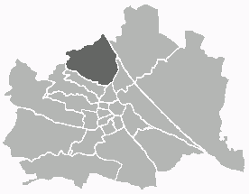
Döbling is the 19th district in the city of Vienna, Austria. It is located in the north of Vienna, north of the districts Alsergrund and Währing. Döbling has some heavily populated urban areas with many residential buildings, and borders the Vienna Woods. It includes some of the most expensive residential areas such as Grinzing, Sievering, and Neustift am Walde, and is home to many Heurigen taverns. There are some large Gemeindebauten, including Vienna's most famous, the Karl-Marx-Hof.
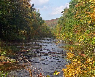
Rondout Creek is a 63.3-mile-long (101.9 km) tributary of the Hudson River in Ulster and Sullivan counties, New York, United States. It rises on Rocky Mountain in the eastern Catskills, flows south into Rondout Reservoir, part of New York City's water supply network, then into the valley between the Catskills and the Shawangunk Ridge, where it goes over High Falls and finally out to the Hudson at Kingston, receiving along the way the Wallkill River.

The Fresno River is a river in Central California and a major tributary of the San Joaquin River. It runs approximately 83 miles (134 km) from the Sierra Nevada Range to the San Joaquin River if measured from the source of Rainier Creek, near Raymond Mountain in Yosemite National Park. Although called the 'Fresno' River, it is one of the largest and longest river systems in Madera County.
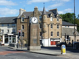
Canonmills is a district of Edinburgh, the capital of Scotland. It lies to the south east of the Royal Botanic Garden at Inverleith, east of Stockbridge and west of Bellevue, in a low hollow north of Edinburgh's New Town. The area was formerly a loch which was drained in three phases in the 18th and 19th centuries, disappearing finally in 1865.
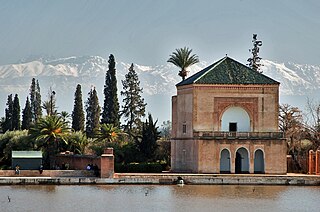
The Menara Gardens are a historic public garden and orchard in Marrakech, Morocco. They were established in the 12th century by the Almohad Caliphate ruler Abd al-Mu'min. Along with the Agdal Gardens and the historic walled city of Marrakesh, the gardens have been listed as UNESCO World Heritage Site since 1985. The gardens are laid out around a central water basin and reservoir, next to which is a pleasure pavilion dating in its current form from the 19th century. The reservoir and its pavilion, often framed in pictures against the background of the High Atlas Mountains to the south, are considered one of the iconic views and symbols of Marrakesh.

North/Northwest Phoenix is a region in the city of Phoenix, Arizona. While the area with this name has no official separate status, it usually refers to the Urban Villages of Paradise Valley, North Mountain, Deer Valley, Desert View, and North Gateway.

Old Tbilisi refers to the historical parts of Tbilisi. Although the term "Old Tbilisi" has long been used to denote the oldest part of the city, it was only in 2007 that it became an official administrative distinct, while also incorporating several historical neighbourhoods formerly included in the districts of Mtatsminda-Krtsanisi, Isani-Samgori, and Didube-Chugureti. The official district was abolished in 2013, with its territories allotted to several other divisions of the capital; however, locals and visitors continue to refer to historical districts as "Old Tbilisi" without precise boundaries.
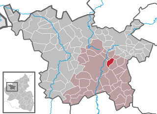
Hörscheid is an Ortsgemeinde – a municipality belonging to a Verbandsgemeinde, a kind of collective municipality – in the Vulkaneifel district in Rhineland-Palatinate, Germany. It belongs to the Verbandsgemeinde of Daun, whose seat is in the like-named town.

The High Falls Historic District corresponds roughly to the downtown section of the hamlet of that name in Marbletown, New York, United States. It is a 21-acre (8.5 ha) area around the intersection of state highway NY 213, Main Street, Mohonk Road (Ulster County Route 6A0 and Bruceville Road just south of Rondout Creek.

Turtle Lake is a direct English translation of Kus Tba, a small lake at the outskirts of Tbilisi, the capital of Georgia. The other, less frequently used name of this lake is K'ork'i.
Xələc is a village and municipality in the Sharur District of Nakhchivan, Azerbaijan. It is located near the Khalaj Mount, eight kilometres (5.0 mi) north-west of the district center, on the bank of the Aras River. Its population is mainly busy with farming. There are secondary school, kindergarten, library, club and a medical center in the village. It has a population of 1,268.
Nehrəm is a village and the most populous municipality in the Babek District of Nakhchivan, Azerbaijan. It is located 4 km in the south from the district center, on the left bank of the Araz River. Its population is busy with grain-growing, vine-growing, horticulture, vegetable-growing, and animal husbandry. There are 3 secondary schools, technical and vocational school, club, 4 libraries, kindergarten, music school, the house of schoolchildren, maternity hospital and hospital in the village. It has a population of 13,900 people. The water pipeline was built to the village from 4.3 km distance (1993). Nearby of the village there are workshops of aslant. Until recently, it was Azerbaijan's most populous rural community until surpassed by Ərkivan.

Rashid Behbudov Street is an arterial road in central Baku, Azerbaijan, named after famed Azerbaijani singer Rashid Behbudov. It begins at the south end of the Sabayil district of Baku and continues north, terminating at intersection with Bakikhanov Street intersecting Uzeyir Hajibeyov Street.

Giorgi Leonidze State Museum of Literature, Georgia was founded in 1930 upon the initiative of David Arsenishvili, a legendary museum-founder, who also was the creator of Tbilisi Theater Museum, and later the famous Andrej Rublow museum in Moscow.

Lakia, the later name of the ethnic territory of the Laks in the central part of mountainous Dagestan, which is historically known as Gumik or Tuman. Kumukh is the main historical, cultural, spiritual and political center of Lakia that consists of Lakskiy and Kulinskiy districts.
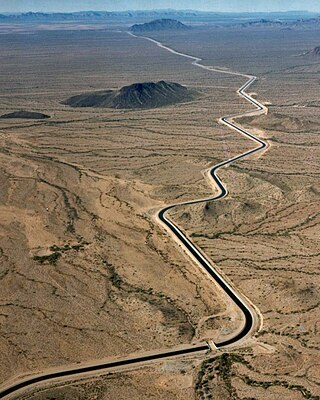
An aqueduct is a watercourse constructed to carry water from a source to a distribution point far away. In modern engineering, the term aqueduct is used for any system of pipes, ditches, canals, tunnels, and other structures used for this purpose. The term aqueduct also often refers specifically to a bridge carrying an artificial watercourse. Aqueducts were used in ancient Greece, the ancient Near East, ancient Rome, ancient Aztec, and ancient Inca. The simplest aqueducts are small ditches cut into the earth. Much larger channels may be used in modern aqueducts. Aqueducts sometimes run for some or all of their path through tunnels constructed underground. Modern aqueducts may also use pipelines. Historically, agricultural societies have constructed aqueducts to irrigate crops and supply large cities with drinking water.
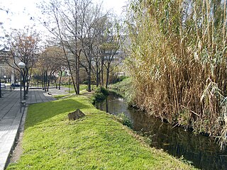
The Rec Comtal of Barcelona was a hydraulic structure of first magnitude that was an irrigation canal until the 19th century being one of the main water supplies of the city, which was used for irrigation and also as hydraulic force to operate the various mills built along its route. It transported water from the Besòs river to the walls of the city. Its construction was begun by Miro, Count of Barcelona in the 10th century, but it may date back to Roman times. It supplied water until the mid-20th century. In March 2016, extensive remains of structures associated with the system were discovered during excavations at Plaça de les Glòries Catalanes, and is a work protected as a Cultural Property of Local Interest.
Vake is a neighborhood in the southwestern part of Tbilisi, Georgia, on the right bank of the river Mtkvari; it is part of Vake District.
Oqrokana is a village in the Mtatsminda District of Tbilisi, Georgia, located on the Trialeti Range. Its elevation above sea level is 760 m.
