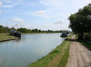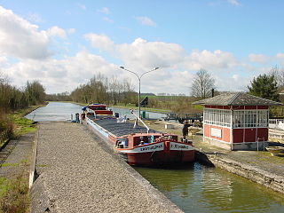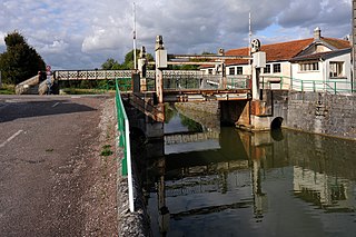
The Scarpe is a river in the Hauts-de-France region of France. It is a is 94 km (58 mi) long left-bank tributary of the river Escaut (Scheldt). The source of the river is at Berles-Monchel near Aubigny-en-Artois. It flows through the towns of Arras, Douai and Saint-Amand-les-Eaux. The river ends at Mortagne-du-Nord, where it flows into the Scheldt. Scarpe Mountain in Alberta, Canada, was named after the river. The navigable waterway and its coal barges also feature in the novels by 19th century author Émile Zola.

The Somme is a river in Picardy, northern France.

The Mayenne is a 202.3 km (125.7 mi) long river in western France, principally located in the French region of Pays de la Loire. Together with the river Sarthe and its tributary the Loir it forms the Maine, which is a tributary to the Loire.

The Lot, originally the Olt, is a river in France. It is a right-bank tributary of the Garonne. It rises in the Cévennes mountains, flowing west through Quercy, where it flows into the Garonne near Aiguillon, a total distance of 485 kilometres (301 mi). It gives its name to the départements of Lot and Lot-et-Garonne.

The Aisne is a river in northeastern France. It is a left tributary of the Oise. It gave its name to the French department of Aisne. It was known in the Roman period as Axona.

The Yonne is a river in France, a left-bank tributary of the Seine. It is 292 km (181 mi) long. The river gives its name to the Yonne département. It rises in the Nièvre département, in the Morvan hills near Château-Chinon. It flows into the river Seine at Montereau-Fault-Yonne.

The Briare Canal is one of the oldest canals in France. Its construction started in 1604. It was the first summit level canal in Europe that was built using pound locks, connecting the Rhone-Saône and Seine valleys. It is 57 kilometres long and is part of the Bourbonnais route from Saint-Mammès on the Seine to Chalon-sur-Saône on the Saône.

The Nantes–Brest canal is a French canal which links the two seaports of Nantes and Brest through inland Brittany. It was built in the early 19th century, and its total length as built was 385 km with 238 locks.

The Canal de la Marne au Rhin is a canal in north-eastern France. It connects the river Marne and the Canal entre Champagne et Bourgogne in Vitry-le-François with the port of Strasbourg on the Rhine. The original objective of the canal was to connect Paris and the north of France with Alsace and Lorraine, the Rhine, and Germany. The 313 km (194 mi) long canal was the longest in France when it opened in 1853.

The Canal du Centre, originally known as the Canal du Charollais, is a French canal running from Digoin, where it now joins the Canal latéral à la Loire, to the Saône at Chalon-sur-Saône. It was opened in 1792 and was the first watershed canal allowing boats to pass from the north of France to the south. It is 112.1 kilometres (69.7 mi) long and has 61 locks. Most of its traffic was generated by now abandoned coal mines at Montceau-les-Mines.

The Canal du Nord is a 95-kilometre (59 mi) long canal in northern France. The canal connects the Canal latéral à l'Oise at Pont-l'Évêque to the Sensée Canal at Arleux. The French government, in partnership with coal-mining companies in the Nord and Pas-de-Calais departments, developed the canal to help French coal mining companies withstand foreign competition. Construction of the canal began in 1908 but halted in 1914, because of the First World War. The war caused widespread destruction of the canal and the French government made no attempt to resume construction until 1959. Construction recommenced in 1960 and the waterway opened to the public in 1965. The Canal du Nord and the Canal de Saint-Quentin may be supplanted by the Seine–Nord Europe Canal, a projected high capacity link between the Oise River at Janville and the high capacity Dunkirk-Escaut Canal.

The Seine–Nord Europe Canal is a planned high-capacity canal in France that would link the Oise River at Compiègne with the Dunkirk-Scheldt Canal, east of Arleux. It is the French part of a proposed Seine-Scheldt canal that would ultimately connect the Rhine and Seine basins inland. The stated objective is to expand trade flows in a fuel-efficient and ecologically friendly manner between the Seine basin and Belgium, Germany and the Netherlands, while reducing saturation on the A1 motorway in France and reducing the CO2 emissions in the transport sector within this corridor. Completion is expected in 2030.

The Rhône–Rhine Canal is one of the important watershed canals of the French waterways, connecting the Rhine to the Saône and the Rhône and thereby the North Sea and the Mediterranean. As built, the canal was made up of four distinct sections:

The Canal de l'Ourcq is a 108.1 km (67.2 mi) long canal in the Île-de-France region with 10 locks. It was built at a width of 3.20 m (10.5 ft) but was enlarged to 3.7 m (12 ft), which permitted use by more pleasure boats. The canal begins at Port-aux-Perches near the village of Troesnes, where it splits from the channeled river Ourcq, and flows to the Bassin de la Villette, where it joins the Canal Saint-Martin. Paris requires 380,000 cubic metres of water daily for cleaning the sewer system, gutters, and parks. The Canal de l'Ourcq provides about half of the requirement. Since 1983, the waterway has been designated for use by pleasure craft, and its water is designated for non-drinking uses.

The Canal latéral à l'Aisne is a canal in northern France, which connects the Canal des Ardennes at Vieux-lès-Asfeld to the canalised river Aisne at Condé-sur-Aisne. It is 51.3 km (31.9 mi) long, with 8 locks. It runs alongside the Aisne. It has junctions with the Canal de l'Aisne à la Marne at Berry-au-Bac and with the Canal de l'Oise à l'Aisne in Bourg-et-Comin.

The Canal latéral à l'Oise is a canal in northern France that, along with the river Oise, connects the Canal de Saint-Quentin at Chauny to the Seine at Conflans-Sainte-Honorine. See under the river Oise for the continuation of the route; the junction is made downstream of the lock at Janville 49.45750°N 2.85933°E. When a canal is latéral, it follows the course of the river it is named after but in a separate excavated channel. The route described below is the 34 km of canal parallel to the river Oise and 103.5 km of the canalised river Oise.

The Canal de Saint-Quentin is a canal in northern France connecting the canalised river Escaut in Cambrai to the Canal latéral à l'Oise and Canal de l'Oise à l'Aisne in Chauny.

The Canal entre Champagne et Bourgogne, previously named Canal de la Marne à la Saône, is a canal in north-eastern France connecting the towns of Vitry-le-François and Maxilly-sur-Saône. It is a summit level canal of Freycinet dimensions connecting the Marne and the Saône. It is 224.191 kilometres long, and has 114 locks and two tunnels, Condes which is 275 metres long and the tunnel on the summit level between Balesmes-sur-Marne and Noidant-Chatenoy, 4820 metres long. which runs almost exactly underneath the source of the Marne.

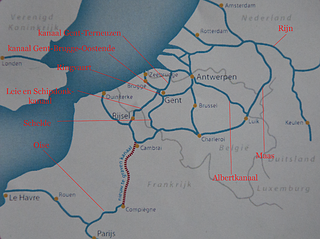
The Dunkirk-Scheldt Canal is a 189 km long series of historic canals, and the canalised river Scheldt that were substantially rebuilt from the mid-1950s up to ca. 1980, with some new sections, from Dunkirk to the Belgian border at Mortagne-du-Nord. Existing canals were straightened and widened; and new locks were built, also on the river Scheldt, from the junction at Bouchain to the border. The route is also known as the Liaison 'à grand gabarit'Dunkerque-Escaut. Some authors have separated the waterway into the canal proper and the canalised river Scheldt, but current practice is to use the simple name throughout. The Liaison was designed for large commercial vessels up to 85m long by 11.50m wide. The entire route is being further upgraded to offer European Class Vb dimensions, for push-tows 185m by 11.50m, and motor barges up to 125m long, as part of the current EU-funded Seine-Scheldt-Rhine waterway corridor investments, including the new Seine-Nord Europe Canal.

The Canal de la Deûle is one of the oldest canals in northern France, originally connecting the river Scarpe near Douai with the river Lys at Deûlémont near the Belgian border. Roughly half of its original length has been absorbed in the high-capacity Dunkerque-Escaut waterway, as shown on the map, and the remaining length through the port of Lille is often considered as a branch of the main route, hence the alternative names Liaison or Antenne Bauvin-Lys. This official name was never adopted by the local population, which refers simply to the Deûle, evoking its original state as a natural river, although it has the size and the appearance of a built canal. It is 34.8 kilometres (21.6 mi) long with 3 locks.


