Son, Norway

Last updated
Son Harbour01.JPG
Son
Town
Norway Akershus location map.svg
Red pog.svg
Son
Coordinates: 59°31′25″N10°41′15″E / 59.52361°N 10.68750°E / 59.52361; 10.68750
Country Norway
County Akershus
Municipality Vestby
Time zone UTC+1 (CET)
  Summer (DST) UTC+2 (CEST)

Son is an old town, and a former municipality. It is located in Vestby municipality in Akershus.

Contents

Overview

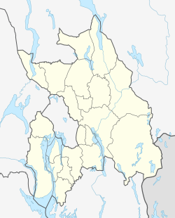
Son is located at the Oslofjord, 50 kilometres south of the Norwegian capital Oslo, just north of Moss and near the border of Østfold, and is located west of the village of Hølen. Before the merge with Vestby the number of inhabitants in Son was about 800–900 (1940). Today, Son, including Store Brevik has 5035 inhabitants (2006).

Son, together with the village of Hølen, was established as a municipality January 1, 1838 (see formannskapsdistrikt). Son and Hølen were separated as municipalities of their own January 1, 1848. On January 1, 1964, Son was merged with Vestby and then lost its status as a town (ladested). [1]

History

In the Renaissance era, Son became famous as a harbour. Timber came from the nearby areas and was partially floated down the river. On many Dutch maps from that time (the oldest being from 1582) the Oslo fjord is noted as Zoon Water. However, when this period ended, Son lost much of its importance.

Later, Son became known as an 'artist town', as many well-known painters and writers have resided there. [1]

The name

The name Son is pronounced with a long [u] > [su:n].

Son is probably the old name of the river Hølenselva (Norse *Són). Some distance up this river lies the parish Såner (Norse Sánar), and this name is most likely the plural of *Són. In Norse literature is the word són used as a poetic word for blood, and it is probably an old word for liquid.

Until 1889 the name was written Soon.

Coordinates: 59°31′24.76″N10°41′9.28″E / 59.5235444°N 10.6859111°E / 59.5235444; 10.6859111

Notable people

Related Research Articles

<span class="mw-page-title-main">Akershus</span> Former county (fylke) of Norway

Akershus is a traditional region and current electoral district in Norway, with Oslo as its main city and traditional capital. It is named after the Akershus Fortress in Oslo. From the middle ages to 1919, Akershus was a fief and main county that included most of Eastern Norway, and from the 17th century until 2020, Akershus also had a more narrow meaning as a (sub) county that included most of the Greater Oslo Region. After 2020 the former county of Akershus was merged into Viken along with the former counties of Østfold and Buskerud. In 2022 the Storting voted to dissolve Viken and reestablish Akershus county.

<span class="mw-page-title-main">Spydeberg</span> Municipality in Østfold, Norway

Spydeberg was a municipality in former Østfold county, Norway, until December 31. 2019. At January 1. 2020 it became a part of the new and greater municipality named "Indre Østfold Kommune" after the region, together with Askim and Trøgstad and Eidsberg and Hobøl kommuner (Municipalities).

<span class="mw-page-title-main">Vestby</span> Municipality in Viken, Norway

Vestby is a municipality in former Akershus now Viken county, Norway. It is part of the Follo traditional region. The administrative centre of the municipality is the village of Vestby.

<span class="mw-page-title-main">Øyer</span> Municipality in Innlandet, Norway

Øyer is a municipality in Innlandet county, Norway. It is located in the traditional district of Gudbrandsdal. The administrative centre of the municipality is the village of Tingberg. The two largest villages in the municipality are Granrudmoen and Tretten.

<span class="mw-page-title-main">Levanger</span> Municipality in Trøndelag, Norway

Levanger is a municipality in Trøndelag county, Norway. It is part of the district of Innherred. The administrative centre of the municipality is the town of Levanger. Some of the notable villages in the municipality include Alstadhaug, Ekne, Hokstad, Markabygd, Momarka, Frol, Mule, Nesset, Okkenhaug, Ronglan, Skogn, and Åsen.

<span class="mw-page-title-main">Egersund</span> Town in Western Norway, Norway

Egersund is a town in Eigersund municipality in Rogaland county, Norway. The town is located along the southwestern coast of Norway, about 75 kilometres (47 mi) south of the city of Stavanger. The town is situated along a strait which separates the mainland from the island of Eigerøya. From 1838 until 1964, the town was also an independent municipality.

<span class="mw-page-title-main">Florø</span> Town in Vestland, Norway

Florø  is a town and the administrative centre of the municipality of Kinn, Vestland, Norway. The town was founded by royal decree in 1860 as a ladested on the island of Florelandet, located between the Botnafjorden and Solheimsfjorden. Florø is Norway's westernmost town. It is the most western town on the mainland in the Nordic countries.

<span class="mw-page-title-main">Kyrkjebø</span> Former municipality in Sogn og Fjordane, Norway

Kyrkjebø is a former municipality in the old Sogn og Fjordane county, Norway. The 681-square-kilometre (263 sq mi) municipality existed from 1858 until 1964 when it became part of the new municipality of Høyanger which still exists and is part of the new Vestland county. Prior to its dissolution, the municipality of Kyrkjebø included land on the north and south side of the Sognefjorden. The administrative centre of the municipality was the village of Kyrkjebø, where the main Kyrkjebø Church is located.

<span class="mw-page-title-main">Moland</span> Former municipality in Aust-Agder, Norway

Moland is a former municipality in the old Aust-Agder county in Norway. The 127-square-kilometre (49 sq mi) municipality existed from 1962 until 1992 when it was merged into the present-day municipality of Arendal which is located in what is now Agder county. The administrative centre of the municipality was the village of Eydehavn which had a population of 6,011 in 1967 and 8,148 in 1992. Other villages in the municipality included Kilsund, Narestø, Saltrød, Brekka, Strengereid, Vatnebu, and Sagene. The municipality consisted of the mainland area to the north and northeast of the town of Arendal plus the islands of Flostaøya and Tverrdalsøya.

<span class="mw-page-title-main">Lavik</span> Former municipality in Sogn og Fjordane, Norway

Lavik is a former municipality in the old county of Sogn og Fjordane, Norway. It was located in the western part of the present-day municipality of Høyanger which is in Vestland county. The municipality was mostly on the northern side of the Sognefjorden. A small part of Lavik was located on the southern side of the Sognefjorden, a narrow strip of land running south around the Ikjefjorden, past the village of Øystrebø, all the way south to the border with Hordaland county. The municipality of Lavik existed from 1838 until 1861 and then again from 1905 until 1964. Upon its dissolution, the municipality was 220 square kilometres (85 sq mi). The administrative centre of the municipality was the village of Lavik where Lavik Church is located.

Aker was a former independent municipality in Akershus, Norway, that constitutes the vast majority of the territory of the modern city of Oslo.

<span class="mw-page-title-main">Evje</span> Former municipality in Aust-Agder, Norway

Evje is a former municipality in the old Aust-Agder county in Norway. The 177-square-kilometre (68 sq mi) municipality existed from 1877 until 1960. It was located in what is now the eastern part of the present-day municipality of Evje og Hornnes in the Setesdal valley of Agder county. The administrative centre was the village of Evje where the Evje Church is located. The lake Høvringsvatnet is located about 10 kilometres (6.2 mi) northeast of the village.

<span class="mw-page-title-main">Austre Moland</span> Former municipality in Aust-Agder, Norway

Austre Moland is a former municipality in the old Aust-Agder county in Norway. The roughly 72-square-kilometre (28 sq mi) municipality existed from 1838 until 1962 when it was merged with several neighboring municipalities to form the new municipality of Moland. It is now part of the municipality of Arendal in Agder county. The administrative centre was at Brekka where the Austre Moland Church is located.

Hølen is a village and former town and municipality in Akershus county, Norway.

Hvitsten is a former town in Akershus county, Norway, located between Drøbak and Son.

<span class="mw-page-title-main">Såner Station</span>

Såner Station was a railway station on the Østfold Line in Norway. It was located between Hølen and Sonsveien Station in the Såner village in the Municipality of Vestby. Designed by Peter A. Blix in Swiss chalet style, it was opened on 2 January 1879. The station was closed on 21 September 1996, when the section between Rustad and Kambo Station was upgraded to double tracks.

<span class="mw-page-title-main">Oddernes (municipality)</span> Former municipality in Norway

Oddernes is a former municipality that was located in the old Vest-Agder county in Norway. The 103-square-kilometre (40 sq mi) municipality existed from 1838 until its dissolution in 1964. The administrative centre was the village of Lund on the east side of the river Otra near where Lund Church is located. The former area of the municipality makes up the area just west of the urban town of Kristiansand within the municipality of Kristiansand in Agder county. The old municipality encircled the town of Kristiansand, and it included the villages such as Flekkerøy, Vågsbygd, Slettheia, Lund, Strai, Mosby, and Justvik. Today, the town of Kristiansand has a borough named Oddernes, but it has very different boundaries than the old municipality had.

<span class="mw-page-title-main">Vemundvik (municipality)</span> Former municipality in Nord-Trøndelag, Norway

Vemundvik is a former municipality in the old Nord-Trøndelag county, Norway. The 247-square-kilometre (95 sq mi) municipality existed from 1838 until its dissolution in 1964. By 1964, the municipality roughly corresponded to the mainland areas north of the river Namsen in what is now the municipality of Namsos in Trøndelag county. From 1838 until about 1942, the administrative centre was the village of Vemundvik where Vemundvik Church is located. After 1941, the municipal offices and administration was headquartered in the town of Namsos.

<span class="mw-page-title-main">Grip (municipality)</span> Former municipality in Møre og Romsdal, Norway

Grip is a former municipality in Møre og Romsdal county, Norway. With a land area of only 0.48 square kilometres and a population of 104, Grip was the smallest municipality in Norway during its existence from 1897 until it merged with Kristiansund in 1964. Grip municipality included all the islands in the Grip archipelago. The administrative centre of the municipality was the one fishing village in the municipality, known as Gripholmen, where the historic Grip Stave Church is located.

<span class="mw-page-title-main">Vinger (municipality)</span> Former municipality in Hedmark, Norway

Vinger is a former municipality in the old Hedmark county, Norway. The 499-square-kilometre (193 sq mi) municipality existed from 1838 until 1964 when it became part of Kongsvinger Municipality. The municipality was located in the Vinger region in the southern part of the county, along the border with Sweden. The administrative centre of Vinger was located in the town of Kongsvinger where Vinger Church is located.

References

  1. 1 2 A small town community www.herison.no (in English)

SonNorway - The Place without Mondays Archived 2016-10-31 at the Wayback Machine