Dhaka Division is an administrative division within Bangladesh. Dhaka serves as the capital city of the Dhaka Division, the Dhaka District and Bangladesh. The division remains a population magnet, covers an area of 20,508.8 km2 with a population in excess of 44 million, It is the most populous country second level division of the world, growing at 1.94% rate since prior count, compared with national average of 1.22%. However, national figures may include data skewing expatriation of male labor force as gender ratio is skewed towards females.
Isa Khan was the leader of the 16th-century Baro-Bhuiyan chieftains of Bengal. During his reign, he successfully unified the chieftains of Bengal and resisted the Mughal invasion of Bengal. It was only after his death that the region fell totally under Mughal control. He remains an iconic figure throughout West Bengal and Bangladesh as a symbol of his rebellious spirit and unity.

Sonargaon is a historic city in central Bangladesh. It corresponds to the Sonargaon Upazila of Narayanganj District in Dhaka Division.

Narayanganj District is a district in central Bangladesh which is a part of the Dhaka Division. It is the smallest district in Bangladesh. It is home to the ancient city of one of the oldest industrial districts in the country. The district lies on the banks of the Shitalakshya River and the Meghna River. It is an industrial hub and plays an important part in the country's jute trade, plant processing and sector. It is nicknamed the "Dundee of Bangladesh" due to the presence of many jute mills.

Gazipur is a district in central Bangladesh, that is part of the Dhaka Division. It has an area of 1741.53 km2. It is the home district of Tajuddin Ahmad, the first Prime Minister of Bangladesh and has been a prominent centre of battles and movements throughout history. Gazipur is home to the Bishwa Ijtema, the second-largest annual Muslim gathering in the world with over 5 million attendees. The district is home to numerous universities, colleges, the Bangabandhu Sheikh Mujib Safari Park, Bhawal National Park as well as the country's only business park - the Bangabandhu Hi-Tech City.

Dhaka (Dacca) is a modern megacity with origins dating to circa the 7th century CE. The history of Dhaka begins with the existence of urbanised settlements that were ruled by the Hindu Gauda Kingdom, Buddhist and Shaivite Pala Empire before passing to the control of the Hindu Sena dynasty in the 10th century CE. After the Sena dynasty, the city was ruled by the Hindu Deva Dynasty.

Bandar is an upazila (sub-district) of the Narayanganj District in central Bangladesh, part of the Dhaka Division. Bandar is a part of Greater Dhaka; the conurbation surrounding the Bangladeshi capital city of Dhaka.

Shitalakshya River is a distributary of the Brahmaputra. A portion of its upper course is known as Banar River or Banor River. In the Shitalakshya's initial stages, it flows in a southwest direction and then east of the city of Narayanganj in central Bangladesh until it merges with the Dhaleswari near Kalagachhiya. The river is about 110 kilometres (68 mi) long and at it widest, near Narayanganj, it is 300 metres (980 ft) across. Its flow, measured at Demra, has reached 74 cubic metres per second (2,600 cu ft/s). It remains navigable year round. The Shitalakshya flows through Gazipur district forming its border with Narsingdi for some distance and then through Narayanganj District.

Bangladesh's military history is intertwined with the history of a larger region, including present-day India, Pakistan, Nepal, Bhutan and Myanmar. The country was historically part of Bengal – a major power in South Asia and Southeast Asia.
Musa Khan was the leader of the Bara-Bhuiyans of Bengal following the death of his father, Isa Khan, who is known for resisting the Mughal invasion of Bengal.

Hajiganj Fort, also known as Khizirpur fort, situated at Hajiganj locality of Narayanganj, Bangladesh, on the western bank of Shitalakshya.

The Dhanmondi Shahi Eidgah, also known as Mughal Eidgah, is located in Saat Masjid road, in Dhanmondi residential area of Dhaka, Bangladesh. The Eidgah was built in 1640 CE during the Mughal era and has been in use for Eid celebration since then.

The Bengal Subah, also referred to as Mughal Bengal, was the largest subdivision of Mughal India encompassing much of the Bengal region, which includes modern-day Bangladesh, the Indian state of West Bengal, and some parts of the present-day Indian states of Bihar, Jharkhand and Odisha between the 16th and 18th centuries. The state was established following the dissolution of the Bengal Sultanate, a major trading nation in the world, when the region was absorbed into the Mughal Empire. Bengal was the wealthiest region in the Indian subcontinent.

Lalbagh anda is a fort in the old city of Dhaka, Bangladesh. Its name is derived from its neighborhood Lalbagh, which means Red Garden. The term Lalbagh refers to reddish and pinkish architecture from the Mughal period. The original fort was called Fort Aurangabad. Its construction was started by Prince Muhammad Azam Shah, who was the son of Emperor Aurangzeb and a future Mughal emperor himself. After the prince was recalled by his father, the fort's construction was overseen by Shaista Khan. The death of Shaista Khan's daughter Pari Bibi resulted in a halt to the construction process, apparently due to Shaista Khan's superstition that the fort brought bad omen. Pari Bibi was buried inside the fort.

Idrakpur Fort is a river fort situated in Munshiganj, Bangladesh. The fort was built approximately in 1660 A.D. According to a number of historians, the river fort was built by Mir Jumla II, a Subahdar of Bengal under the Mughal Empire, to establish the control of Mughal Empire in Munsiganj, and to defend Dhaka and Narayanganj from the pirates.

Dhaka Gate also known as Mir Jumla's Gate or Ramna Gate is a monument believed to be built by Mir Jumla II and enlisted as one of the oldest Mughal architectures in Dhaka. This gate is considered as one of the integral parts of the history of Dhaka.

Musa Khan Mosque is a Mughal-era structure in Bangladesh that stands in the southern part of the country's capital Dhaka. Built in 18th century the mosque holds significant historical values and is named after the son of medieval Bengal's one of the most prominent Baro-Bhuyans, Isa Khan's son Musa Khan. The structure was erected during the Mughal regime in Bengal by the grandson of Musa Khan, Diwan Munawar Khan.
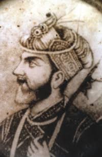
Khawāja Uthmān Khān Lōhānī, popularly known as Khwaja Usman, was a Pashtun chieftain and warrior based in northeastern Bengal. As one of the Baro-Bhuyans, he was a zamindar ruling over the northern parts of Bengal including Greater Mymensingh and later in South Sylhet. He was a formidable opponent to Man Singh I and the Mughal Empire, and was the last of the Afghan chieftains and rulers in Bengal. His defeat led to the surrender of all the remaining Pashtuns as well as the incorporation of the Sylhet region into the Bengal Subah. He is described as the most romantic figure in the history of Bengal. His biography can be found in the Baharistan-i-Ghaibi, Tuzk-e-Jahangiri as well as the Akbarnama.
Ṣabīḥ Khān, popularly known as Sabi Khan, was a Mughal statesman best known for serving as the Kotwal and Faujdar of Bakla (Barisal) during the reign of Mughal emperor Jahangir. He was renowned for the construction of numerous roads, bridges, reservoirs and places of worship in the Barisal region. Henry Beveridge credits him as the first road-builder of the region. The Kotalipara Upazila is named after him.

The Conquest of Bakla refers to the Mughal conquest of the Chandradwip Kingdom, which covered much of the present-day Barisal Division of Bangladesh. The campaign was led by Syed Hakim, under the orders of Islam Khan I, against Raja Ramchandra Basu.