Sonning Works

Last updated
View of the Sonning Works, owned by Lafarge. Lafarge concrete works, Sonning - geograph.org.uk - 497774.jpg
View of the Sonning Works, owned by Lafarge.
Former gravel pits, now a set of artificial lakes known as Caversham Lakes, with the Sonning Works in the distance. Former gravel pit, Sonning - geograph.org.uk - 552070.jpg
Former gravel pits, now a set of artificial lakes known as Caversham Lakes, with the Sonning Works in the distance.

The Sonning Works are a gravel works owned by Lafarge, located near Sonning Eye, Oxfordshire, England. [1]

Lafarge (company) French industrial company

Lafarge S.A. is a French industrial company specialising in three major products: cement, construction aggregates, and concrete.

Sonning Eye hamlet on the River Thames in Oxfordshire, England

Sonning Eye is a hamlet on the River Thames in the Sonning Common ward of South Oxfordshire, England, in the civil parish of Eye & Dunsden, at what is since 1974 the southernmost tip of Oxfordshire.

Oxfordshire County of England

Oxfordshire is a county in South East England. The ceremonial county borders Warwickshire to the north-west, Northamptonshire to the north-east, Buckinghamshire to the east, Berkshire to the south, Wiltshire to the south-west and Gloucestershire to the west.

Contents

Overview

The gravel works is positioned on the south side of the B478 Playhatch Road between Playhatch to the west and Sonning Eye on the River Thames to the east. [2] To the west and north is Berry Brook, which joins the River Thames at Hallsmead Ait to the northeast.

Gravel mix of crumbled stone (grain size range = 2-63 mm according to ISO 14688)

Gravel is a loose aggregation of rock fragments. Gravel is classified by particle size range and includes size classes from granule- to boulder-sized fragments. In the Udden-Wentworth scale gravel is categorized into granular gravel and pebble gravel. ISO 14688 grades gravels as fine, medium, and coarse with ranges 2 mm to 6.3 mm to 20 mm to 63 mm. One cubic metre of gravel typically weighs about 1,800 kg.

Playhatch human settlement in United Kingdom

Playhatch is a hamlet in the civil parish of Eye & Dunsden in South Oxfordshire, England, about 2 miles (3.2 km) northeast of Reading, Berkshire.

River Thames river in southern England

The River Thames, known alternatively in parts as the Isis, is a river that flows through southern England including London. At 215 miles (346 km), it is the longest river entirely in England and the second-longest in the United Kingdom, after the River Severn.

Gravel has been extracted from the River Thames floodplain between Caversham, a suburb of Reading, and Sonning Eye for much of the second half of the 20th century. The facility was previously owned by Redland plc before it was taken over by the French firm Lafarge in the late 1990s. The gravel pits are permanently flooded as a set of artificial lakes known as Caversham Lakes.

Reading, Berkshire Place in England

Reading is a large, historic university and minster town in Berkshire, England, of which it is now the county town. It is in the Thames Valley at the confluence of the River Thames and River Kennet, and on both the Great Western Main Line railway and the M4 motorway. Reading is 70 miles (110 km) east of Bristol, 24 miles (39 km) south of Oxford, 40 miles (64 km) west of London, 14 miles (23 km) north of Basingstoke, 12 miles (19 km) south-west of Maidenhead and 15 miles (24 km) east of Newbury as the crow flies.

Redland plc was a leading British building materials business. It was listed on the London Stock Exchange and was once a constituent of the FTSE 100 Index.

Caversham Lakes

Caversham Lakes is a set of lakes created through gravel extraction between the suburb of Caversham in Reading, Berkshire and the hamlet of Sonning Eye in Oxfordshire, just north of the River Thames and also refers to the sports buildings and facilities alongside those lakes.

Sports

To the southwest is the Redgrave-Pinsent Rowing Lake, formed from former gravel pits extracted by the works in the past. Also located here are facilities for sailing at Reading Sailing Club [3] and waterskiing. [4] Princess Margaret and her husband Lord Snowdon waterskied here during the 1960s. In addition, there is fishing in the artificial lake. [5]

Gravel pit open-pit mine for the extraction of gravel

A gravel pit is an open-pit mine for the extraction of gravel. Gravel pits often lie in river valleys where the water table is high, so they may naturally fill with water to form ponds or lakes. Old, abandoned gravel pits are normally used either as nature reserves, or as amenity areas for water sports, landfills and walking. In addition, many gravel pits in the United Kingdom have been stocked with freshwater fish such as the common carp to create coarse fishing locations. Gravel and sand are mined for concrete, construction aggregate and other industrial mineral uses.

Sailing Propulsion of a vehicle by wind power

Sailing employs the wind—acting on sails, wingsails or kites—to propel a craft on the surface of the water, on ice (iceboat) or on land over a chosen course, which is often part of a larger plan of navigation.

Fishing Activity of trying to catch fish

Fishing is the activity of trying to catch fish. Fish are normally caught in the wild. Techniques for catching fish include hand gathering, spearing, netting, angling and trapping. “Fishing” may include catching aquatic animals other than fish, such as molluscs, cephalopods, crustaceans, and echinoderms. The term is not normally applied to catching farmed fish, or to aquatic mammals, such as whales where the term whaling is more appropriate. In addition to being caught to be eaten, fish are caught as recreational pastimes. Fishing tournaments are held, and caught fish are sometimes kept as preserved or living trophies. When bioblitzes occur, fish are typically caught, identified, and then released.

Sonning Regatta is held every two years on the river here near the sailing club or on the lake if the weather is bad.

Sonning Regatta is the regatta of the village of Sonning in Berkshire and the hamlet of Sonning Eye in Oxfordshire, England, on the north and south banks of the River Thames.

Related Research Articles

Kennet and Avon Canal waterway in southern England linking the cities of Reading and Bristol

The Kennet and Avon Canal is a waterway in southern England with an overall length of 87 miles (140 km), made up of two lengths of navigable river linked by a canal. The name is commonly used to refer to the entire length of the navigation rather than solely to the central canal section. From Bristol to Bath the waterway follows the natural course of the River Avon before the canal links it to the River Kennet at Newbury, and from there to Reading on the River Thames. In all, the waterway incorporates 105 locks.

Wraysbury a village located in Windsor and Maidenhead, United Kingdom

Wraysbury is a village and civil parish in the Royal Borough of Windsor and Maidenhead in England. It is under the western approach path of London Heathrow airport. It is located on the east bank of the River Thames, roughly midway between Windsor and Staines-upon-Thames, and 18 miles (29 km) west by south-west of London.

Caversham, Reading village in Berkshire, UK

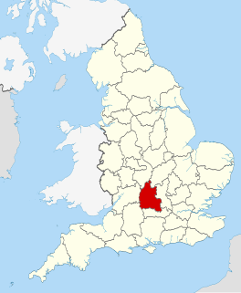
Caversham is a suburb in the Borough of Reading, a unitary authority, in the royal, non-administrative county of Berkshire, England. Originally a village founded in the Middle Ages, it lies on the north bank of the River Thames, opposite the rest of Reading. Caversham Bridge, Reading Bridge, Christchurch Bridge, and Caversham Lock provide crossing points, with Sonning Bridge also available a few miles east of Caversham.

River Colne, Hertfordshire river in Hertfordshire, England

The Colne is a river in England which is a tributary of the River Thames. Just over half its course is in south Hertfordshire. Downstream, the Colne is the boundary between Buckinghamshire and London and finally between corners of Berkshire and Surrey. On leaving Hertfordshire, the watercourse splits off into several separate branches, a few of which rejoin it, and its main branch flows into the River Thames on the reach above Penton Hook Lock at Staines-upon-Thames.

Caversham Lock

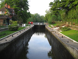
Caversham Lock is a lock and main weir on the River Thames in England at Reading, Berkshire. Both structures connect to De Bohun Island, a long island. The original lock was built by the Thames Navigation Commissioners in 1778. Additional sluices north of verdant View Island and multiple home Heron Island form the whole weir complex. A footbridge passes over all three islands to connect Lower Caversham to Reading via an alternative route than George Street and Reading Bridge.

Sonning Lock

Sonning Lock is a lock and associated weir situated on the River Thames at the village of Sonning near Reading, Berkshire, England. The first lock was built by the Thames Navigation Commission in 1773 and it has been rebuilt three times since then. There is a weir a little upstream at the top of the island where Sonning Backwater separates from the main course of the river.

Reading East (UK Parliament constituency) Parliamentary constituency in the United Kingdom, 1983 onwards

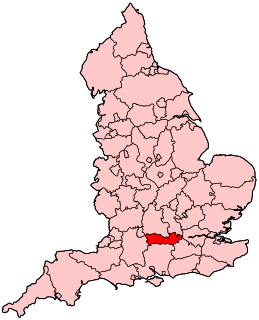
Reading East is a constituency represented in the House of Commons of the UK Parliament since 2017 by Matt Rodda, of the Labour Party. The seat is one of two won by a Labour candidate in 2017 from a total of eight covering its county. Rodda's 2017 win was one of 30 net gains of the Labour Party.

Cotswold Water Park

The Cotswold Water Park is the United Kingdom's largest marl lake system, straddling the Wiltshire–Gloucestershire border, northwest of Cricklade and south of Cirencester. The lakes were created in the second half of the 20th century by extraction of glacial Jurassic limestone gravel, which had eroded from the Cotswold Hills, and these filled naturally after working began to cease in the early 1970s.

The Redgrave Pinsent Rowing Lake is a rowing lake in the United Kingdom, named after the Olympic rowers Sir Steve Redgrave and Sir Matthew Pinsent. The lake and its boathouse are specifically designed for training use, and provide training, medical, and scientific facities for the GB rowing squad, and for Oxford University in preparation for the Boat Race. The lake is also used by crews from University College, Oxford and Oxford Brookes University.

Thames and Kennet Marina

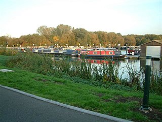
The Thames and Kennet Marina is located at Caversham Lakes in south Oxfordshire, England, just north off the River Thames on the reach above Sonning Lock. It is just to the east of Caversham, a suburb in the north of Reading, Berkshire. The marina is named after the River Thames and the River Kennet which joins the Thames nearby.

View Island island in the River Thames

View Island is a small island near Caversham Lock, on the River Thames at Reading, Berkshire in England.

Eye and Dunsden civil parish in South Oxfordshire district, Oxfordshire, England

Eye and Dunsden is a largely rural civil parish in the most southern part of English county of Oxfordshire.

Benns Island island in the River Thames

Benn's Island, previously named Church Eyot, Kember’s Eyot and sometimes referred to as Benn's Ait, is a private 0.1-acre (0.040 ha) ait (island) on the River Thames south-west of London. It is among a string of narrow islands above Molesey Lock and due to its clubhouse and size — the second-smallest named island on the Thames — it has deep foundation pilings to raise the building more than 1 m above the water line.

Heron Island is a small island near Caversham Lock, on the north bank of the River Thames at Reading, Berkshire in England.

Berry Brook

The Berry Brook is a stream close to Sonning Eye in the flood plain of the River Thames, in southern Oxfordshire, England.

Thames Young Mariners

Thames Young Mariners is a 25-acre area of land situated in Ham. It includes the Thames Young Mariners Base Lagoon, which is a calm 10-acre lake connected to the River Thames by a lock. The site was established over 40 years ago and sits in between Richmond and Kingston.

Lofts Farm Pit

Lofts Farm Pit is a 4.5 hectare geological Site of Special Scientific Interest in Heybridge, a suburb of Maldon in Essex. It is a Geological Conservation Review site.

References

  1. Smith, Andrew. "SU7476: Lafarge concrete works, Sonning". UK: Geograph . Retrieved September 5, 2011.
  2. Reading, Henley-on-Thames, Wokingham: Street AZ Atlas. Geographer' A-Z Map Company. 1995. pp. 13–14. ISBN   0-85039-277-2.
  3. "Some club history". UK: Reading Sailing Club. Retrieved September 5, 2011.
  4. Ashford, Nick (1964). "Focus on Sonning Water Skiing Club: Clearest Water in England?". British Water Skiing Championships Held at Sonning 1964. ISIS. Retrieved September 5, 2011.
  5. Philps, Duncan. "Sonning Gravel Pit — Opportunity Knocks". UK: Social and Specialist Angling. Archived from the original on September 24, 2015. Retrieved September 5, 2011.

Coordinates: 51°28′42″N0°55′37″W / 51.4784429°N 0.9269473°W / 51.4784429; -0.9269473

Geographic coordinate system Coordinate system

A geographic coordinate system is a coordinate system that enables every location on Earth to be specified by a set of numbers, letters or symbols. The coordinates are often chosen such that one of the numbers represents a vertical position and two or three of the numbers represent a horizontal position; alternatively, a geographic position may be expressed in a combined three-dimensional Cartesian vector. A common choice of coordinates is latitude, longitude and elevation. To specify a location on a plane requires a map projection.