Sorpe Dam

Last updated

Sorpe Dam
Sundern-Amecke, Germany.jpg
Aerial photograph of Sorpesee; the Sorpe dam is in the very background
Relief Map of Germany.svg
Red pog.svg
Location of Sorpe Dam in Germany
Official nameSorpetalsperre
Country Germany
Location Sundern, Hochsauerland
Coordinates 51°21′01″N07°58′03″E / 51.35028°N 7.96750°E / 51.35028; 7.96750
Construction began1926
Opening date1935
Dam and spillways
Impounds Sorpe (Röhr)
Height69 m (226 ft)
Length700 m (2,297 ft)
Dam volume3,380,000 m3 (119,000,000 cu ft)
Reservoir
Total capacity70 MCM
Surface area3.3 km2 (1.3 sq mi)
Power Station
Type Conventional
Installed capacity 7.44 MW

The Sorpe Dam (German : Sorpetalsperre) is a dam on the Sorpe river, near the small town of Sundern in the district of Hochsauerland in North Rhine-Westphalia, Germany.

Contents

Together with the Biggesee, the Möhne Reservoir, and the Verse reservoir, the Sorpe Reservoir is one of the major artificial lakes of the Sauerland's Ruhrverband reservoir association. It serves as a water supply, drives hydroelectric generators, and is used for leisure and recreation.

Geography

Sorpe location in Germany Location Sorpesee.PNG
Sorpe location in Germany

The Sorpe Dam is situated to the north of the Homert natural park, south-west of the city of Arnsberg in an area belonging to the borough of Sundern (Sauerland) between the villages of Langscheid (at the dam) and Amecke. It is supplied by the Sorpe stream.

About once a year in spring, the reservoir runs over into the spillway, generating massive whitewater down the cascades to the stilling basin that draws crowds of spectators for a few days.

Neighbouring municipalities

History

The major prerequisite for the construction of the Sorpe Dam was the completion of the Röhrtal railway on 1 June 1900, a standard gauge Kleinbahn connecting Sundern to the Obere Ruhrtalbahn at Neheim-Hüsten. During construction, its steam locomotives pulled heavy construction trains over a specially laid construction spur and the newly erected railway viaduct at Stemel to what became Europe's largest construction site between 1926 and 1935. In total, the steam trains carried more than 300,000 metric tonnes of construction material to the Sorpe dam, where smaller light railways took over.

In World War II, the Sorpe Dam was among the targets of the British airstrikes of Operation Chastise in the night from 16 to 17 May 1943, as were the dams on the Eder and Möhne. In these attacks, the Royal Air Force attempted to destroy the dams using bouncing bombs, achieving at least one direct hit on the Sorpe Dam. According to the BBC 'Dambusters Declassified' the bomb used on Sorpe was not to spin as it was dropped on the dam rather than on the water and had no need to bounce. However, while the older arch-gravity dams of Eder and Möhne were successfully breached, causing a catastrophic flooding of the Ruhr valley, the Sorpe's embankment dam with its concrete core covered in soil withstood the attacks with only minor damage. The planners of the Operation had estimated that it would take 5 of the bouncing bombs placed correctly to weaken the dam sufficiently for water pressure to complete the break. The attacks also had to be made parallel to the line of the dam rather than perpendicular. A second British airstrike on 15 October 1944 with five-ton Tallboy bombs also failed, leaving behind only several huge craters and causing minor spillage.

After the war, in late 1958 the reservoir was drained for bomb damage repairs, in the course of which, shortly before Christmas, workers discovered an unexploded Tallboy bomb. On 6 January 1959 the whole village of Langscheid was evacuated while Northrhine-Westphalia's chief bomb disposal officer, Walter Mietzke, and British Lieutenant, James M. Waters, jointly defused the 3.6m long bomb that still contained 2.5 metric tonnes of high explosive and 3 highly unstable tail-fuzes. [1]

Recreation

Today, the Sorpe Reservoir affords opportunities to several recreational activities like scuba diving, rowing, yachting, windsurfing, beach volleyball, and recreational fishing, while the surrounding area offers a golf course, hiking trails, rock climbing, four lakeshore campsites on the west bank, and more. It has therefore become a favourite local recreation area for residents of the nearby Ruhr Area and is also popular with Dutch tourists. The passenger motor ship MS Sorpesee is available for outings during the summer season. Four DLRG lifeguard bases as well as a Red Cross base on campsite 3 provide safety.

The campsites are numbered 2 through 5 from North to South; the youth hostel was built at the location of former campsite 1.

A new bicycle and pedestrian lane was constructed on the west bank parallel to the quayside road in 2006, connecting the hamlets of Sundern-Amecke and Sundern-Langscheid. Motor access to the east bank road is limited to service vehicles. Private motor boats are prohibited on the reservoir to prevent oil spills and for maintaining a high drinking water quality.

See also

Related Research Articles

<span class="mw-page-title-main">Ruhr (river)</span> River in Germany

The Ruhr is a river in western Germany, a right tributary (east-side) of the Rhine.

Soest is a Kreis (district) in the middle of North Rhine-Westphalia, Germany. Neighbouring districts are Warendorf, Gütersloh, Paderborn, Hochsauerland, Märkischer Kreis, Unna and the independent town of Hamm.

<span class="mw-page-title-main">Arnsberg</span> Town in North Rhine-Westphalia, Germany

Arnsberg is a town in the Hochsauerland county, in the German state of North Rhine-Westphalia. It is the location of the Regierungsbezirk Arnsberg administration and one of the three local administration offices of the Hochsauerlandkreis district.

<span class="mw-page-title-main">Sauerland</span> Rural, hilly area in North Rhine-Westphalia, Germany

The Sauerland is a rural, hilly area spreading across most of the south-eastern part of North Rhine-Westphalia, in parts heavily forested and, apart from the major valleys, sparsely inhabited.

<span class="mw-page-title-main">Operation Chastise</span> 1943 attack on German dams by Royal Air Force

Operation Chastise, commonly known as the Dambusters Raid, was an attack on German dams carried out on the night of 16/17 May 1943 by 617 Squadron RAF Bomber Command, later called the Dam Busters, using special "bouncing bombs" developed by Barnes Wallis. The Möhne and Edersee dams were breached, causing catastrophic flooding of the Ruhr valley and of villages in the Eder valley; the Sorpe Dam sustained only minor damage. Two hydroelectric power stations were destroyed and several more damaged. Factories and mines were also damaged and destroyed. An estimated 1,600 civilians – about 600 Germans and 1,000 enslaved labourers, mainly Soviet – were killed by the flooding. Despite rapid repairs by the Germans, production did not return to normal until September. The RAF lost 56 aircrew, with 53 dead and 3 captured, amid losses of 8 aircraft.

<span class="mw-page-title-main">Eder (Fulda)</span> River in Germany

The Eder is a 177-kilometre-long (110 mi) major river in Germany that begins in eastern North Rhine-Westphalia and passes in to Hesse, where it empties into the River Fulda.

<span class="mw-page-title-main">Edersee Dam</span> Dam in Waldeck-Frankenberg, Hesse

The Edersee Dam is a hydroelectric dam spanning the Eder river in northern Hesse, Germany. Constructed between 1908 and 1914, it lies near the small town of Waldeck at the northern edge of the Kellerwald. Breached by Allied bombs during World War II, it was rebuilt during the war, and today generates hydroelectric power and regulates water levels for shipping on the Weser river.

<span class="mw-page-title-main">Möhne Reservoir</span> Artificial lake in Germany

The Möhne Reservoir, or Moehne Reservoir, is an artificial lake in North Rhine-Westphalia, some 45 km east of Dortmund, Germany. The lake is formed by the damming of two rivers, Möhne and Heve, and with its four basins stores as much as 135 million cubic metres of water.

<span class="mw-page-title-main">Sundern</span> Town in North Rhine-Westphalia, Germany

Sundern is a town in the Hochsauerland district, in North Rhine-Westphalia, Germany. The name Sundern is common in Westphalia, as it means "ground given away for private usage" in the Westphalian dialect.
<span class="mw-page-title-main">Biggesee</span> Dam in Sauerland, Olpe

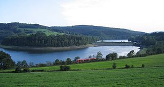
The Biggesee or Bigge Reservoir is a reservoir in Germany. It lies in the southern part of the Sauerland between Olpe and Attendorn.
<span class="mw-page-title-main">Battle of the Ruhr</span> British bombing campaign during World War II

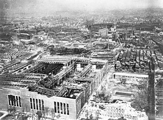
The Battle of the Ruhr was a strategic bombing campaign against the Ruhr Area in Nazi Germany carried out by RAF Bomber Command during the Second World War. The Ruhr was the main centre of German heavy industry with coke plants, steelworks, armaments factories and ten synthetic oil plants. The British attacked 26 targets identified in the Combined Bomber Offensive. Targets included the Krupp armament works (Essen), the Nordstern synthetic oil plant at Gelsenkirchen and the Rheinmetall–Borsig plant in Düsseldorf, which was evacuated during the battle. The battle included cities such as Cologne not in the Ruhr proper but which were in the larger Rhine-Ruhr region and considered part of the Ruhr industrial complex. Some targets were not sites of heavy industry but part of the production and movement of materiel.
<span class="mw-page-title-main">Langscheid (Sundern)</span> Ortsteil of Sundern in North Rhine-Westphalia, Germany

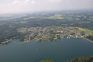
The hamlet of Langscheid is a part of the town of Sundern in the Sauerland in the district Hochsauerlandkreis in the federal state of North Rhine-Westphalia, Germany.

<span class="mw-page-title-main">Lenne Mountains</span> Mountain range in Germany

The Lenne Mountains, or Lenne Uplands (Lennebergland), is a range of hills up to 656 m above sea level (NN) high in the German state of North Rhine-Westphalia. It is part of the Süder Uplands within the Rhine Massif.
<span class="mw-page-title-main">Oker Dam</span> Dam

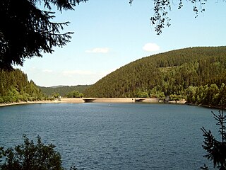
The Oker Dam is a dam in the Harz mountains in Lower Saxony, Germany. It is fed by the River Oker.

<span class="mw-page-title-main">Haar (Westphalia)</span> Hill ridge in Germany

The Haar or Haarstrang is a ridge of hills on the southern edge of the Westphalian Basin in the German state of North Rhine-Westphalia. From a natural region perspective it is the southern, submontane part of the Hellweg Börde, which stands opposite the northern area of the Süder Uplands, north of the Möhne and Ruhr rivers.

Sorpe is a river of Hochsauerlandkreis, North Rhine-Westphalia, western Germany. It is a left (western) tributary of the Röhr, which is a tributary of the Ruhr, a tributary of the Rhine.

<span class="mw-page-title-main">Randenigala Dam</span> Dam in Rantembe, Central Province, Sri Lanka

The Randenigala Dam is a large hydroelectric embankment dam at Rantembe, in the Central Province of Sri Lanka. Construction of the dam began in November 1982, and was completed in approximately 4 years. The dam and power station was ceremonially opened by then President J. R. Jayawardene in 1986.

<span class="mw-page-title-main">Plackweghöhe</span> Highest point in the borough of Warstein, Germany

The Plackweghöhe, whose main summit has hitherto had no official name, is the highest point in the borough of Warstein, the hill ridge of the Plackwald, the North Sauerland Uplands, and the Arnsberg Forest Nature Park in the German state of North Rhine-Westphalia. It is 581.5 m above sea level (NHN) and lies within the counties of Soest and Hochsauerlandkreis. The Lörmecke Tower observation tower at the top is a popular destination.

<span class="mw-page-title-main">Hachen</span> Ortschaft of Sundern in North Rhine-Westphalia, Germany

Hachen is an Ortschaft (subdivision) of the town of Sundern in the Hochsauerland district of North Rhine-Westphalia, Germany. It is the second largest Ortschaft of Sundern.

References

  1. w.e. "Der größte Blindgänger wird heute entschärft" (PDF). abendblatt.de. Archived from the original (PDF) on 14 July 2014. Retrieved 8 July 2014.