
Papua New Guinea is a country in Oceania that comprises the eastern half of the island of New Guinea and its offshore islands in Melanesia. Officially the Independent State of Papua New Guinea, it shares its only land border with Indonesia to the west and it is directly adjacent to Australia to the south and the Solomon Islands to the east. Its capital, located along its southeastern coast, is Port Moresby. The country is the world's third largest island country, with an area of 462,840 km2 (178,700 sq mi).

The geography of Papua New Guinea describes the eastern half of the island of New Guinea, the islands of New Ireland, New Britain and Bougainville, and smaller nearby islands. Together these make up the nation of Papua New Guinea in tropical Oceania, located in the western edge of the Pacific Ocean.

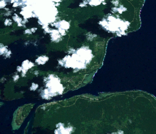
Bougainville, officially the Autonomous Region of Bougainville, is an autonomous region in Papua New Guinea. The largest island is Bougainville Island, while the region also includes Buka Island and a number of outlying islands and atolls. The current capital is Buka, situated on Buka Island.

Bougainville Island is the main island of the Autonomous Region of Bougainville, which is part of Papua New Guinea. Its land area is 9,300 km2 (3,600 sq mi). The population of the whole province, including nearby islets such as the Carterets, is approximately 300,000. The highest point is Mount Balbi, on the main island, at 2,715 m (8,907 ft).
Bougainville Copper Limited (BCL) is a mining company of Papua New Guinea (PNG) that is listed on the Australian Securities Exchange (ASX). BCL operated the copper, gold and silver mine at the Panguna mine on Bougainville Island in PNG from 1971 to 15 May 1989, when mining operations were officially halted due to militant activity. The mine has remained closed since then.

Panguna is a town next to the Panguna copper mine on Bougainville Island, Papua New Guinea. It was owned and operated by Bougainville Copper Ltd, a subsidiary of Rio Tinto. Beginning operations in 1972, the company hired thousands of workers, most from other parts of the country.

Empress Augusta Bay is a bay on the western side of the island of Bougainville Island, within the Autonomous Region of Bougainville in northeastern Papua New Guinea.
Cape Torokina is a promontory at the north end of Empress Augusta Bay, along the central part of the western coast of Bougainville, in Papua New Guinea.
The North Solomon Islands form a geographical area covering the more northerly group of islands in the Solomon Islands archipelago and includes Bougainville and Buka Islands, Choiseul, Santa Isabel, the Shortland Islands and Ontong Java Atoll. In 1885 Germany declared a protectorate over these islands forming the German Solomon Islands Protectorate. With the exception of Bougainville and Buka, these were transferred to the British Solomon Islands Protectorate in 1900. Bougainville and Buka continued under German administration until the outset of World War I, when they were transferred to Australia, and after the war, were formally passed to Australian jurisdiction under a League of Nations mandate.

The North Bougainville or West Bougainville languages are a small language family spoken on the island of Bougainville in Papua New Guinea. They were classified as East Papuan languages by Stephen Wurm, but this no longer seems tenable, and was abandoned in Ethnologue (2009).
The South Bougainville or East Bougainville languages are a small language family spoken on the island of Bougainville in Papua New Guinea. They were classified as East Papuan languages by Stephen Wurm, but this does not now seem tenable, and was abandoned in Ethnologue (2009).

The Torokina River is a river on Bougainville Island, within the Autonomous Region of Bougainville, in northeastern Papua New Guinea.
Jaba River is a river in Bougainville, Papua New Guinea. It empties to Empress Augusta Bay at 6.3833333°S 155.2166667°E. It was polluted by waste from the Panguna mine, which specialized in copper. The aquatic life of Jaba river was destroyed due to heavy metal pollution. The environmental pollution of river was one of the causes of armed conflict on the island and struggle of local people for independence.
Buka is a town located on the southern coast of Buka Island, in the Autonomous Region of Bougainville, in eastern Papua New Guinea. It is administered under Buka Rural LLG. It is the capital of the North Bougainville District and the interim capital of the Autonomous Region of Bougainville. It contains Our Lady of the Assumption Cathedral.
Torokina is a coastal village on Bougainville Island, in the Autonomous Region of Bougainville, eastern Papua New Guinea. It is administered under Torokina Rural LLG.

The Solomon Islands (archipelago) is an island group in the western South Pacific Ocean, north-east of Australia. The archipelago is in the Melanesian subregion and bioregion of Oceania and forms the eastern boundary of the Solomon Sea. The many islands of the archipelago are distributed across the sovereign states of Papua New Guinea and Solomon Islands. The largest island in the archipelago is Bougainville Island, which is a part of the Autonomous Region of Bougainville along with Buka Island, the Nukumanu Islands, and a number of smaller nearby islands. Much of the remainder falls within the territory of Solomon Islands and include the atolls of Ontong Java, Sikaiana, the raised coral atolls of Bellona and Rennell, and the volcanic islands of Choiseul, Guadalcanal, Makira, Malaita, New Georgia, the Nggelas, Santa Isabel, and the Shortlands. The Santa Cruz Islands are not a part of the archipelago.
Central Bougainville District is a district of the Autonomous Region of Bougainville of Papua New Guinea. Its capital is Arawa-Kieta.
North Bougainville District is a district of the Autonomous Region of Bougainville of Papua New Guinea. Its capital is Buka. North Bougainville languages are spoken in the district.
The Hongorai River is a river on the southern coast of Bougainville Island.
The Atara River is a river on southeastern Bougainville Island.
