
The Au Sable River in Michigan, United States runs approximately 138 miles (222 km) through the northern Lower Peninsula, through the towns of Grayling and Mio, and enters Lake Huron at the town of Oscoda. It is considered one of the best brown trout fisheries east of the Rockies and has been designated a blue ribbon trout stream by the Michigan Department of Natural Resources. French Rivière au sable means "Sand River." A 1795 map calls it the Beauais River.

The River Wharfe is a river in Yorkshire, England. For much of its length it is the county boundary between West Yorkshire and North Yorkshire.

Chester-le-Street was a local government district in County Durham, England. Its council was based in Chester-le-Street. Other places in the district included Great Lumley and Sacriston.

The Feather River is the principal tributary of the Sacramento River, in the Sacramento Valley of Northern California. The river's main stem is about 73 miles (117 km) long. Its length to its most distant headwater tributary is just over 210 miles (340 km). The main stem Feather River begins in Lake Oroville, where its four long tributary forks join together—the South Fork, Middle Fork, North Fork, and West Branch Feather Rivers. These and other tributaries drain part of the northern Sierra Nevada, and the extreme southern Cascades, as well as a small portion of the Sacramento Valley. The total drainage basin is about 6,200 square miles (16,000 km2), with approximately 3,604 square miles (9,330 km2) above Lake Oroville.

The River Esk, also known as the Border Esk, is a river in Dumfries and Galloway, Scotland, that enters the English county of Cumbria and flows into the Solway Firth.
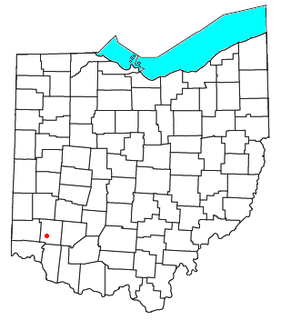
Middletown Junction is an unincorporated community and was the point in northwestern Hamilton Township, Warren County, Ohio, United States, on the eastern bank of the Little Miami River where the Middletown and Cincinnati Railroad joined with the Little Miami Railroad about midway between Kings Mills and South Lebanon. The Little Miami Scenic Trail runs through here today.
Wasdale is a valley and civil parish in the western part of the Lake District National Park in Cumbria, England. The River Irt flows through the valley to its estuary at Ravenglass. A large part of the main valley floor is occupied by Wastwater, the deepest lake in England (258 feet). The population of Wasdale was only minimal and, from the 2011 Census is included in the parish of Gosforth.

Waldridge is a village in County Durham, in England. The population at the 2001 Census was 215. Prior to the 2011 Census the parish boundaries changed and the population shown at this census was 4,215. It is situated to the south west of Chester-le-Street. It is known as either Waldridge Fell or Waldridge Village, the 'Fell' referring to the surrounding area of moorland. The village used to be known as Waldridge Colliery. The current village dates back to the 1890s, the original village having been located on the fell which overlooks the present location. Rainwater runs into the Cong Burn to the north and the South Burn to the south, both of which flow into the River Wear which is a few miles to the east.

Nidderdale, historically also known as Netherdale, is one of the Yorkshire Dales in North Yorkshire, England. It is the upper valley of the River Nidd, which flows south underground and then along the dale, forming several reservoirs including the Gouthwaite Reservoir, before turning east and eventually joining the River Ouse.
Green Spring Run is an 8.9-mile-long (14.3 km) tributary stream of the North Branch Potomac River in Hampshire County in the U.S. state of West Virginia. Green Spring Run rises in Greenwood Hollow north of Springfield and meanders northeast through Green Spring Valley. The South Branch Valley Railroad and Green Spring Road run parallel to the stream. It runs through the community of Green Spring, from which the stream takes its name. From Green Spring, Green Spring Run flows east where it reaches its confluence with the North Branch Potomac shortly before the North Branch joins with the South Branch Potomac River to form the Potomac River.

The River Mite is a river in the county of Cumbria in northern England.

Dacre Beck is a small river in Cumbria, England.

Overhill Cherokee was the term for the Cherokee people located in their historic settlements in what is now the U.S. state of Tennessee in the Southeastern United States, on the western side of the Appalachian Mountains. This name was used by 18th-century European traders and explorers from British colonies along the Atlantic coast, as they had to cross the mountains to reach these settlements.

Tallassee is a prehistoric and historic Native American site in present-day Blount and Monroe counties, Tennessee in the southeastern United States. Tallassee was the southernmost of a string of Overhill Cherokee towns that existed along the lower Little Tennessee River on the west side of the Appalachian Mountains in the 18th century. Although Tallassee receives scant attention in primary historical accounts, it is one of the few Overhill towns to be shown on every major 18th-century map of the Little Tennessee Valley.

Waldridge Fell is a Site of Special Scientific Interest located immediately south-west of Chester-le-Street in the northern part of County Durham, England. It is one of the largest areas of lowland heath in County Durham and contains the only lowland valley-mire in the county. The fell is home to a number of plants and insects that are scarce to rare elsewhere in the county.

The Cong Burn is a small river in County Durham, England. It has its origin in a number of streams, among them Wheatley Green Burn, that rise on the southern and eastern slopes of Wheatley Hill, north of the village of Burnhope, and other streams, principally Whiteside Burn, that have their source on the southern slopes of Wheatley Hill and the northern slopes of Taylor's Hill, just east of Burnhope.

The Wasdale Horseshoe is a group of hills on the eastern fringe of the English Lake District, to the west of the A6, south of Shap, Cumbria. They surround the valley of Wasdale Beck, a tributary of Birk Beck and ultimately of the River Lune. The horseshoe is the subject of a chapter of Wainwright's book The Outlying Fells of Lakeland. This Wasdale should not be confused with the better known Wasdale, containing Wast Water, on the west of the Lake District.

The Naddle Horseshoe is a group of summits in the English Lake District, south of Mardale valley, Cumbria. It is the subject of a chapter of Wainwright's book The Outlying Fells of Lakeland.
New River is in the Florida Panhandle. It originates in the far north of the Apalachicola National Forest and joins with the Crooked River (Florida) above Carrabelle, Florida to become the Carrabelle River, which opens onto St. George Sound and the Gulf of Mexico. The New River watershed drains a large part of Liberty County, Florida with the Apalachicola River to the west and the Wakulla River to the east.
