South Dakota Highway 36

Last updated

SD 36.svg

Highway 36

South Dakota Highway 36 map 1.png

Route of SD 36 (in red)
Route information
Defined by SDCL §31-4-157
Maintained by SDDOT
Length 9.087 mi [1] (14.624 km)
Existed 1926 – present
Major junctions
West endUS 16A.svg US 16A in Custer State Park
East endSD 79.svg SD 79 near Hermosa
Location
Counties Custer
Highway system
  • South Dakota Highways
SD 35.svg SD 35 SD 37 SD 37.svg

South Dakota Highway 36 (SD 36) is an eastwest state route located in southwest South Dakota. It begins at the junction of U.S. Route 16A on the eastern edge of Custer State Park, and ends at South Dakota Highway 79 just south of Hermosa. It is slightly over nine miles (14 km) in length.

South Dakota State of the United States of America

South Dakota is a U.S. state in the Midwestern region of the United States. It is named after the Lakota and Dakota Sioux Native American tribes, who compose a large portion of the population and historically dominated the territory. South Dakota is the seventeenth largest by area, but the fifth smallest by population and the 5th least densely populated of the 50 United States. As the southern part of the former Dakota Territory, South Dakota became a state on November 2, 1889, simultaneously with North Dakota. Pierre is the state capital and Sioux Falls, with a population of about 183,200, is South Dakota's largest city.

U.S. Route 16A is a 36.971-mile-long (59.499 km) scenic United States highway. It is an alternate route for US 16. It splits from US 16 in the Black Hills of the southwestern part of the U.S. state of South Dakota. The highway's western terminus is an intersection with US 16, US 385, and South Dakota Highway 89 (SD 89) in Custer, South Dakota. The eastern terminus is at an interchange with US 16 called the Keystone Wye south of Rapid City, South Dakota. Portions of US 16A are known as the Iron Mountain Road.


South Dakota Highway 79 (SD 79) is a 209-mile-long (336 km) state highway in the U.S. state of South Dakota. It runs from Maverick Junction near the Black Hills National Forest to the North Dakota state line.

Contents

Route description

South Dakota Highway 36 begins at a junction with SD 79 approximately one mile south of Hermosa. From there, it travels southwest along a winding mountainous road for about 9 miles (14 km) before terminating in Custer State Park at a junction with US 16A. [2]

Hermosa, South Dakota Town in South Dakota, United States

Hermosa is a town in Custer County, South Dakota, United States. The population was 398 at the 2010 census.

Custer State Park state park in South Dakota, United States

Custer State Park is a South Dakota State Park and wildlife reserve in the Black Hills, United States. The park is South Dakota's largest and first state park, named after Lt. Colonel George Armstrong Custer. The area originally started out as sixteen sections, but was later changed into one block of land because of the challenges of the terrain. The park began to grow rapidly in the 1920s and gained new land. During the 1930s the Civilian Conservation Corps built miles of roads, laid out parks and campgrounds, and built three dams that set up a future of water recreation at the park. In 1964 an additional 22,900 acres (93 km2) were added to the park. The park covers an area of over 71,000 acres (287 km2) of hilly terrain and is home to many wild animals.

History

South Dakota 36 was implemented in 1926. At that time, it continued further west to the Wyoming border, utilizing the current route of US 16A to Custer, and U.S. Route 16 west of Custer; US 16 went northwest from Rapid City. The western terminus was pulled back to its present location around 1935, when US 16 was rerouted southwest through the Black Hills.

Wyoming State of the United States of America

Wyoming is a state in the mountain region of the western United States. The state is the 10th largest by area, the least populous, and the second most sparsely populated state in the country. Wyoming is bordered on the north by Montana, on the east by South Dakota and Nebraska, on the south by Colorado, on the southwest by Utah, and on the west by Idaho and Montana. The state population was estimated at 586,107 in 2015, which is less than 31 of the most populous U.S. cities including neighboring Denver. Cheyenne is the state capital and the most populous city, with an estimated population of 63,335 in 2015.

Custer, South Dakota City in South Dakota, United States

Custer is a city in Custer County, South Dakota, United States. The population was 1,987 at the 2010 census. It is the county seat of Custer County.

Rapid City, South Dakota City in South Dakota, United States

Rapid City is the second most populous city in South Dakota and the county seat of Pennington County. Named after Rapid Creek, on which the city is established, it is set against the eastern slope of the Black Hills mountain range. The population was 67,956 as of the 2010 Census.

In 1933 and 1934, this route was also part of U.S. Route 216, which then continued north to Rapid City.

Major intersections

The entire route is in Custer County.

Locationmi [1] kmDestinationsNotes
Custer State Park 0.0000.000US 16A.svg US 16A
Hermosa 9.08714.624SD 79.svg SD 79
1.000 mi = 1.609 km; 1.000 km = 0.621 mi

Related Research Articles

U.S. Route 83 highway in the United States

U.S. Route 83 (US 83) is a major north–south U.S. Highways that extends 1,885 miles (3,034 km) in the central United States. Only four other north–south routes are longer: U.S. Routes 1, 41, 59, and 87. The highway's northern terminus is north of Westhope, North Dakota, at the Canada–United States border, where it continues as Manitoba Highway 83. The southern terminus is in Brownsville, Texas, at the Veterans International Bridge on the Mexico–United States border, connecting with both Mexican Federal Highway 101 and Mexican Federal Highway 180.

U.S. Route 212 (US 212) is a spur of U.S. Route 12. It does not intersect U.S. 12 now, but it once had an eastern terminus at U.S. 12 in St. Paul, Minnesota. It runs for 949 miles (1,527 km) from Minnesota Highway 62 at Edina, Minnesota to Yellowstone National Park.

U.S. Route 385 highway in the United States

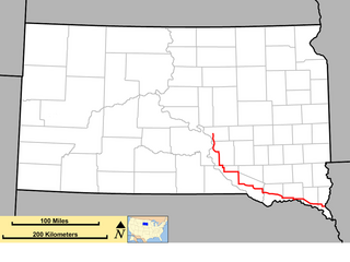
U.S. Route 385 is a spur of U.S. Route 85 that runs for 1,206 miles (1,941 km) from Deadwood, South Dakota to Big Bend National Park in Texas.

Interstate 190 (I-190) is an auxiliary Interstate Highway in the U.S. state of South Dakota. The route runs for about 2 miles (3.2 km) connecting I-90 to downtown Rapid City. Its length from I-90 to Omaha Street runs concurrent with US 16. It is the westernmost auxiliary route of I-90 and its only auxiliary route west of the Mississippi River.

South Dakota Highway 240 highway in South Dakota

South Dakota Highway 240 (SD 240), also signed as the Badlands Loop, is a 40.033-mile-long (64.427 km) state highway located in the southeastern part of Pennington and the northwestern part of Jackson counties of the southwestern part of the U.S. state of South Dakota. It travels through the eastern portion of Badlands National Park.

South Dakota Highway 44 highway in South Dakota

South Dakota Highway 44 (SD 44) is a state highway in southern South Dakota that runs from U.S. Route 385 (US 385) west of Rapid City to Interstate 29 (I-29) south of Sioux Falls. It is just more than 379 miles (610 km) long.

South Dakota Highway 87 highway in South Dakota

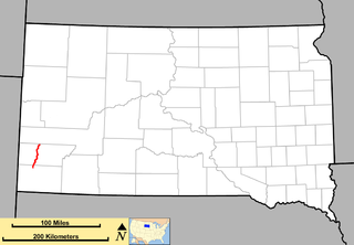
South Dakota Highway 87 (SD 87) is a 37.894-mile-long (60.984 km) state highway in the southwestern part of the U.S. state of South Dakota. It travels through the Black Hills region. The highway's southern terminus is at an intersection with U.S. Route 385 (US 385), about 6 miles (9.7 km) southeast of Pringle, within the southwestern part of Wind Cave National Park. Its northern terminus is at an intersection with US 16/US 385 about 3 miles (4.8 km) south-southwest of Hill City, within the east-central part of the Black Hills National Forest.

South Dakota Highway 43 highway in South Dakota

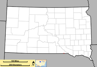
South Dakota Highway 43 (SD 43) is a 1.131-mile-long (1.820 km) state highway that exists entirely in the southern part of Gregory County in the southern part of the U.S. state of South Dakota. It begins as an extension of Nebraska Highway 11 (N-11) at the Nebraska state line south of Fairfax. It travels northwest to an intersection with U.S. Route 18 (US 18) south-southwest of the town.

South Dakota Highway 48 highway in South Dakota

South Dakota Highway 48 is a short state route in the far southeast corner of the U.S. state of South Dakota. The route, which runs entirely through Union County, begins at Interstate 29 about 2.5 miles (4.0 km) west of Spink, and becomes Big Sioux River Road, formerly Iowa Highway 403, northwest of Akron, Iowa. It is 12 miles (19 km) in length.

South Dakota Highway 15 highway in South Dakota

South Dakota Highway 15 (SD 15) is a 67.562-mile-long (108.730 km) state highway in the northeastern part of the U.S. state of South Dakota. It connects Clear Lake, Milbank, and Wilmot.

South Dakota Highway 50 highway in South Dakota

South Dakota Highway 50 is a state route serving south central and southeast South Dakota. The current alignment begins at the junction of South Dakota Highway 34 at "Lee's Corner" east of Fort Thompson, and ends at the Iowa border near Richland, where it continues as Iowa Highway 3. It is about 212 miles (341 km) in length.

South Dakota Highway 34 highway in South Dakota

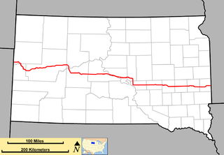
South Dakota Highway 34 is a state route that runs across the entire state of South Dakota, parallel to Interstate 90. It begins at the Wyoming border west of Belle Fourche, as a continuation of Wyoming Highway 24 (WYO 24). The eastern terminus is at the Minnesota border east of Egan, or southwest of Airlie, Minnesota, where it continues as Minnesota State Highway 30 (MN 30). It is just over 419 miles (674 km) in length.

South Dakota Highway 42 highway in South Dakota

South Dakota Highway 42 (SD 42) is a segmented state highway in southeastern South Dakota. The first segment is a six-mile-long (9.7 km) highway in Aurora County. The second and longest is 60 miles (97 km) long and connects Ethan and Sioux Falls. The final segment connects Sioux Falls to Iowa Highway 9 southeast of Rowena.

In the U.S. state of South Dakota, Interstate 90 traverses east–west through the southern half of the state.

South Dakota Highway 40 highway in South Dakota

South Dakota Highway 40 (SD 40) is a state highway in southwest South Dakota. The highway is just over 37 miles (60 km) long and runs from U.S. Route 16A (US 16A) in Keystone to Bureau of Indian Affairs Highway 41 in Red Shirt. The highway runs near Mount Rushmore National Memorial in Keystone, and its eastern terminus is on the Pine Ridge Indian Reservation near the edge of Badlands National Park. SD 40 was established along its current route in 1976; the SD 40 designation was originally used on a highway that is now part of SD 44.

Peter Norbeck Scenic Byway

The Peter Norbeck Scenic Byway is a National Scenic Byway in the Black Hills National Forest in the southwestern part of the U.S. state of South Dakota. It is a loop which is composed of portions of U.S. Route 16A (US 16A), South Dakota Highway 244 (SD 244), SD 87, and SD 89. Parts of the byway enter Black Hills National Forest, Custer State Park, and the Mt. Rushmore National Memorial; the byway also travels within five miles of the Crazy Horse Memorial. The byway is named after Peter Norbeck, who served as governor of and senator for South Dakota.

South Dakota Highway 89 highway in South Dakota

South Dakota Highway 89 (SD 89) is a 34.5-mile-long (55.5 km) state highway in the southwestern part of the U.S. state of South Dakota. The highway travels from U.S. Route 18 (US 18) near Minnekahta to SD 87 in Custer State Park. SD 89 is concurrent with US 385 from Pringle to Custer. The portion of the highway from Custer to SD 87 is part of the Peter Norbeck Scenic Byway.

References

  1. 1 2 "State Highway Log" (PDF). Rapid City region: South Dakota Department of Transportation. January 2011. p. 70. Retrieved December 24, 2011.
  2. "Google Maps Overview of SD 36" . Retrieved November 3, 2012.

Route map: Google

KML file (edithelp)
KML is from Wikidata