List of Interstate Highways in South Dakota

Last updated

I-90.svg I-229.svg

Business Loop 90.svg

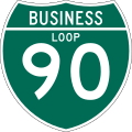
Standard South Dakota highway shields
System information
NotesSouth Dakota highways are generally state-maintained.
Highway names
Interstates Interstate X (I-X)
US Highways U.S. Highway X (US X)
State (State) Highway X (SD X)
System links
  • South Dakota State Trunk Highway System

The Interstate Highways in South Dakota are the segments of the Dwight D. Eisenhower National System of Interstate and Defense Highways owned and maintained by the South Dakota Department of Transportation in the US state of South Dakota.

Contents

Mainline highways

NumberLength (mi)Length (km)Southern or western terminusNorthern or eastern terminusFormedRemovedNotes
I-29.svg I-29 252.50406.36 I-29 at the Iowa state line at Dakota Dunes I-29 / US 81 at the North Dakota state line north-northwest of Victor 01958-01-011958current 
I-90.svg I-90 412.76664.27 I-90 at the Wyoming state line west-northwest of North Spearfish I-90 at the Minnesota state line north-northeast of Valley Springs  
I-190.svg I-190 1.722.77 US 16 / SD 44 / West Boulevard in Rapid City I-90 / US 14 / US 16 / SD 79 in Rapid City 01962-01-011962current 
I-229.svg I-229 11.3318.23 I-29 in Sioux Falls I-90 / CR 125 north of Sioux Falls 01966-01-011966current 

Business routes

NumberLength (mi)Length (km)Southern or western terminusNorthern or eastern terminusFormedRemovedNotes
Business Loop 29.svg I-29 BL Serves Elk Point
Business Spur 29.svg I-29 BS Serves Sioux Falls
Business Spur 29.svg I-29 BS Serves Brookings
Business Loop 90.svg I-90 BL Serves Spearfish
Business Loop 90.svg I-90 BL Serves Sturgis
Business Loop 90.svg I-90 BL Serves Rapid City
Business Loop 90.svg I-90 BL Serves Wall
Business Loop 90.svg I-90 BL Serves Kadoka
Business Loop 90.svg I-90 BL Serves Murdo
Business Loop 90.svg I-90 BL Serves Presho
Business Loop 90.svg I-90 BL Serves Chamberlain
Business Loop 90.svg I-90 BL Serves Mitchell
Business Spur 90.svg I-90 BS Serves Sioux Falls
Downtown Loop 229.svg I-229 Dwtn. Serves Sioux Falls

See also

Related Research Articles

<span class="mw-page-title-main">Pierre, South Dakota</span> Capital city of South Dakota, United States

Pierre is the capital city of the U.S. state of South Dakota and the seat of Hughes County. The population was 14,091 at the 2020 census, making it the second-least populous US state capital after Montpelier, Vermont. It is South Dakota's ninth-most populous city. Founded in 1880, it was selected as the state capital when the territory was admitted as a state. Pierre is the principal city of the Pierre Micropolitan Statistical Area, which includes all of Hughes and Stanley counties.

<span class="mw-page-title-main">Interstate 29</span> Interstate Highway from Kansas City north to Canada

Interstate 29 (I-29) is an Interstate Highway in the Midwestern United States. I-29 runs from Kansas City, Missouri, at a junction with I-35 and I-70, to the Canada–US border near Pembina, North Dakota, where it connects with Manitoba Provincial Trunk Highway 75 (PTH 75), which continues on to Winnipeg. The road follows the course of three major rivers, all of which form the borders of US states. The southern portion of I-29 closely parallels the Missouri River from Kansas City northward to Sioux City, Iowa, where it crosses and then parallels the Big Sioux River. For the northern third of the highway, it closely follows the Red River of the North. The major cities that I-29 connects to includes Council Bluffs, Iowa; Sioux Falls, South Dakota; and Fargo, North Dakota.

<span class="mw-page-title-main">Interstate 94</span> Interstate Highway across the upper Midwestern US

Interstate 94 (I-94) is an east–west Interstate Highway connecting the Great Lakes and northern Great Plains regions of the United States. Its western terminus is just east of Billings, Montana, at a junction with I-90; its eastern terminus is in Port Huron, Michigan, where it meets with I-69 and crosses the Blue Water Bridge into Sarnia, Ontario, Canada, where the route becomes Ontario Highway 402. It thus lies along the primary overland route from Seattle to Toronto and is the only east–west Interstate Highway to have a direct connection to Canada.

<span class="mw-page-title-main">U.S. Route 81</span> Numbered U.S. Highway in the United States

U.S. Route 81 or U.S. Highway 81 (US 81) is a major north–south U.S. highway that extends for 1,220 miles (1,960 km) in the central United States and is one of the original United States Numbered Highways established in 1926 by the American Association of State Highway Officials.

<span class="mw-page-title-main">U.S. Route 183</span> Numbered Highway in the United States

U.S. Route 183 (US 183) is a north–south United States highway. The highway's northern terminus is in Presho, South Dakota, at an intersection with Interstate 90. Its southern terminus is in Refugio, Texas, at the southern intersection of U.S. Highway 77 and Alternate US 77.

<span class="mw-page-title-main">U.S. Route 18</span> Highway in the United States

U.S. Route 18 is an east–west U.S. highway in the Midwestern United States. The western terminus is in Orin, Wyoming at an interchange with Interstate 25. Its eastern terminus is in downtown Milwaukee, Wisconsin. However, US 18 runs concurrent with other U.S. routes from its western terminus to Mule Creek Junction, Wyoming. US 18 is one of the original United States highways of 1926. The US 18 designation was originally proposed for a road in Michigan from Grand Haven east to Detroit. This roadway was eventually designated as U.S. Route 16.

<span class="mw-page-title-main">U.S. Route 85</span> Highway in the United States

U.S. Route 85 (US 85) is a 1,479-mile-long (2,380 km) north–south United States Highway that travels in the Mountain and Northern Plains states of the United States. The southern terminus of the highway is at the Mexican border in El Paso, Texas, connecting with Mexican Federal Highway 45. The northern terminus is at the Canadian border in Fortuna, North Dakota, where the route continues north as Saskatchewan Highway 35. The highway route is part of the CanAm Highway. Sections of US 85 are designated as the Theodore Roosevelt Expressway.

<span class="mw-page-title-main">U.S. Route 385</span> Highway in the United States

U.S. Route 385 (US 385) is a spur of U.S. Route 85 that runs for 1,206 miles (1,941 km) from Deadwood, South Dakota to Big Bend National Park in Texas.

<span class="mw-page-title-main">Interstate 129</span> Highway in Iowa and Nebraska

Interstate 129 (I-129) is an auxiliary Interstate Highway which connects South Sioux City to I-29 in Sioux City, Iowa. Opened in 1976, I-129 is a 3.5-mile-long (5.6 km) route, running 3.21 miles (5.17 km) in Nebraska. At 0.286 miles (0.460 km), I-129 is the shortest highway in the state of Iowa. All of the route's length is concurrent with U.S. Route 20 (US 20) and most of its length is concurrent with US 75. I-129 is also one of only four auxiliary Interstate Highways to go into a state its parent route does not.

<span class="mw-page-title-main">Interstate 190 (South Dakota)</span> Highway in South Dakota

Interstate 190 (I-190) is an auxiliary Interstate Highway in the US state of South Dakota. The route runs for about two miles (3.2 km) connecting I-90 to downtown Rapid City. Its length from I-90 to Omaha Street runs concurrent with US Highway 16 (US 16). It is the westernmost auxiliary route of I-90 and its only auxiliary route west of the Mississippi River.

<span class="mw-page-title-main">South Dakota Highway 115</span>

South Dakota Highway 115 is a 40-mile (64 km) state highway in Lincoln and Minnehaha countess in South Dakota, United States, that was created from the routing of US 77, "Old 77", when its alignment was moved west to become Interstate 29 around 1980 and SD 15's route from US 18 to Sioux Falls. SD 115 routes from its intersection with US 18 about 13 miles (21 km) south of Sioux Falls to Interstate 29 three miles west of Dell Rapids. It is about 40.5 miles (65.2 km) in length.

<span class="mw-page-title-main">Interstate 94 in North Dakota</span>

Interstate 94 (I-94) runs east–west for 352.4 miles (567.1 km) through the southern half of the US state of North Dakota, from the Montana state line east to the Red River at Fargo. The route generally follows the route of the Northern Pacific Railway.

<span class="mw-page-title-main">South Dakota Highway 34</span>

South Dakota Highway 34 is a state route that runs parallel to Interstate 90 across the entire state of South Dakota. It begins at the Wyoming border west of Belle Fourche, as a continuation of Wyoming Highway 24 (WYO 24). The eastern terminus is at the Minnesota border east of Egan, or southwest of Airlie, Minnesota, where it continues as Minnesota State Highway 30 (MN 30). It is just over 419 miles (674 km) in length, making it the longest state highway in South Dakota.

<span class="mw-page-title-main">Interstate 29 in South Dakota</span>

Interstate 29 (I-29) is a north–south Interstate Highway in the midwestern United States. In the state of South Dakota, I-29 traverses on the eastern side of the state from the Iowa border near Sioux City to the North Dakota border near New Effington. On its route, I-29 passes through western portions of Sioux Falls, the state's largest city. It travels 252.5 miles (406.4 km) in the state, the longest stretch of any of the four states through which it passes. I-229, the highway's lone auxiliary route in South Dakota, serves as a bypass around southern and eastern Sioux Falls.

<span class="mw-page-title-main">Interstate 90 in South Dakota</span> Section of Interstate Highway in South Dakota, United States

Interstate 90 (I-90) in the US state of South Dakota traverses east–west through the southern half of the state.

<span class="mw-page-title-main">Interstate 29 in North Dakota</span> Highway in North Dakota

Interstate 29 (I-29) in the US state of North Dakota runs from the state's southern border with South Dakota near Hankinson to the Canadian border just north of Pembina. The highway runs concurrently twice with U.S. Highway 81 (US 81). The first such overlap begins in Watertown, South Dakota, across the state line to Manvel. The other is from exit 203 to the Canadian border. The highway runs somewhat parallel to the Minnesota border to the east and passes through two major cities, Fargo and Grand Forks.

This article describes transportation in the U.S. state of South Dakota.

<span class="mw-page-title-main">Business routes of Interstate 90</span>

Interstate 90 Business may refer to several business routes of the Interstate Highway System that connects Interstate 90 with the central business district of various cities bypassed by I-90. Each business route can be either a business loop or a business spur, depending on whether both ends connect to I-90. The business route in each community is considered a unique route. In many cases, these routes are a former section of a U.S. Route.

<span class="mw-page-title-main">South Dakota Highway 79</span> State highway in South Dakota, United States

South Dakota Highway 79 (SD 79) is a 209-mile (336 km) state highway in western South Dakota, United States, that runs from Maverick Junction near the Black Hills National Forest to the North Dakota state line.

References