Southworth Creek

Last updated
Southworth Creek
Name origin:For Lewis Southworth, an early settler
Country United States
State Oregon
County Lincoln
SourceBurnt Timber Mountain
 - location Siuslaw National Forest
 - elevation1,231 ft (375 m) [1]
 - coordinates 44°22′16″N123°59′32″W / 44.37111°N 123.99222°W / 44.37111; -123.99222   [2]
Mouth Alsea River
 - locationnear Waldport
 - elevation7 ft (2 m) [2]
 - coordinates 44°24′45″N123°59′15″W / 44.41250°N 123.98750°W / 44.41250; -123.98750 Coordinates: 44°24′45″N123°59′15″W / 44.41250°N 123.98750°W / 44.41250; -123.98750   [2]
Length3 mi (5 km) [2]
USA Oregon location map.svg
Red pog.svg
Location of the mouth of Southworth Creek in Oregon

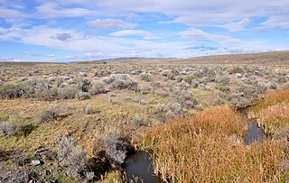
Southworth Creek is a stream, about 5 miles (8 km) long, in Lincoln County, in the U.S. state of Oregon. [2] It is a tributary of the Alsea River, which it enters upstream of Waldport and the Pacific Ocean. It flows north from the slopes of Burnt Timber Mountain to join the larger stream at an elevation of just 7 feet (2.1 m) above sea level. [2]

Lincoln County, Oregon county in Oregon, USA

Lincoln County is a county located in the U.S. state of Oregon. As of the 2010 census, its population was 46,034. The county seat is Newport. The county is named for Abraham Lincoln, 16th president of the United States.

U.S. state constituent political entity sharing sovereignty as the United States of America

In the United States, a state is a constituent political entity, of which there are currently 50. Bound together in a political union, each state holds governmental jurisdiction over a separate and defined geographic territory and shares its sovereignty with the federal government. Due to this shared sovereignty, Americans are citizens both of the federal republic and of the state in which they reside. State citizenship and residency are flexible, and no government approval is required to move between states, except for persons restricted by certain types of court orders. Four states use the term commonwealth rather than state in their full official names.

Oregon State of the United States of America

Oregon is a state in the Pacific Northwest region on the West Coast of the United States. The Columbia River delineates much of Oregon's northern boundary with Washington, while the Snake River delineates much of its eastern boundary with Idaho. The parallel 42° north delineates the southern boundary with California and Nevada. Oregon is one of only three states of the contiguous United States to have a coastline on the Pacific Ocean.

Southworth Creek was named for Lewis Southworth, a former slave who settled there in the 1880s. [2] It was originally called Darkey Creek until the Oregon Geographic Names Board was asked to officially change the name. [3]

Lewis Southworth, also identified as Louis Southworth (1830–1917), was a pioneer and freed slave who settled a donation land claim in 1880 near Waldport in the U.S. state of Oregon. Born in Tennessee, he was brought to the territory by his "master", from whom he bought his freedom with cash earned chiefly from his expertise with the fiddle or violin. Southworth lived or worked near Monroe, Jacksonville, and Buena Vista before settling along a small tributary of the Alsea River, where he farmed and engaged in other enterprises and civic undertakings. After his wife died in 1901, Southworth bought a house in Corvallis, where he lived for the rest of his life.

Oregon Geographic Names Board

The Oregon Geographic Names Board is responsible for recommending names for geographic features in the state of Oregon. The board submits its recommendations to the United States Board on Geographic Names for approval. In 1959, administrative responsibility for the board was transferred from the state government to the Oregon Historical Society.

See also

Related Research Articles

Alsea River river in the United States of America

The Alsea River flows 48.5 miles (78.1 km) from Alsea, an unincorporated community in the coastal mountains of the U.S. state of Oregon, to the Pacific Ocean near the city of Waldport. It begins at the confluence of the North Fork Alsea River and the South Fork Alsea River and ends in Alsea Bay, a wide estuary at Waldport. The river flows generally west-northwest in a winding course through the mountains of southern Benton and Lincoln counties, passing near the unincorporated community of Tidewater and through the Siuslaw National Forest. Its drainage basin extends into Lane County, along the headwaters of the South Fork Alsea River.

Bear Creek (Rogue River) stream located entirely within Jackson County, Oregon

Bear Creek is the name of a stream located entirely within Jackson County, Oregon. The stream drains approximately 400 square miles (1,000 km2) of the Rogue Valley and discharges an annual average of 114 cubic feet per second (3.2 m3/s) into the Rogue River. It begins near Emigrant Lake and travels 28.8 miles (46.3 km) through the municipalities of Ashland, Talent, Phoenix, Medford, and Central Point.

Succor Creek

Succor Creek is a 69.4-mile-long (111.7 km) tributary of the Snake River in the U.S. states of Idaho and Oregon. The creek begins in the Owyhee Mountains in Owyhee County, Idaho. After flowing for about 23 miles (37 km) in Idaho, Succor Creek enters Malheur County, Oregon, where it flows for 39 miles (63 km) before re-entering Idaho for its final 5 miles (8.0 km). It joins the Snake near Homedale, about 413 river miles (665 km) from the larger river's confluence with the Columbia River.

Fifteenmile Creek (Columbia River) river in the United States of America

Fifteenmile Creek is a 54-mile (87 km) long tributary of the Columbia River in the U.S. state of Oregon. It drains 373 square miles (966 km2) of Hood River and Wasco counties. Arising in the Cascade Range near Mount Hood, it flows northeast then west to its confluence with the Columbia near The Dalles.

Butter Creek (Oregon) river in the United States of America

Butter Creek is a 57-mile (92 km) long creek in the U.S. state of Oregon. The source of the creek is at an elevation of 5,034 feet (1,534 m) in Umatilla National Forest, while the mouth is at an elevation of 535 feet (163 m) upstream of Hermiston, Oregon. Butter Creek has a 465-square-mile (1,200 km2) watershed, and is a tributary of the Umatilla River.

West Little Owyhee River river in the United States of America

West Little Owyhee River is a 63.1-mile-long (101.5 km) tributary of the Owyhee River in the U.S. state of Oregon. The source of the river is at an elevation of 6,508 feet (1,984 m) near McDermitt, while the mouth is at an elevation of 4,373 feet (1,333 m) in the Owyhee Desert. West Little Owyhee River has a 310-square-mile (800 km2) watershed.

Rock Creek (Catlow Valley) stream in the Catlow Valley, Oregon, United States

Rock Creek is a 56-mile (90 km) intermittent stream flowing in Lake and Harney counties in the U.S. state of Oregon. The source of Rock Creek is at an elevation of 6,914 feet (2,107 m) on Hart Mountain, while the mouth is at an elevation of 4,557 feet (1,389 m) in the Catlow Valley. Rock Creek has a 269-square-mile (700 km2) watershed.

Crooked Creek (Oregon) river in the United States of America

Crooked Creek is a 51-mile (82 km) tributary of the Owyhee River in the U.S. state of Oregon. The source of Crooked Creek is at an elevation of 3,921 feet (1,195 m) at Crooked Creek Spring, while the mouth is at an elevation of 3,343 feet (1,019 m) near Rome. Crooked Creek has a 1,340-square-mile (3,500 km2) watershed.

Kiger Creek (Harney County, Oregon) river in the United States of America

Kiger Creek is a tributary of Swamp Creek in Harney County in the U.S. state of Oregon. It originates on Steens Mountain and flows generally north through Kiger Gorge to meet Swamp Creek near the unincorporated community of Diamond. The combined streams flow into Diamond Swamp and the Malheur National Wildlife Refuge.

Whychus Creek river in the United States of America

Whychus Creek is a tributary of the Deschutes River in Deschutes and Jefferson counties in the U.S. state of Oregon. Formerly named Squaw Creek, considered derogatory in the 21st century, it was renamed in 2006. Explorer John C. Frémont camped along the stream in 1843 but did not identify it by name. Robert S. Williamson, a surveyor who camped there in 1855, said its Indian name was Why-chus.

Willamina Creek river in the United States of America

Willamina Creek is a tributary, about 20 miles (32 km) long, of the South Yamhill River in the U.S. state of Oregon. Beginning in the Northern Oregon Coast Range in Yamhill County, it briefly enters and exits a small part of eastern Tillamook County, then flows generally south to meet the larger stream at Willamina, near the border with Polk County.

Muddy Creek (Linn County, Oregon)

Muddy Creek is a tributary of the Willamette River that flows through parts of Lane and Linn counties in the U.S. state of Oregon. It begins near Coburg Ridge, northeast of Eugene, and meanders north across the floor of the Willamette Valley roughly parallel to the river. It joins the East Channel of the Willamette upstream of Corvallis.

Mosby Creek (Oregon) river in the United States of America

Mosby Creek is a 21-mile (34 km) tributary of the Row River in Lane County, in the U.S. state of Oregon. It begins at the confluence of the east and west forks of the creek near the Calapooia Divide and the border with Douglas County. From its source it flows generally north-northwest to meet the river slightly east of Cottage Grove and about 4 miles (6 km) from the larger stream's confluence with the Coast Fork Willamette River.

Tenmile Creek (Lane County, Oregon)

Tenmile Creek is a stream in Lane County, in the U.S. state of Oregon. It flows west from the Siuslaw National Forest in the Oregon Coast Range into the Pacific Ocean at Stonefield Beach State Recreation Site, about 6 miles (10 km) south of Yachats.

French Pete Creek river in the United States of America

French Pete Creek is a tributary of the South Fork McKenzie River in Lane County, in the U.S. state of Oregon. It flows generally west through the Three Sisters Wilderness to the south end of Cougar Reservoir, about 11 miles (18 km) from the larger river's confluence with the McKenzie River. The creek has two named tributaries—Olallie Creek and, further downstream, Pat Creek—both of which enter from the right.

North Fork Alsea River river in the United States of America

The North Fork Alsea River is a 16-mile (26 km) tributary of the Alsea River in the U.S. state of Oregon. It begins at Klickitat Lake, fed by Klickitat and Lake creeks in the Central Oregon Coast Range, and flows generally south to near Alsea, where it joins the South Fork Alsea River to form the main stem. For most of its course, the North Fork winds through the Siuslaw National Forest in Lincoln County and then Benton County. It passes under Oregon Route 34 northeast of Alsea.

South Fork Alsea River river in the United States of America

The South Fork Alsea River is a tributary of the Alsea River in the U.S. state of Oregon. It begins at northeast of Horton on the east side of the Central Oregon Coast Range and flows generally northwest to near Alsea. There it joins the North Fork Alsea River to form the main stem.

Garoutte Creek river in the United States of America

Garoutte Creek is a tributary of the Little River in the U.S. state of Oregon. Rising along the Calapooya Divide near the border between Lane and Douglas counties, it flows generally northeast to meet the larger stream near Black Butte. The butte is a dark-colored mountain, the site of a former mine, and the site of a former post office. Little River joins Big River a few miles downstream to form the Coast Fork Willamette River.

References

  1. Source elevation derived from Google Earth search using GNIS source coordinates.
  2. 1 2 3 4 5 6 7 "Southworth Creek". Geographic Names Information System. United States Geological Survey (USGS). May 22, 1986. Retrieved November 5, 2015.
  3. "Creek May Be Named for Oregon Pioneer". Eugene Register-Guard. December 6, 1999. p. 2D. Retrieved April 30, 2015.