Oregon Geographic Names Board

Last updated
Oregon Geographic Names Board
Oregon Geographic Names Board logo.jpg
Official logo adopted in 2002
Agency overview
Formed1908
JurisdictionState of Oregon
Headquarters Portland, Oregon, USA
Agency executives
  • Champ C. Vaughan, Board president
  • Dr. George L. Vogt, Board secretary
Parent agency Oregon Historical Society
Website Oregon Geographic Names Board

The Oregon Geographic Names Board (originally known as the Oregon Geographic Board) is responsible for recommending names for geographic features in the state of Oregon. The board submits its recommendations to the United States Board on Geographic Names for approval. In 1959, administrative responsibility for the board was transferred from the state government to the Oregon Historical Society.

Contents

Board responsibility

Today, the Oregon Geographic Names Board is responsible for recommending names for geographic features within the state of Oregon. It ensures standard geographic nomenclature is applied to Oregon place names and prevents name duplication. The board assists federal, state, and local governments by reviewing geographic name proposals. The board submits its recommendations to the United States Board on Geographic Names for approval. [1] [2] [3]

History

In 1890, President Benjamin Harrison established the United States Board on Geographic Names. The board was given responsibility for settling questions regarding the names of geographic features within the United States. The board was needed because inconsistencies in place names were causing serious problems for surveyors, map makers, and scientists who required uniform geographic nomenclature. This problem was especially acute in the western states and territories where explorers, soldiers, miners, and settlers all had a hand in naming geographic features in addition to the names given to features by Native Americans. In 1906, President Theodore Roosevelt expanded the board's charter to include responsibility for approving all new place names and name changes on behalf of the U.S. government. In addition, the board was specifically directed to standardize and document geographic names of all domestic, foreign, or undersea features. Today, Antarctic names are within the U.S. board's jurisdiction as well. [2] [3] [4]

The Oregon Geographic Board was established by Governor George Chamberlain in an executive order signed on October 1, 1908. [1] [2] [3] It was created to assist the United States Board on Geographic Names in naming geographic features within the state of Oregon. [1] [2] [3] In 1911, the U.S. Board formally recognized the Oregon Board as its official advisory body for Oregon geographic names. [1] [2] [3]

Members of the Oregon Geographic Names Board posing in front of "Frustration Falls" on the Salmon River, Salmon-Huckleberry Wilderness, Mt. Hood National Forest, Oregon. This photo was taken during a 1963 expedition to name the waterfalls in the Salmon River Gorge. The men pictured are thought to be Thomas Vaughan of the Oregon Historical Society, Herb Stone of the U.S. Forest Service and Donald Sterling, Editor of the Oregon Journal. Frustration Falls.JPG
Members of the Oregon Geographic Names Board posing in front of "Frustration Falls" on the Salmon River, Salmon–Huckleberry Wilderness, Mt. Hood National Forest, Oregon. This photo was taken during a 1963 expedition to name the waterfalls in the Salmon River Gorge. The men pictured are thought to be Thomas Vaughan of the Oregon Historical Society, Herb Stone of the U.S. Forest Service and Donald Sterling, Editor of the Oregon Journal.

In October 1908, Governor Chamberlain appointed William Gladstone Steel, Doctor Joseph Schafer, and John B. Horner to the board. In December of that year, he added George H. Himes and Major Thomas L. "Lee" Moorhouse to the board. The members selected Steel, a well known outdoorsman and advocate for national parks, as the board's first president. On December 26, 1908, the Oregon Geographic Board took its first action in recommending that Mount Pitt in Jackson County be changed to Mount McLoughlin in honor of Doctor John McLoughlin, head of Hudson's Bay Company in the Oregon Country from 1825 until 1846. [3]

After Steel left the board in 1911 to devote his time to the development of Crater Lake National Park, the board elected George H. Himes as its president, a position he held until his death in 1940. Himes was one of Oregon's most respected historians and also a founder of the Oregon Historical Society, as well as museum curator from 1915 to 1940. [3]

In 1914, Governor Oswald West appointed Lewis A. "Tam" McArthur to the board. McArthur was a Pacific Power and Light Company executive with a passion for geography and history. In 1916, he was selected board secretary, a position he held until 1949. McArthur's position on the board allowed him to study journals of early explorers, read pioneer diaries, browse newspaper archives, research government documents, and thoroughly reviewed every book on Oregon history he could find. He also conducted personal interviews with living Oregon pioneers. The Oregon Historical Society published his research in eight issues of the Oregon Historical Quarterly in the early 1920s. In 1928, McArthur paid to have the first edition of Oregon Geographic Names published. The book was quickly recognized as the authoritative source for information regarding the origins and history of Oregon place names. A second edition was published in 1944. The book's third edition was published in 1951, shortly after his death. [3] [5] [6]

Another long-serving member of the Oregon Geographic Board was the well known newspaper journalist and science writer Phil Brogan of Bend. Brogan served as president of the board from 1947 to 1958 and then again from 1960 until 1968. [3]

In 1959, Governor Mark Hatfield transferred the administration of the Oregon Geographic Board from the state government to the Oregon Historical Society. As part of the reorganization, the name of the board was officially changed to the Oregon Geographic Names Board. The membership was also increased and the executive director of the Oregon Historical Society became the board's permanent secretary. The board secretary was also given responsibility for appointing new members to the board. The first board secretary under this arrangement was Thomas Vaughan, who served as permanent secretary from 1959 until 1989. Today, the board is still associated with the Oregon Historical Society, which maintains the board's records and provides limited administrative support. [1] [2] [3]

In 2001, members of the Confederated Tribes of Warm Springs persuaded the Oregon Legislative Assembly to pass a law requiring that many place names including the word squaw be changed. [7]

Membership

The Oregon Geographic Names Board has twenty-five members representing all geographic areas of the state. They are selected by the board secretary for their knowledge of Oregon geography and history. Board members are appointed to three-year terms and serve without compensation. The board members elect the board president and vice-president for two-year terms. The executive director of the Oregon Historical Society serves as the board's permanent secretary. In addition, the board is supported by advisers from state and federal land management and mapping agencies as well as the Oregon Historical Society. [1] [2] [3]

Board presidents

Members of the Oregon Geographic Names Board elect the board president. Since the board was established in 1908, these individuals have served as president: [3]

Related Research Articles

<span class="mw-page-title-main">Modoc Point</span>

Modoc Point is a cliff on the east shore of Upper Klamath Lake, in Klamath County, Oregon, United States, approximately 15 miles north of Klamath Falls on U.S. Route 97. It is part of the larger cliff known as Modoc Rim or Modoc Ridge.

Dairy is an unincorporated community in Klamath County, Oregon, United States.
<span class="mw-page-title-main">Pittsburg, Oregon</span> Unincorporated community in the state of Oregon, United States

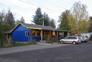
Pittsburg is an unincorporated community in Columbia County, Oregon, United States. Pittsburg is located on the Nehalem River near its confluence with the East Fork Nehalem River. The Scappoose-Vernonia road and the St. Helens-Pittsburg road join Oregon Route 47 near Pittsburg. Pittsburg's elevation is 584 feet (178 m).

<span class="mw-page-title-main">Cherry Grove, Oregon</span> Unincorporated community in the state of Oregon, United States

Cherry Grove is an unincorporated community in Washington County, Oregon, United States. Cherry Grove is situated on the north bank of the Tualatin River near where it exits the Northern Oregon Coast Range and enters Patton Valley.

Rice is an unincorporated community in Wasco County, in the U.S. state of Oregon. It is about 5 miles (8 km) northeast of Dufur, near Boyd and U.S. Route 197.

<span class="mw-page-title-main">Lewis A. McArthur</span> American historian

Lewis Ankeny McArthur, known as "Tam" McArthur, was an executive for Pacific Power and Light Company. He was also the secretary for the Oregon Geographic Board for many years and the author of Oregon Geographic Names. His book, now in its seventh edition, is a comprehensive source of information on the origins and history of Oregon place names. It is a standard reference book in libraries throughout Oregon and the Pacific Northwest. Tam McArthur Rim in the Cascade Mountains is named in his honor.

<span class="mw-page-title-main">Brogan, Oregon</span> Unincorporated community in Oregon, US

Brogan is an unincorporated community and Census-designated place (CDP) in Malheur County, Oregon, United States, on U.S. Route 26. Brogan was founded by D. M. Brogan in 1909, and when a post office was established in the locality on April 23 that year, it was named for him. Brogan is located on the north end of the now-abandoned Union Pacific Railroad branch line from Vale.

<span class="mw-page-title-main">Clifton N. McArthur</span> American politician

Clifton Nesmith McArthur was a U.S. Representative from Oregon, and grandson of Senator James Willis Nesmith. His father was a member of the Oregon Supreme Court, and Clifton twice served as Speaker of the Oregon House of Representatives.
<span class="mw-page-title-main">Valley Falls, Oregon</span> Unincorporated community in the state of Oregon, United States

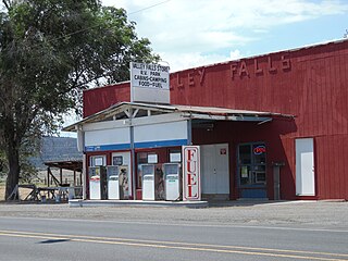
Valley Falls is a small unincorporated community in Lake County, Oregon, United States. The settled area is located at the junction of U.S. Route 395 and Oregon Route 31. The community is named for a small falls on the Chewaucan River just north of the occupied site. East of Valley Falls, the cliff face of Abert Rim overlooks the community.

<span class="mw-page-title-main">Greenleaf, Oregon</span> Unincorporated community in Oregon, United States

Greenleaf is an unincorporated community in Lane County, Oregon, United States. Greenleaf lies on Oregon Route 36 east of Deadwood and west of Triangle Lake.
<span class="mw-page-title-main">Phil Brogan</span> American journalist

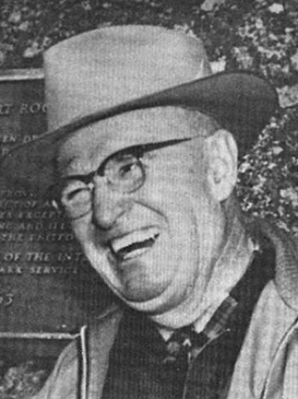
Philip Francis Brogan was an Oregon journalist and author. He was a reporter, writer, and editor for the Bend Bulletin for 44 years, earning numerous awards for his work. He was also a well known historian, geologist, paleontologist, geographer, meteorologist, astronomer, and outdoorsman. He served as president of the Oregon Geographic Names Board for over twenty years. Brogan wrote East of the Cascades in 1964, an important source of information on the geology, geography, and history of Central Oregon. Brogan was given the title "Father of Oregon Speleology" by Charles V. Larson for his dedication to the study and conservation of caves, particularly Fort Rock Cave, Skeleton Cave and Lavacicle Cave. Phil Brogan Viewpoint near Lava Butte in Newberry National Volcanic Monument is named in his honor.

<span class="mw-page-title-main">John M. Drake</span>

John Miller Drake was a Union Army officer in the 1st Oregon Cavalry and the 1st Oregon Infantry regiments during the American Civil War. He eventually reached the rank of lieutenant colonel. He led one of the first campaigns to respond to the threat Chief Paulina posed to settlers and rival Indians in central Oregon. Later he was a purchasing agent for the Oregon Railway and Navigation Company.

Mayger is an unincorporated community in Columbia County, Oregon, United States. Fishing is important to Mayger. It was originally the site of Frenchman Charles Mayger's Mayger Logging Company, which he sold in 1886 to William F. Slaughter. Mayger's post office was established three years later and its first postmaster was Charles Mayger. It closed in 1961. Mayger is served by the Clatskanie, Oregon post office.

<span class="mw-page-title-main">Mayville, Oregon</span> Unincorporated community in the state of Oregon, United States

Mayville is an unincorporated community in Gilliam County, Oregon, United States. It is located on Oregon Route 19. According to 1909 Oregon law, Mayville was the permanent meeting place of the board of commissioners of Gilliam and Wheeler counties. They met in Mayville each year to elect the president of the board. A post office was established in Mayville and "put in operation in October 1884 with Samuel Thornton postmaster." The community's name was originally made by Thornton's wife.

Mohler is an unincorporated community in Tillamook County, Oregon, United States. It is east of U.S. Route 101 on Oregon Route 53 along the Nehalem River.It is the smallest unincorporated community in the county, comprising approximately eight acres of land. Within the community's boundaries there are eight acres of residential land and community commercial land, in 15 parcels.

Willowcreek is an unincorporated village in Malheur County, Oregon, United States. It is about 11 miles (18 km) northwest of Vale on U.S. Route 26. The village has a combined store and café, and the region's elementary school. Willowcreek is located at 44.114605°N 117.364349°W. Today Willowcreek has a Vale mailing address, although the nearest post office is in nearby Jamieson.

<span class="mw-page-title-main">Charles S. Drew</span> American Union Army officer (1825–1886)

Charles Stewart Drew, also known as C.S. Drew, was a representative in the legislature of the Oregon Territory of the United States and quartermaster general of the territorial militia in the 1850s. During the American Civil War, he was a Union Army officer, serving in the 1st Oregon Cavalry regiment. He eventually reached the rank of lieutenant colonel. In 1864, he led an Army reconnaissance party into southeastern Oregon. The expedition, known as the Owyhee Reconnaissance, traveled through uncharted country from Fort Klamath to Fort Boise and back. Drew was the author of two historically important military reports; one documented Indian attacks on American settlers in the Oregon Territory and the other was his report of the Owyhee Reconnaissance.

Rieth is an unincorporated community in Umatilla County, Oregon, United States. It is south of Interstate 84/U.S. Route 30/U.S. Route 395 about 5 miles (8 km) west of Pendleton near the Umatilla River.

Upper Chush Falls is a 200-foot (61 m) waterfall on Whychus Creek, in the Cascade Range southwest of Sisters in the U.S. state of Oregon. Chush Falls, a 50-foot (15 m) waterfall, is further downstream on the same creek. Lying between Chush and Upper Chush is a third waterfall, The Cascade. These and several other falls on tributaries in the vicinity are within the Three Sisters Wilderness. The Northwest Waterfall Survey lists the fall's average flow at 40 cubic feet per second (1.1 m3/s). The highest flows occur between May and August.

<span class="mw-page-title-main">Fleetwood, Oregon</span> Ghost town in Oregon, United States

Fleetwood was an unincorporated community located in Lake County, Oregon, United States. The first homesteaders arrived in the area around Fleetwood in 1905. The Fleetwood post office was opened in 1913. By 1920, the local population was declining due to a severe drought that dried up surface water and lowered the water table in the area around Fleetwood. Today, Fleetwood is a ghost town with no population and no surviving structures at the townsite. The site is located approximately 10 miles (16 km) east of Fort Rock state park. The nearest inhabited place is the small unincorporated community of Fort Rock, Oregon, which is 9 miles (14 km) west of the Fleetwood townsite.

References

  1. 1 2 3 4 5 6 Vaughan, Champ C., "Oregon Geographic Names Board", Oregon Blue Book, Oregon State Archives, Office of the Oregon Secretary of State, August 28, 2009.
  2. 1 2 3 4 5 6 7 Payne, Roger L., "Oregon Geographic Names", Oregon Historical Society, Portland, Oregon, 2008.
  3. 1 2 3 4 5 6 7 8 9 10 11 12 Vaughan, Champ Clark, "The Oregon Geographic Names Board One Hundred Years of Toponymic Nomenclature" [ permanent dead link ], Oregon Historical Quarterly (Volume 109, Number 3), Portland, Oregon, Fall 2008.
  4. "U.S. Board of Geographic Names", United States Geological Survey, United States Department of Interior, Reston, Virginia, May 1, 2009.
  5. Peneva, Erin McCullugh, "The Importance of Memory and Place, A Narrative of Oregon Geographic Names with Lewis L. McArthur" Archived 2009-02-28 at the Wayback Machine , Oregon Historical Quarterly (Volume 109, Number 3), Portland, Oregon, Fall 2008.
  6. McArthur, Lewis A. and Lewis L. McArthur, Oregon Geographic Names (Seventh Edition), Oregon Historical Society Press, Portland, Oregon, 2003, Preface vii.
  7. Sanders, Eli (December 11, 2004). "Renaming 'Squaw' Sites Proves Touchy in Oregon". The New York Times. Archived from the original on 2012-11-08.