Spakenburg | |
|---|---|
 | |
 | |
 | |
| Coordinates: 52°15′01″N5°22′37″E / 52.25028°N 5.37694°E | |
| Country | Netherlands |
| Province | Utrecht |
| Municipality | Bunschoten |
| • Density | 638/km2 (1,650/sq mi) |
| Area code | 033 |
| Website | http://www.bunschoten.nl |
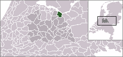
Spakenburg is a Dutch village north of Bunschoten. Spakenburg is formally called Bunschoten-Spakenburg since its fusion with Bunschoten. The village lies south of the IJsselmeer in the municipality Bunschoten, Utrecht.
Wikimedia Commons has media related to Spakenburg .
| International | |
|---|---|
| National | |
| Other | |
| | This Utrecht location article is a stub. You can help Wikipedia by expanding it. |