Spanish colonial pueblos and villas in North America

Last updated
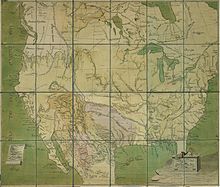
Historical map of Spanish North America
Map of Spanish America c. 1800
Diagram of Pueblo of Santa Barbara, California (Walter A. Hawley, 1910) Spanish North America.png
Historical map of Spanish North America
Map of Spanish America c. 1800 Mapa de la America espanola (1800).png
Map of Spanish America c.1800
Diagram of Pueblo of Santa Barbara, California (Walter A. Hawley, 1910) Diagram of Pueblo of Santa Barbara (Walter A. Hawley, 1910).jpg
Diagram of Pueblo of Santa Barbara, California (Walter A. Hawley, 1910)
U.S. post office application from 1866 shows the four square Spanish leagues of the pre-statehood Los Angeles Pueblo Post office application Los Angeles 1866 02.jpg
U.S. post office application from 1866 shows the four square Spanish leagues of the pre-statehood Los Angeles Pueblo
Provincias Ynternas de Nueva Espana mapped in 1817 Provincias Ynternas Nueva Espana 1817.jpg
Provincias Ynternas de Nueva España mapped in 1817

Spanish colonial authorities in North America established misiones (churches with attached farms), presidios (military forts) and villas or pueblos (civilian settlements with residences, retail businesses, agricultural markets, etc.). Official pueblo establishments (as opposed to those that developed organically) were granted four square Spanish leagues of land and were required to be sited at least five Spanish leagues away from any other pueblo. According to one Arizona history, "Each organized pueblo was to have at least thirty inhabitants, each one to have ten breeding cows, four oxen, one brood mare, one sow, twenty Castillian ewes, six hens and one cock. House lots and sowing lands were to be distributed among pueblo settlers." [1] Among the leadership of a pueblo was an alcalde (preceded in the history of Spanish administration by the title corregidor ).

Contents

Spanish colonial pueblos in North America included: [2]

See also

Related Research Articles

<span class="mw-page-title-main">Spanish missions in California</span> 18th to 19th-century Catholic religious outposts in California

The Spanish missions in California formed a series of 21 religious outposts or missions established between 1769 and 1833 in what is now the U.S. state of California. The missions were established by Catholic priests of the Franciscan order to evangelize indigenous peoples backed by the military force of the Spanish Empire. The missions were part of the expansion and settlement of New Spain through the formation of Alta California, expanding the empire into the most northern and western parts of Spanish North America. Civilian settlers and soldiers accompanied missionaries and formed settlements like the Pueblo de Los Ángeles.

<span class="mw-page-title-main">Alta California</span> Former province of New Spain and Mexico

Alta California, also known as Nueva California among other names, was a province of New Spain formally established in 1804. Along with the Baja California peninsula, it had previously comprised the province of Las Californias, but was made a separate province in 1804. Following the Mexican War of Independence, it became a territory of Mexico in April 1822 and was renamed Alta California in 1824.

<span class="mw-page-title-main">Mariano Guadalupe Vallejo</span> Early State of California politician (1807–1890)

Don Mariano Guadalupe Vallejo was a Californio general, statesman, and public figure. He was born a subject of Spain, performed his military duties as an officer of the Republic of Mexico, and shaped the transition of Alta California from a territory of Mexico to the U.S. state of California. He served in the first session of the California State Senate. The city of Vallejo, California, is named after him, and the nearby city of Benicia is named after his wife.

<span class="mw-page-title-main">Presidio</span> Fort type

A presidio was a fortified base established by the Spanish Empire between the 16th and 18th centuries in areas under their control or influence. The term is derived from the Latin word praesidium meaning protection or defense.

<span class="mw-page-title-main">Californios</span> Term for Hispanic natives of California

Californios are Hispanic Californians, especially those descended from Spanish and Mexican settlers of the 17th through 19th centuries. California's Spanish-speaking community has resided there since 1683 and is made up of varying Spanish and Mexican origins, including criollos, Mestizos, Indigenous Californian peoples, and small numbers of Mulatos. Alongside the Tejanos of Texas and Neomexicanos of New Mexico and Colorado, Californios are part of the larger Spanish-American/Mexican-American/Hispano community of the United States, which has inhabited the American Southwest and the West Coast since the 16th century. Some may also identify as Chicanos, a term that came about in the 1960s.

Gabriel Moraga was a Sonoran-born Californio explorer and army officer. He was the son of the expeditionary José Joaquín Moraga who helped to lead the de Anza Expedition to California in 1774, Like his father, Moraga is one of the most notable Spanish expeditionaries in the history of Alta California and the origin of the names of many of the most notable rivers and cities of Northern California and the Central Valley.

Luis María Peralta was a Spanish-born Californio ranchero and soldier in the Spanish Army. Peralta received Rancho San Antonio, one of the largest of the rancho grants in California, covering 44,800-acre (181 km2) that encompassed most of the East Bay region of the Bay Area in Northern California.

José Francisco Ortega was a Spanish soldier and early settler of Alta California. He joined the military at the age of twenty-one and rose to the rank of sergeant by the time he joined the Portola expedition in 1769. At the end of his military duty he would be granted land which he named Rancho Nuestra Senora del Refugio near Santa Barbara.

<span class="mw-page-title-main">Suisun people</span>

The Suisunes were a Patwin tribe of Wintun people, originating in the Suisun Bay and Suisun Marsh regions of Solano County in Northern California. Their traditional homelands stretched between what is now Suisun City, Vacaville and Putah Creek around 200 years ago. The Suisunes' main village, Yulyul, is believed to be where Rockville, California is located today. Father Abella, visitor to the tribe in 1811, indicated they resided in the present location of Fairfield, north of the Suisun Bay. One of the Suisunes' primary food sources was acorns. Their diet also included fish as well as miner's lettuce. Their huts were conical wikiups made of rushes or tule thatch.

<span class="mw-page-title-main">Pueblo de Los Ángeles</span> Spanish colonial pueblo; predecessor to the city of Los Angeles

El Pueblo de Nuestra Señora la Reina de los Ángeles, shortened to Pueblo de los Ángeles, was the Spanish civilian pueblo settled in 1781, which became the American metropolis of Los Angeles. The pueblo was built using labor from the adjacent village of Yaanga and was totally dependent on local Indigenous labor for its survival.

<span class="mw-page-title-main">Camino Real de Tierra Adentro</span> Northernmost of Mexico Citys four "royal roads"

The Camino Real de Tierra Adentro, also known as the Silver Route, was a Spanish 2,560-kilometre-long (1,590 mi) road between Mexico City and San Juan Pueblo, New Mexico, that was used from 1598 to 1882. It was the northernmost of the four major "royal roads" that linked Mexico City to its major tributaries during and after the Spanish colonial era.

<span class="mw-page-title-main">Ranchos of California</span> Land concessions by Spain and land grants by Mexico in the 18th and 19th centuries in California

The Spanish and Mexican governments made many concessions and land grants in Alta California and Baja California from 1775 to 1846. The Spanish Concessions of land were made to retired soldiers as an inducement for them to settle in the frontier. These Concessions reverted to the Spanish crown upon the death of the recipient.

José Joaquín de la Santísima Trinidad Moraga, usually simply known as José Joaquín Moraga, was a Spanish colonial expeditionary and soldier who founded San Jose, California, in 1777.

Rancho San Dieguito was a 8,824-acre (35.71 km2) Mexican land grant in present-day San Diego County, California given in 1845 by Governor Pío Pico to Juan María Osuna. The rancho property was renamed Rancho Santa Fe in 1922 by the Santa Fe Land Company.

<span class="mw-page-title-main">Rancho Tulucay</span> Mexican land

Rancho Tulucay was a 8,866-acre (35.88 km2) Mexican land grant in present day Napa County, California given in 1841 by Governor pro tem Manuel Jimeno to Cayetano Juarez. The Tulucay name originates with the names Tulkays and Ulucas that were applied to the inhabitants of Tuluka, a Patwin village in the area. The grant was on the east side of the Napa River, between Soscol Creek on the south, and Sarco Creek on the north.

The Berryessa family is a prominent Californio family of Northern California. Members of the family held extensive rancho grants across the Bay Area during 18th and 19th centuries. Numerous places are named after the family, including the Berryessa district of San Jose and Lake Berryessa in Napa County.

Santiago Argüello (1791–1862) was a Californio, a soldier in the Spanish army of the Viceroyalty of New Spain in Las Californias, a major Mexican land grant ranchos owner, and part of an influential family in Mexican Alta California and post-statehood California.

<span class="mw-page-title-main">Sonoma Barracks</span> 19th century adobe barracks in California

The Sonoma Barracks is a two-story, wide-balconied, adobe building facing the central plaza of the City of Sonoma, California. It was built by order of Mariano Guadalupe Vallejo to house the Mexican soldiers that had been transferred from the Presidio of San Francisco in 1835. The Presidio Company and their commander, Vallejo, were also responsible for controlling the Native Americans living on the northern border of Mexican California.

<span class="mw-page-title-main">Mexican secularization act of 1833</span> Legislation concerning the separation of church and state

The Mexican Secularization Act of 1833, officially called the Decree for the Secularization of the Missions of California, was an act passed by the Congress of the Union of the First Mexican Republic which secularized the Californian missions. The act nationalized the missions, transferring their ownership from the Franciscan Order of the Catholic Church to the Mexican authorities.

References

  1. Mattison, Ray (1946-10-01). "Early Spanish and Mexican Settlements in Arizona". New Mexico Historical Review. 21 (4). ISSN   0028-6206.
  2. 1 2 3 4 "Rancho, Pueblo, Presidio & Mission Lands". CA State Lands Commission. Retrieved 2023-03-30.
  3. 1 2 3 4 "Renewing Spanish Colonial Society". myText CNM. Retrieved 2023-03-30.
  4. Cerkkila (2022-07-27). "Santa Fe and the Spanish City System". SAH ARCHIPEDIA. Retrieved 2023-03-30.
  5. Shorris, Earl (1999-05-09). "Rio Grande, Ciudad Juarez". The New York Times. ISSN   0362-4331 . Retrieved 2023-03-30.
  6. "A Year in the Life of a Spanish Colonial Pueblo: San José de Guadalupe in 1809". Google Arts & Culture. Retrieved 2023-03-30.
  7. Robinson, W. W. (1948). Land in California, the story of mission lands, ranchos, squatters, mining claims, railroad grants, land scrip [and] homesteads. Chronicles of California. Berkeley: Univ. of California Press. p. 37.
  8. "Santa Barbara Pueblo Lands, Diseños 543, GLO 386, Santa Barbara County, and associated historical documents".