U.S. Route 40 or U.S. Highway 40 (US 40), also known as the Main Street of America, is a major east–west United States Highway traveling across the United States from the Mountain States to the Mid-Atlantic States. As with most routes whose numbers end in a zero, US 40 once traversed the entire United States. It is one of the first U.S. Highways created in 1926 and its original termini were in San Francisco, California and Atlantic City, New Jersey. In the western United States, US 40 was functionally replaced by Interstate 80 (I-80), resulting in the route being truncated multiple times. US 40 currently ends at a junction with I-80 in Silver Summit, Utah, just outside Salt Lake City.

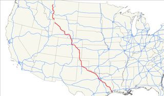
U.S. Route 287 (US 287) is a north–south United States highway. At 1,791 miles (2,882 km) long, it is the longest three-digit U.S. route. It serves as the major truck route between Fort Worth and Amarillo, Texas, and between Fort Collins, Colorado, and Laramie, Wyoming. The highway is broken into two segments by Yellowstone National Park, where an unnumbered park road serves as a connector.
U.S. Route 6 (US 6), also called the Grand Army of the Republic Highway, honoring the American Civil War veterans association, is a main route of the U.S. Highway system. While it currently runs east-northeast from Bishop, California, to Provincetown, Massachusetts, the route has been modified several times. The highway's longest-lasting routing, from 1936 to 1964, had its western terminus at Long Beach, California. During this time, US 6 was the longest highway in the country.

U.S. Route 34 (US 34) is an east–west United States highway that runs for 1,122 miles (1,806 km) from north-central Colorado to the western suburbs of Chicago. Through Rocky Mountain National Park it is known as the Trail Ridge Road where it reaches elevation 12,183 feet (3,713 m), making it the third highest paved through highway in the United States. The highway's western terminus is Granby, Colorado at US 40. Its eastern terminus is in Berwyn, Illinois at Illinois Route 43 and Historic US 66.

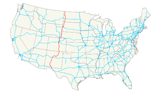
U.S. Route 85 (US 85) is a 1,479-mile-long (2,380 km) north–south United States Highway that travels in the Mountain and Northern Plains states of the United States. The southern terminus of the highway is at the Mexican border in El Paso, Texas, connecting with Mexican Federal Highway 45. The northern terminus is at the Canadian border in Fortuna, North Dakota, where the route continues north as Saskatchewan Highway 35. The highway route is part of the CanAm Highway. Sections of US 85 are designated as the Theodore Roosevelt Expressway.
U.S. Route 211 is a spur of US 11 in the U.S. state of Virginia. Known for most of its length as Lee Highway, the U.S. Highway runs 59.09 miles (95.10 km) from Interstate 81 (I-81) and Virginia State Route 211 in New Market east to US 15 Business, US 29 Business, and US 211 Business in Warrenton. US 211 connects the Shenandoah Valley with the Piedmont town of Warrenton via Luray and Sperryville, where the highway runs concurrently with US 340 and US 522, respectively.
U.S. Route 321 (US 321) is a spur of U.S. Route 21. It runs for 516.9 miles (831.9 km) from Hardeeville, South Carolina to Lenoir City, Tennessee; with both serving as southern termini. It reaches its northernmost point at Elizabethton, Tennessee. Because of its unusual "north–south–north" routing, U.S. Route 321 intersects both Interstate 40 and U.S. Route 70 three separate times. The highway serves different roles in each state: An alternate route to interstates in South Carolina, a major highway in North Carolina, and a scenic route in Tennessee.
Interstate 180 (I-180) is a one-mile (2 km)-long connector in the U.S. state of Wyoming between Interstate 80 and downtown Cheyenne, Wyoming.
Interstate 76 (I-76) is an Interstate Highway in the Western United States that runs from Interstate 70 in Arvada, Colorado to an intersection with Interstate 80 near Big Springs, Nebraska. It is one of the two interstates that carries the "76" designation but it has no connection with the eastern route. Spanning 187.29 miles (301.41 km), all but approximately three miles of the highway is in Colorado. Along the route, the highway runs concurrent with US 6, US 85 in the Denver Metro Area, and US 34 from Wiggins to Fort Morgan. It currently has no auxiliary interstates but it has two business routes that are located in northeastern Colorado.
State Highway 2 (SH 2) is a state highway of the U.S. state of Colorado. It runs for approximately 20 miles (32 km) north–south entirely within the urbanized environment of the Denver Metropolitan Area. It is one of the major north–south thoroughfares of east Denver, where it is known as Colorado Boulevard.

State Highway 7 is an 81.64 miles (131.39 km) long state highway in the U.S. state of Colorado. It is located in the north-central portion of the state, traversing the mountains on the east of the continental divide south of Estes Park as well as portions of the Colorado Piedmont north of Denver. The northwestern segment of the highway is part of the Peak-to-Peak Scenic Byway and furnishes an access route to Estes Park, Colorado and Rocky Mountain National Park. In its southeast portion it skirts the northern end of the Denver Metropolitan Area, providing an access route connecting Boulder, Lafayette and Brighton with Interstate 25 and Interstate 76.

State Route 25 (SR 25) is part of the system of numbered highways in Maine. It runs for 42.4 miles (68.2 km) across the south central part of the state. SR 25 begins at the New Hampshire border near Porter, where it continues west as New Hampshire Route 25 (NH 25). Its eastern terminus is in downtown Portland at the intersection of Park Avenue and State Street. Administratively, it shares a terminus with SR 22 and SR 77.
Interstate 25 (I-25) is a part of the Interstate Highway System that runs from Las Cruces, New Mexico, to Buffalo, Wyoming. In Wyoming, the Interstate Highway runs 300.530 miles (483.656 km) from the Colorado state line near Cheyenne north to its national terminus at I-90 near Buffalo. I-25 connects Wyoming's largest city and capital, Cheyenne, with its second largest city, Casper, and the smaller communities of Wheatland, Douglas, and Buffalo. The highway also connects those cities with Denver and Billings via I-90. I-25 runs concurrently with U.S. Route 87 for almost its entire course in Wyoming. The highway also has extensive concurrencies with US 20 and US 26 along its east–west segment through the North Platte River valley. The Interstate has business loops through Cheyenne, Chugwater, Wheatland, Douglas, Glenrock, Casper, and Buffalo.
In the U.S. state of Colorado, Interstate 25 (I-25) follows the north–south corridor through Colorado Springs and Denver. The highway enters the state from the north near Carr and exits the state near Starkville. The highway also runs through the cities of Fort Collins, Loveland, and Pueblo. The route is concurrent with U.S. Highway 87 through the entire length of the state. I-25 replaced U.S. Highway 87 and most of U.S. Highway 85 for through traffic.
U.S. Highway 36 is a major east–west route in the U.S. state of Colorado, extending from Rocky Mountain National Park to the Kansas state line.
U.S. Route 34 (US 34) is a part of the U.S. Highway System that travels from Granby, Colorado, to Berwyn, Illinois. In the U.S. state of Colorado, US 34 is a 260-mile-long (420 km) road that spans across northern Colorado. It begins at US 40 in Granby and ends at the Nebraska border, where it continues as US 34, east of Laird.

State Highway 263 (SH 263) is a 2.73-mile-long (4.39 km), two-lane state highway located within the city limits of Greeley, Colorado. The average daily traffic of the route, which was recorded in 2008, was about 5700 cars entering at the junction with U.S. Highway 85, and 4700 cars exiting at the intersection with Fern Avenue It is classified as a Major Urban Collector highway by the Colorado Department of Transportation, and does not have any truck limitations.
There are 13 active business routes of Interstate 70 in Colorado. I-70 spans Colorado in an east-west fashion, holding many business loops and spurs along the way varying from lengths of 0.22 mi (0.35 km) to 27.47 mi (44.21 km), with a total of 55.51 miles. Four other business routes also used to exist within the state.
Interstate 90 Business may refer to several business routes of the Interstate Highway System that connects Interstate 90 with the central business district of various cities bypassed by I-90. Each business route can be either a business loop or a business spur, depending on whether both ends connect to I-90. The business route in each community is considered a unique route. In many cases, these routes are a former section of a U.S. Route.
Interstate business routes are roads connecting a central or commercial district of a city or town with an Interstate bypass. These roads typically follow along local streets often along a former U.S. route or state highway that had been replaced by an Interstate. Interstate business route reassurance markers are signed as either loops or spurs using a green shield shaped sign and numbered like the shield of the parent Interstate highway.


